
Aside from the very random and difficult to predict tornadoes Western PA has seen this year, it has been a quiet start to severe thunderstorm season. Statistically, right around now is when things usually pick up in a hurry in PA, especially in Central and Eastern PA.
While Wednesday’s threat will again target mainly the western half of the state, an active pattern going forward nearly guarantees severe storms opportunities in the near future in all areas of the state.
STORM TIMING
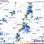
Sufficient dynamics for a damaging wind risk will be in play Wednesday afternoon and evening, along with hail. Storms are expected to fire up near I-79 in Western PA early Wednesday afternoon and push east. Below is HRRR Future Radar for 2:00 PM Wednesday.
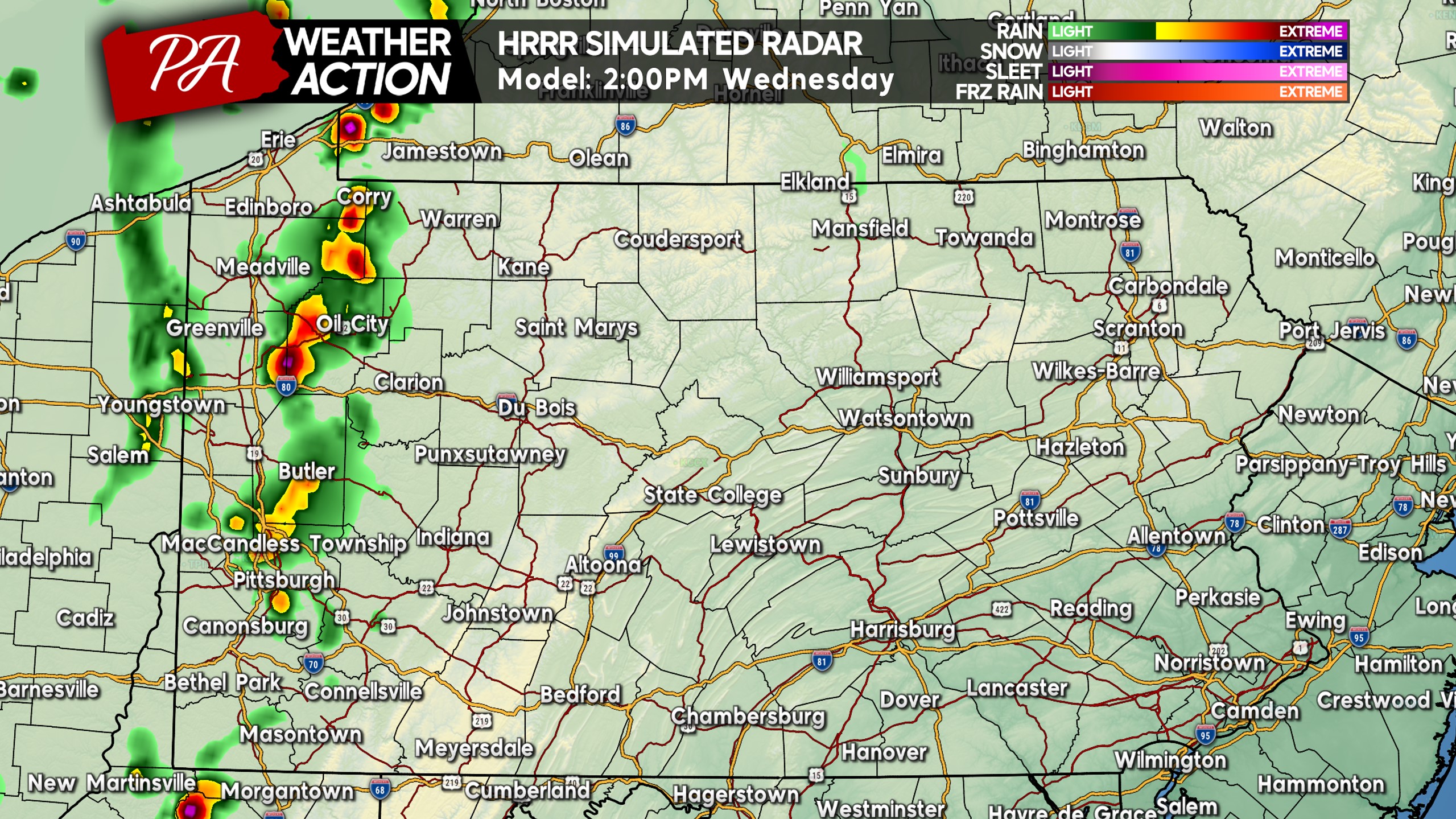
Thunderstorms will intensify as they push east into the mountains, which is a bit abnormal compared to how we usually do storms here in PA. The usual format is Western PA sees storms at the end of a day, and then the next day storms fire up over the Appalachians and push east. However this time, storms will to reach their peak intensity over the Appalachians.
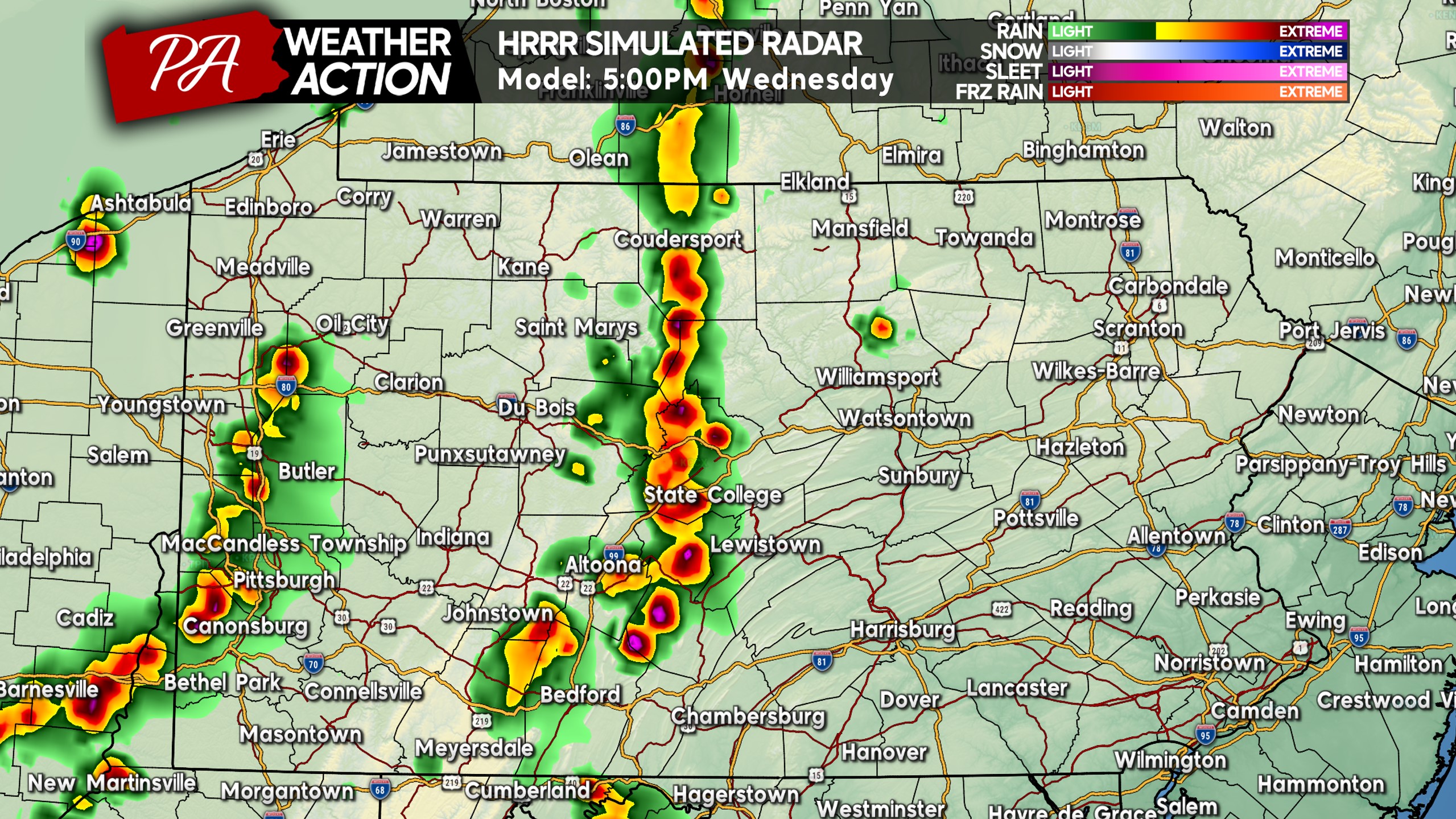
By 3-5 PM Wednesday, storms are expected to push over the Alleghenies and be near the spine of the Appalachians. This is when hail will be most likely, going into the Wednesday PM commute. At the same time, more storms may fire up in Western PA near the Ohio border. See HRRR Future Radar for 5:00 PM Wednesday below.
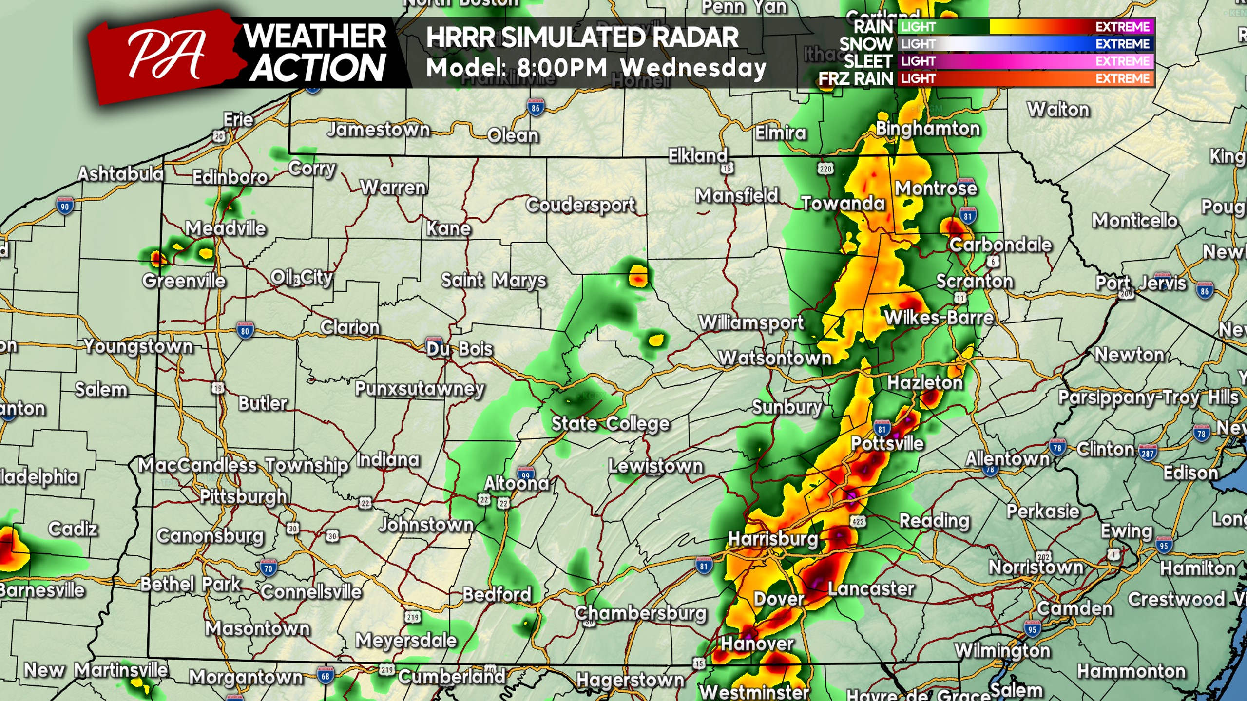
As we approach sunset, storms are projected to be near the I-81 corridor up and down the state. At that point is when storms will begin to exit the area of greatest instability, and are likely to weaken as they push into Eastern PA.
However, storms have a tendency to stay strong for longer than expected, so we wouldn’t be shocked to see places like the Poconos and Lehigh Valley see strong storms late Wednesday evening. View HRRR Future Radar for 8:00 PM Wednesday below.
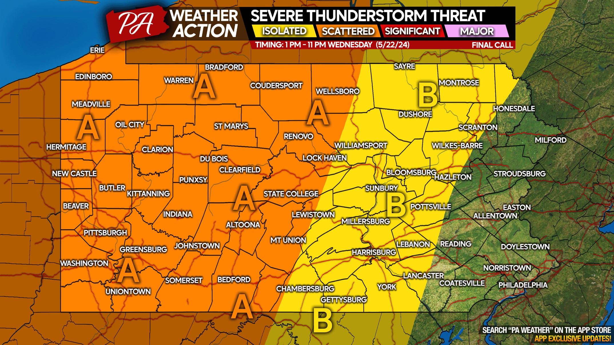
WEDNESDAY SEVERE THUNDERSTORM THREAT MAP
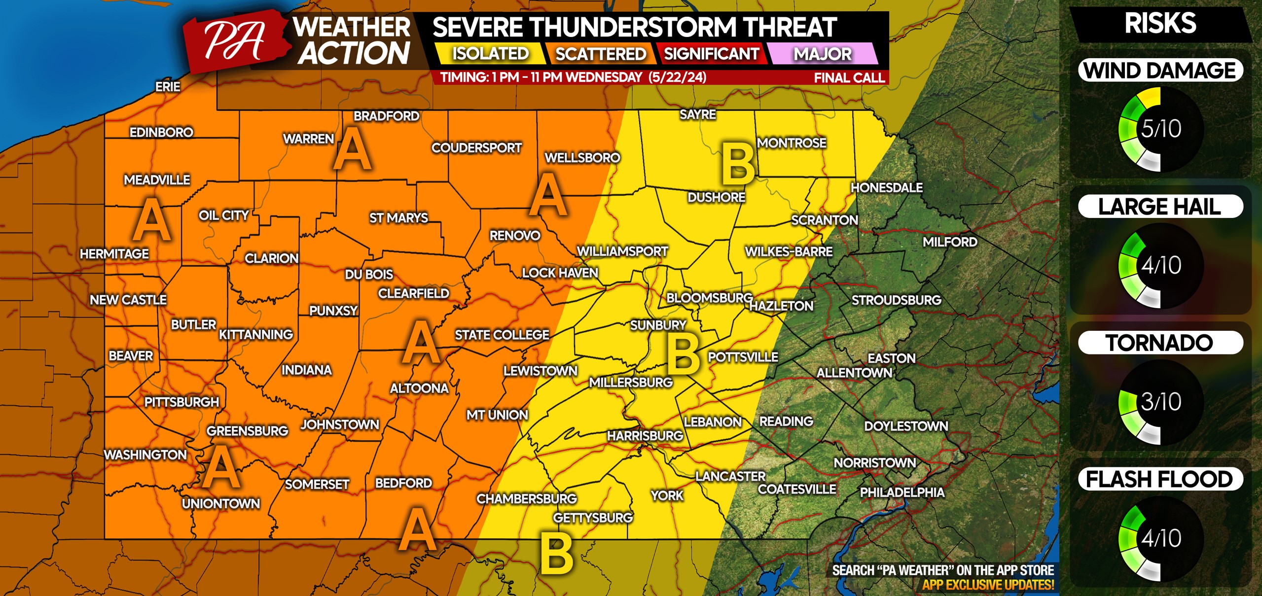
Area A: Scattered severe thunderstorms possible Wednesday afternoon and evening. Damaging winds up to 60MPH are the main concern, along with isolated hail in the strongest storms. Frequent lightning is likely.
Area B: Isolated severe thunderstorms possible, with damaging winds being the main concern. Very isolated hail is possible, along with frequent lightning.
Don’t forget to share this forecast with family and friends! A lot of people have outdoor events on Wednesday evenings this time of year!
You must be logged in to post a comment.