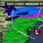
Based off current radar observations and latest guidance, it looks like about half of PA will be able to escape the brunt of the Severe Thunderstorms and heavy rainfall during overnight hours and into Tomorrow Morning.
Latest short range model, HRRR, shows this well valid for 7 am:
It looks like if you live north of I-80 in PA your Thursday Morning will remain completely dry. Those areas south of the PA/MD border are in store for what looks to be a good amount of rainfall, perhaps over 2 and even 3 inches in spots. Just 36 hours ago, most guidance had this tracking over much of PA. The low pressure system has trended a good 50-75 miles out over those last 36 hours.
Based on all that, here is the latest forecast map, based on the Storm Prediction Center’s Forecast. Western PA will get into the rain and thunderstorms a little after Midnight, the rest of Southern PA will see thunderstorms throughout the Morning hours. By noontime, all activity should be off to our Southeast.
Area A – This region remains under a SLIGHT RISK for severe weather. The potential exists for damaging winds and large hail.
Area B – This region is under a MARGINAL RISK for severe weather. The Northern extent of this zone up in Northwest PA will likely remain dry, however the southern extent may potentially see damaging winds and flash flooding.
Area C – All activity should remain under Severe criteria. Localized downpours are possible. Areas in Central and in Northwest PA located in this zone will likely remain dry.

[facebook_share url=”https://paweatheraction.com/?p=1537&preview=true” width=”” layout=”button_count”]


You must be logged in to post a comment.