Severe weather season is quickly ramping up across Pennsylvania, right on time with our usual start. A weak cold front will sweep through as a low pressure pushes through Upstate New York on Saturday. Partnered with sufficient instability and a relatively moist column, storms are expected to fire up in Western PA and push east.
STORM TIMING
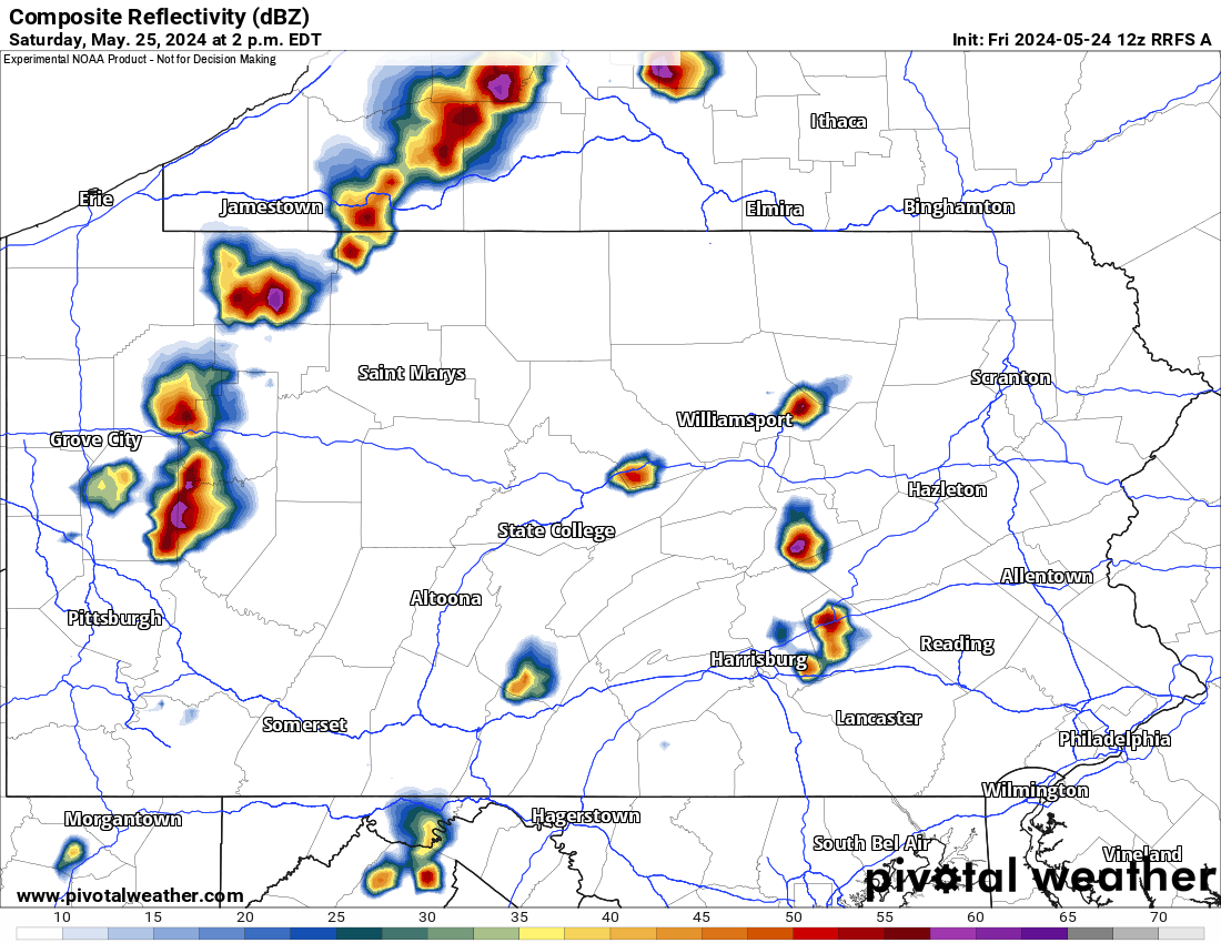
Thunderstorms are projected to fire up in Western PA between 1-3 PM, and strengthen as they push east into the Alleghenies. Small hail and gusty winds will immediately be probable in stronger cells. Below is future radar for 2:00 PM Saturday. There may be a few cells that fire up in the Susquehanna Valley as well.
As move into the late afternoon and early evening, storms will likely reach their maximum strength for the day, which for the most part will be below severe criteria, which is 58mph winds. With that said, a few storms likely will be severe.
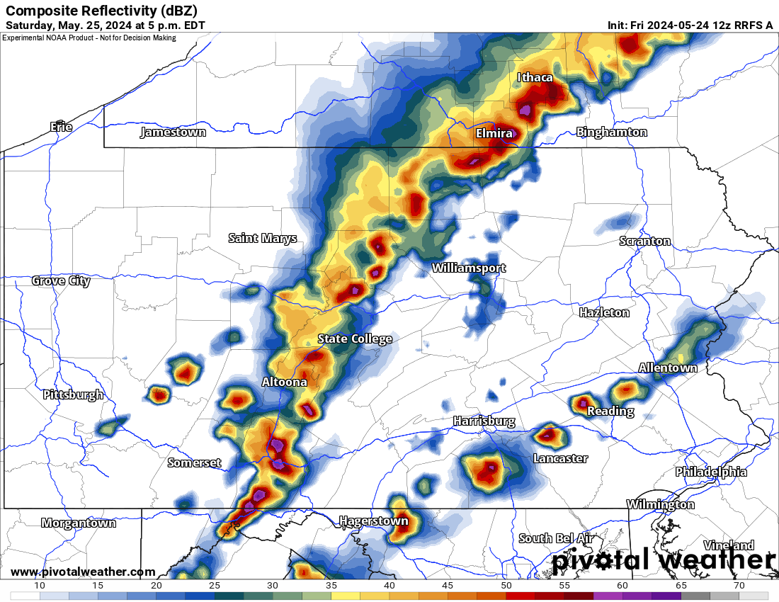
By 5:00 PM Saturday, a broken line of storms is anticipated to be pushing through much of Central PA. This is also when a slim tornado threat will exist, especially near north of I-80. View future radar below.
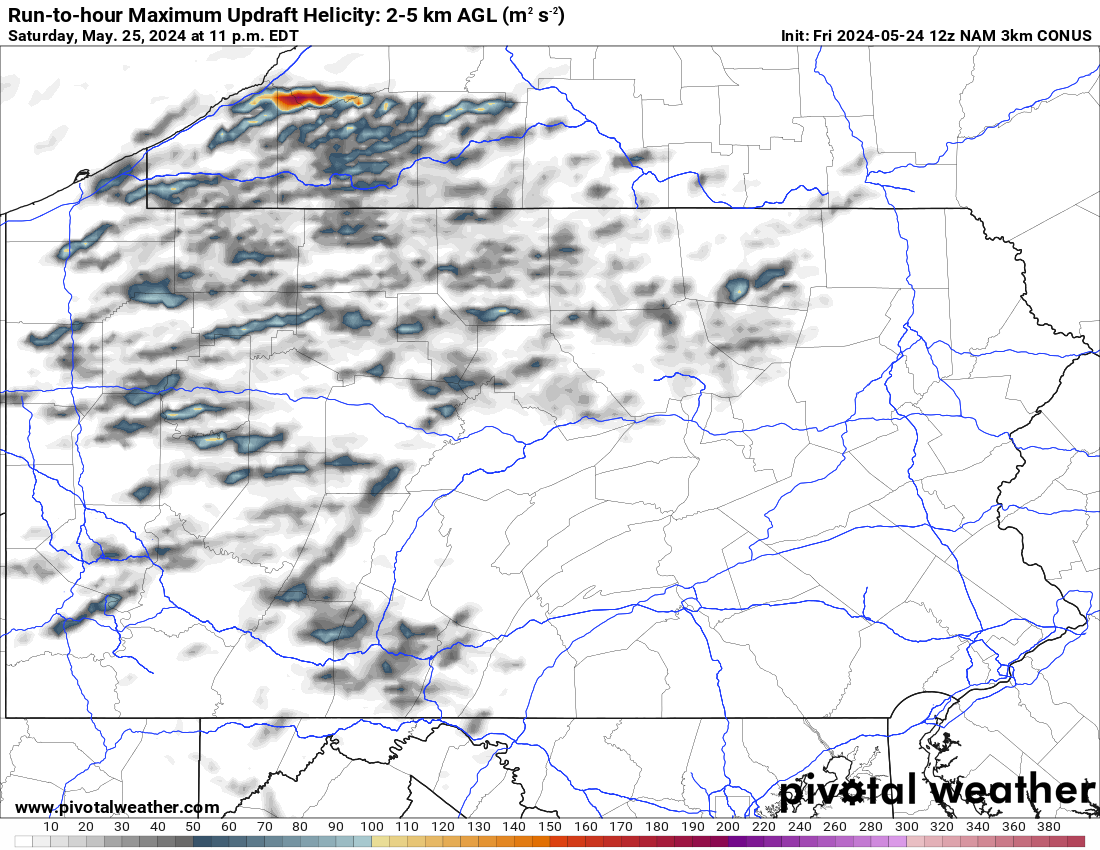
As mentioned, the tornado threat will be non-zero, as decent wind shear will be present especially across Northern Pennsylvania. The SPC currently has no tornado risk, but we expect an upgrade to 2%, still very low.
The map below displays maximum updraft helicity, which is basically maximum spin among cells. There will be some broad spin to these cells, but nothing stands out as overly concerning.
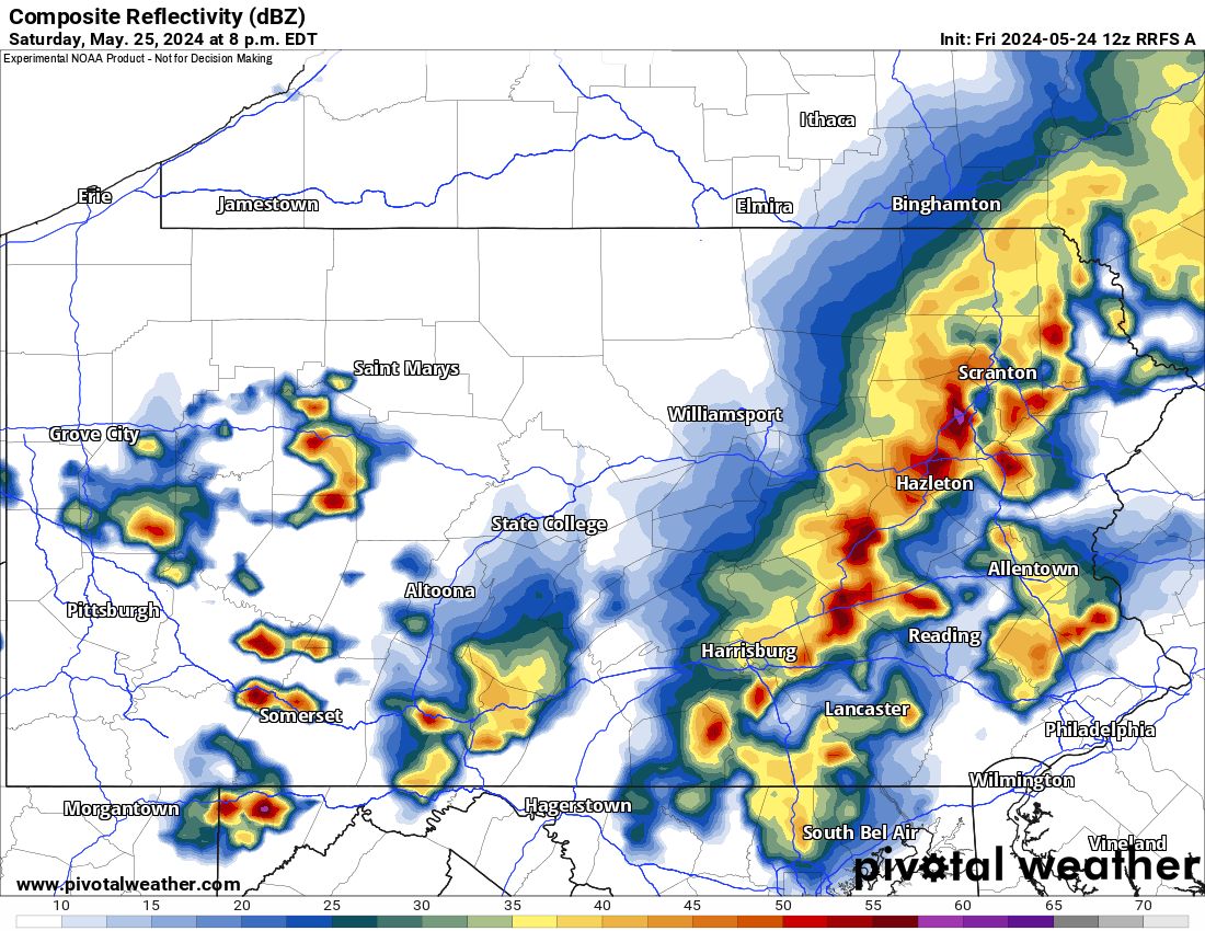
Finally as we move into Saturday evening, storms are likely to be near I-81, and will be exiting the area of greatest instability. This is when storms will slowly weaken, but lightning and gusty winds will still be a concern for Saturday evening plains across Central and western parts of Eastern PA. View future radar for 8:00 PM below.
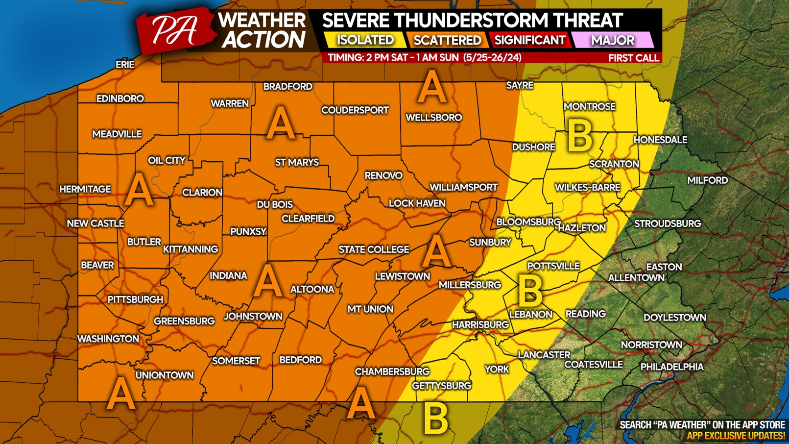
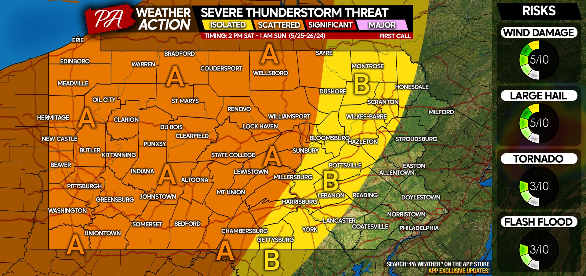
SEVERE THUNDERSTORM THREAT MAP FOR SATURDAY 5/25/24
Area A: Scattered severe thunderstorms likely Saturday afternoon and evening. Damaging winds up to 60MPH are the main concern, along with scattered hail in the strongest storms. Frequent lightning is likely.
Area B: Isolated severe thunderstorms likely, with damaging winds and isolated hail possible.
Non-severe thunderstorms are possible east of Area B late Saturday evening, with lightning a concern for outdoor plans.
Don’t forget to share this forecast with family and friends who may have outdoor plans!

You must be logged in to post a comment.