
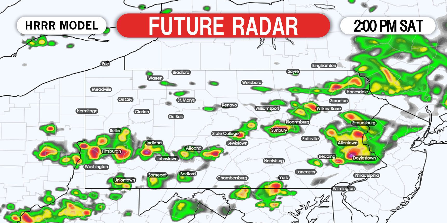
While heavy showers and storms are expected to move through parts of the state tonight and into Saturday morning, we will have another potential for severe weather later Saturday afternoon. Much of the state is under a Slight Risk for scattered severe thunderstorms expected Saturday afternoon.
Most of the severe weather is likely to be south of I-80, according to latest short range models. Storms will likely pop-up near or just south of I-80 around noon Saturday and move southeast. Damaging winds and small hail are the main threats, but an isolated tornado can’t be ruled out in southeast PA.
STORM TIMING
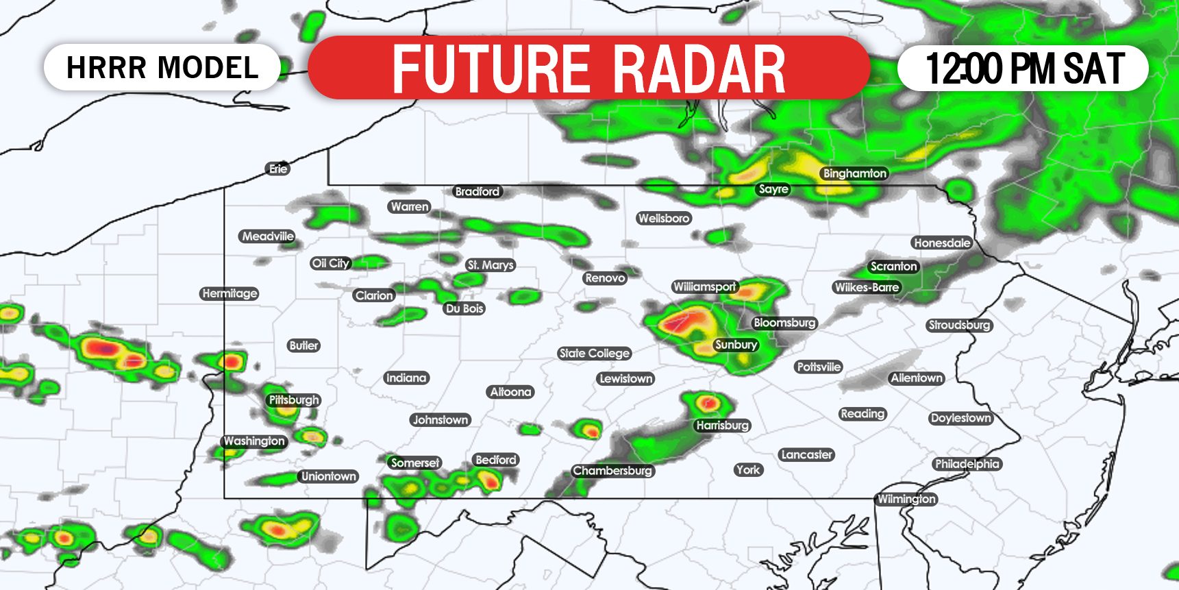
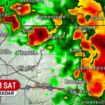
Starting at noon Saturday, thunderstorms will begin to develop near I-80. Some are likely to strengthen while others may dissipate, they will be hit-or-miss. Below is HRRR future radar for 12:00 PM Saturday.
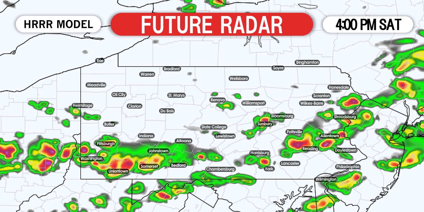
Around 4:00 PM is when the thunderstorms will be most intense, and is when the hail threat and that very isolated tornado threat will exist in southeast PA (including the LV). By 4 the storms will be near the PA Turnpike in southern PA, from Washington to Somerset, over to Harrisburg and to Reading. Here is future radar for 4:00 PM Saturday afternoon.
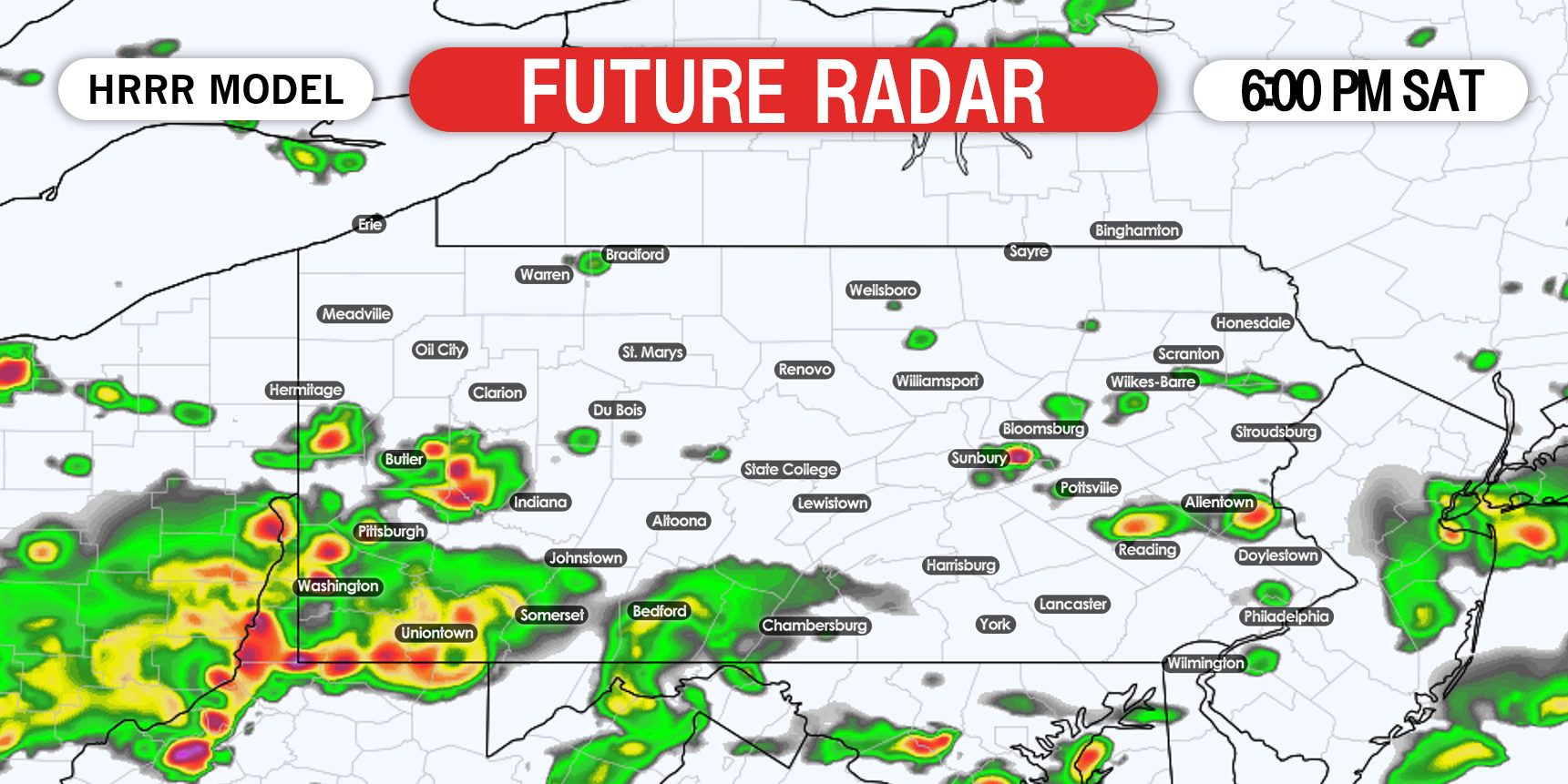
By 6 PM we expect the storms to be near the southern PA state line, if not south of it. This will be mainly a Saturday afternoon event, as things should be mostly cleared up by the evening. Below is future radar for 6:00 PM.
SPC SEVERE THUNDERSTORM OUTLOOK FOR SATURDAY AFTERNOON
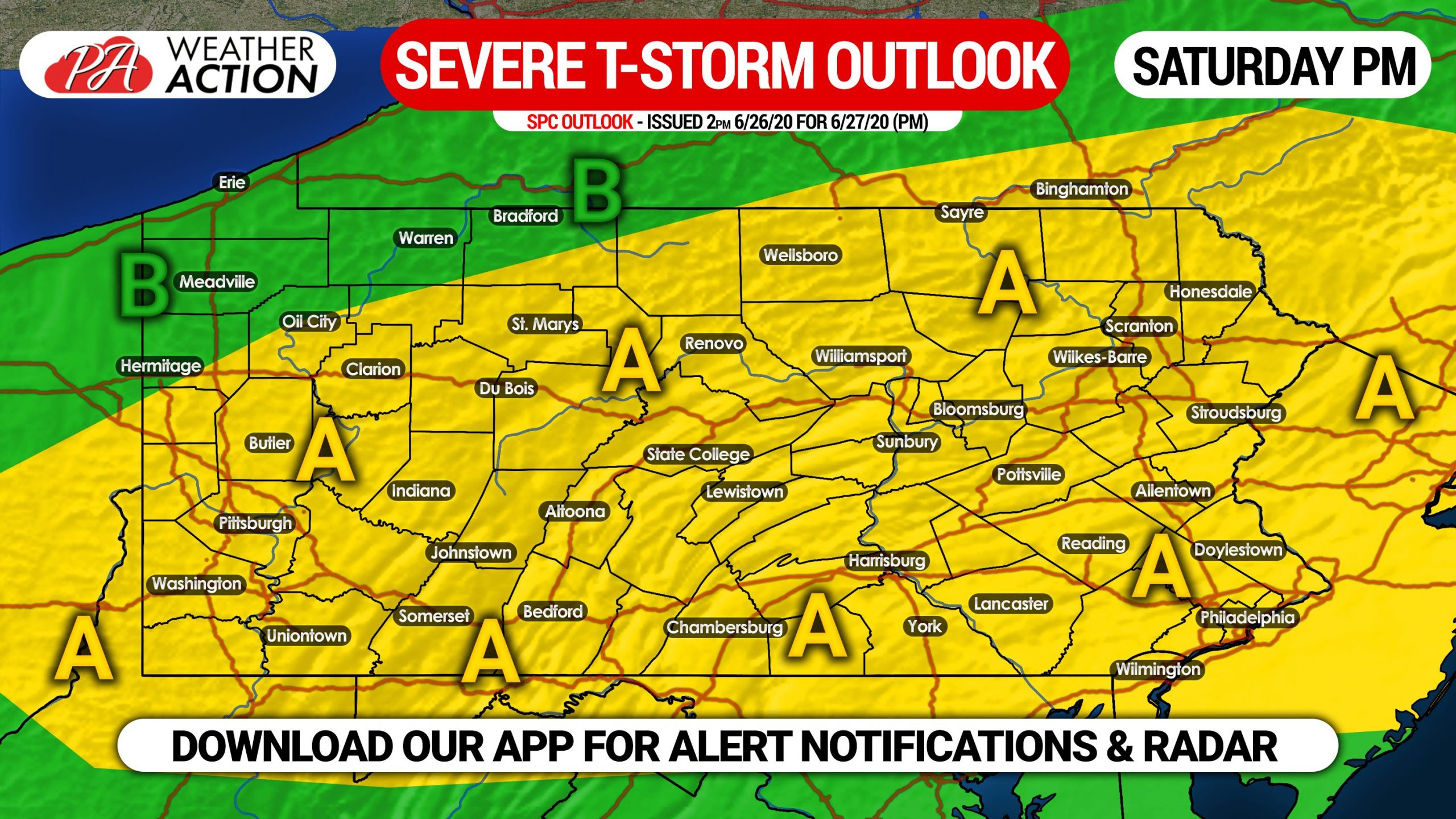
Area A: Scattered strong to severe thunderstorms possible. Not everyone will be hit, as we are not looking at a linear threat. Damaging winds and hail are possible along with an isolated tornado in southeast Pennsylvania.
Area B: These locations in northwest PA will see their storms early Saturday morning. If they do see anything later in the day Saturday, it will be around or just before noon but we don’t expect much in the way of strong to severe storms.
We will have live radar on facebook Saturday, and you can also track the storms with our app, where you will be sent push notifications as soon as an alert is issued for your area. Download it here >>> Weather Action App
Don’t forget to share this update with family and friends who may be impacted!
You must be logged in to post a comment.