Good morning, after a long night of significant winds, large hail and some tornadoes, we now shift our focus East towards the Midwest as this large cyclone moves in.
Tuesday’s Severe Weather Outlook
A moderate risk today for the upper Midwest in the Missouri and Mississippi River Valleys. A large cyclone with a cold front will move East into IA,Northern MO, MN,WI and IL later this afternoon.
A severe weather outbreak is very likely today with very large hail, significant winds and a possible tornado outbreak with strong tornadoes. Please see SPC threat map. 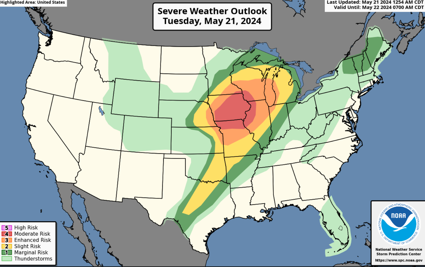
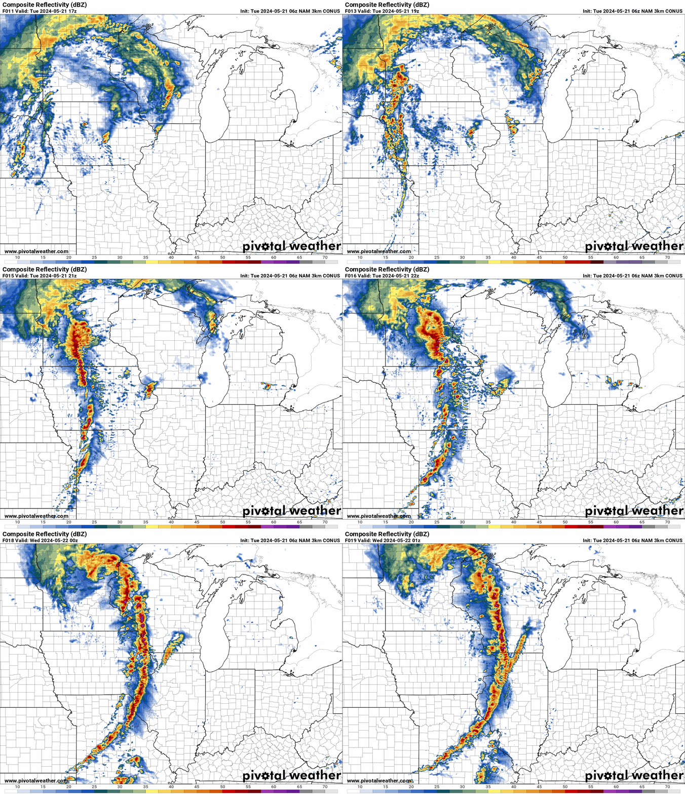
NAM Future Radar for Tuesday
The future radar shows multiple lines of severe weather starting in Western IA later today and moving East into IA,Northern MO, Southern MN, WI and Northern IL. Very large hail, significant winds and a tornado outbreak is likely. This is expected to start this afternoon around 2 to 3 pm and quickly move East by tonight.
HRRR Helicity Tracks for Tuesday
A huge swath of significant winds, very large hail and possible longe tracked tornadoes are highlighted on the helicity map for today. This will start after noon today and go into overnight. 
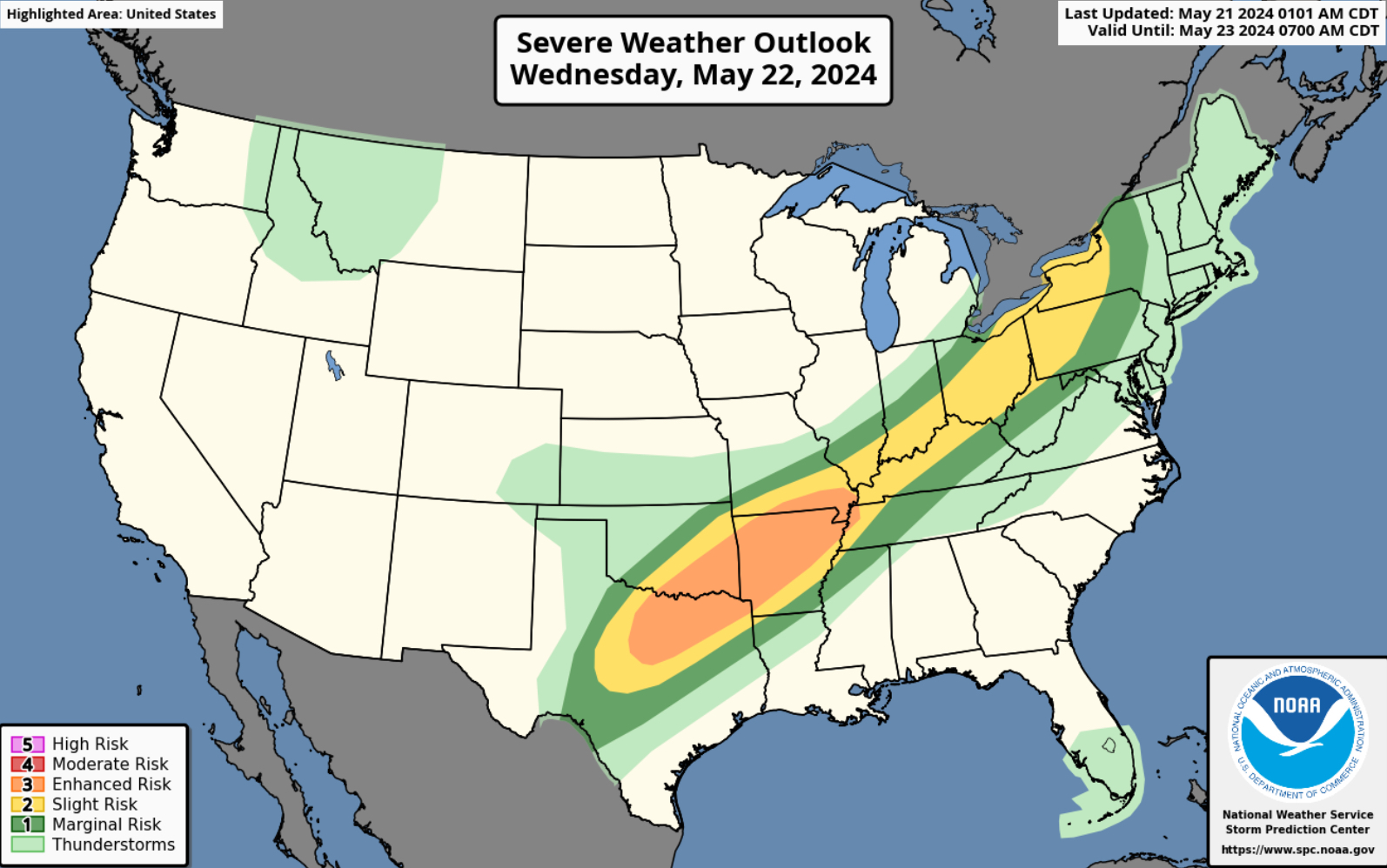
Wednesday’s Severe Weather Outlook
Very large hail, damaging winds and possible tornadoes for the Southern Plains and the Mid South then East towards the Tennessee and Ohio Valleys. This will include North TX, Central and Eastern OK, AR, MO, LA, TN, KY, IL, IN, OH, NW MS, PA, WV and Western NY. Please see SPC map.
Thursday’s Severe Weather Outlook
Large hail and damaging winds will be the main threat for Thursday with possible tornadoes. A cold front will push through the Southern Plains bringing severe weather to OK, TX,KS, AR, MO and LA.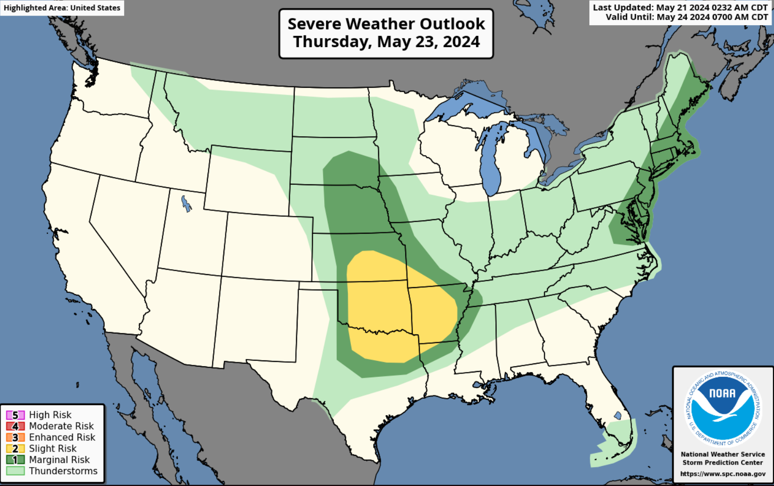
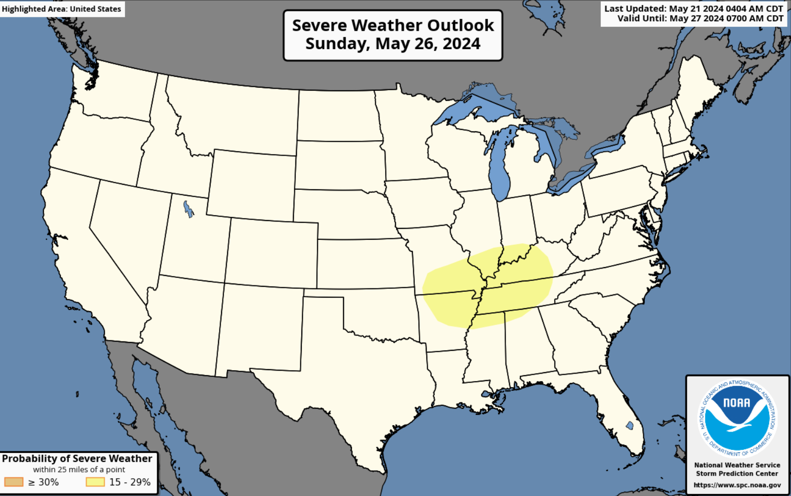
Severe Weather for Memorial Day Weekend
Another system moves through on your Memorial Day weekend bringing more severe weather to the Plains, Mississippi, Missouri, Tennessee and Ohio Valleys. We will have more on this set up as we get more updates from the SPC.


You must be logged in to post a comment.