
The threat of severe weather possible on Saturday with the passage of a low pressure system, wet conditions will continue into Sunday with the passage of a cold front.
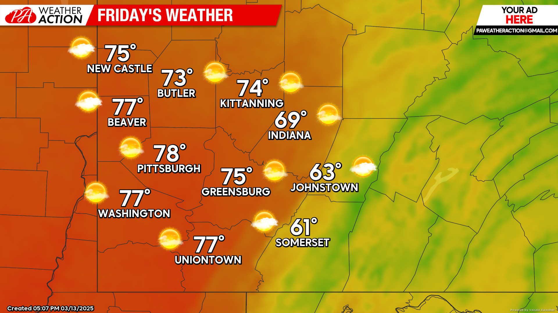
Friday
Dry and warm conditions continue with mostly sunny conditions. Highs will be in the upper 70s to low 60s, lows will be in the mid 50s to mid 40s. Winds will be out of the south-southeast at 5-10 mph, wind gusts 20+ mph are possible in the higher altitudes.
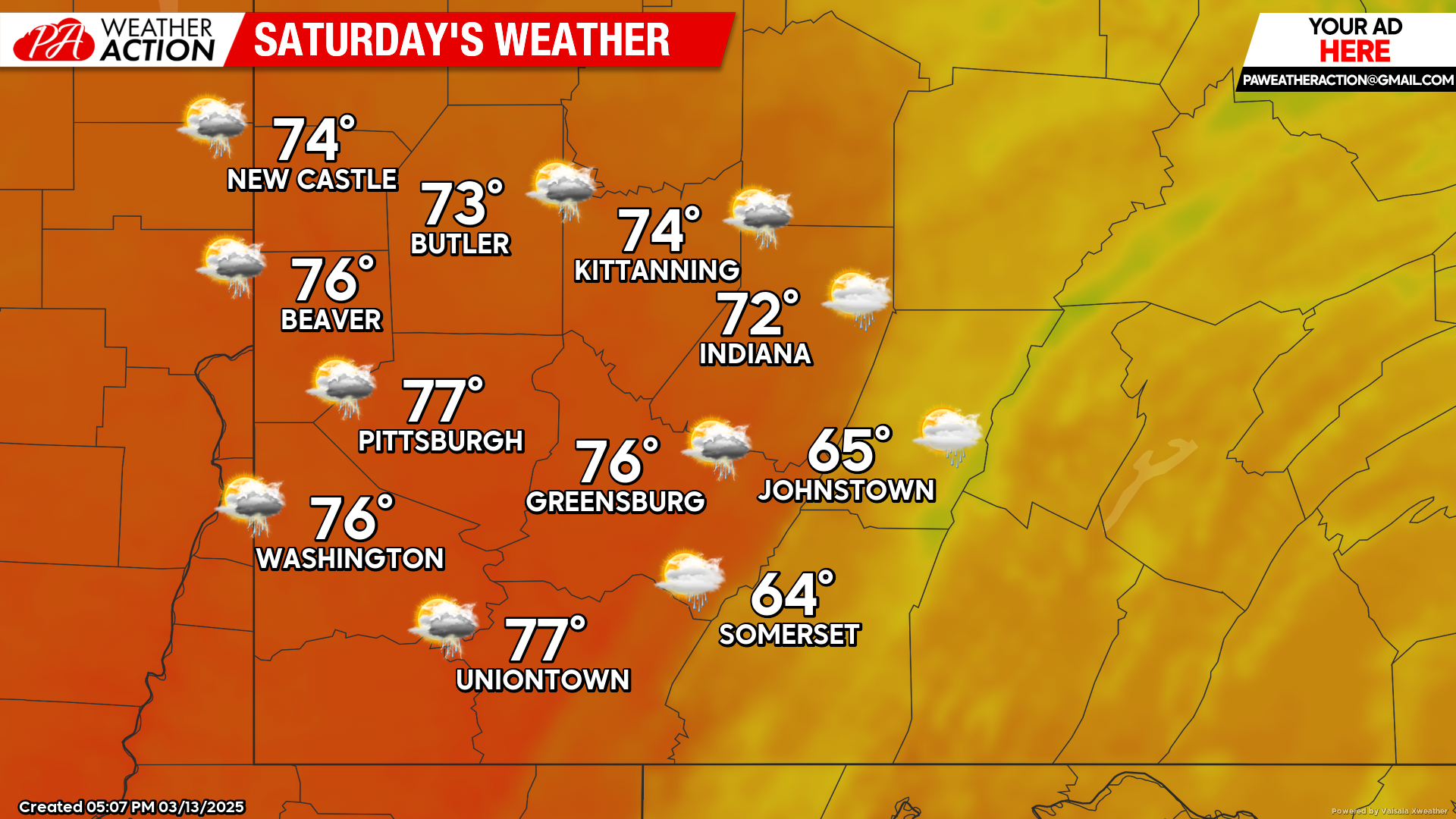
Saturday
Mostly cloudy conditions will transition to showers and thunderstorms in the afternoon hours, some storms could be severe. Heavy rainfall could lead to flooding in some areas. Highs will be in the mid 70s to mid 60s, lows will be in the low 60s to mid 50s. Winds will be out of the south-southeast at 7-15 mph, wind gusts as high as 25 mph are possible, some gusts could be stronger in thunderstorms.
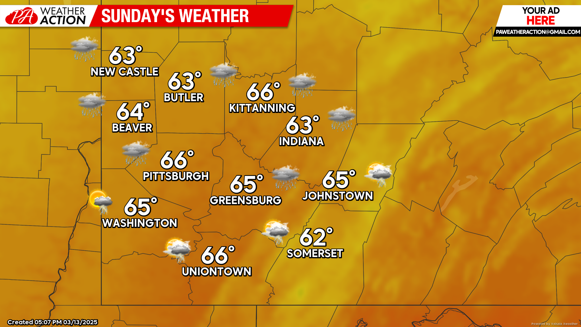
Sunday
Showers and thunderstorms are expected to continue with the passage of a cold front. Highs will be in the mid to low 60s, lows will be in the mid to low 30s.
Drier but cooler conditions are expected to start the week. Be sure to follow PA Weather Action for more forecasts.


You must be logged in to post a comment.