Good afternoon everyone, after a busy weekend of severe storms in the Plains and other parts of the US, we now focus on an active week ahead.
Severe Weather Outlook for Monday
A slight risk for severe weather are all possible today for the Northern and Central Plains, West Texas and the Southeast US. Large hail and damaging winds will be the main threat today, with a low chance of tornadoes. Please see SPC risk map.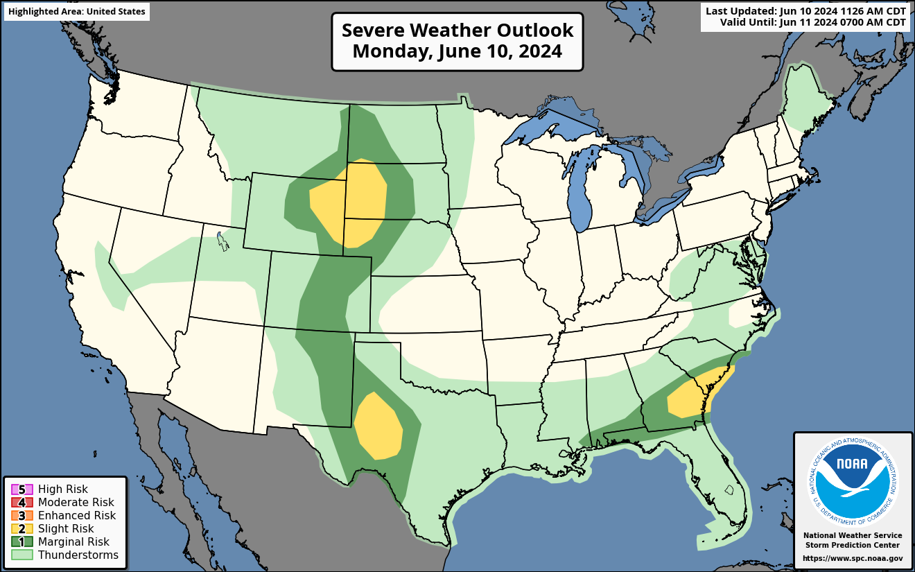
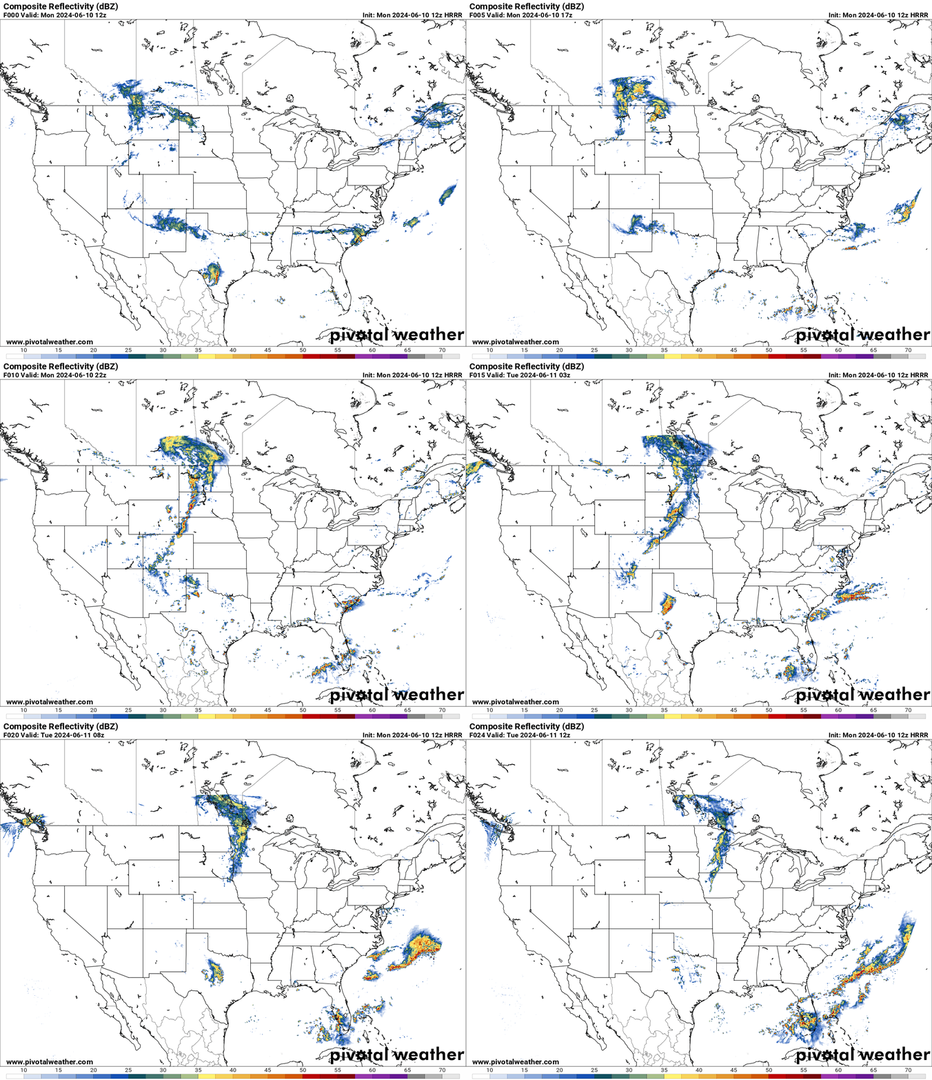
HRRR Future Radar for Monday
A large low pressure system will be moving into the Plains today bringing a cold front with it with severe weather in the Plains. Large hail and damaging winds will be the main threat with a low chance of tornadoes.
There is another severe threat in the Southeast US as a front moves through that area. Main threat is large hail and damaging winds.
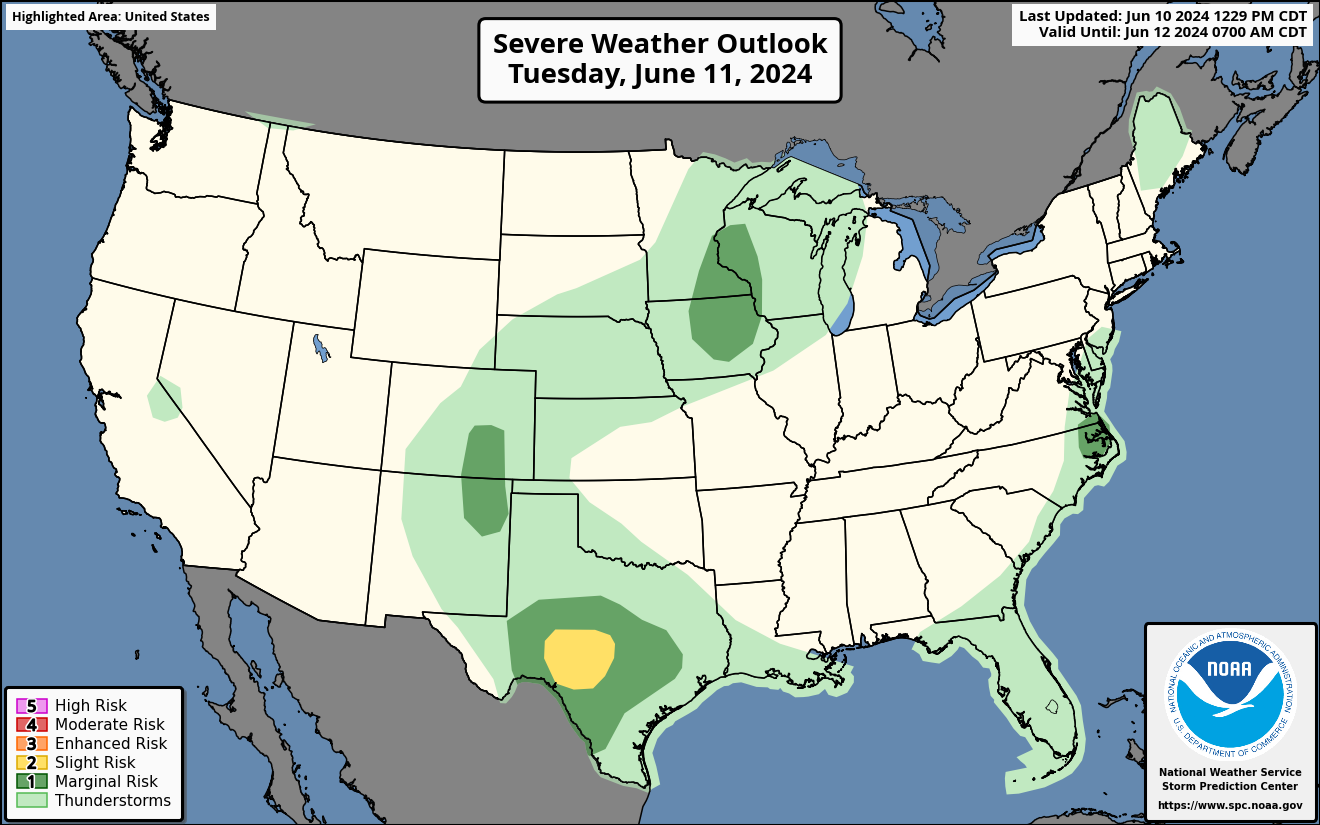
Severe Weather Outlook for Tuesday
A slight risk for severe storms on Tuesday in the Edwards Plateau of West Texas. Large hail and damaging winds will be the concern.
A marginal risk for severe weather in New Mexico, Colorado and in the Upper Midwest with damaging winds and large hail are possible. Please see the SPC risk map.
Severe Weather Outlook for Wednesday
A slight risk of severe weather for the Upper Midwest on Wednesday as a front moves through the area. Large hail and damaging winds will ge the main concern. Please the SPC risk map. 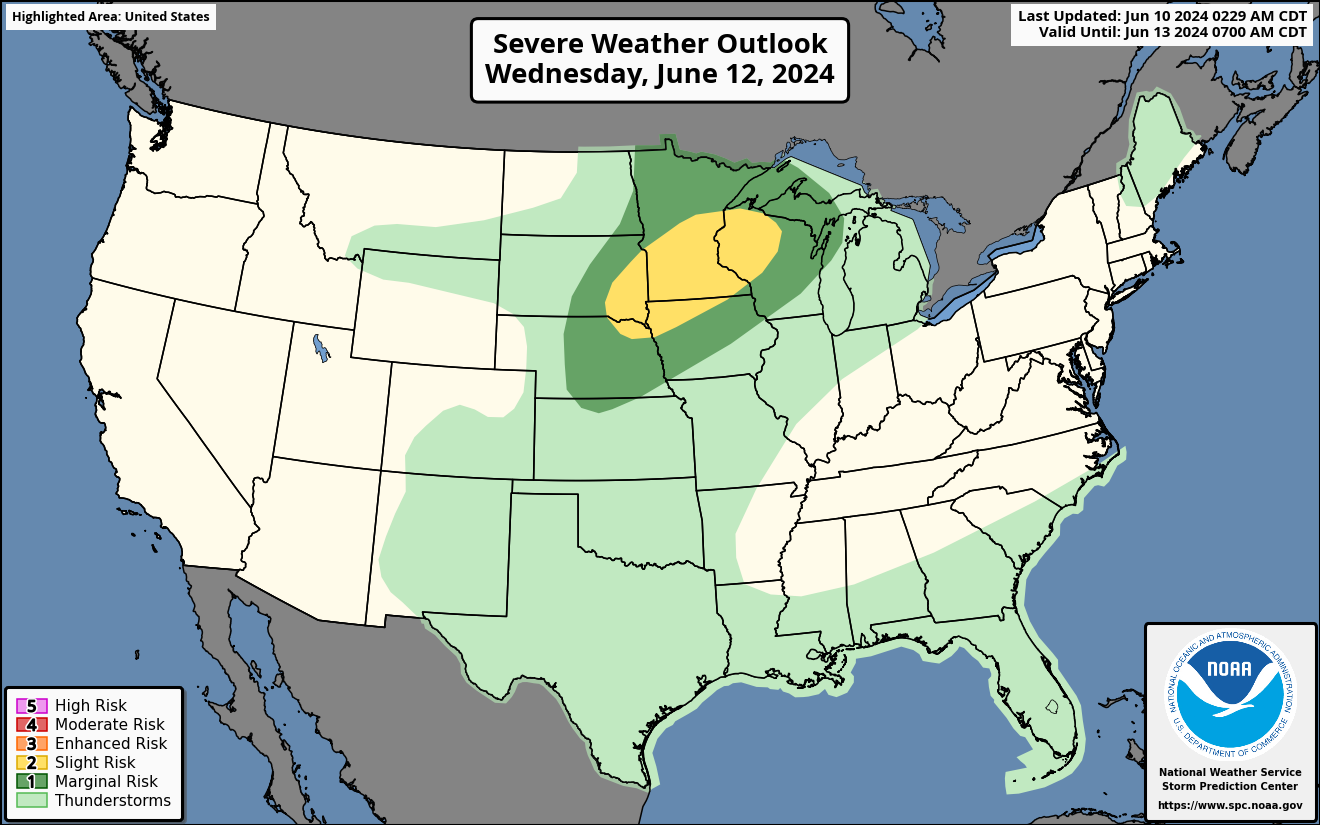
Severe Weather Outlook for Thursday
A severe weather threat for Thursday in the Central Plains and Midwest. Large hail and damaging winds are the concern. Here is the SPC risk map. 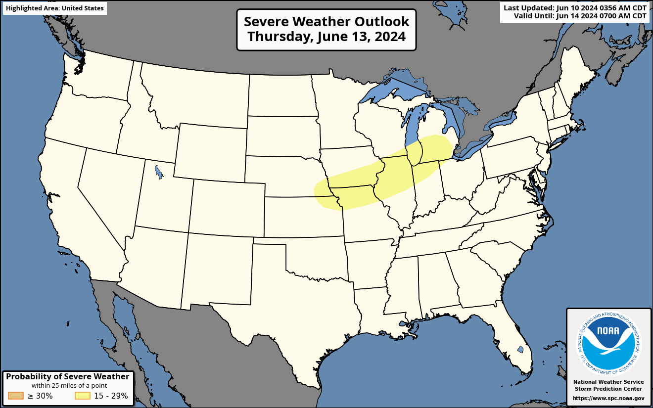
A Major Flood Risk for Florida this Week
As a tropical system moves up towards Florida, it will meet up with a front that will be moving through the area starting tomorrow. The interaction with the two features will cause a huge surge of tropical moisture creating a monsoon for Florida, where over a foot of rain could fall this week. Although beneficial rains for a drought stricken Florida, this could lead to a lot of flooding issues. 

You must be logged in to post a comment.