
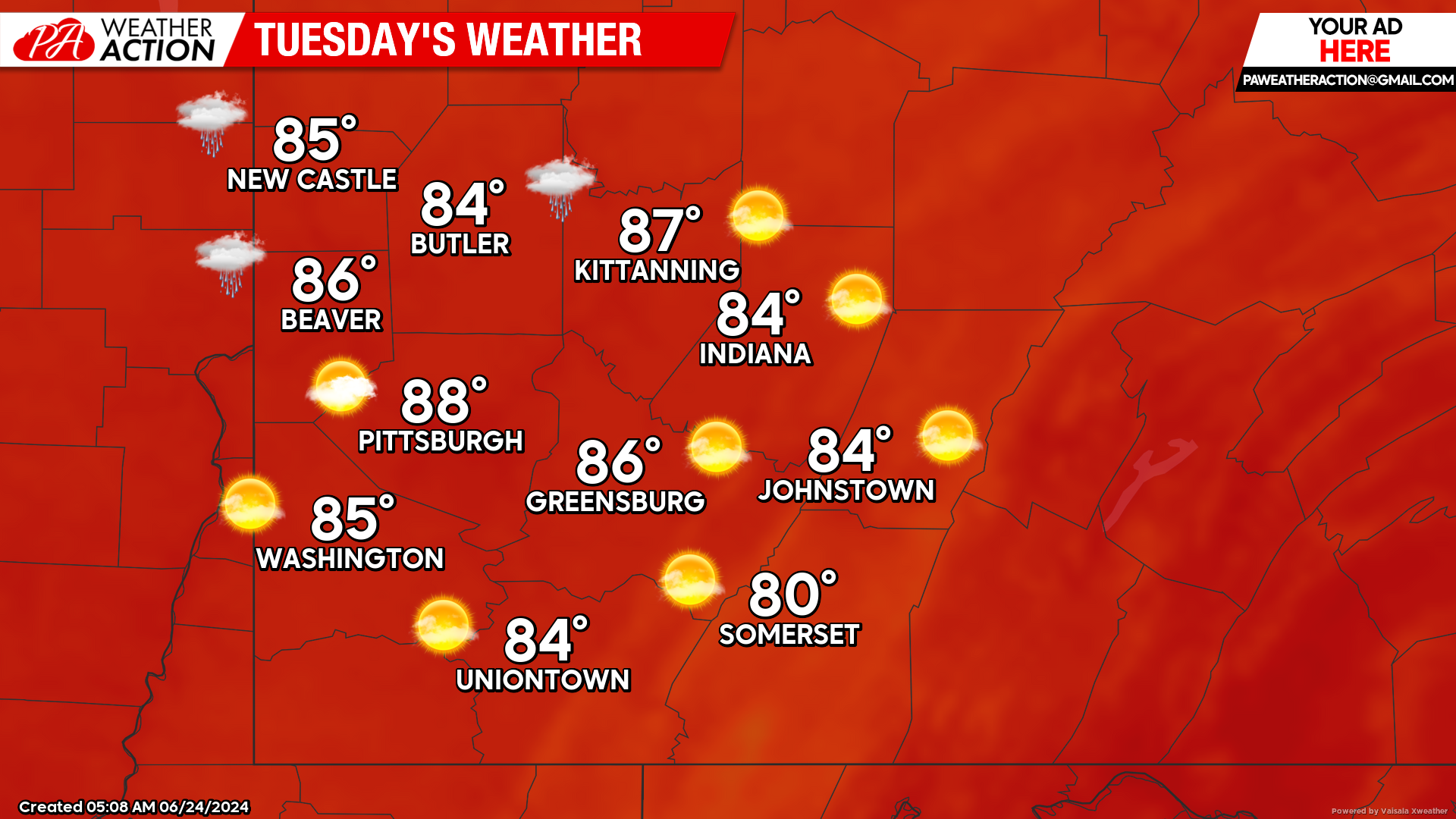
Warmer temperatures are expected Tuesday before the next chance for severe weather to possibly impact the region Wednesday as storms are expected in the afternoon hours.
Tuesday
Mostly sunny conditions with increasing clouds moving into the region with chances for showers and thunderstorms in the overnight hours. Highs will range in the 80s, with lows in the low 70s to mid 60s. Winds will be out of the south-southwest at 5 to 10 mph.
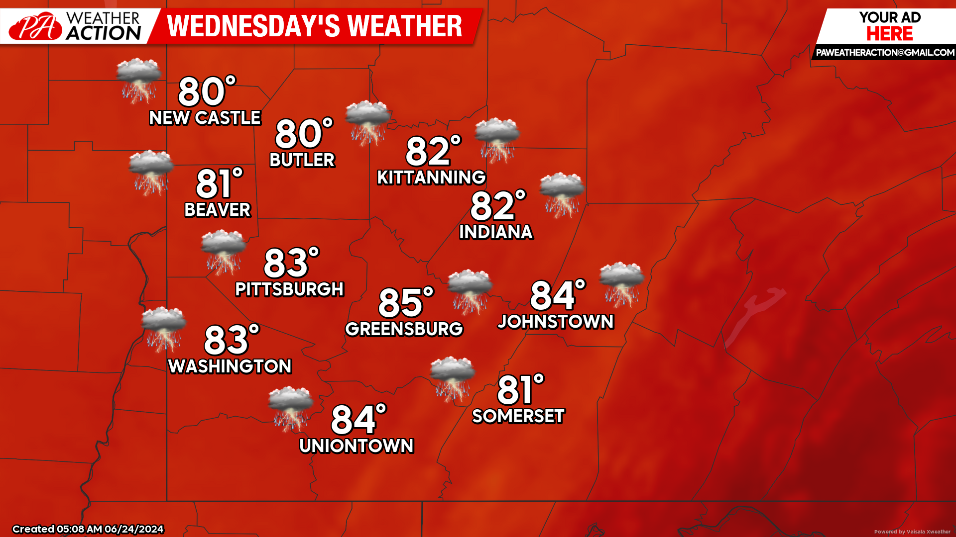
Wednesday
Showers and thunderstorms, some storms could be severe, best chance for storms will be in the afternoon and evening hours. Highs will be in the mid to low 80s, lows will be in the low 60s. Winds will be out of the West-Soutwest at 7 to 14 mph, wind gust 20+ mph are possible in the higher elevations.
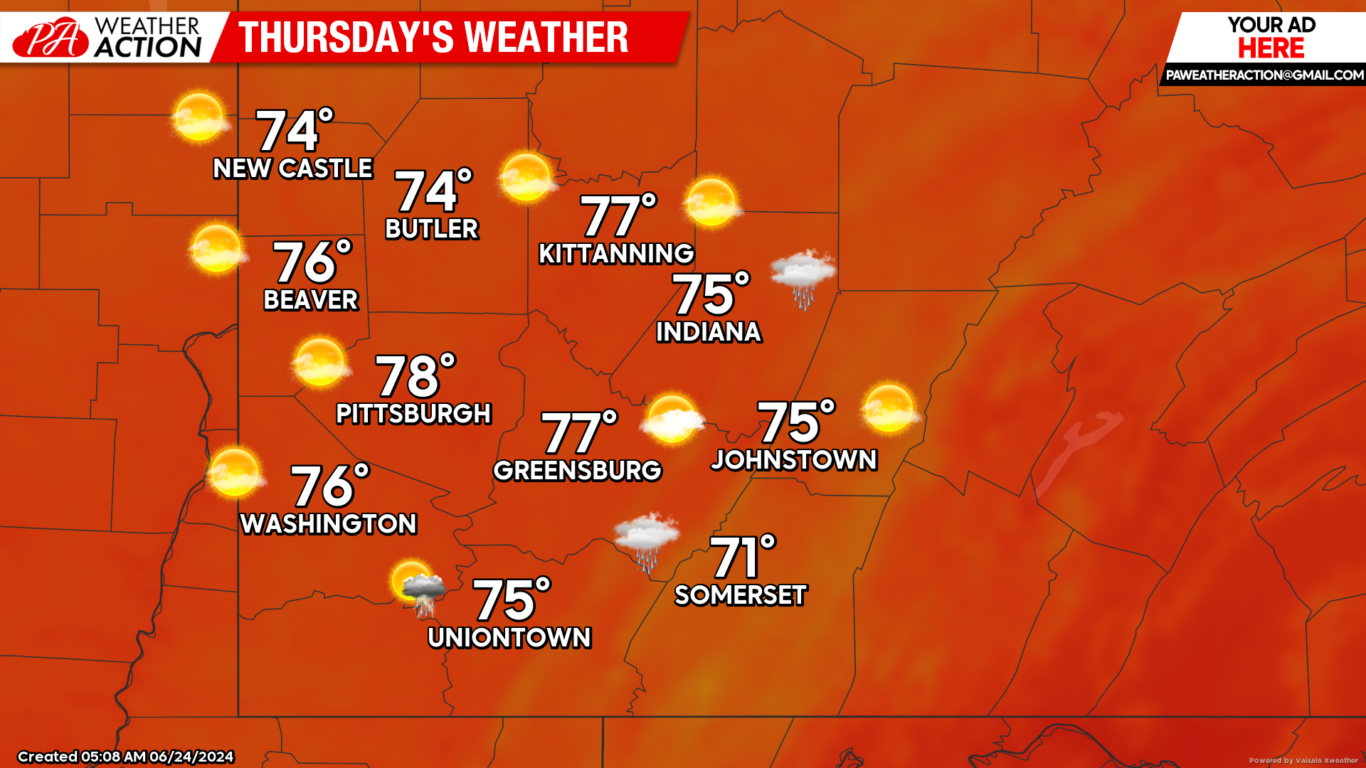
Thursday
Mostly sunny conditions with cooler temperatures throughout the region. Highs will be in the mid to low 70s, lows will be in the mid to low 50s.
Temperatures look to rebound as we approach the weekend with high temperatures approaching 90 degrees. Be sure to follow PA Weather Action for more details and updated forecasts.


You must be logged in to post a comment.