
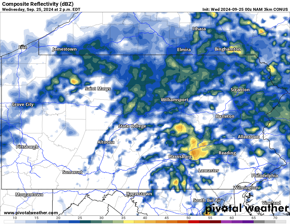
Mother Nature has delivered much needed rain over the state the past several days and that theme looks to continue through the end of the week. Below is a look at the latest radar:
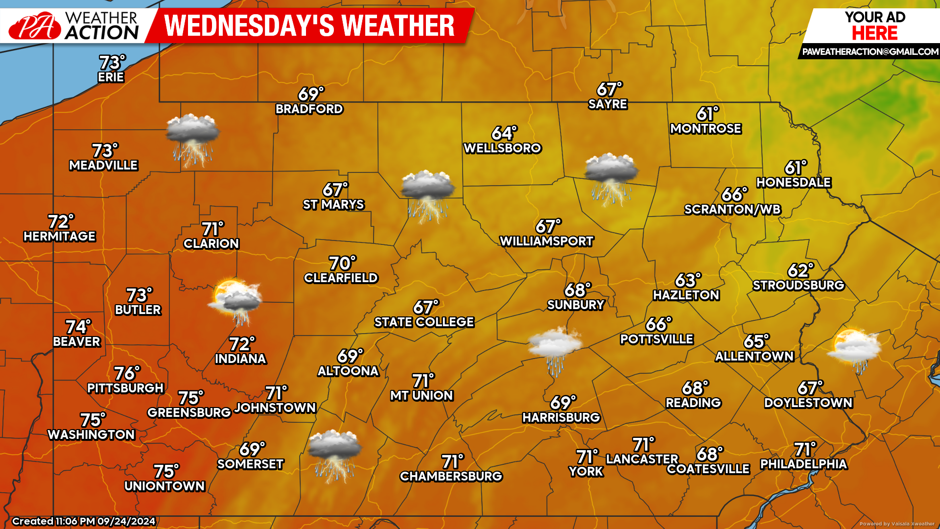
Today’s Weather Forecast: 3/10
Numerous showers and perhaps a rumble of thunder is expected today across the state with temperatures in the 60s and 70s.
Hi-Res NAM Future Radar Valid for 2:00 PM Today:
Below is a look at the Hi-Res NAM future radar valid for 2:00 PM Today. Most of the shower activity will be during the morning and early afternoon hours. Brief heavy downpours are possible.
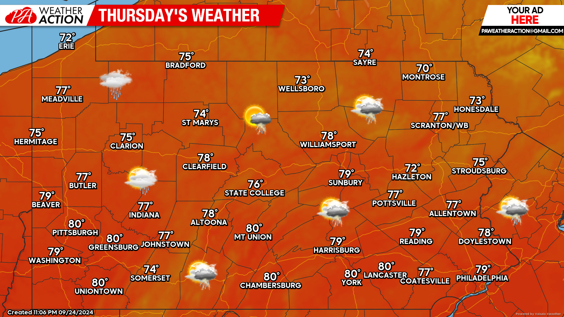
Thursday’s Weather Forecast: 7/10
Isolated showers and thunderstorms are expected Thursday. Warmer air will filter into the state with many locations reaching the upper 70s to near 80 degrees.
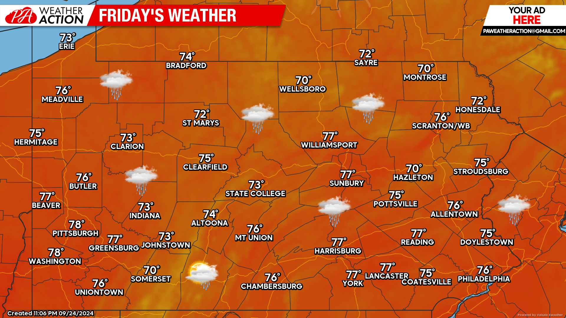
Friday’s Weather Forecast: 7/10
Friday will feature the chances for on and off showers state-wide with temperatures generally in the 70s.
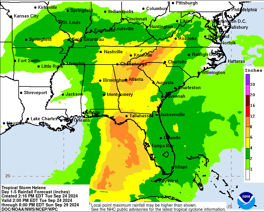
Hurricane Helene:
As I am typing this article Helene is currently a tropical storm, but will very soon reach Hurricane criteria. While the Southeast US and Southern Mid-Atlantic region will face significant impacts from Hurricane Helene, we should remain clear from any Helene remnants. Below is a look at the National Hurricane Center’s projected rainfall totals from Helene through Sunday:

You must be logged in to post a comment.