


Typically when we talk snow in April in Pennsylvania, it’s relatively minor and nothing that would affect travel conditions. That will not be the case this time, as a coastal system will rapidly intensify at a perfect time as a strong cold shot just made its way into the region.
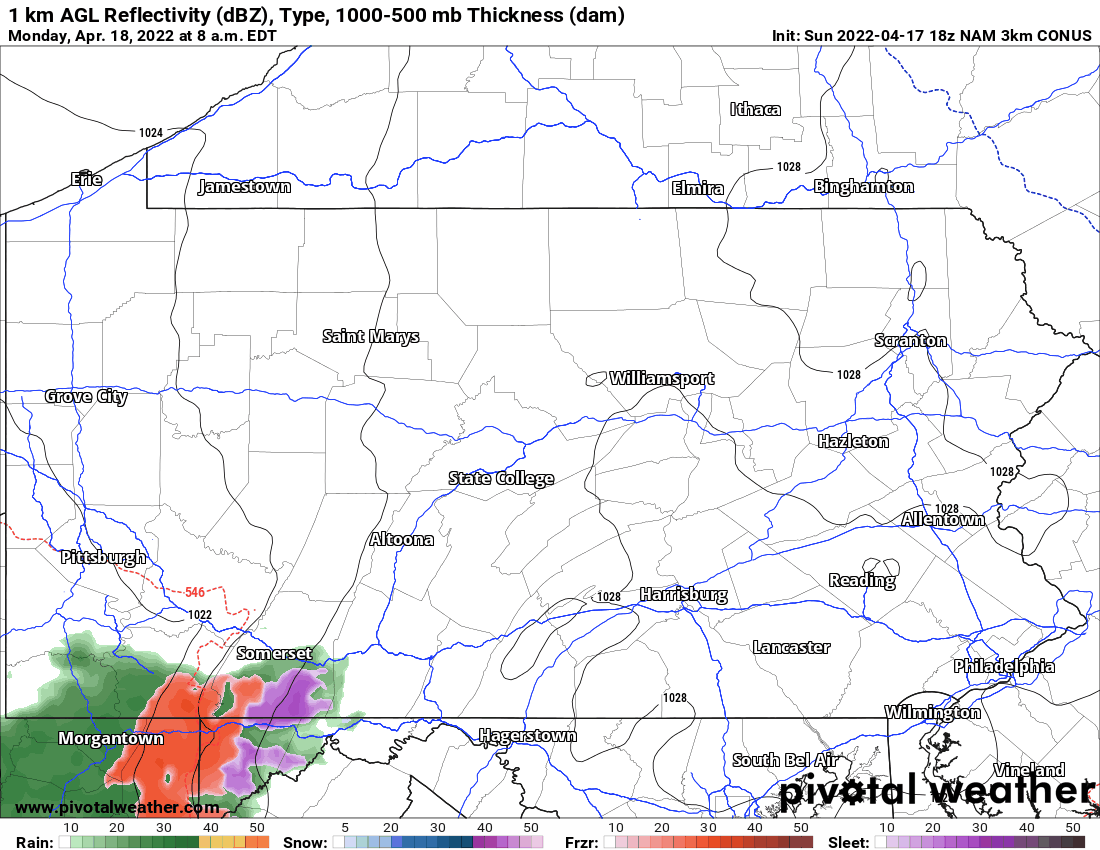
Low elevations will begin as rain generally, with high elevation snow Monday afternoon. Areas over 1000′ elevation in Central & Eastern PA, as well as NWPA, will then change to wet snow as precipitation rates become heavier in the evening. Highest snow accumulations will be above 1500′ elevation in Northeast PA. Heavy rain and snow will persist into the early morning hours of Tuesday before exiting to the northeast. Below is future radar for illustration.
SNOWFALL FORECAST FOR MONDAY AFTERNOON TO TUESDAY MORNING
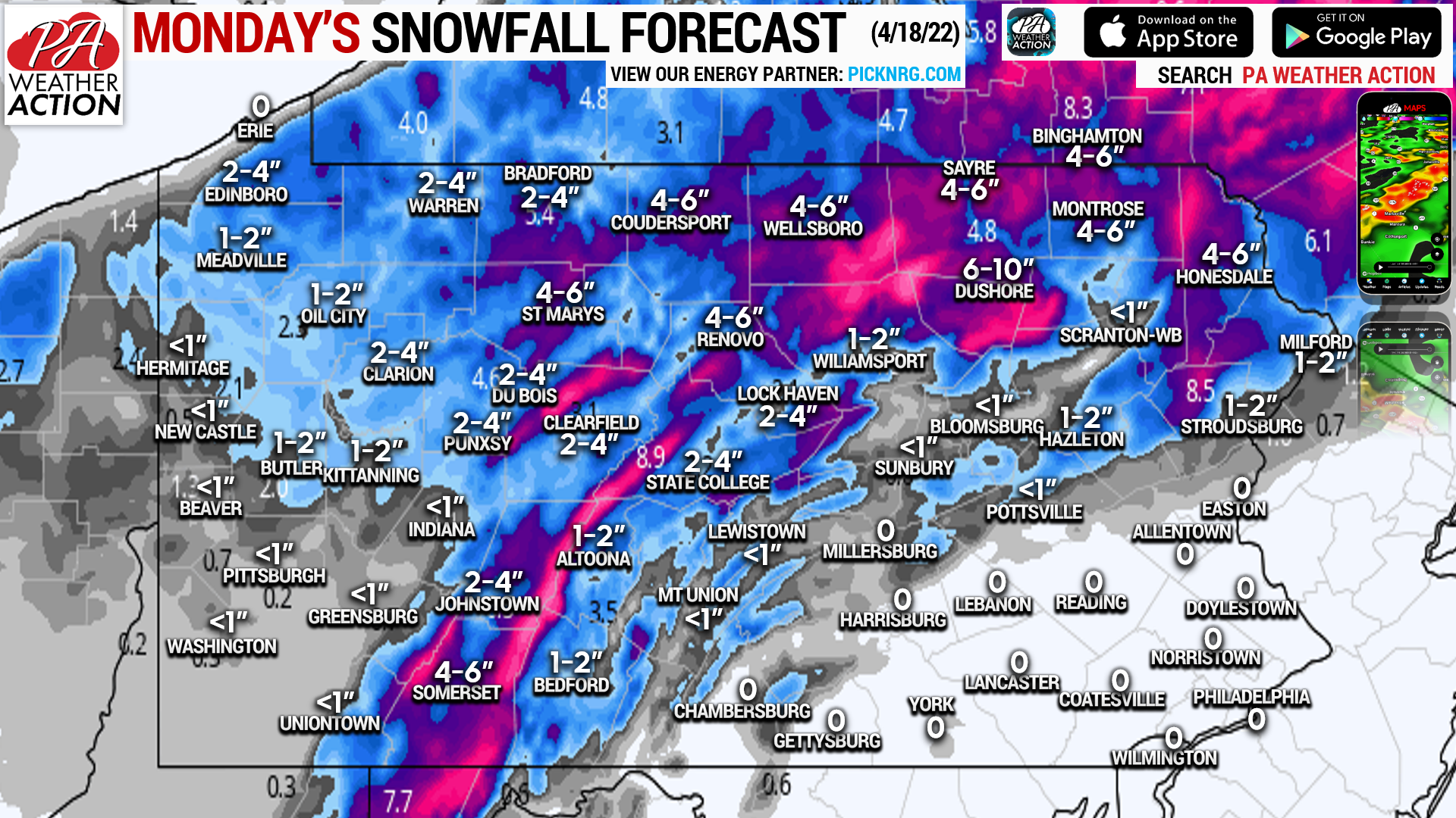
This will be an extremely elevation-dependent snow event. Mountain tops will see about three times the amount of snow as the valleys. So be aware of changing conditions if your drive includes venturing over the mountains.
Be sure to share this forecast with those who may have no idea this is happening due to the time of year!
[social_warfare]
You must be logged in to post a comment.