Good morning, after a long day and night of devastating tornadoes in the Midwest, we now focus on Wednesday for another round of severe weather in the Southern Plains, OH,MO,TN and MS Valleys.
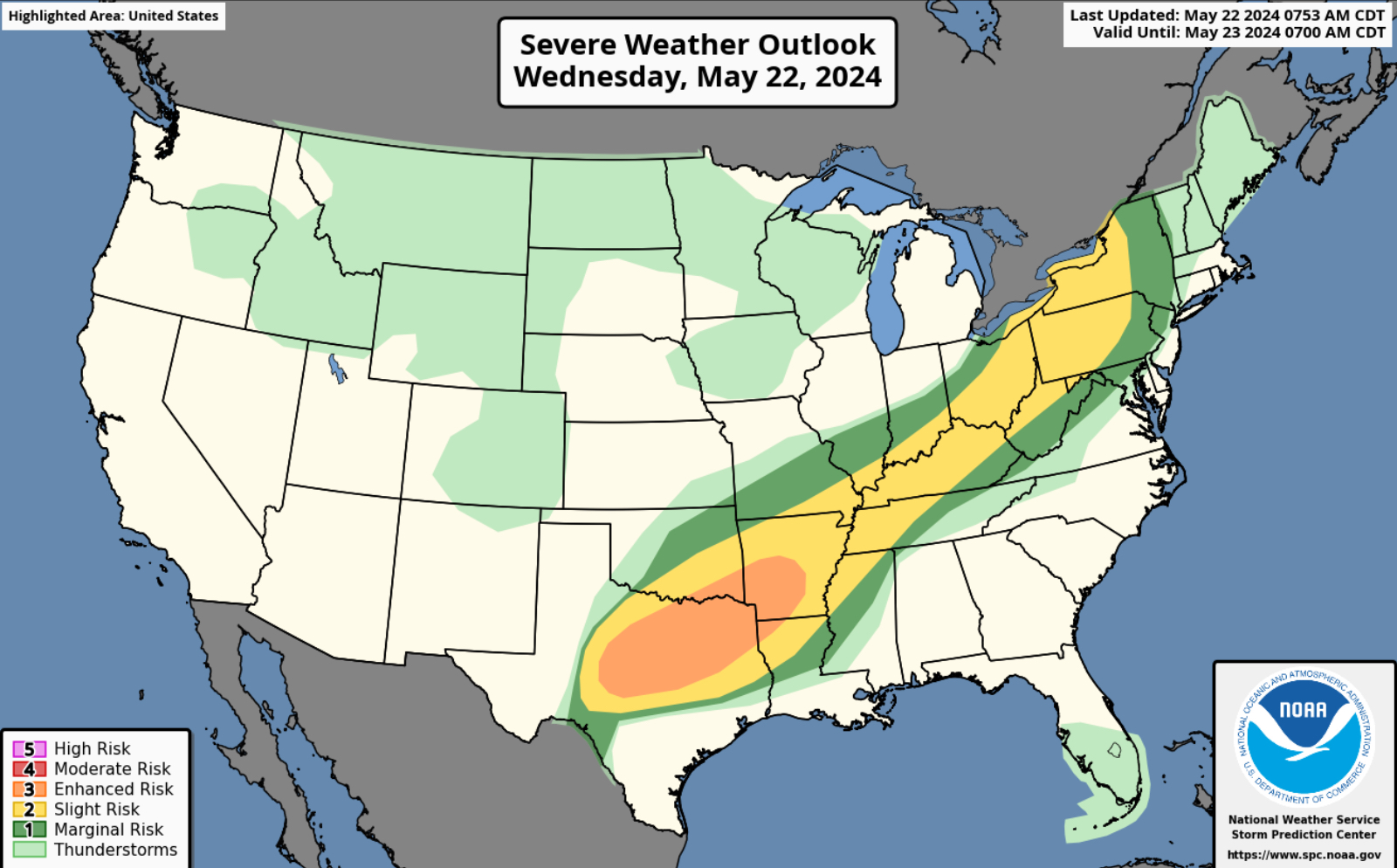
Wednesday’s Severe Weather Outlook
Significant hail and damaging winds with possible tornadoes in the Southern Plains today and a low chance of tornadoes in Western NY and NE OH. Please see SPC threat map.
NAM Future Radar Loop for Wednesday
The future radar loop shows a line of severe storms pushing through the Southern Plains this morning and then East into MO, MS and TN Valleys this afternoon.
Another line of severe weather will move into North and Central TX, Southern and Eastern OK, Arklatex, West TN, Northern MS, SE and Boot Heel of MO later this evening with significant hail, damaging winds with possible tornadoes.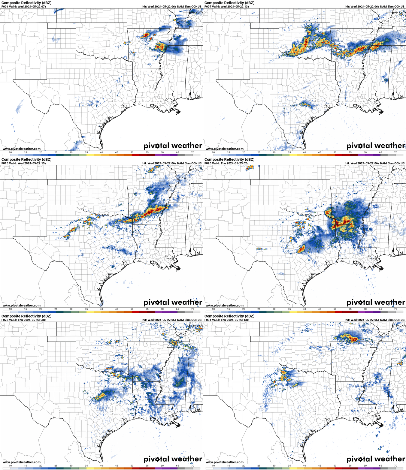
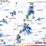
HRRR Loop of Helicity tracks for Wednesday
A swath of damaging winds, significant hail with possible tornadoes are shown in the helicity tracks for today in the Southern Plains and Mid South.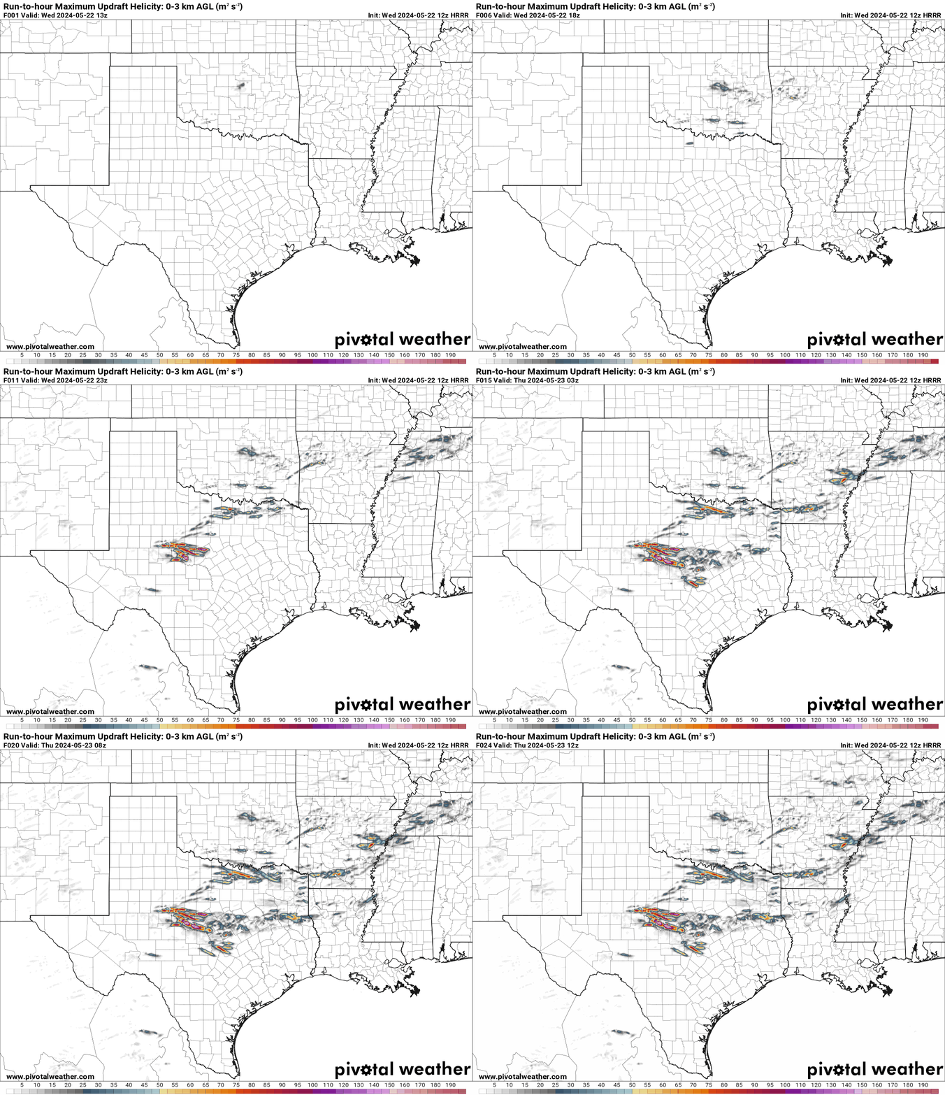
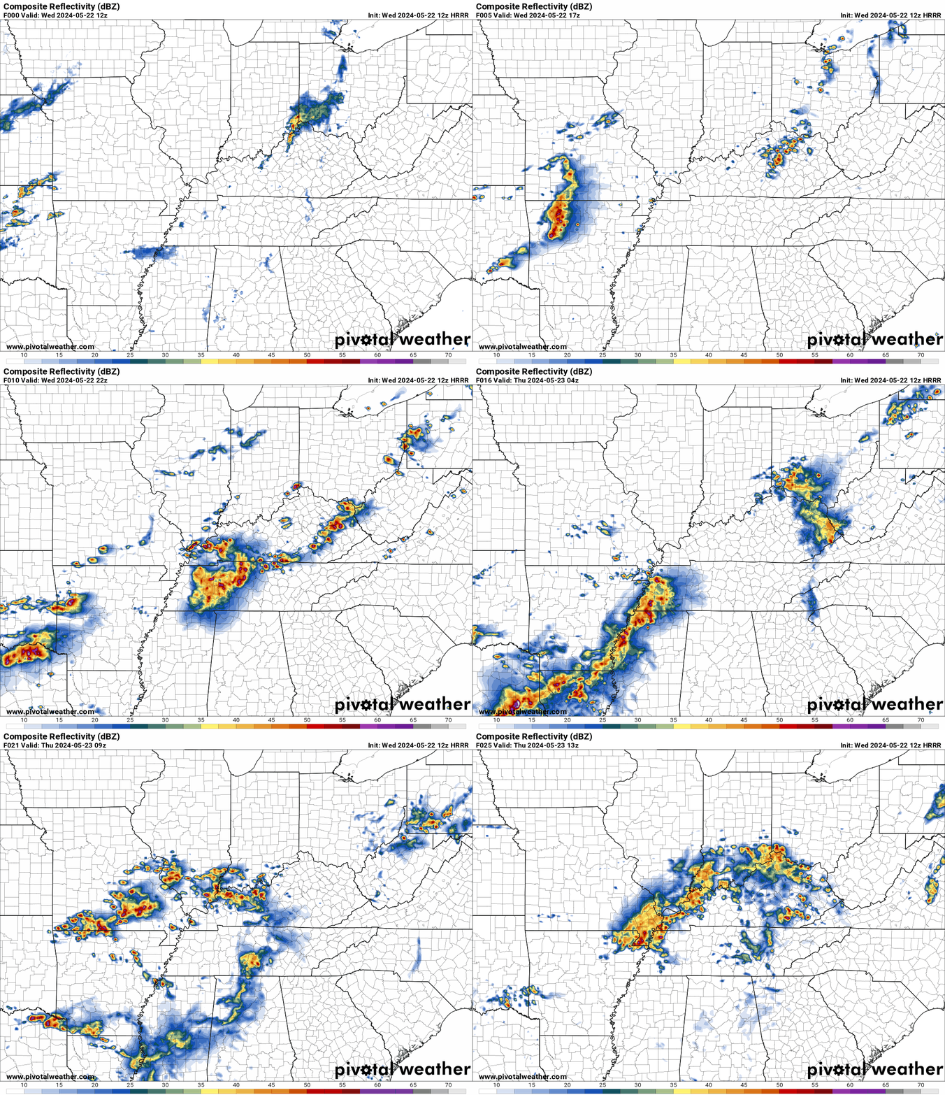
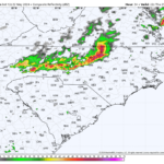
HRRR Future Radar Loop for MO,MS,TN and OH Valleys Wednesday
Multiple rounds of severe storms with large hail, damaging winds with a low risk for tornadoes will move in this afternoon , evening and overnight from AR to Western NY.
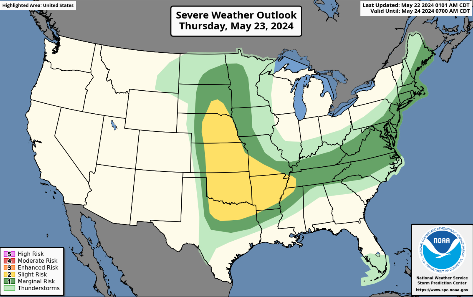
Thursday’s Severe Weather Outlook
A slight risk of severe weather for the Plains tomorrow. Large hail, damaging winds with possible tornadoes.
Severe weather is expected from the Dakotas to Texas then moving East towards the MO,MS,TN,and Ohio Valleys on Thursday. Please see SPC threat map.
Severe Weather Outlook for Friday
A low end severe weather day on Friday for the Mid South and Midwest. A marginal risk for severe weather. Please see SPC threat map below. 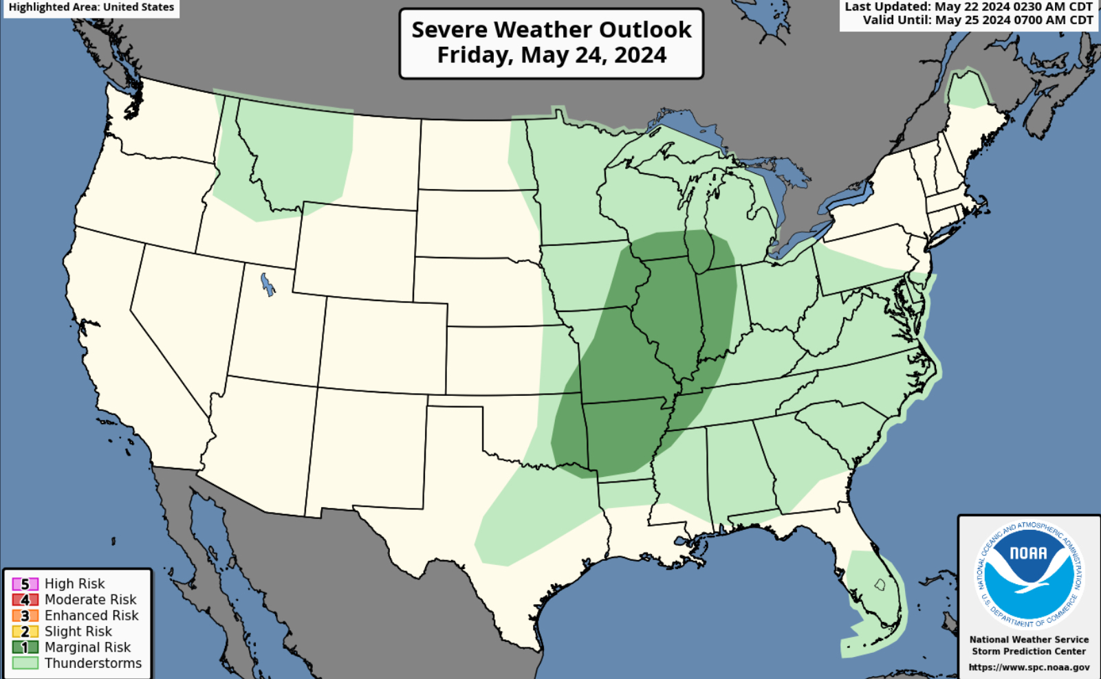
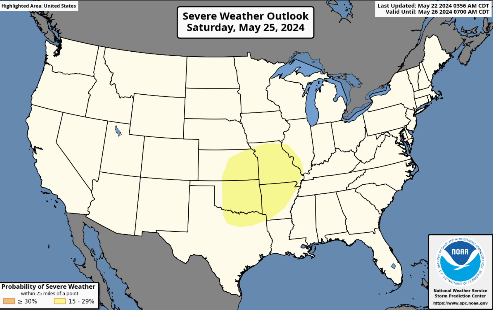
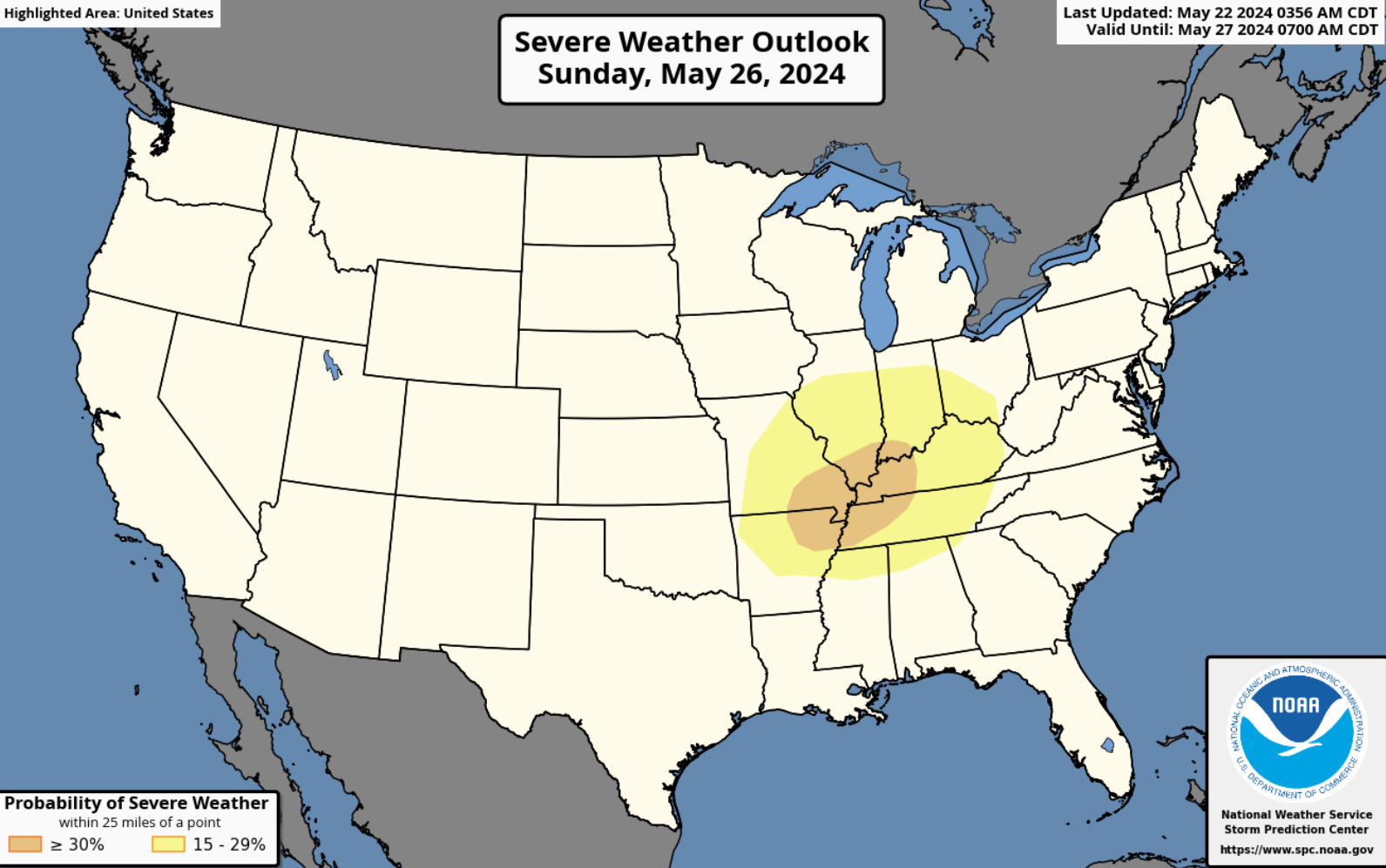
Memorial Day Weekend Severe Weather Threat
A huge concern for severe weather this Memorial Day weekend for the Southern Plains, MO,MS,TN, OH Valleys and the Corn Belt. We will definitely keep you updated for this holiday weekend. Stay tuned for the latest.


You must be logged in to post a comment.