
A low pressure system that is currently tracking over Illinois will be responsible for a complete washout state-wide during the day Tomorrow and will even linger into early Saturday Morning. The low pressure system will track right over PA, before transferring into a coastal low, that will produce wintry weather for the New England states Tomorrow into Saturday. If you have any plans up north this weekend, especially across Massachusetts, Vermont, New Hampshire, and Maine, be on the look out for a major winter storm for this time of year.
Fortunately for us, it is just a plain rainfall this time around. Scattered showers, mixed even with some wet snowflakes in northcentral PA are already in the air across the state this evening. However, this is not the main batch of precipitation we are focusing on. The main batch of precipitation won’t arrive here until Tomorrow Morning.
Scattered showers are possible through the early morning hours Tomorrow, but the bulk of the precipitation will not arrive until after 5 AM for western PA and will spread throughout the rest of the state through the mid-morning hours. Below is the GFS valid 8 AM: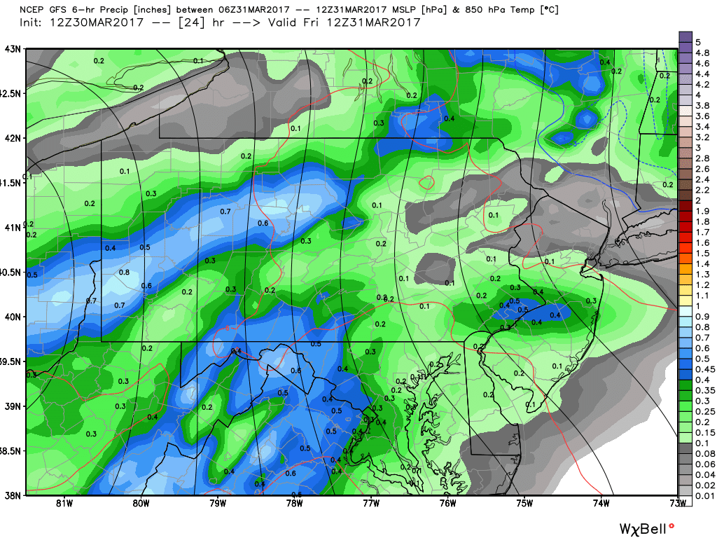
The rain will continue to get heavier as we head into the afternoon hours. Below is valid for 2 PM: 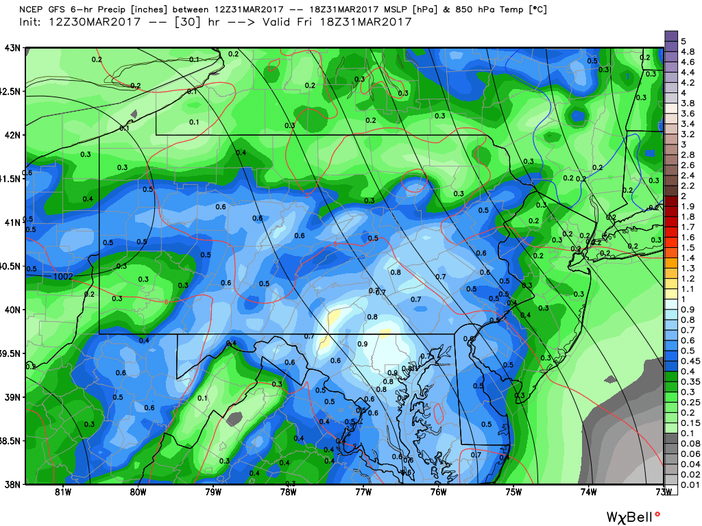
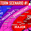
The blues and whites indicate heavy rain, which does cover much of the state at this time. Taking this same model out to 8 PM Tomorrow night, an area of enhanced precip begins to develop over eastern PA due to the coastal low forming. Where this area of enhanced precip forms, will greatly increase the risk for flooding: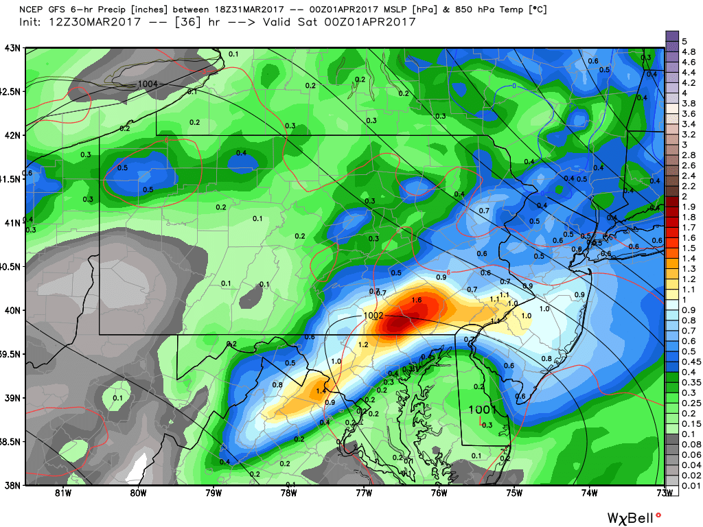
Showers will likely linger into early parts of Saturday Morning for central and eastern PA.
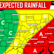
EXPECTED RAINFALL TOTALS THROUGH SATURDAY MORNING
Timing: Rain will develop and overspread the area through the morning hours Tomorrow, and will pick up in intensity as we head into the afternoon hours. The rain will continue through Tomorrow night before tapering off by Saturday Morning.
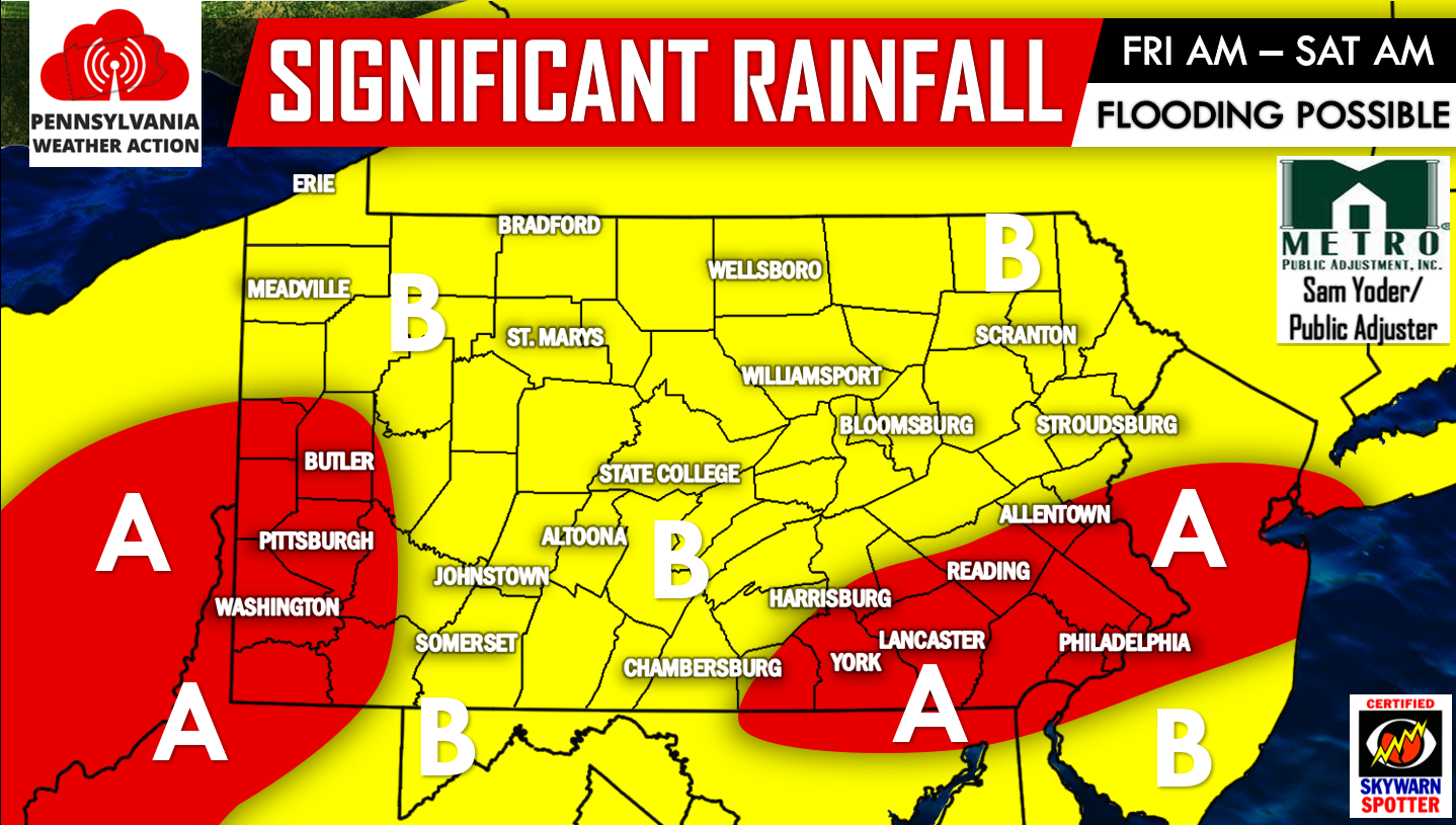
Area A: Best chance to see over 2 inches of rainfall, with locally 3″+ amounts. Flooding is possible.
Area B: 1 to 2 inches of rainfall is possible, with locally greater amounts. Localized flooding is possible.
The good news is, Sunday looks dry. The bad news is more rain returns to the forecast by Monday Afternoon.
For more updates, click here to follow us on our Facebook page>>>PA Weather Action on Facebook!
Be sure to spread the word about the rainy weather we are anticipating for Tomorrow by using the icons below, stay safe!
You must be logged in to post a comment.