
For those wanting a pure snow storm, this will not be your storm. Your best shot will come in very late February or the first half of March. Like most of the storms we’ve had this winter, the low pressure will pass to our west. It will then transfer to the coast, but too late to keep us all snow. As a result, more than half of the precipitation with this storm will likely be freezing rain. This will be thanks to high pressure to our north, keeping cold air damming in place, thus keeping much of us below 32 degrees despite warming upper levels. However, only areas east of the Appalachians “benefit” from cold air damming. This will mean areas such as Pittsburgh, Butler, and Washington won’t get much in the way of wintry precipitation.
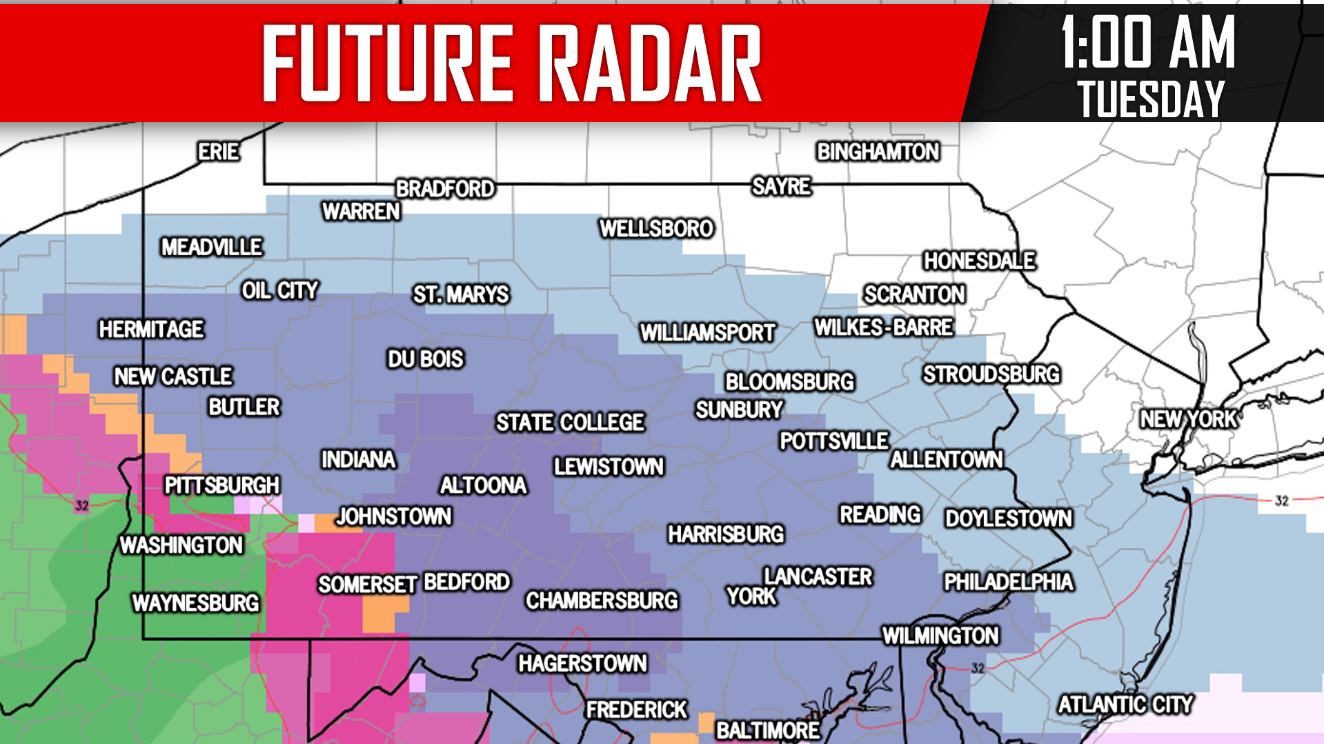
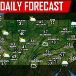
As we get into some very broad timing details, realize we are over three days out from precip. onset with this storm. There will likely be some changes with model guidance in the next few days. Most of us will likely start as a period of snow, except Southwest PA. Here is a model prediction for what the radar may look like around 1:00 AM Tuesday:
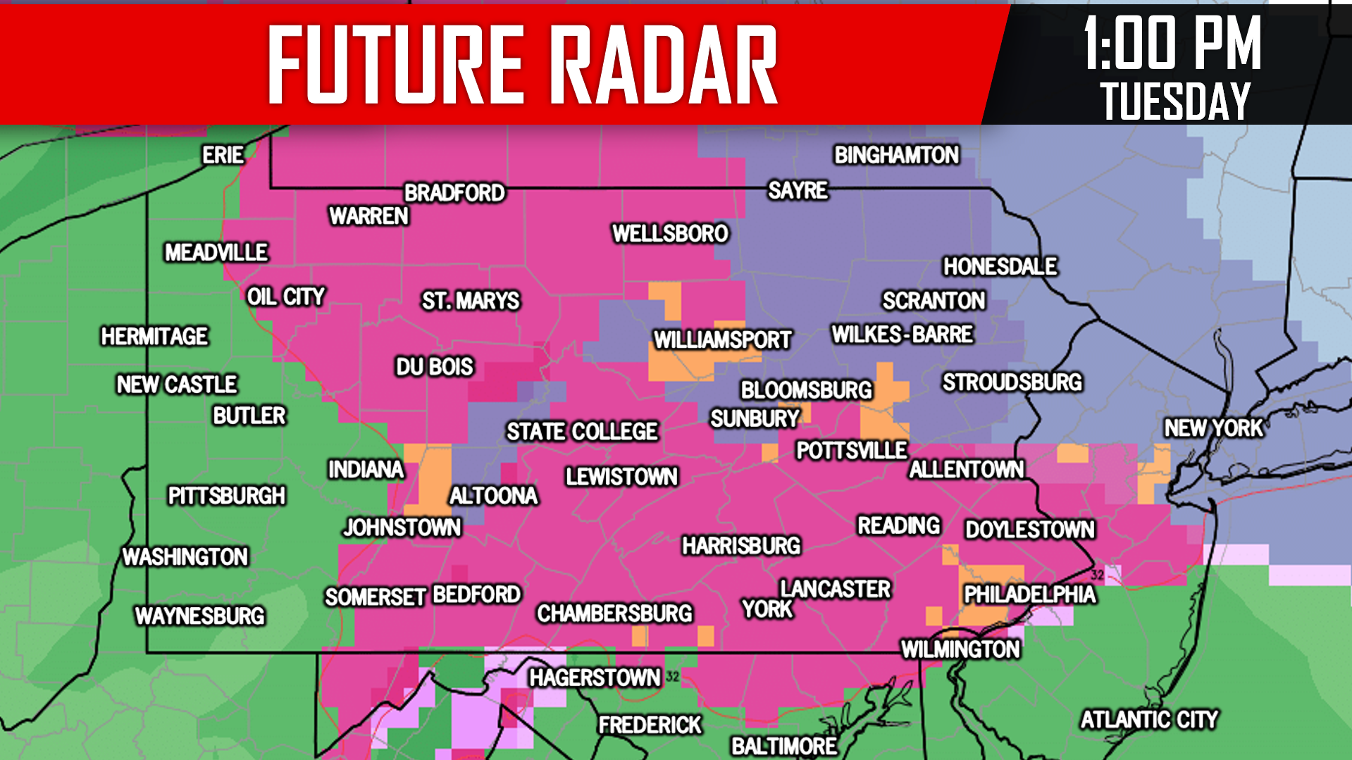
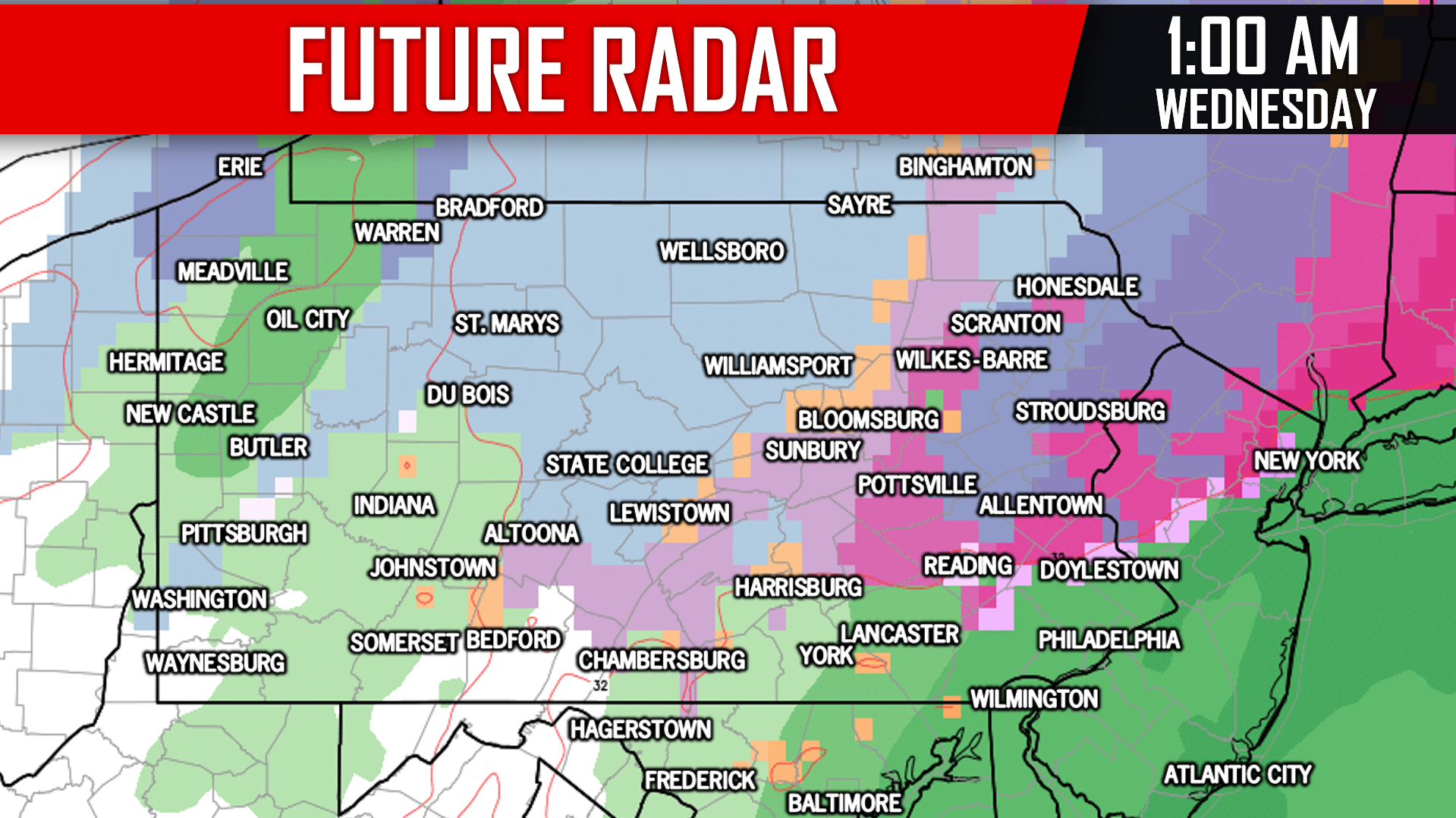
By Tuesday Evening, all of us east of the Bedford-Altoona-Bradford line will likely be seeing freezing rain, while locations west of that line see plain rain. The storm will begin to wrap up late Tuesday Evening, and should be out of the area by Wednesday Morning. Here is a look at 1:00 AM Wednesday:
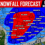
FIRST LOOK AT POTENTIAL SNOW & ICE IMPACTS
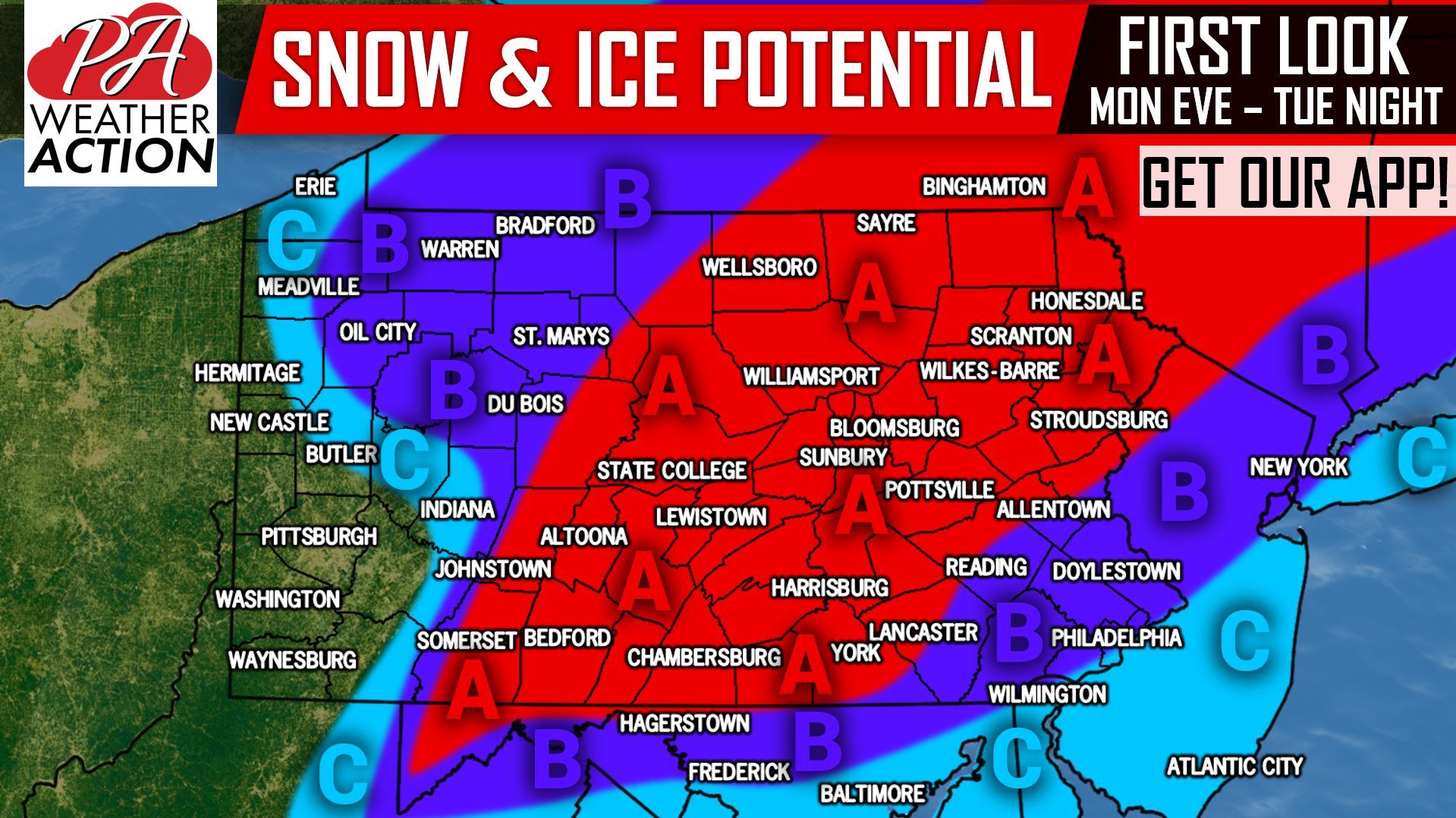
Area A: The potential for a high impact storm exists. Moderate snowfall accumulation is possible, followed by significant ice accumulation. School cancellations are possible due to dangerous travel.
Area B: The potential for a moderate impact storm exists. Light to moderate snowfall accumulation is possible, followed by moderate ice accumulation, and likely ending as a period of plain rain. School cancellations are possible due to dangerous travel.
Area C: The potential for a light impact storm exists. Light snowfall accumulation is possible, before light ice accumulation, followed by plain rain. School delays are possible due to slippery travel.
We all are used to model guidance changing in the span of three days leading up to a storm, but hopefully changes are minimal. We are relying on a strong high pressure to our north to supply cold air. If that high weakens or moves out earlier, we will likely see more precipitation in the form of rain.
Receive Saturday’s First Call Snow & Ice Forecast along with your latest hourly and daily forecast & radar with our free app >>> PA Weather App Link
We will have many updates on our facebook page as well, be sure to like us if you haven’t already >>> PA Weather Action Facebook Page
Don’t forget to share this important update with your friends and family using the button below, as many plans may need to be adjusted.
You must be logged in to post a comment.