
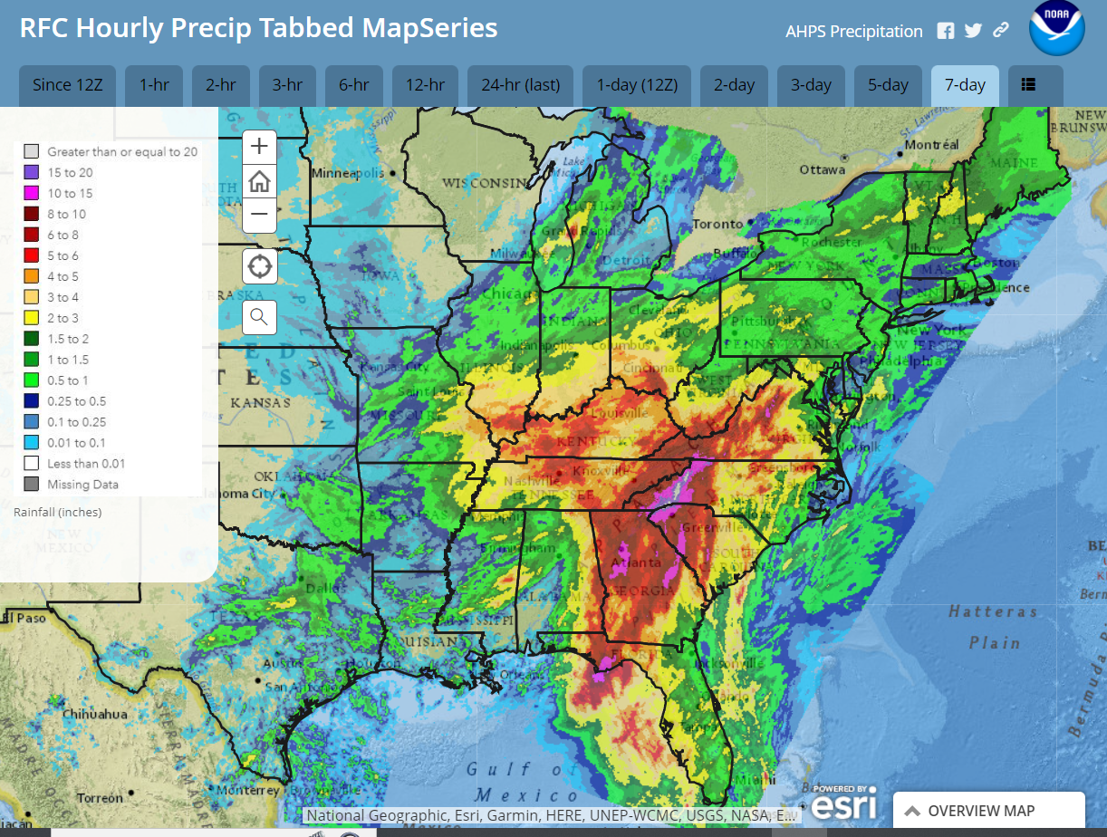
Hurricane Helene churned through the Southeast and slammed into the southern Appalachians Thursday night and Friday. The deep tropical moisture was driven into the 5000-ft mountain barrier at 100 mph and squeezed out 20-30″ rain on the high peaks of North Carolina, unleashing catastrophic flooding!
7-day rainfall from 8am September 23 through 8am September 30
The remnant circulation and moisture of Helene is slowly moving eastward, spiraling rain into southern Pennsylvania today. Meanwhile a sprawling area of high pressure over eastern Canada is circulating dry surface air westward into our area, providing some sunshine this afternoon.
A disturbance approaching from the west will draw some of that moisture northward across our area Tuesday and Wednesday in the form of scattered light showers. Rainfall totals will be a quarter inch of less. The frontal zone associated with that disturbance will cross through our area from west to east Wednesday afternoon and evening, bringing an end to the showers. Sunny weather moves in for Thursday.
Bright comet for mid-late October!
There is also a somewhat rare celestial event to look forward to in a couple of weeks in the form of a very-bright comet! Comet Tsuchinshan-ATLAS is already quite bright, but only visible in the southern hemisphere. Starting around Oct 9th or 10th it should start to become visible in the northern hemisphere, low in the western sky during the evening for a short while after the sun sets. It could actually become bright enough to be visible before the sky darkens! Its closest approach to Earth will be October 12th. As we progress through the latter half of October, the comet will be visible later into the evening, but slowly becoming dimmer as it moves away from the Sun and the Earth. Don’t miss the opportunity!
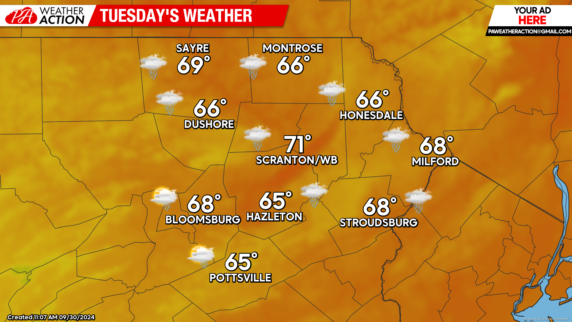
TUESDAY
Skies will be partly to mostly cloudy, with scattered light showers. Not much rainfall is expected, with most locations getting just a few sprinkles. Isolated spots could see a tenth of an inch. Morning temperatures will start in the mid 50s, with afternoon temperatures reaching into the upper 60s.
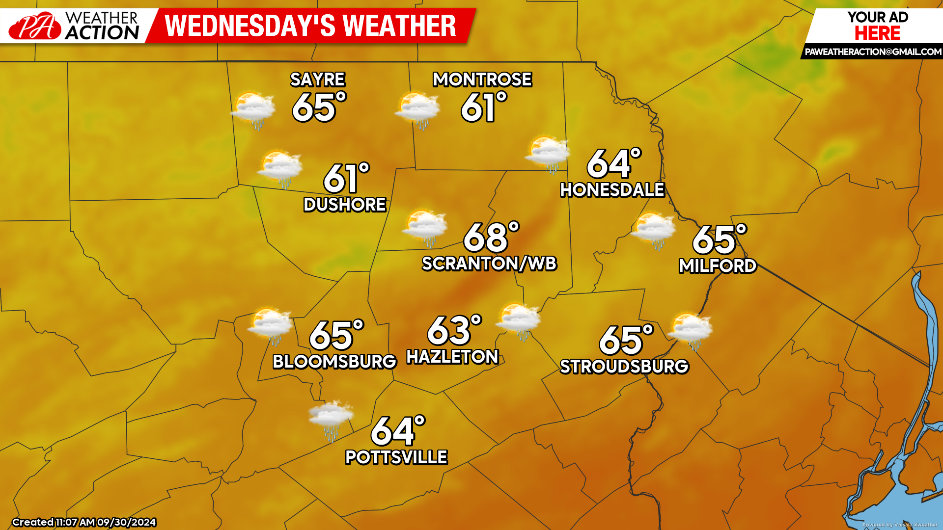
WEDNESDAY
Wednesday morning will also start with widespread mid 50s. Skies will be partly to most-cloudy skies with scattered light showers as the frontal zone approaches. That front will cross our area late in the afternoon into Wednesday evening, ending the opportunity for showers as it passes. Most locations will see a tenth of an inch of rain or less.
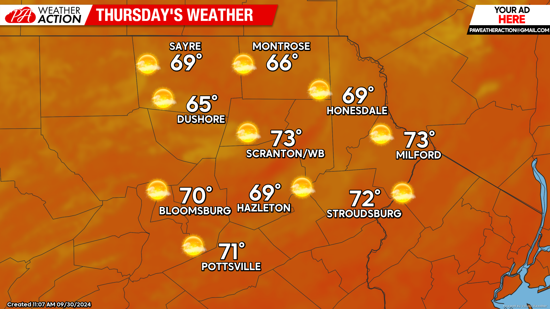
THURSDAY
Thursday will provide sunshine and dry conditions. Temperatures will start in the 50s, but the sunshine should boost temperatures into the upper 60s and lower 70s during the afternoon. Enjoy!
You must be logged in to post a comment.