
Much more of the state will be impacted by the snow coming late this evening into Thursday morning, as guidance has shifted north (shocking). Snow will move in from west to east after dinnertime, and continue through tonight before wrapping up around dawn Thursday. Moderate snow accumulation is expected, with highest amounts to be generally near and south of I-76 (PA Turnpike). Plan on having to shovel out your car Thursday morning, and many roads to be snow-covered.
FUTURE RADAR TIMING
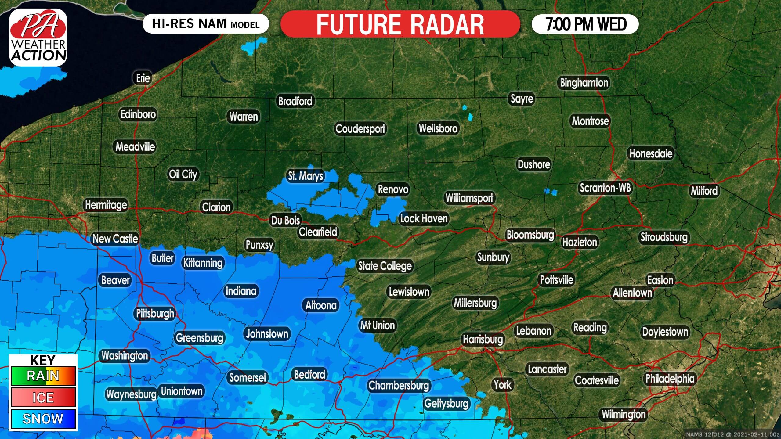
Light to moderate snow will push in to the southwest quarter of Pennsylvania by around or just after dinnertime this evening. Below is Hi-Res NAM future radar for 7:00 PM Wednesday.
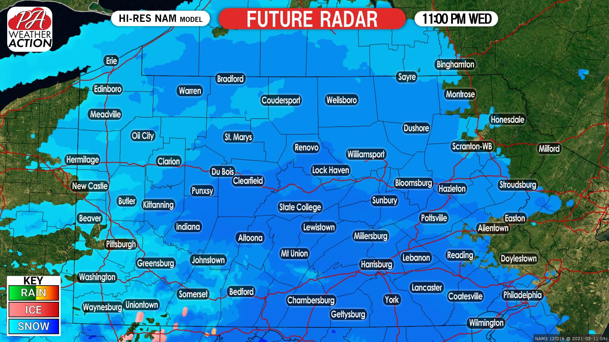
Light to moderate snow will overspread much of the state by late this evening. This is when we expect road conditions to start to deteriorate. Here is future radar for 11:00 PM Wednesday.
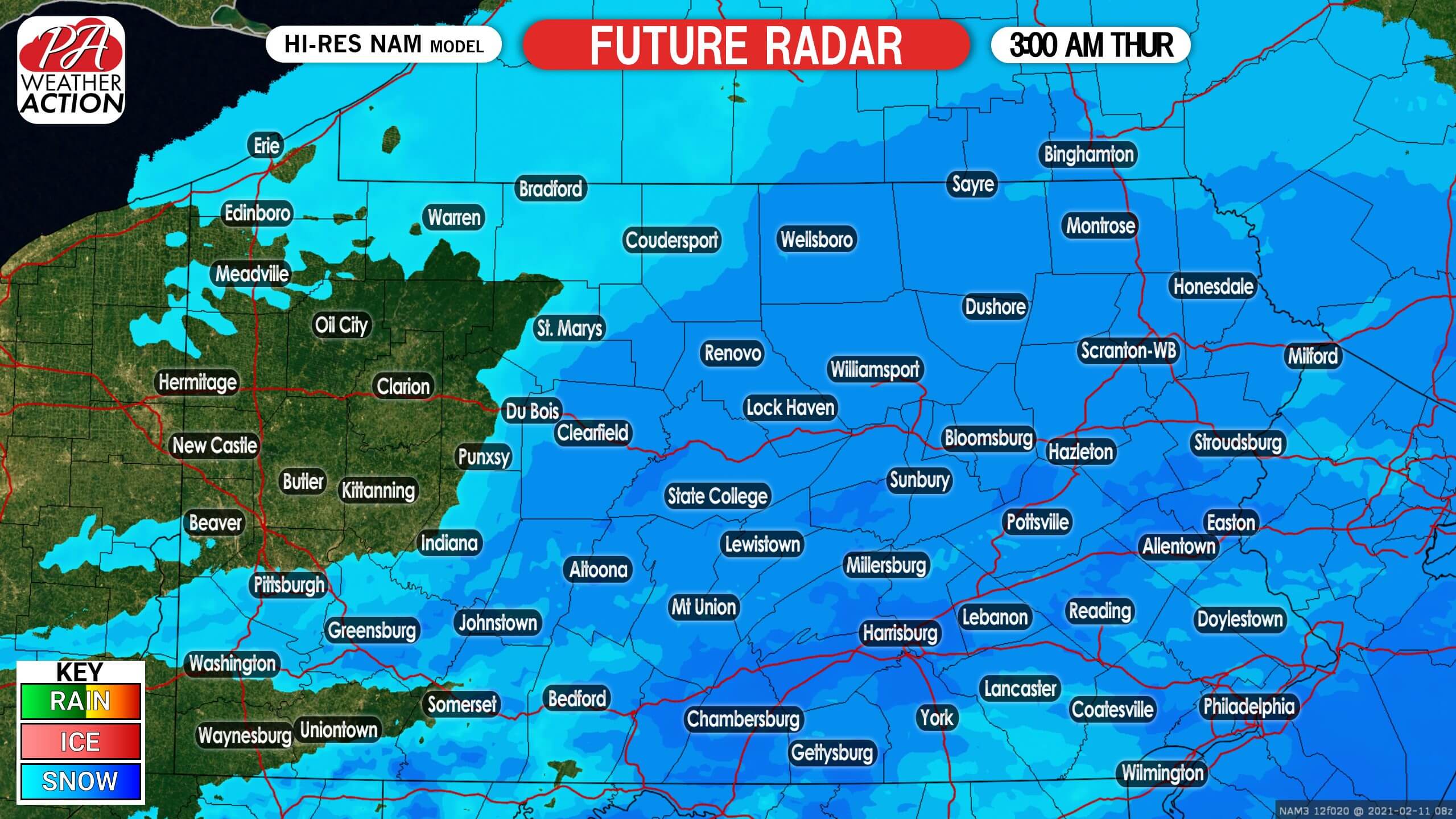
Snow will start to diminish in western PA as we head into the early hours of Thursday morning, while still going at a moderate clip in central and eastern PA. Below is future radar for 3:00 AM Thursday.
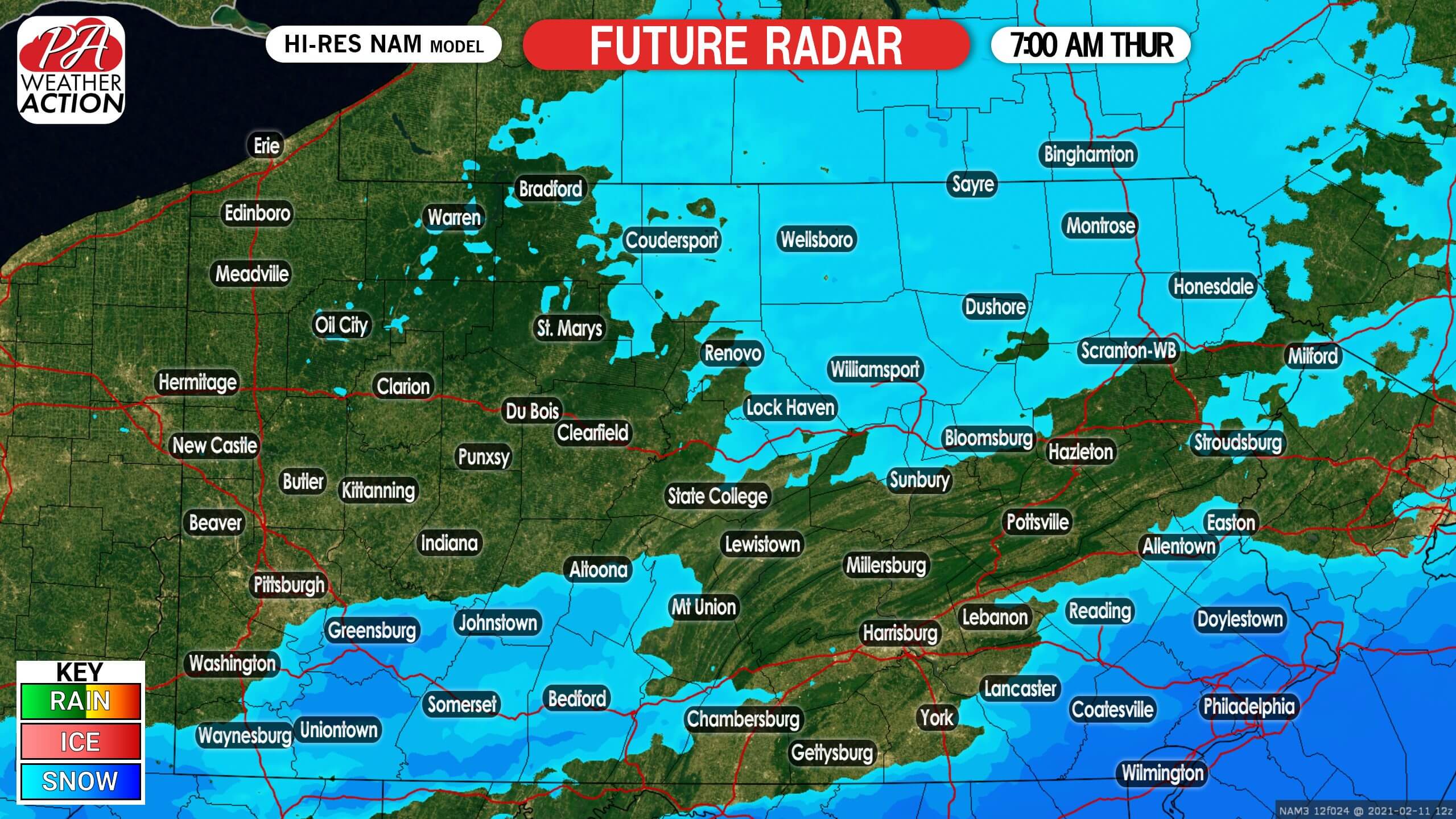
By sunrise, some snow may still be falling in southeast PA, but the rest of us should just be left with a few flurries and another cleanup. Here is future radar for 7:00 AM Thursday.
FINAL CALL SNOWFALL FORECAST FOR TONIGHT – THURSDAY MORNING

Area A: Snowfall accumulation of 4 – 6″ expected. Plan on a very slow Thursday AM commute.
Area B: Snowfall accumulation of 2 – 4″ expected. Plan on a very slow Thursday AM commute.
Area C: Snowfall accumulation of 1 – 2″ expected.
Stay ahead of all the winter weather we have headed our way in the coming weeks with our app! Download it here >>> Weather Action App
Be sure to share this updated forecast with family and friends in impacted areas using the blue button.


You must be logged in to post a comment.