
A storm system moved northeastward along the St Lawrence Seaway today, dragging a warm front across our area. After a coating of snow late last night, precipitation changed to freezing rain over much of the area, with significant icing in some locations. Temperatures have since climbed well above freezing.
The system’s cold front will drive colder air into our region on strong gusty winds this evening. The wind will gust 30-40 mph this evening through the overnight hours. Temperatures will be driven down into the the upper teens and lower 20s by sunrise Friday.
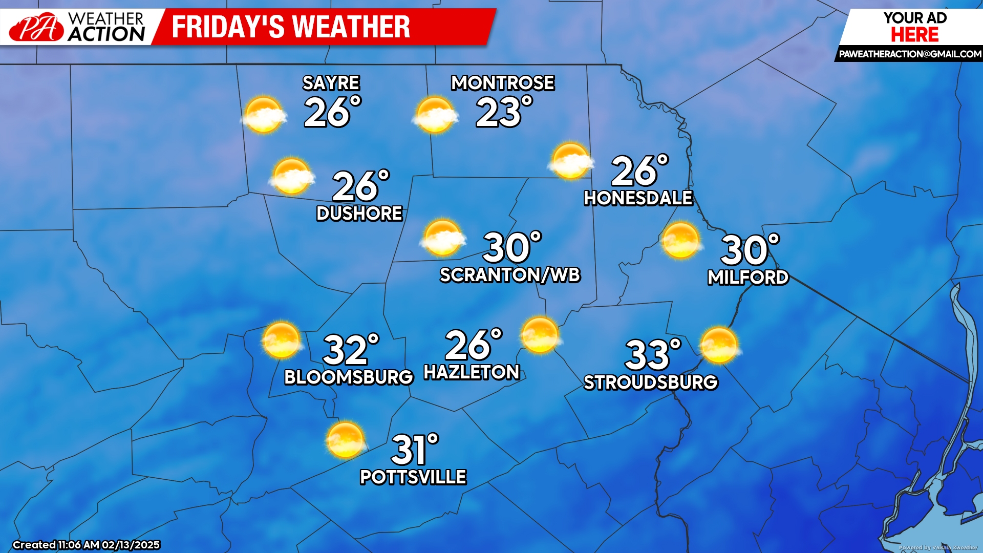
FRIDAY
Cold air will continue to be driven into our region on wind gusts over 30 mph from the northwest. Temperatures will barely climb into the 20s in the higher elevations, but could pop above freezing in the southern valleys. The wind will diminish during the evening as a surface high settles on our area. The clear skies and light wind Friday night will allow temperatures to fall into the low-mid teens in many locations.
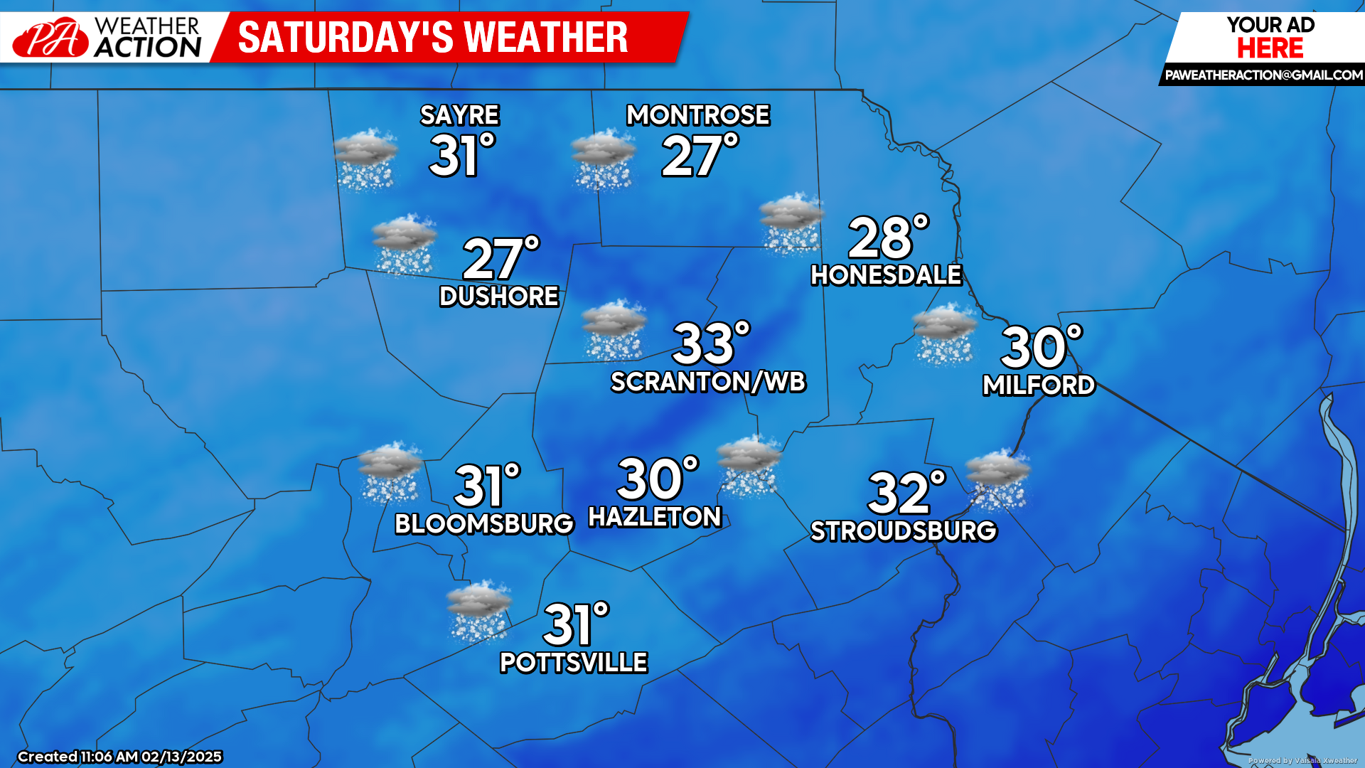
SATURDAY
Another storm system will affect our area Saturday into Sunday. As with the last couple of systems, this one will also track to our west and north, resulting in a changeover event. Snow should break out across the region by early afternoon Saturday, changing over to freezing rain and rain after 8pm. A couple inches of snow will be possible before the changeover, with freezing rain potentially causing icy conditions overnight. Temperatures will climb through the overnight hours and into the low-mid 30s by Sunday morning.
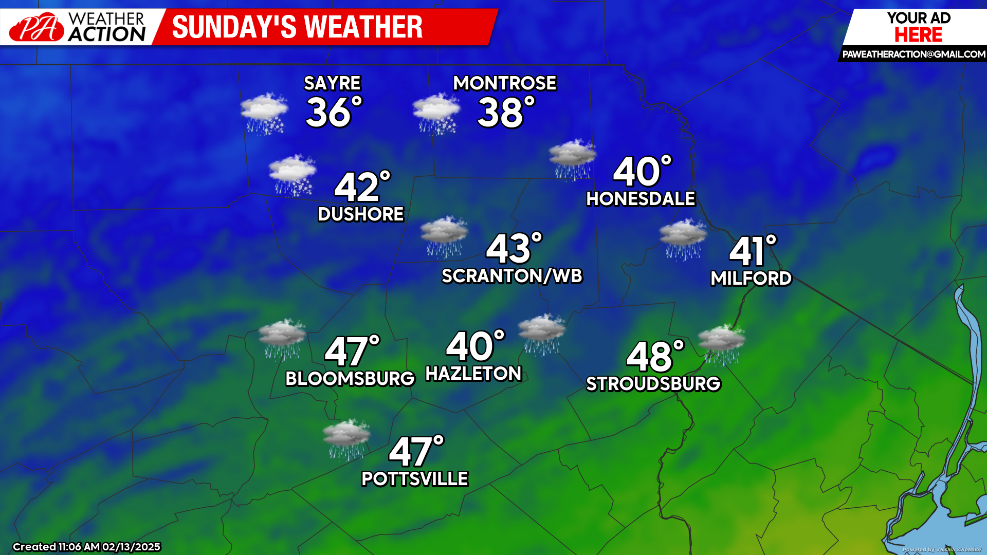
SUNDAY
Mild temperatures and rain will continue through midday, tapering to showers during the afternoon. Do not let these mild temperatures lull you into winter complacency as strong wind from the west will begin driving arctic air into our area by Sunday night, with temperatures expected to be colder than normal through all of next week! This means high temperatures in the 20s and low temperatures in the teens on most days.
SEASON TO DATE SNOWFALL
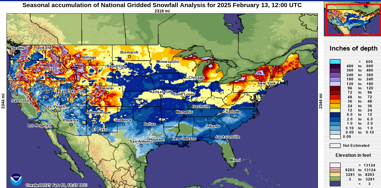
Meanwhile, after missing out on the last several systems, it seems to be a good time to assess our season-to-date snowfall:
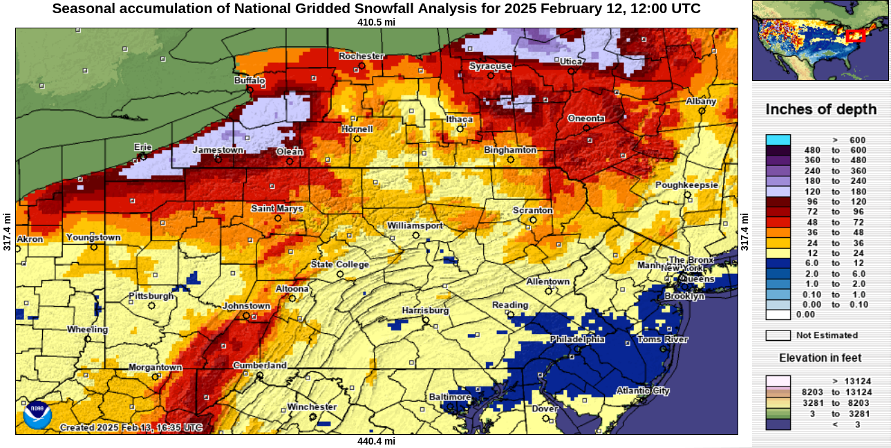
To see how we’ve performed compared to the rest of the Nation, here is the national plot of season-to-date snowfall:
You must be logged in to post a comment.