
A weak low pressure system swinging down from the Northern Plains will make its way just northwest of Pennsylvania. Light snow showers are likely much of Sunday across the western half of the state, followed by scattered lake effect snow squalls on Monday.
Temperatures will be marginal Sunday, so there is no concern for snow accumulation on roadways outside of the lake effect belts. However, lake effect snow squalls are likely Monday mainly in Northwest PA, as strong northwest winds blow over Lake Erie. Snow squalls cause serious accidents if drivers do not take necessary precautions. The best advice we have it so gradually slow down. If visibility is extremely low and you are driving well under the speed limit, use your flashers.
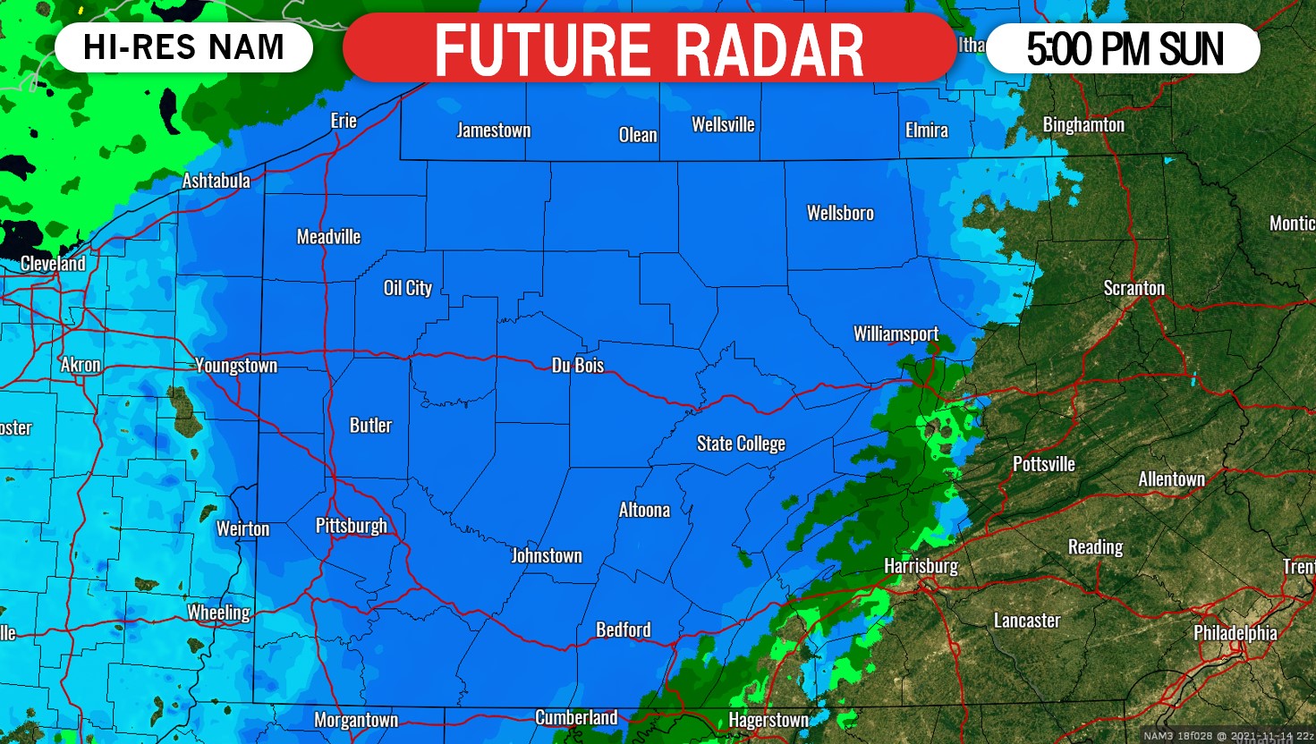
Below is future radar (Hi-Res NAM) for 5:00 PM Sunday. Light snow will start falling early afternoon in Western PA. You may notice flakes flying at the Steelers game, but it will not be a large factor.
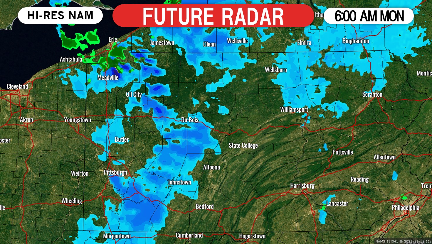
Scattered snow squalls will begin to flow in from Lake Erie early Monday morning. The snow squalls will then continue much of the day Monday. Here is future radar for 6:00 AM Monday.
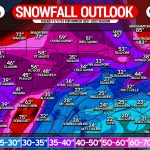
SNOWFALL FORECAST FOR SUNDAY – MONDAY
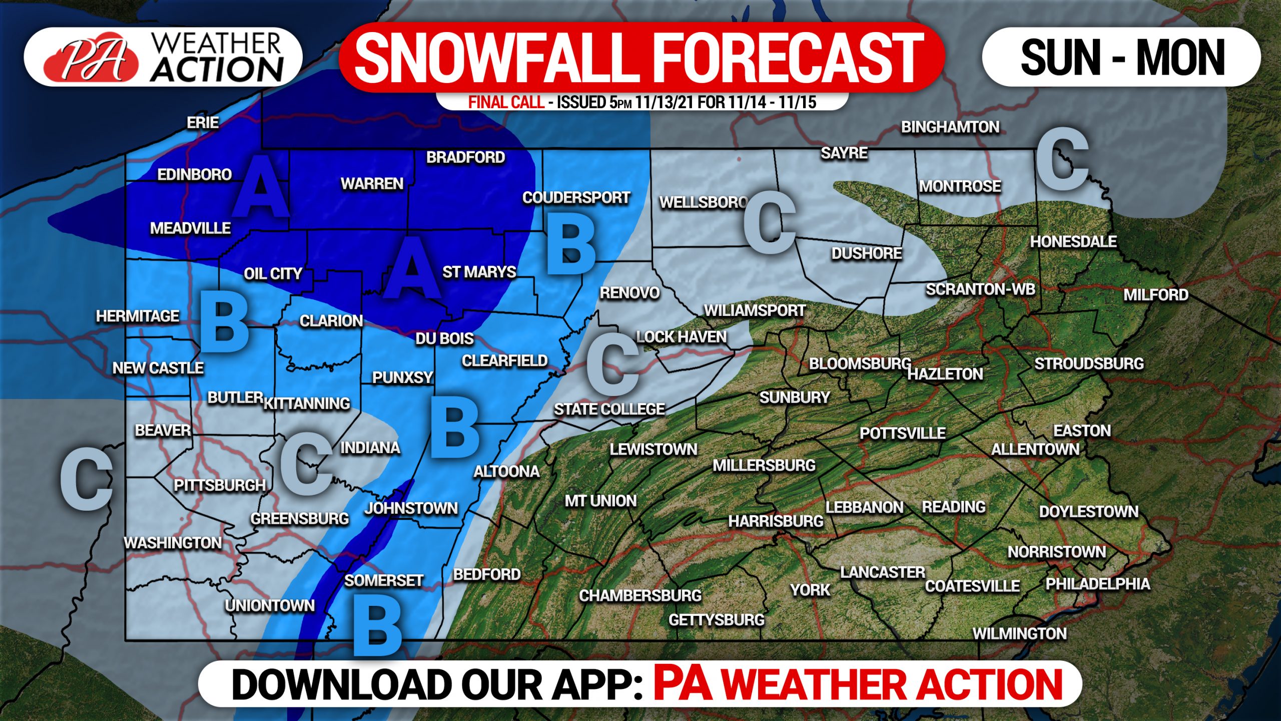
Area A: Snowfall accumulation of 2 – 5″ expected. About half of that will come Sunday in the form of light snow, and the other half on Monday as snow squalls.
Area B: Snowfall accumulation of 1 – 2″ anticipated. Most of this will be light snow on Sunday, however an isolated snow squall is possible Monday.
Area C: Snowfall accumulation of up to 1″ expected. Light snow likely for several hours on Sunday, very isolated snow squall possible Monday.
The first snow of the year often takes people by surprise, be sure to share this with your family and friends!
[social_warfare]
You must be logged in to post a comment.