
If this setup came two weeks ago when climatology was a little colder, we would have been pulling our hair out with this forecast. Instead, what was assumed to be mainly rain with only a bit of wet snow in the highest elevations has turned into something more wintry. Recent trends have shifted to a stronger coastal storm instead of a weaker storm that goes overhead.
This means two things, one being the western half of the state will see hardly any rain from this storm. Even Central PA isn’t looking at much. However due to a strong coastal, precipitation will be heavier and the system will draw in more cold air. This has created a situation where significant snow amounts are now expected across the Catskill and Berkshire Mountains.
In Pennsylvania, the Pocono Mountains will be the focus for potential moderate snow accumulations. Models have been disastrous in terms of consistency and it’s the middle of April, so we’re going into this slightly blind. Here is our best shot at timing and snowfall amounts.
FUTURE RADAR TIMING IN PA
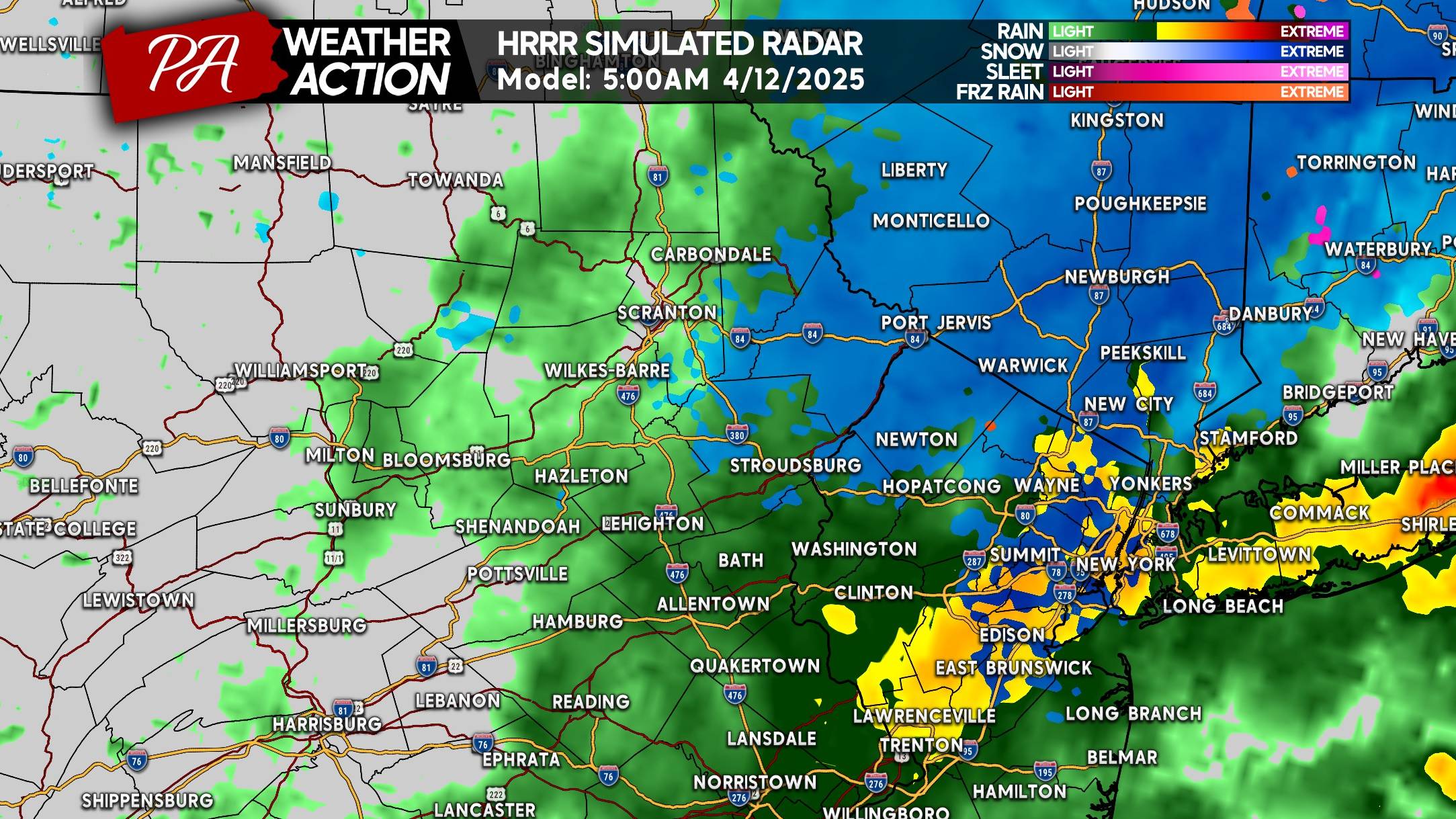
Snow is expected to begin in much of the Poconos a few hours before sunrise Saturday. Where it’s snowing versus raining will come down to precipitation rates and elevation. Latest guidance is actually downplaying elevation more and more, meaning even the valleys may see some snow. But especially lower elevations in Northern NJ, the Hudson Valley, and Southern New England.
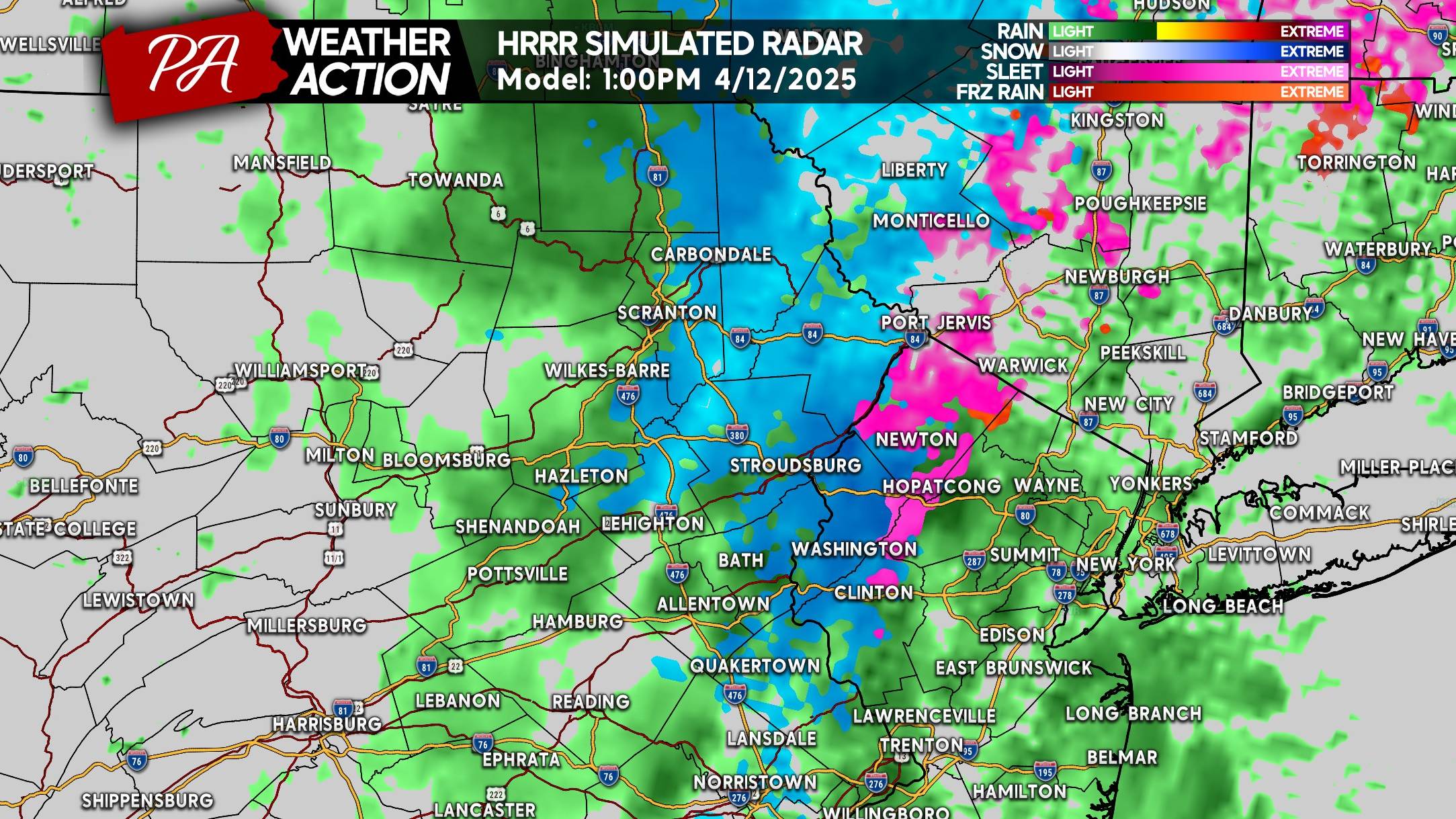
Below is the HRRR Future Radar for 5:00 AM Saturday.
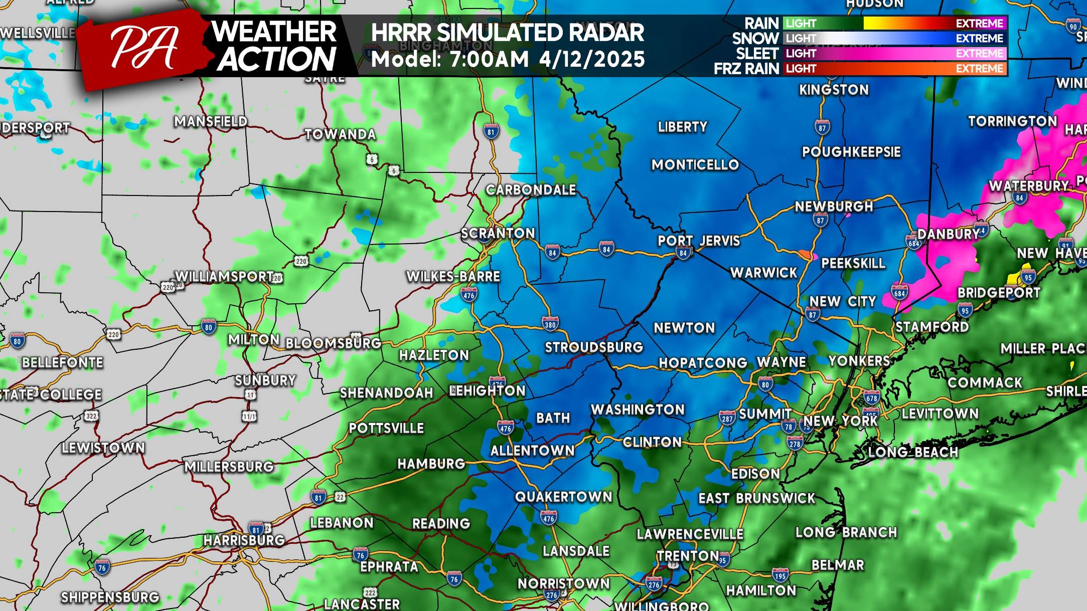
As dynamic cooling continues, places near the Delaware River will likely change from rain to snow. This may also include parts of the Lehigh Valley and Southeast PA above 700′ elevation. Here is HRRR Future Radar for 7:00 AM Saturday.
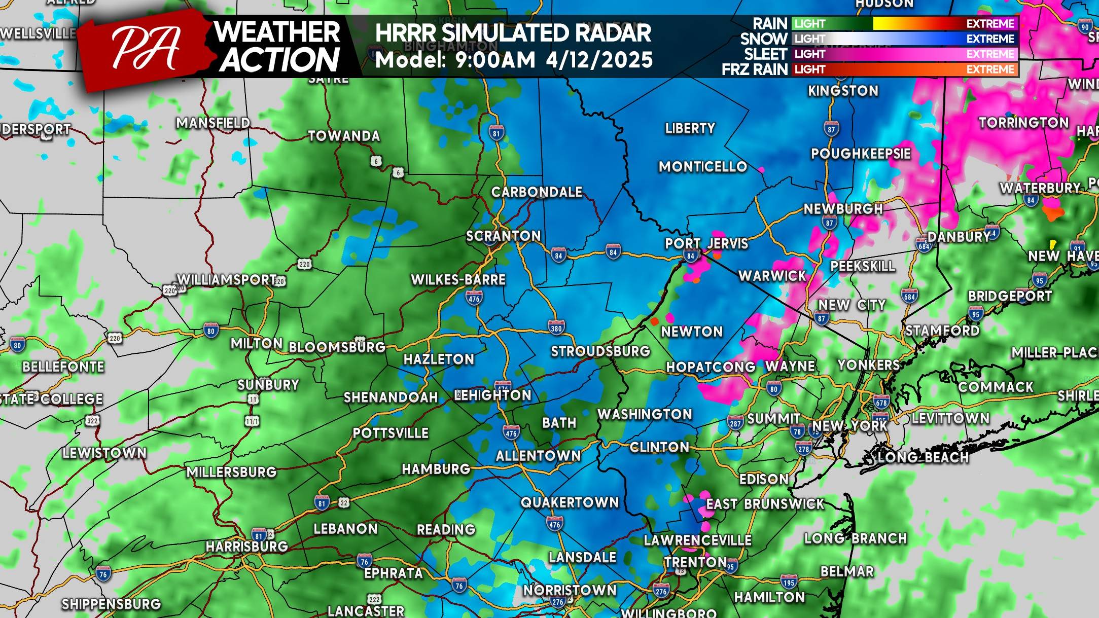
Snow is expected to continue in many of the same places through mid-Saturday morning, with places like Allentown and Scranton likely seeing mixed rain and snow. Models really don’t want to get snow levels low enough in NEPA for the Wyoming Valley to see much snow.
As we near lunchtime, the sun angle will play a greater role. We don’t anticipate much more snow to accumulate past 10-11 AM. Nonetheless, snow will probably continue falling in many of the same areas. Below is HRRR Future Radar for 11:00 AM Saturday.
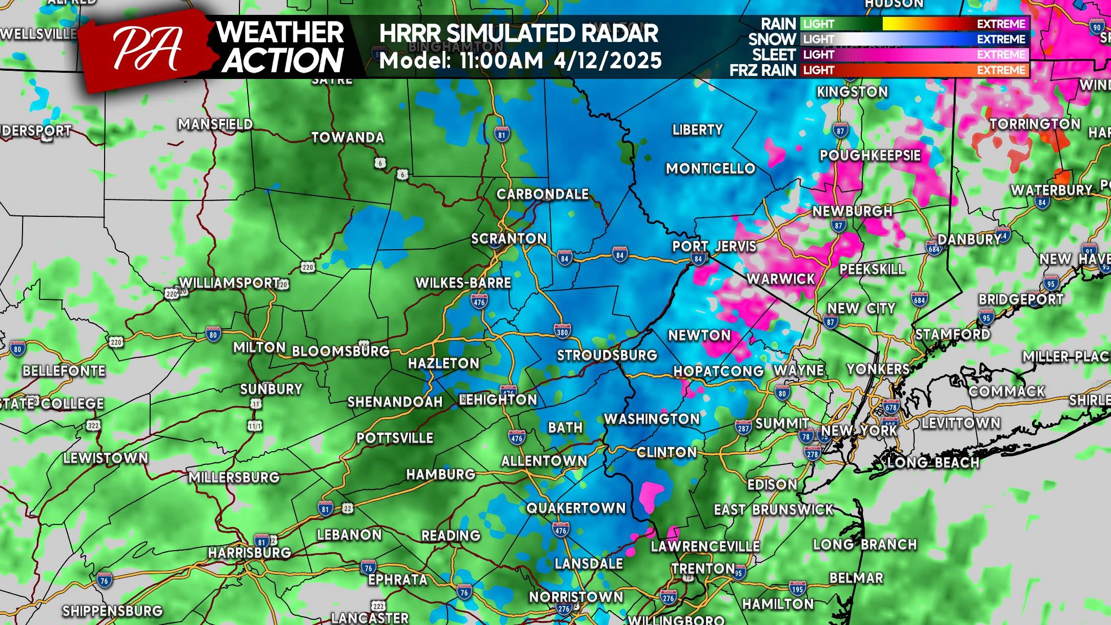
And eventually by the early afternoon, things will wind down as precipitation rates decrease and temperatures warm.
SNOWFALL FORECAST FOR SATURDAY MORNING’S SURPRISE SNOW
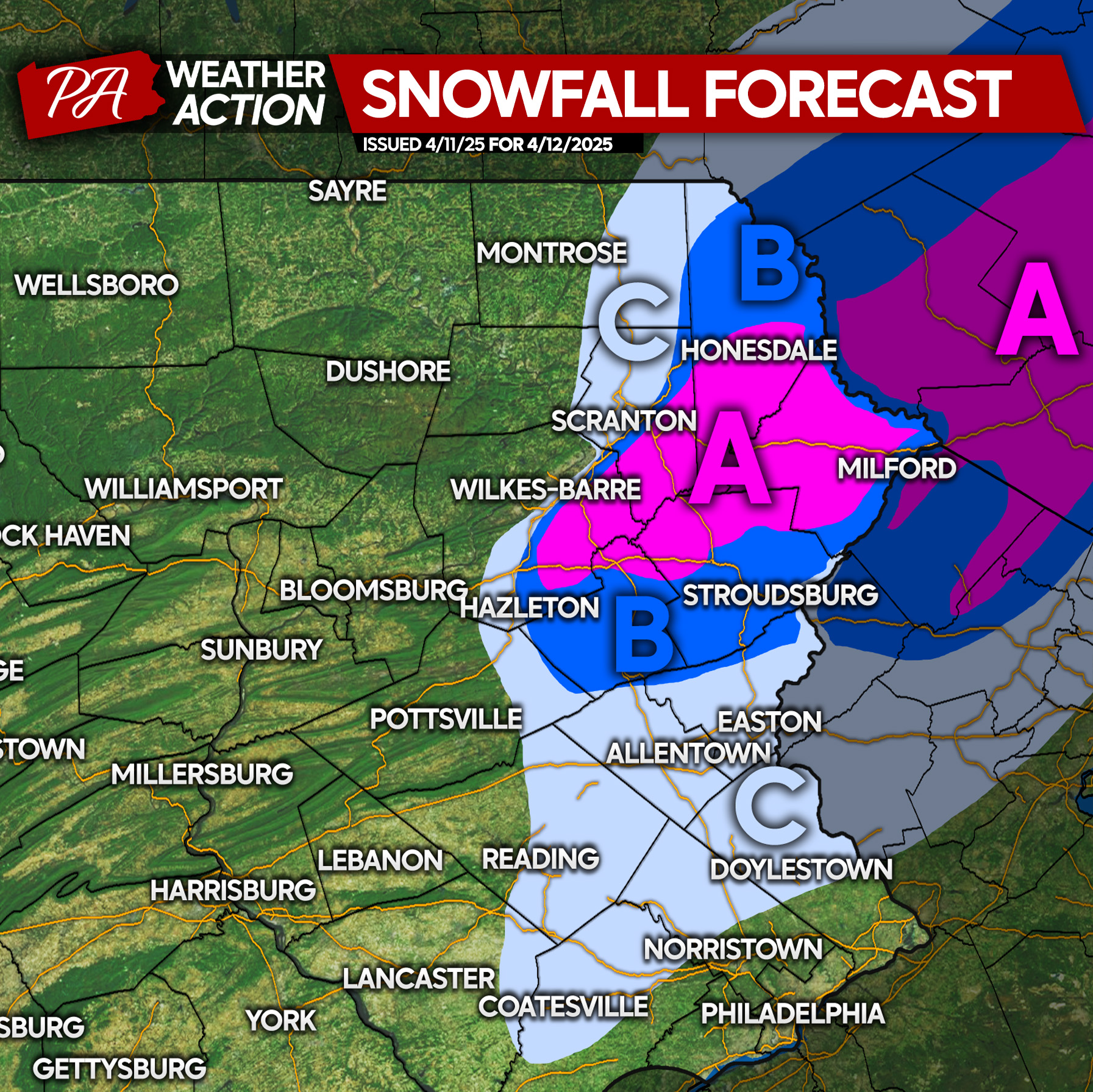
Area A: Snowfall accumulation of 2 – 5″ expected. Elevations above 1800′ will likely be on the higher end of the range, with places below 1200′ on the lower end. Accumulations will mainly be on grassy and elevated surfaces, but we can’t rule out an inch of slush on the roads.
Area B: Snowfall accumulation of 1 – 2″ anticipated. This does not include the Wyoming Valley of NEPA, except Carbondale. Accumulations will be on grassy and elevated surfaces, with a thin slush possible on roadways.
Area C: Snowfall accumulation of a coating to 1″ expected. Southeast PA has a bit more uncertainty, with some guidance showing nothing. Snow will accumulate on grassy and elevated surfaces only.
Be sure to share this forecast with friends and family who are surely thrilled to see winter return! Take it easy Saturday morning on those mountain roads.
You must be logged in to post a comment.