
A cold front passing through the state this evening will be merging with a strong low pressure system off the coast of Virginia early tomorrow. This strong low pressure will rapidly intensify off the coast of New Jersey by Sunday evening leading to strong winds and heavy rain for much of the state.
Before we talk about the nor’easter, the cold front will not only deliver a steady rainfall for western and central areas, it will also drastically drop temperatures. Below is the latest short range model valid for 8:00 PM tonight:
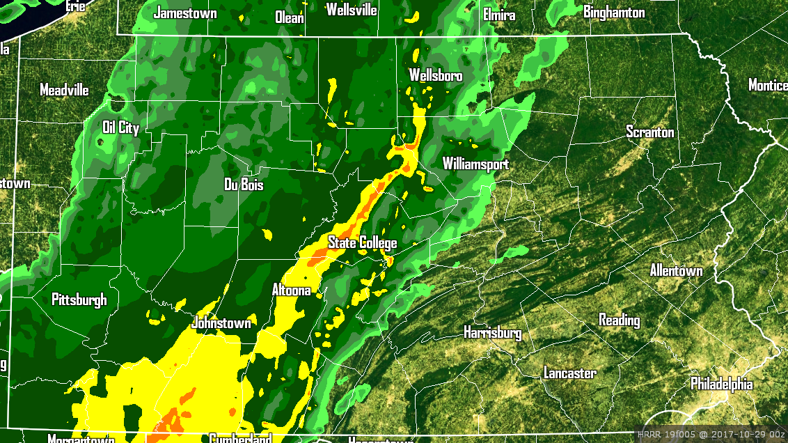
Temperatures in the 30s and 40s behind the cold front, with 50s and 60s out ahead of the front.
A strong cold front merging with a strong low pressure off the coast is the recipe for a rather potent nor’easter. If this was a month later, many areas would be receiving a major snowfall out of this system. Instead, most of us will see a cold, wind whipped rainfall.
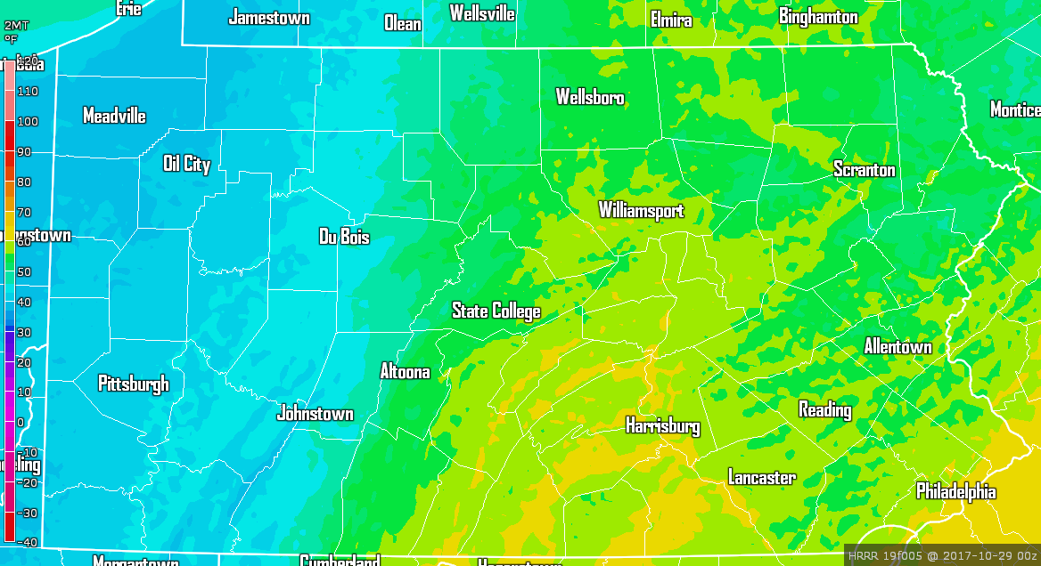
This will be a very cold rainfall. Many of us will only have temperatures in the 40s and some even in the 30s during most of the storm’s duration. Wind chills will be in the 20s across much of the state. Below is projected temperatures valid 2:00 AM Monday morning: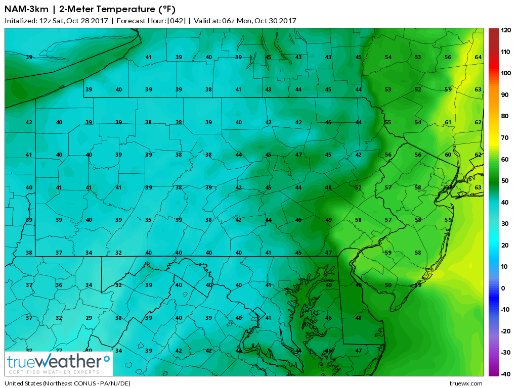
Notice over the higher terrain in the Laurel Highlands, temperatures will be around the freezing mark. This sets the stage up perfectly for a rain changing to snowfall Sunday night into Monday morning. This area has best chance at receiving accumulating snowfall, but they are not the only ones with the chance at receiving their first flakes as you will see in our snow map below.
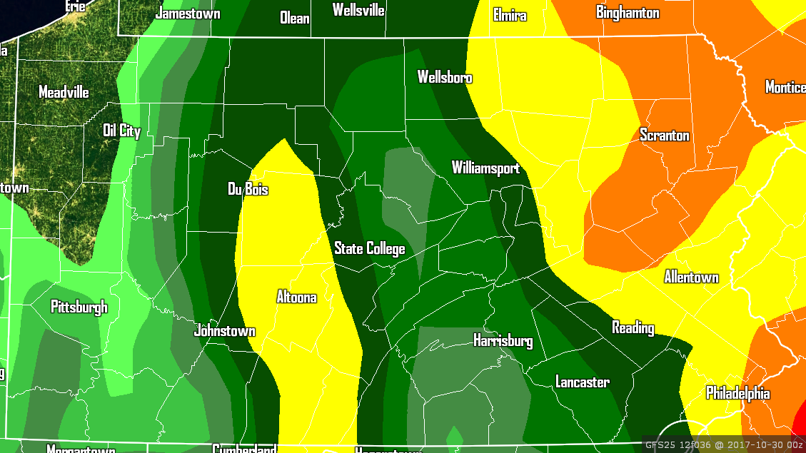
We have three forecast maps below, the first map will be projected rainfall totals, the second map will be projected wind, and the final map will be projected snow totals.
PROJECTED RAINFALL AMOUNTS THROUGH MONDAY
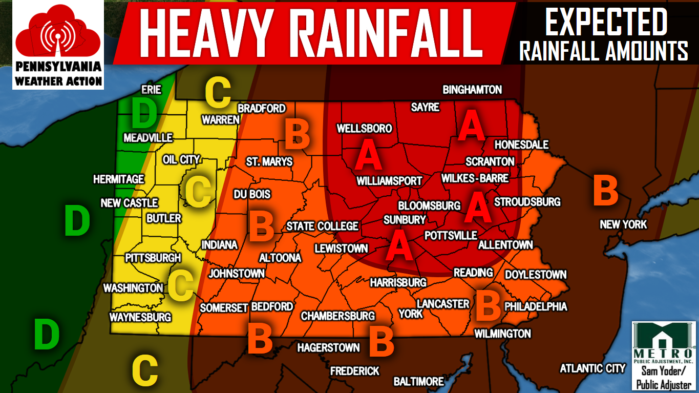
Area A – Rainfall amounts of 3-4″ expected. Flash flood watches are up for many locations within this area.
Area B – Rainfall amounts of 2-3″ expected. Minor flooding will be possible in locations that receive consistent heavy rainfall.
Area C – Rainfall amounts of 1-2″ expected.
Area D – Rainfall amounts of .5-1″ expected.
PROJECTED WIND GUSTS
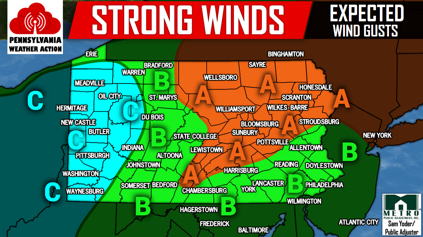
Area A – Wind gusts of 50-60 MPH are expected. Scattered power outages possible especially on ridge tops.
Area B – Wind gusts of 40-50 MPH are expected. Isolated power outages possible.
Area C – Wind gusts of 30-40 MPH are expected.
PROJECTED SNOWFALL THROUGH MONDAY
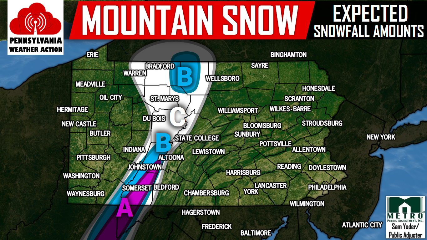
Area A – Snowfall amounts of 1-2″ expected Sunday Night.
Area B – Snowfall amounts of .5-1″ expected Sunday Night.
Area C – A dusting of snowfall is possible Sunday Night.
Make sure you have our app downloaded to stay ahead of this nor’easter and all winter storms to come this season, click here>>>Pennsylvania Weather Action’s App
For all the latest information regarding this nor’easter and more, like us on Facebook by clicking here>>>Pennsylvania Weather Action’s Facebook Page
Don’t forget to share the news regarding the nor’easter with your family and friends by using our icon below!
You must be logged in to post a comment.