After a cool start to the week, heat and humidity crept into our area today. Most locations fell into the 40s last night, but soared into the 80s today under mostly sunny skies.
This brief tease of summer will be squelched by a cold front that will plow through our area Friday afternoon to deliver a cool weekend with low humidity. However, a much bigger heat wave looms on the horizon…
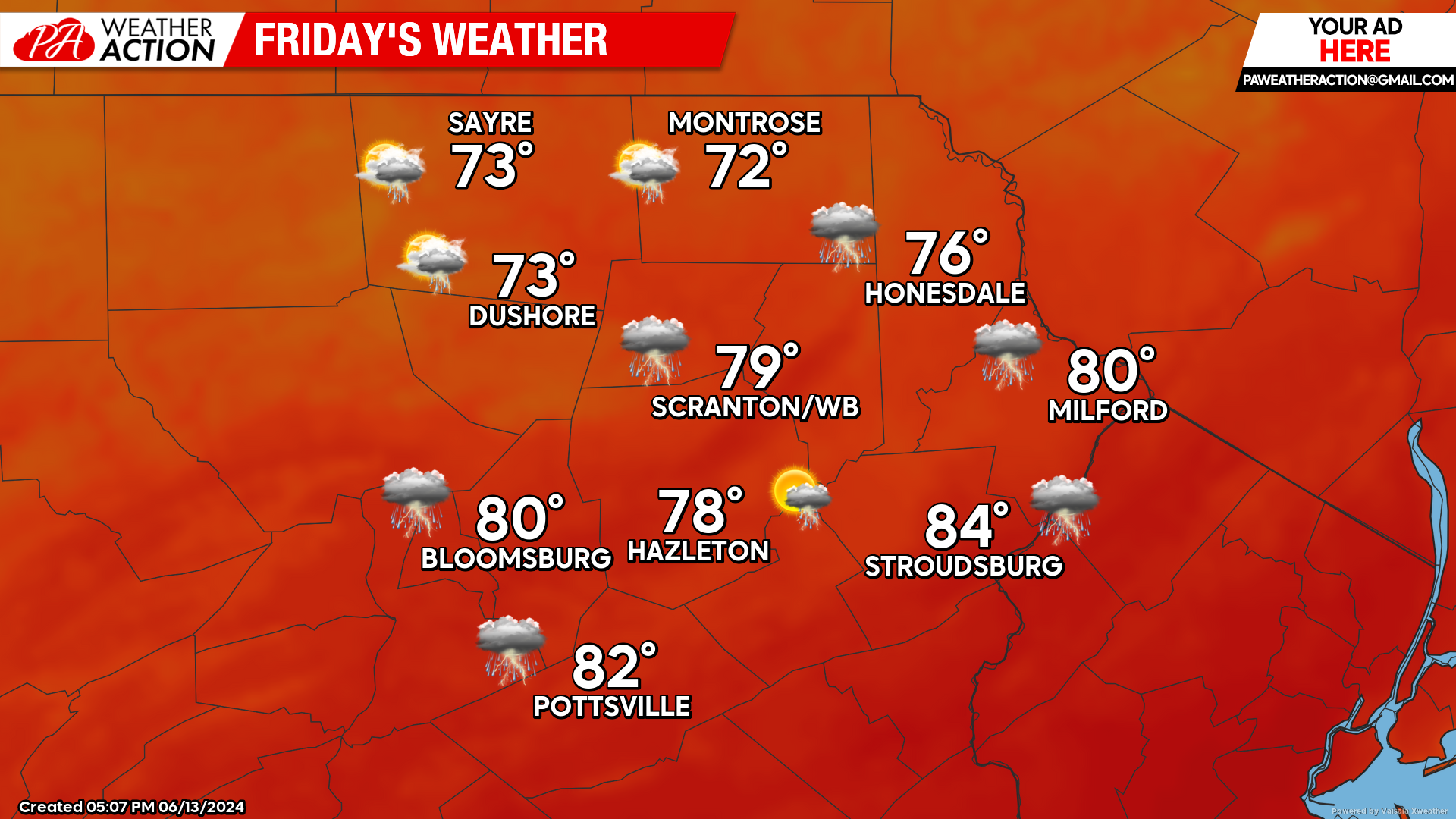
FRIDAY
Today’s warmth and humidity will persist through the morning. Showers will move into our northwestern counties late in the morning, capping their max temperatures in the 70s. However, our southern valleys could manage to climb into the 80s, as the front (and storms) won’t reach those areas until early-mid afternoon.
A cold front will plow through our area, accompanied by thunderstorms and delivering refreshing Canadian air for the weekend. The strongest storms will likely be in the southern half of our area, which will have more time for the solar heating to destabilize the atmosphere. The primary threats will be localized heavy rainfall and strong wind gusts.

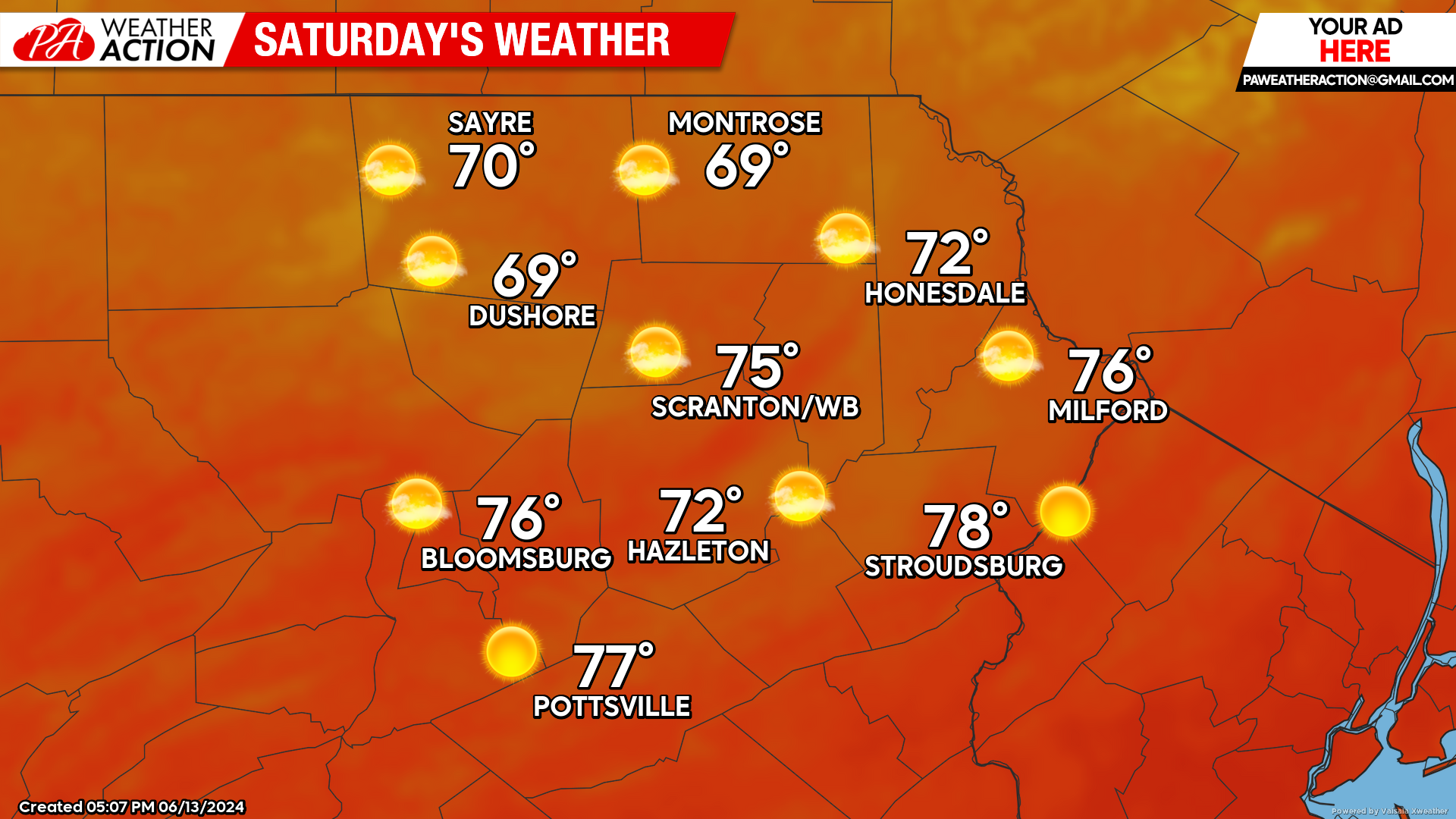
SATURDAY
A refreshing Candian surface high will cover our area, bringing sunshine and low humidity.

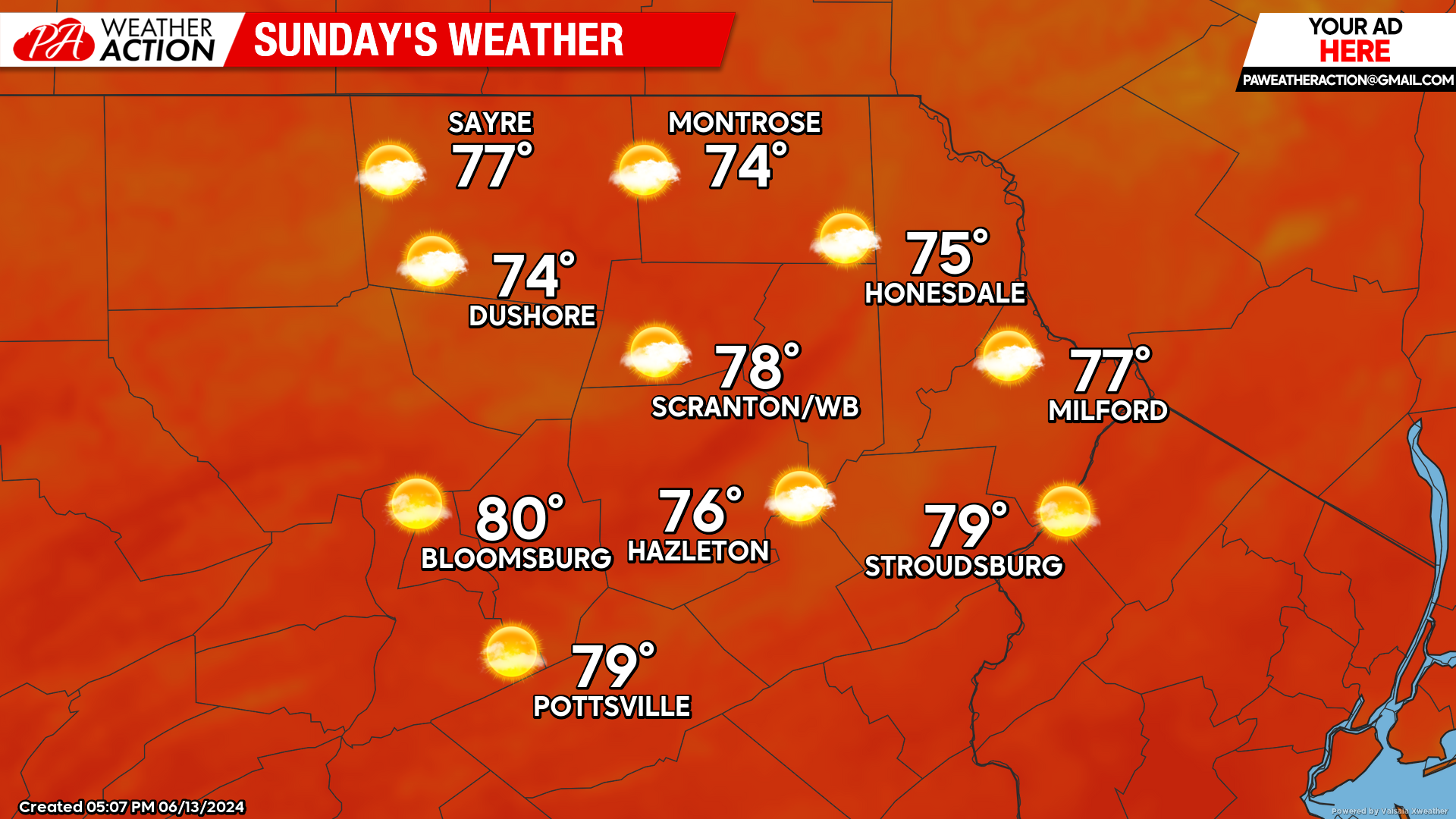
SUNDAY
That surface high will remain over our area, bringing a clear cool Saturday night, and sun-filled Sunday.

BEYOND SUNDAY (Mon-Fri June 17-21)
That surface high will slide eastward into the Atlantic by Monday and start pumping hot and humid air northward into our area. This will result in persistent heat and humidity for most, if not all, of next week. Temperatures in valleys could reach 90 on several days. There will be some teases of upper-level disturbances which could spark isolated thunderstorms throughout the week, but most of the time will be rain-free.


You must be logged in to post a comment.