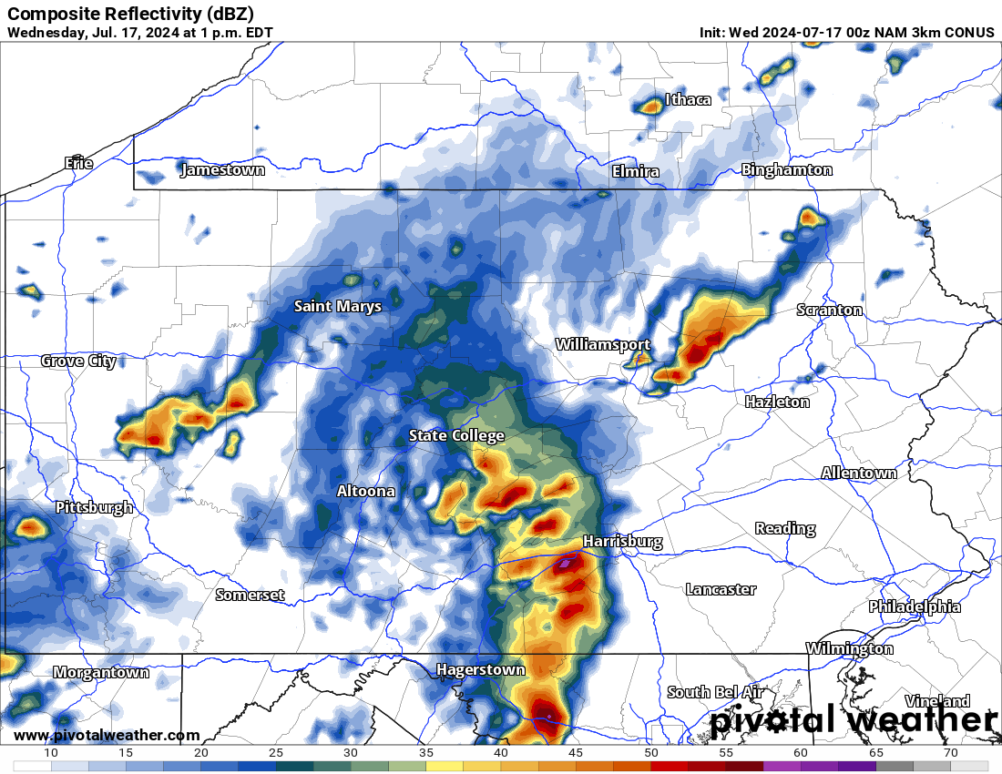
Powerful thunderstorms moved through the state yesterday and more strong storms on the way today. Below is a look at the latest radar imagery:
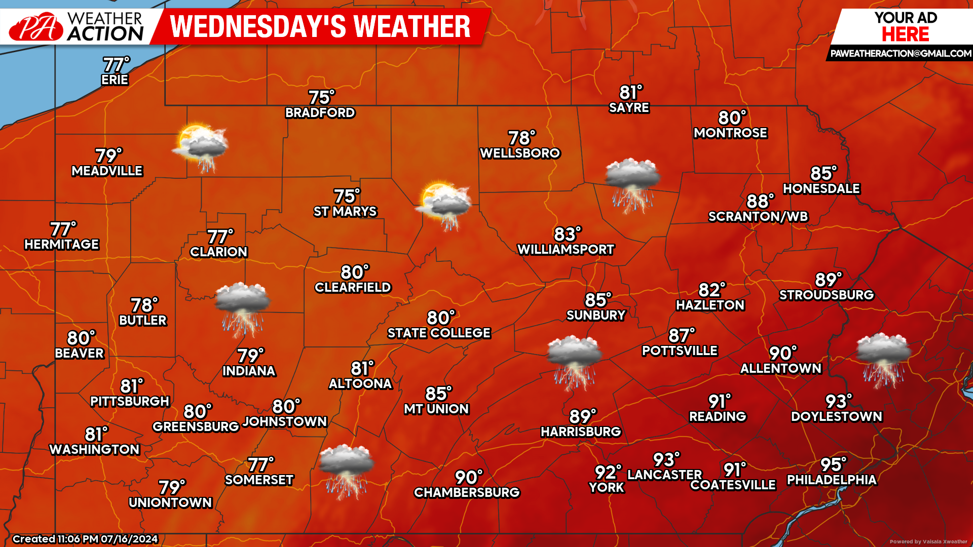
Today’s Weather Forecast: 7/10
Finally, today will be a relief from the extreme heat with the exception being southern counties where temperatures will still soar into the 90s. Strong to severe thunderstorms are likely today in similar areas that were impacted yesterday.
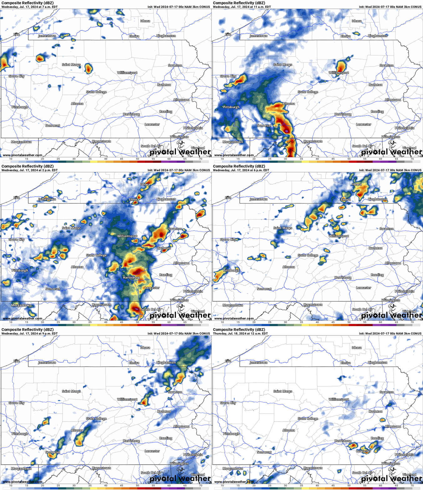
Hi-Res NAM Future Radar Valid Through Tonight:
A line of strong to severe thunderstorms will develop by the lunchtime hours today. Eastern Pennsylvania has the best chance to observe severe weather with main threat being damaging winds. Use the top left of the graphic below for time reference.
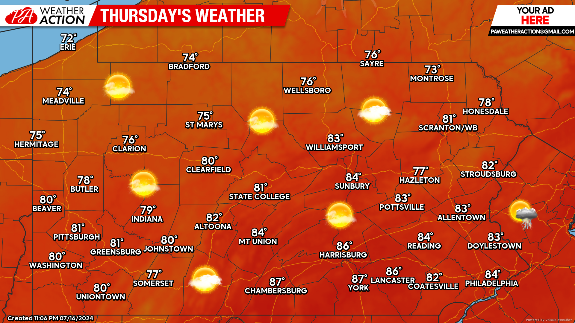
Thursday’s Weather Forecast: 10/10
Thursday will be the first official day that the entire state is free from the extreme heat. A perfect forecast is in store with temperatures in the 70s and 80s across the state and plenty of sunshine.
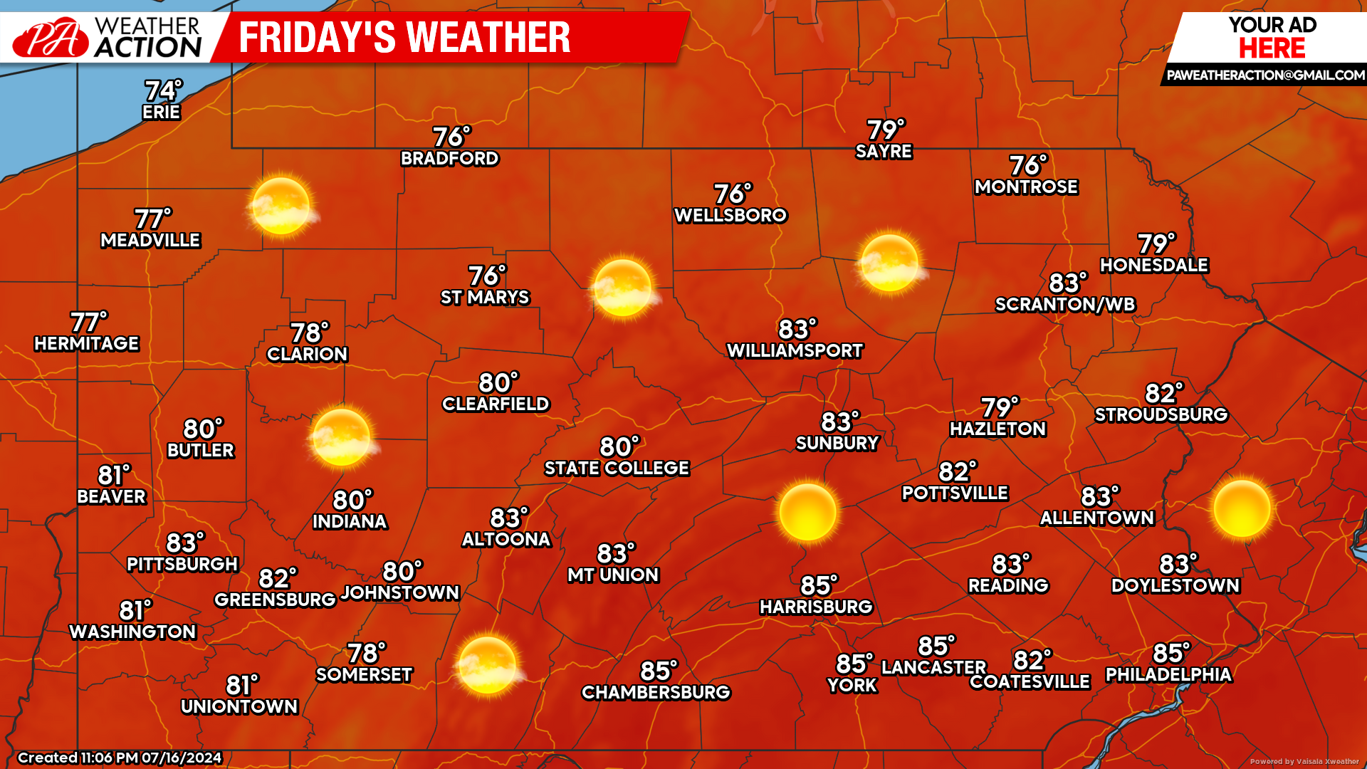
Friday’s Weather Forecast: 10/10
Friday’s weather will be an exact replica of Thursday’s weather. Lots of sunshine with temperatures in the 70s and 80s. I think we can all agree that we earned this stretch of upcoming beautiful weather!


You must be logged in to post a comment.