
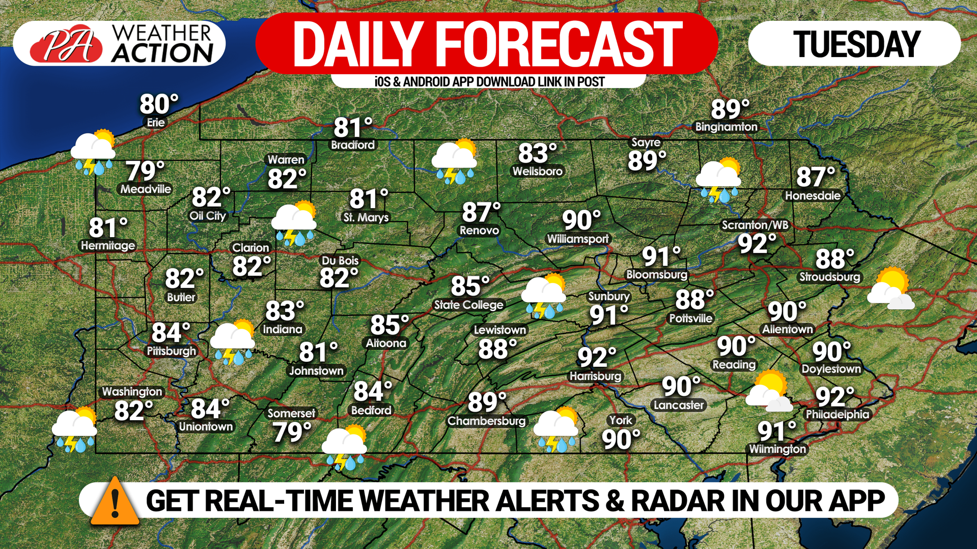
Yesterday’s activity can be summarized in one word: scattered. While some areas saw one to two inches of rain and multiple rounds of heavy storms, others had a dry day with dark clouds in the distance. That’s what we expect again today, as another Marginal Risk is out for severe thunderstorms across western and central Pennsylvania.
Temperatures will be nearly identical to Monday as well, with highs around 90 in eastern and central PA, and in the low 80s in western PA. Thunderstorm coverage will also be in the same areas, as you’ll see on future radar.
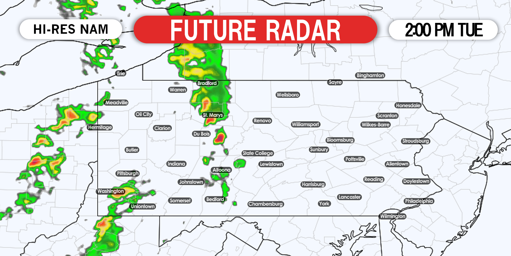
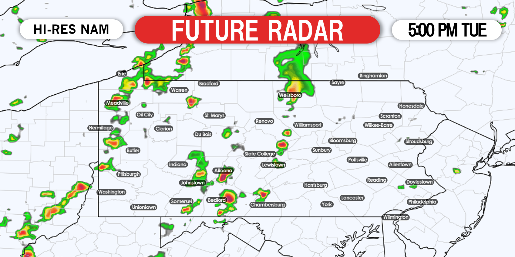
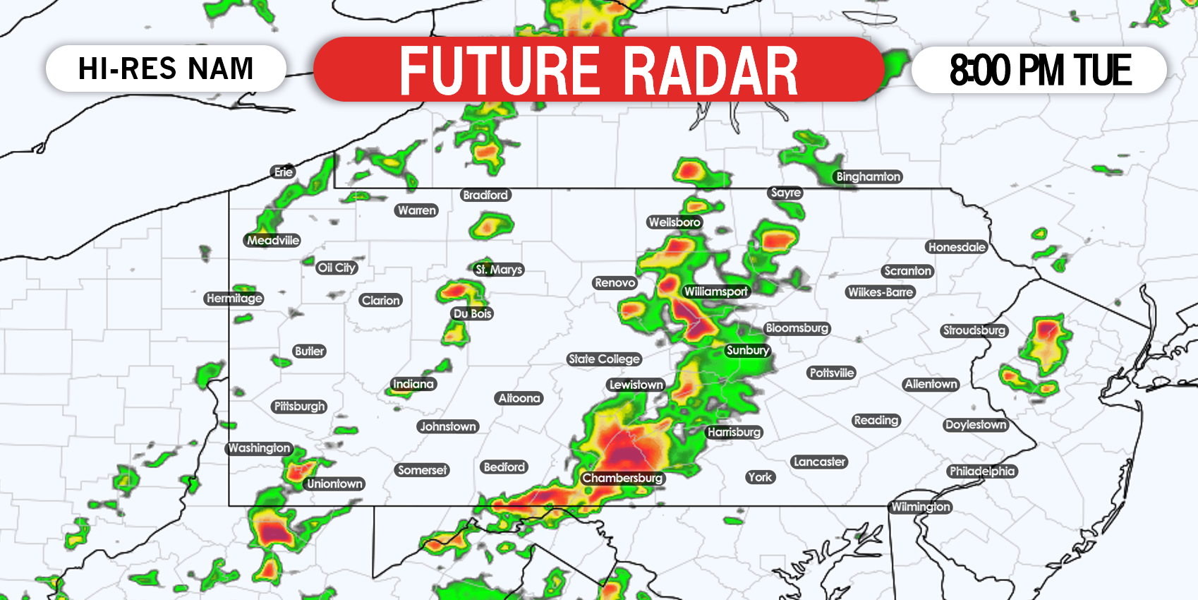
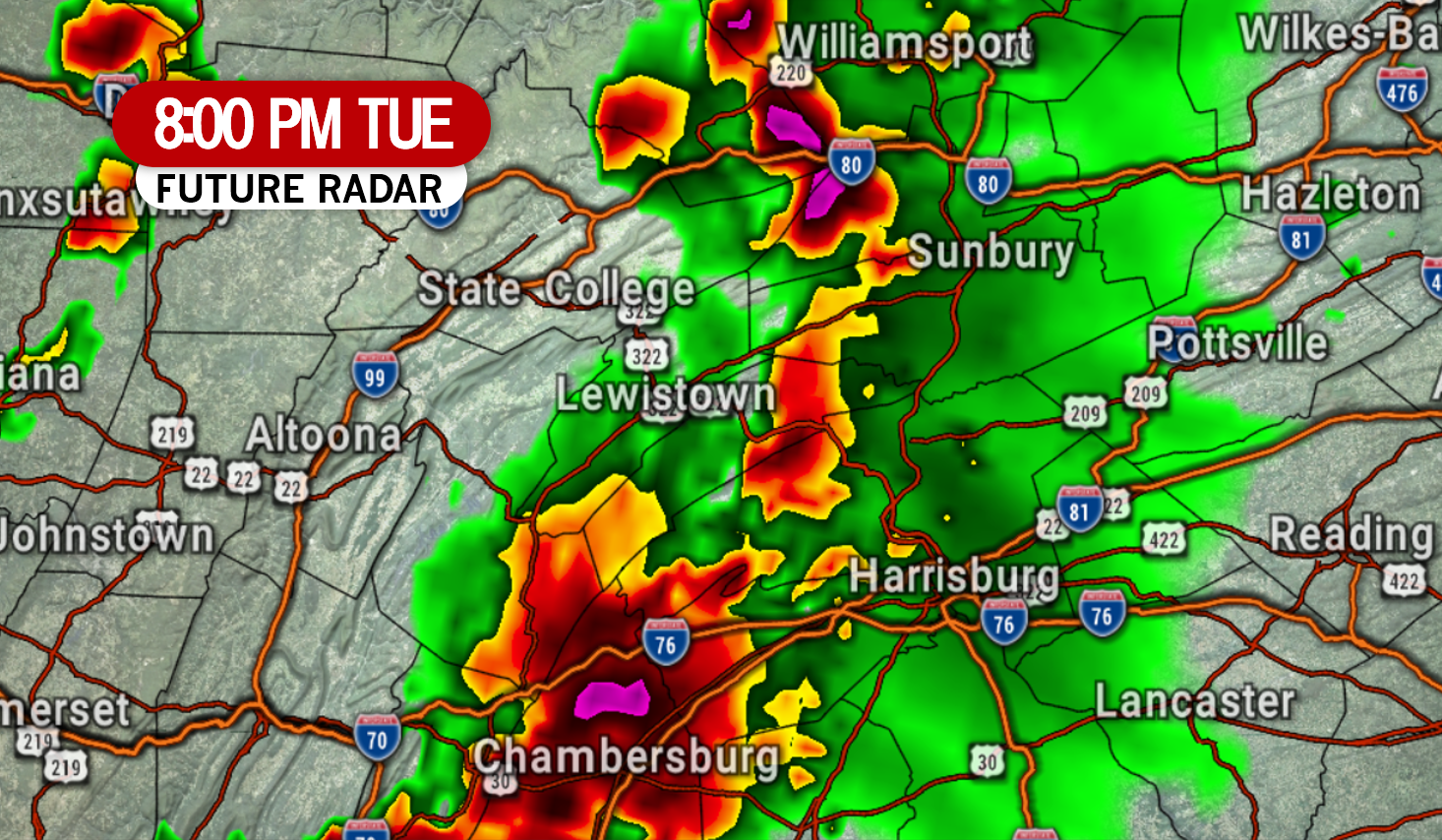
By the late afternoon we expect thunderstorms to pop-up in central Pennsylvania, most likely west of the Susquehanna Valley. These storms will have the potential to turn strong or severe quicker. Storms will move straight east today, as the cold front is arriving. Here is future radar for 5:00 PM.
We may have live radar this evening on our facebook page. Give our app a try if you haven’t, download it here for everything PA Weather Action >>> Weather Action App Link (iOS & Android)
Don’t forget to share this forecast with family and friends who may be out and about today!
You must be logged in to post a comment.