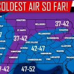
This Fall has been on the warm side across much of the United States. Many areas of Pennsylvania hae yet to see their first flakes. However, a pattern change has been rumored for several weeks now. While the long range remains somewhat uncertain, Thanksgiving Week will be chilly. Is that it, just chilly?
Highs are likely to be in 30s and 40s state-wide next week. In addition, there will be one, possibly two systems that move near the area. At this point we are looking at a system that would impact the region Sunday Morning into Monday Morning and possibly an event on Thanksgiving Day.
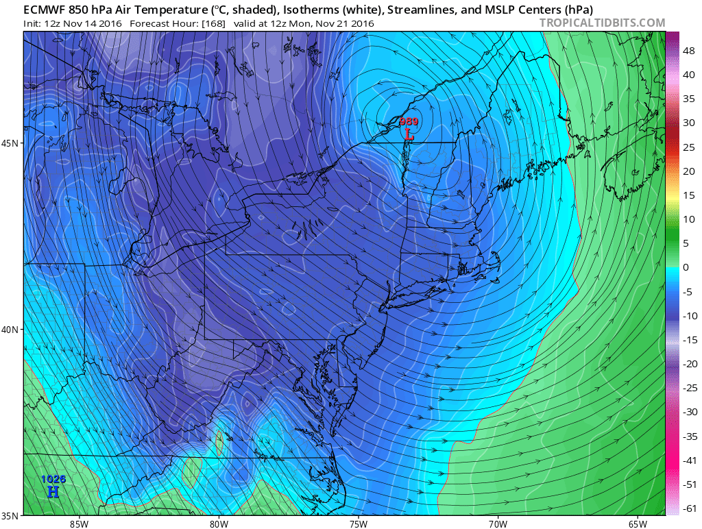
Right now all eyes are on the first event especially due to recent models. This Afternoon’s Euro Model indicated a low pressure just west of Lake Erie transferring to a secondary low pressure off the New Jersey Coast which resulted in much of the state receiving precipitation with temperatures near freezing. However, this is only one run. We need to see consistency before buying into any certain solution.
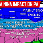
The American Model is similar in some ways but benefits north of the state much more. The coastal low pressure develops off the New England Coast, generating precipitation mainly in the form of snow for Northern PA and Upstate New York.
The Thanksgiving Event is still too far out to get into any details.
Stay tuned to our Facebook Page Pennsylvania Weather Action for rapid updates leading up to not only this event but all in the upcoming Winter Season! Also if you’re a snow fan don’t forget to share this below!