
Saturday’s cold front provided widespread showers for our region, with as much as an inch of rain in some of our eastern counties. That cold front delivered invigorating Canadian air, allowing temperatures to fall to near 40 in many areas by Monday morning.
Radar-estimated rainfall for Friday-Sunday Sept 6-8:
An upper-level disturbance passing to our north generated numerous showers with locally heavy rainfall across New York state this afternoon. Most of these showers remained north of our area today, however some will cross the border into our northern counties this evening. Our southern counties should be mostly dry
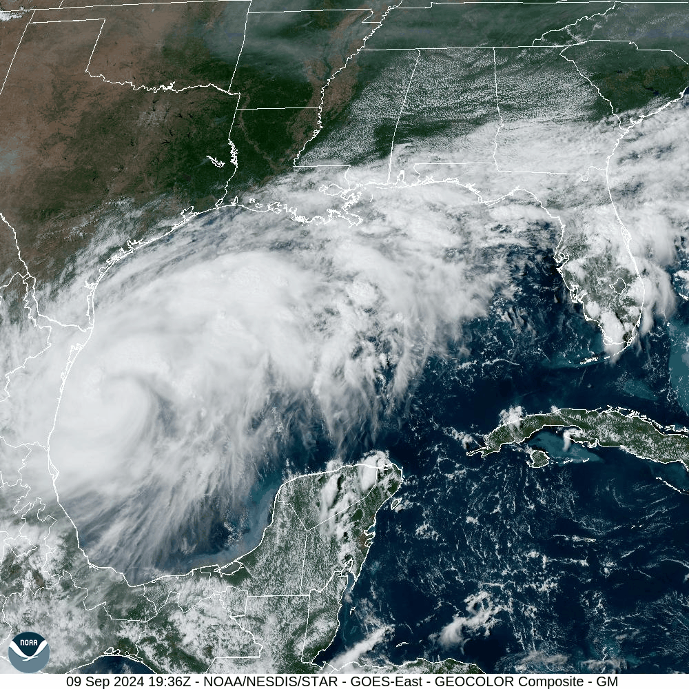
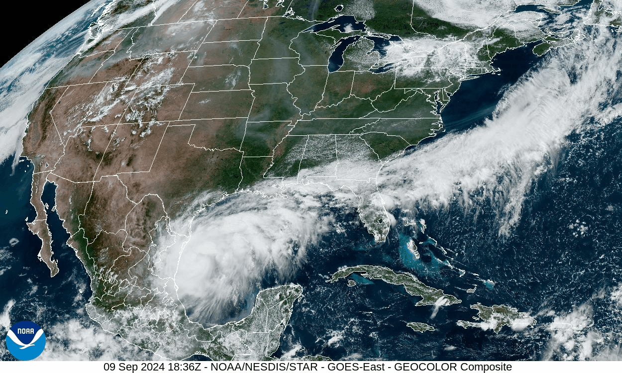
Meanwhile, the southwestern Gulf of Mexico gave birth to Tropical Storm Francine today! As of 4pm CDT, she already sports 65 mph wind, and she is expected to become a formidable Cat 2 hurricane by the time she makes landfall in Louisiana Wednesday afternoon! You can see her growing in the Gulf of Mexico. At this time, Francine’s moisture is not expected to reach our area.
You can see Francine growing in the western Gulf of Mexico in this satellite image. The milky-hazy strip from the Great Lakes through Tennessee and the Carolinas is high-level smoke from the forest fires in the northern Rockies and western Canada.
After this evening’s showers in our northern counties, our weather will be spectacularly sunny with above-normal temperatures this week. With Francine’s moisture expected to avoid our area, we are in for an extended period with no rain.
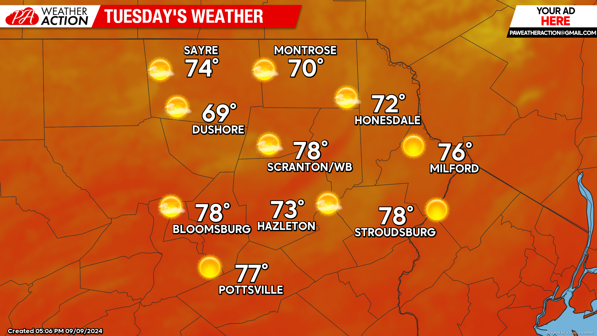
TUESDAY:
The day will start with temperatures in the upper 40s in most locations, with blazing sunshine driving afternoon temperatures well into the 70s.
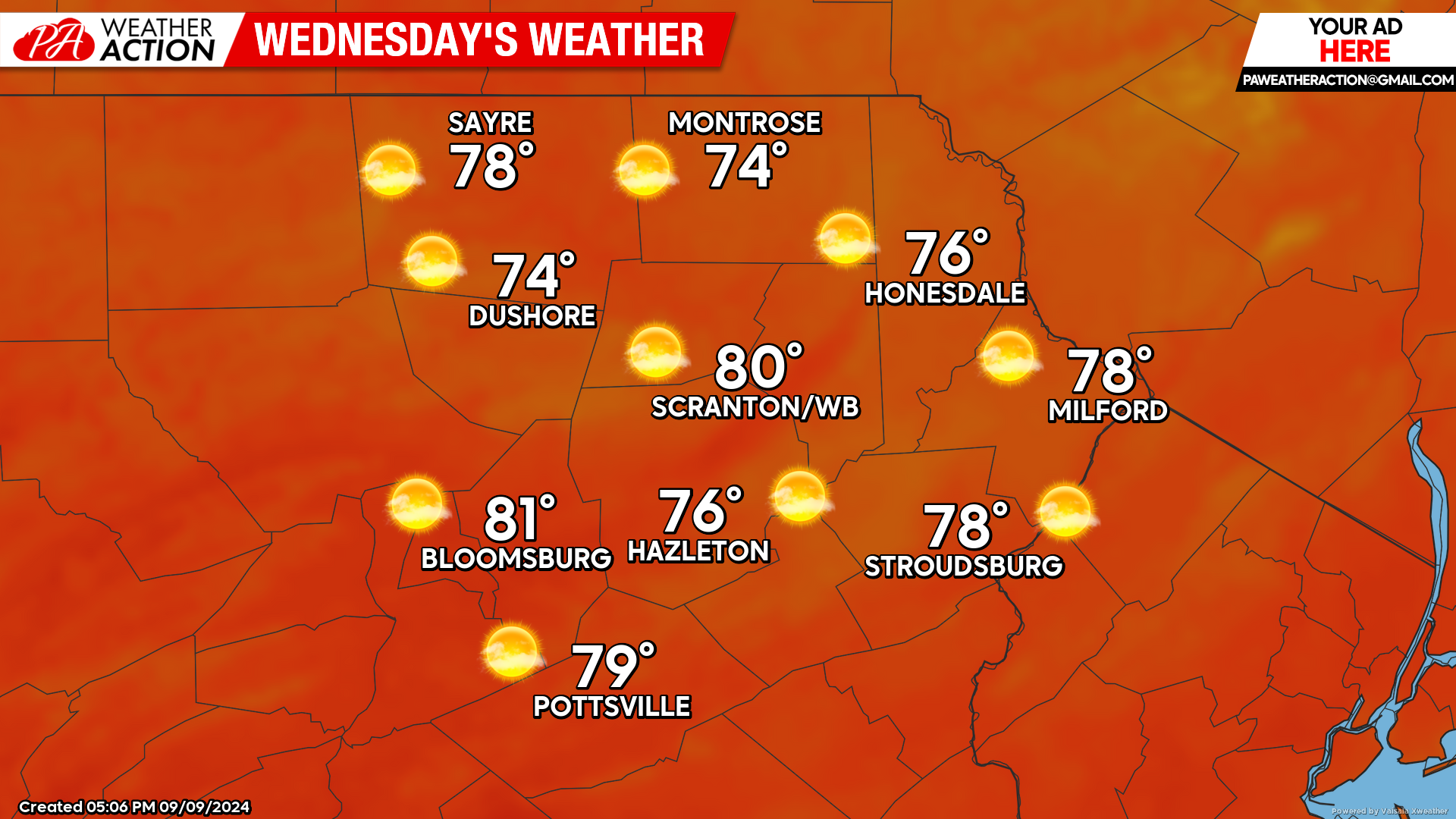
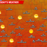
WEDNESDAY:
Wednesday will be a slightly warmer version of Tuesday, with the lower elevations creeping above the 80 degree mark. If you don’t enjoy the glaring sun and are looking for meteorological excitement, Francine will be impacting Louisiana as a strong hurricane on Wednesday.
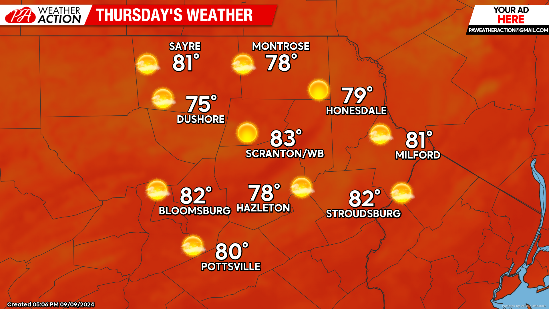
THURSDAY:
Thursday will be a slightly warmer version of Wednesday, with blazing sun driving temperatures into the low 80s in the valleys and upper 70s for the higher elevations. Francine’s rain will work up the Mississippi River and into parts of Indiana, Illinois, and Kentucky. However, at this time her moisture is not anticipated to impact our area.
BEYOND THURSDAY (Friday-Sunday September 13-15)
At this time, Francine’s moisture is expected to be shunted south of our area. This means that dry conditions with sunshine and above-normal temperatures will continue through the weekend. Low temperatures will generally be in the 50s, with afternoon temperatures reaching into the 70s in the high elevations and the low 80s in the valleys.
You must be logged in to post a comment.