It’s been a hectic week of weather in some areas of the state, with basement walls collapsing and basements filling to the brim with rainwater in parts of Central PA 30 miles southeast of Penn State Thursday night.
Meanwhile, much of Southwest PA has only further descended into severe drought conditions. Storms on Saturday look to target that area, along with much of the western half of Pennsylvania. While some believe the storms will survive all the way across the state into Eastern PA, we believe Saturday’s threat will only go as far east as the I-81 corridor.
THUNDERSTORM TIMING
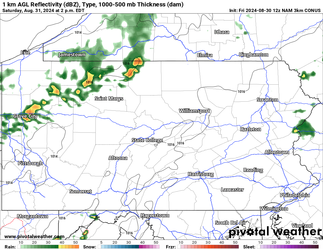
Thunderstorms are expected to fire up in far Northwest PA late Saturday morning into lunchtime near the Erie area. But as you’ll see below, the storms will be scattered across Northwest PA early Saturday afternoon, with some areas likely completely missing out while others see strong to severe storms. Below is Hi-Res NAM Future Radar for 2:00 PM Saturday.
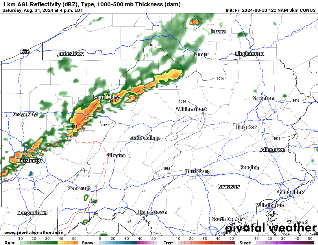
Between 2 and 4 PM Saturday we expect more of an organized line of thunderstorms to develop, ranging from the Northern Alleghenies near Potter County, down through Du Bois and into the Pittsburgh Metro. Storms will be near their peak intensity during this time, and we expect portions of this line to be severe-warned. Below is future radar for 4:00 PM Saturday.
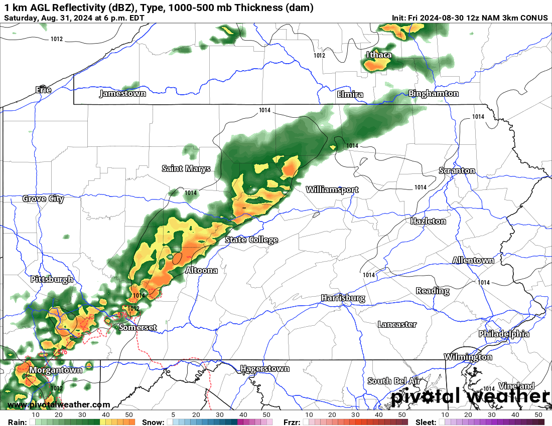
This line of storms is then projected to push east-southeast into Southwest PA, the Laurel Highlands, and mountains north of State College and Williamsport. Wind damage is certainly possible, and may result in plenty of tree damage across these wooded areas. Here is Hi-Res NAM future radar for 6:00 PM Saturday.
Now as these storms push into a gradually less favorable, more stabilized environment in Central PA, they will more than likely weaken. With that said, we believe this model weakens the storms a bit too quickly.
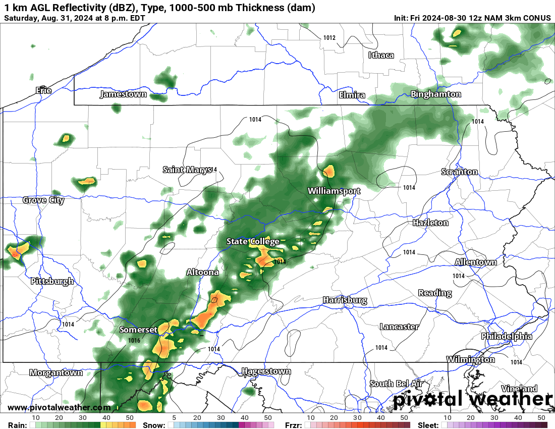
By the time 8 PM comes around, we still foresee strong storms pushing east-southeast across Central PA near and just east of the I-99 corridor. There may be gaps in the line as we approach sunset, with some sections losing strength. Find future radar for 8:00 PM Saturday below.
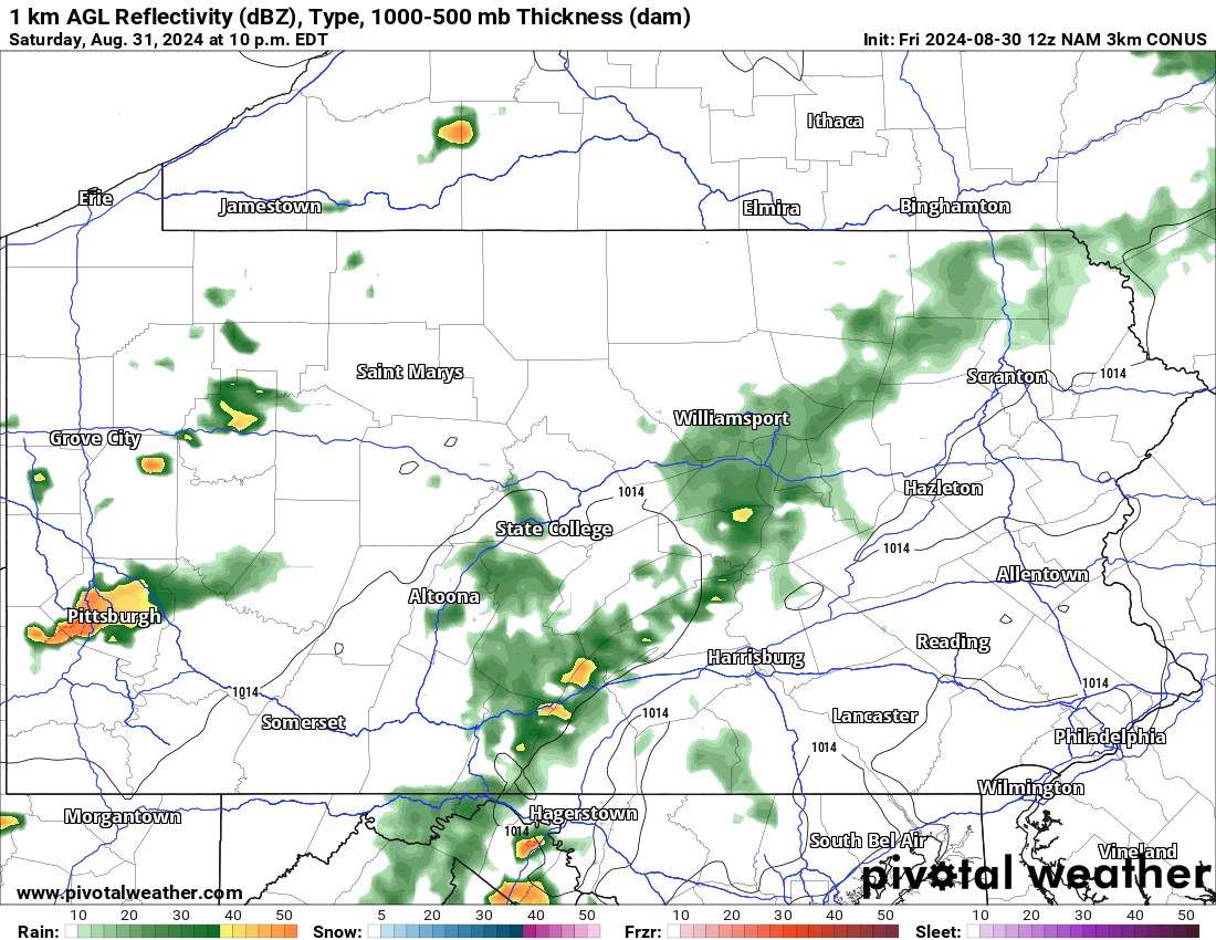
And by 10 PM, storms are anticipated to rapidly weaken as they lose daytime heating and move into a very stable parcel of air near I-81. This will likely be the end of where any severe activity is possible, but the wildcard is if the storms move faster and instability exists a bit farther east.
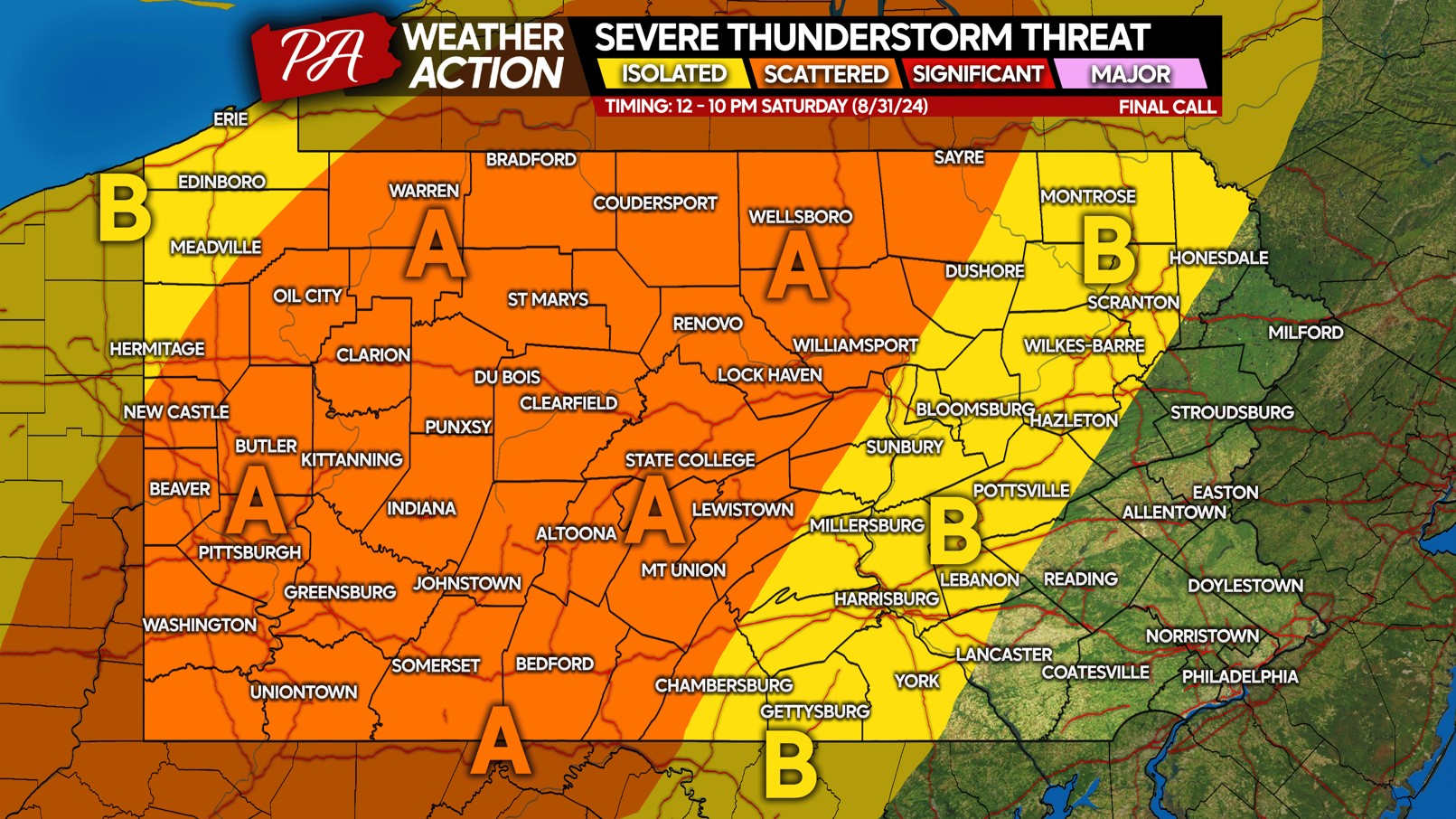
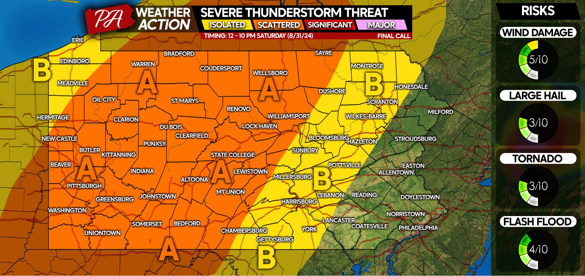
SATURDAY’S SEVERE THUNDERSTORM THREAT MAP
Area A: Scattered severe thunderstorms possible, with damaging winds of 50-70 MPH being the main concern. Isolated hail is possible, with a very isolated tornado not out of the questions. As mentioned, some areas will miss out, and others won’t!
Area B: Isolated severe thunderstorms possible. Just how far east the storms make it will depend on if they’re ahead of schedule and if instability will exist far enough east. Gusty to isolated damaging winds are possible, but unlikely.
A lot of people have outdoor plans this holiday weekend! Don’t forget to share this forecast with friends and family.

You must be logged in to post a comment.