
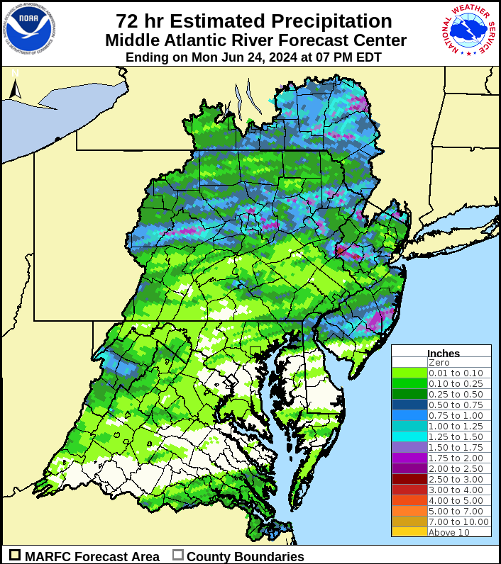
A cold front pushed away the heat and humidity and generated thunderstorms over the weekend. However, as is typical for thunderstorms, the distribution of rainfall was far from uniform.
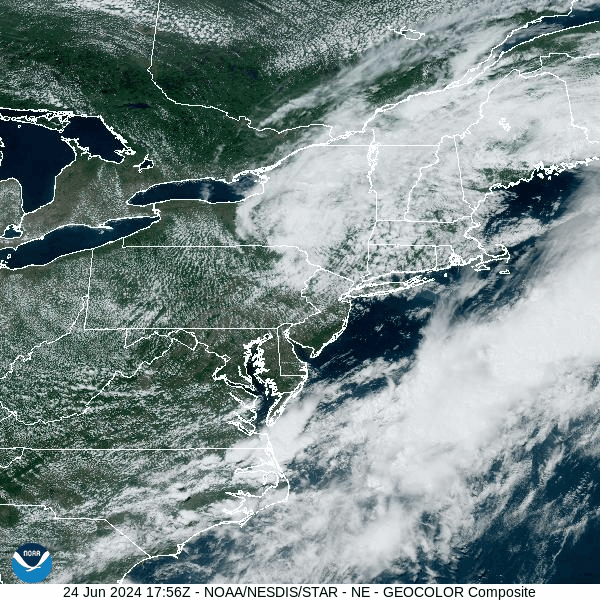
An upper-level low over New England circulated clouds southward into our area all day today. This low also produced wind gusts up to 30 mph in the valleys, and over 40 mph in the higher elevations. These gusts resulted in nearly 20,000 homes without power this afternoon. These gusts will subside overnight as the upper-level low drifts eastward to lose control of our weather.
On a more-positive note, temperatures remained in the upper 60s and lower 70s, along with low humidity today. This welcomed reprieve from the heat and humidity provided an opportunity to open windows and allow fresh air into homes. Temperatures will fall into the 50s tonight. Humidity will briefly return midweek before another cold front delivers Canadian air for the end of the week.
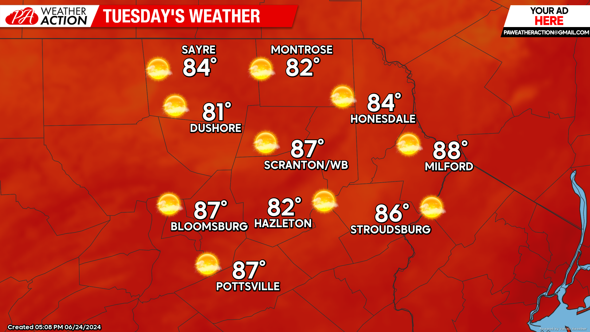
TUESDAY
The wind will become southwesterly and deliver warmer air into our region. Humidity will remain low, while the abundant sunshine should result in widespread highs in the 80s. However, an area of showers and thunderstorms moving eastward across New York could induce an isolated shower in our area during the afternoon or evening, but the probability is low.
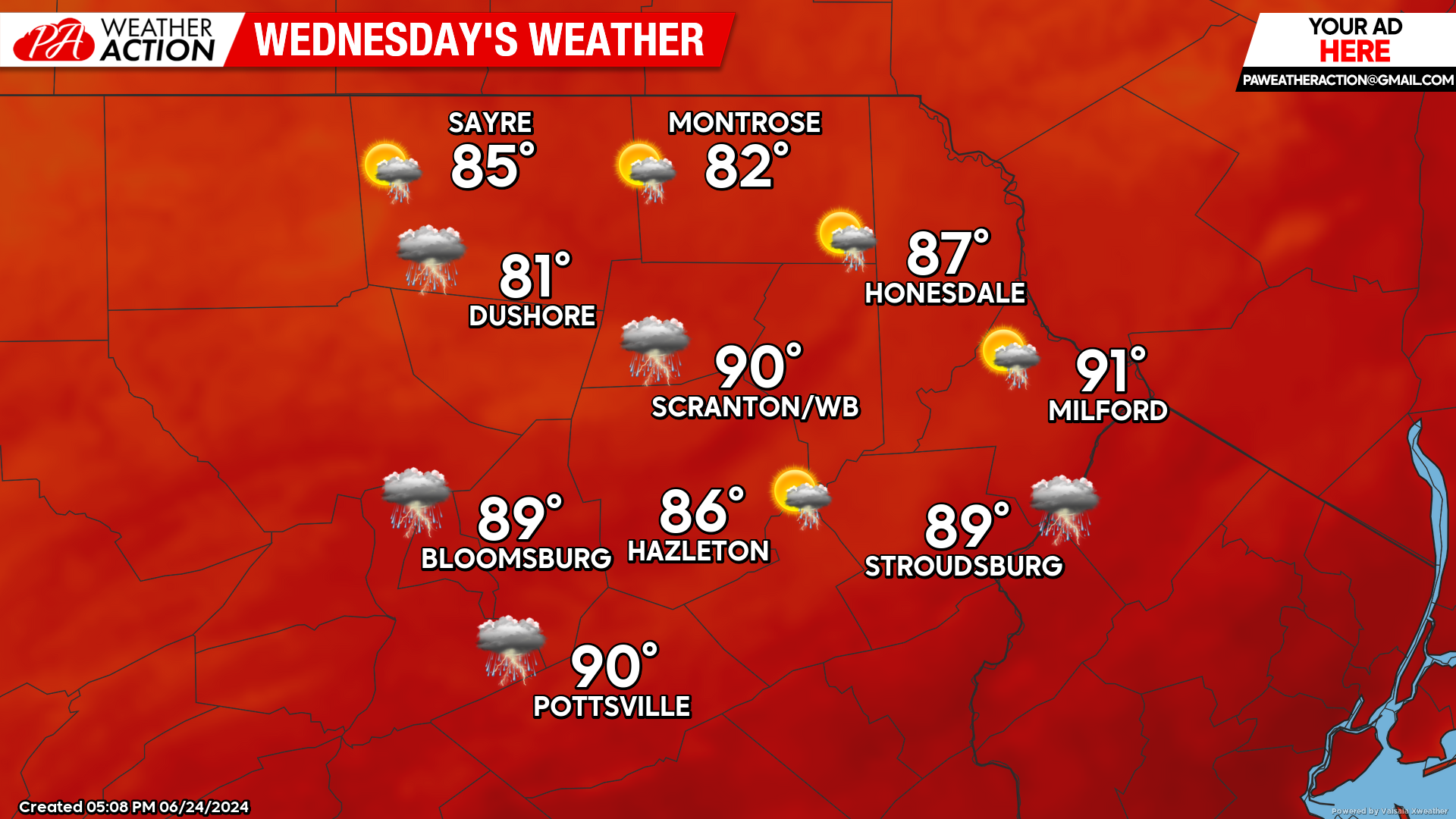
WEDNESDAY
The wind from the southwest will continue ahead of an approaching cold front will deliver humid air. Temperatures should reach well into the 80s.
An upper-level disturbance could spark thunderstorms midday into the afternoon, with an approaching cold front prolonging the opportunity for storms into the early nighttime. Some of those storms could be strong, and NOAA’s severe storm prediction center has us in a slightly risk for severe thunderstorms for Wednesday.
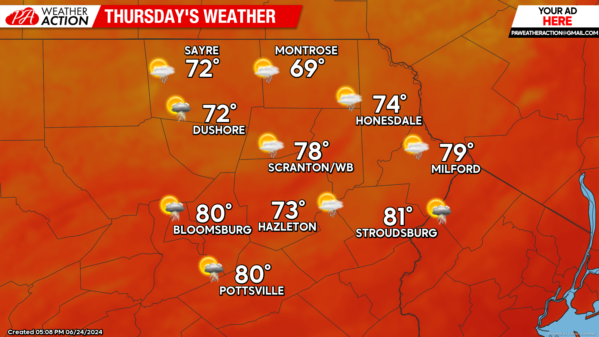
THURSDAY
Canadian air will bring refreshingly low humidity and lower temperatures. There will be the slight risk of a shower, but most of the area will experience a dry day. Enjoy!
BEYOND THURSDAY (Friday-Sunday)
Thursday’s refreshing conditions will last through Friday. As that Candian high slides to our east Friday night, it will circulate warmer, more humid air into our area for the weekend.
Another cold front will cross our area late Saturday or Sunday, bringing the opportunity for more thunderstorms. The front will herald yet another Canadian surface high to bring lower temperatures and low humidity to start the first week of July.

You must be logged in to post a comment.