The remnants of Beryl are finally making their way through, and they’ll come in the form of a “cold front”. Primary concerns Wednesday are a few tornadoes particularly across North Central Pennsylvania, and scattered damaging winds throughout many other areas of the state. This cold front will cool us down into the 80s for a few days, so perhaps get a light jacket out before we heat back up by the weekend.
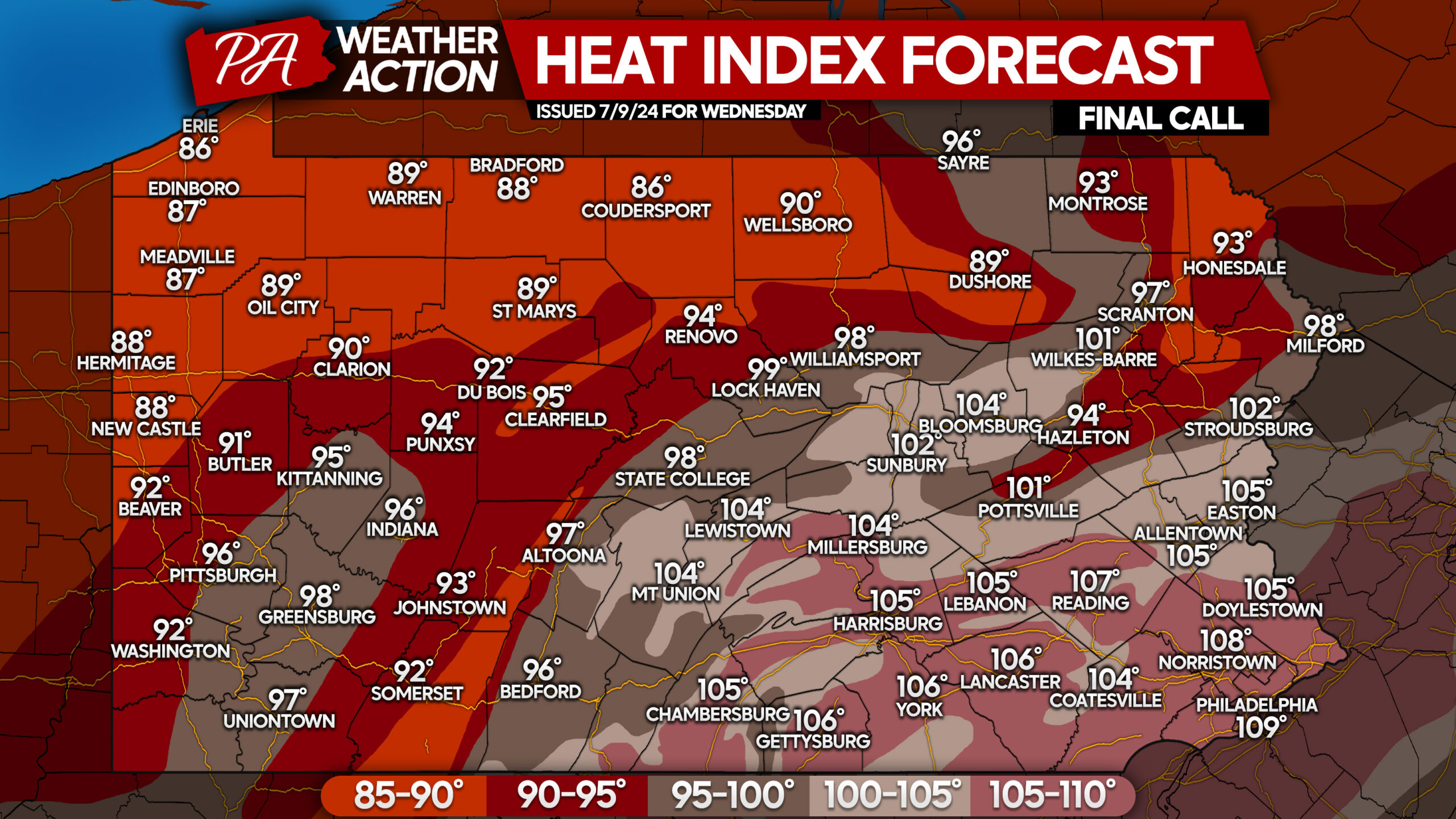
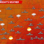
Wednesday will also feature dangerous heat indexes ahead of the storms in South Central and Southeast PA, where temperatures in the 90s combined with dew points in the mid to upper 70s will create heat indexes well above 100°. View maximum heat indexes for Wednesday below!
WEDNESDAY THUNDERSTORM TIMING
We are going to use the High Resolution NAM Model for this timing forecast, but we have bumped everything up by two hours based on the model’s performance this year so far.
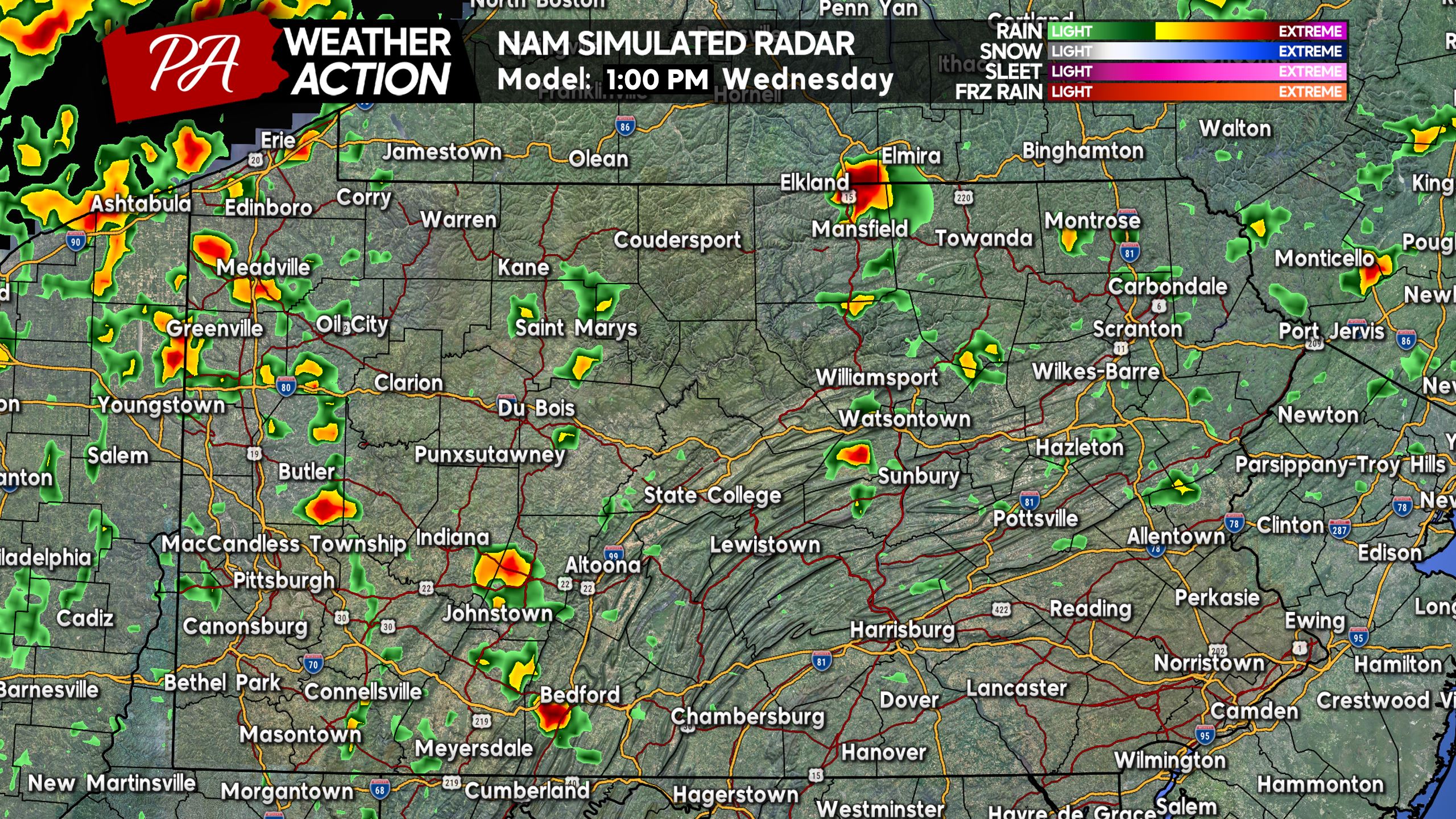
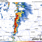
We expect showers and storms to begin to fire in Western PA primarily by around 1:00 PM Wednesday. These aren’t anticipated to be severe just yet. Here is future radar for 1:00 PM Wednesday.
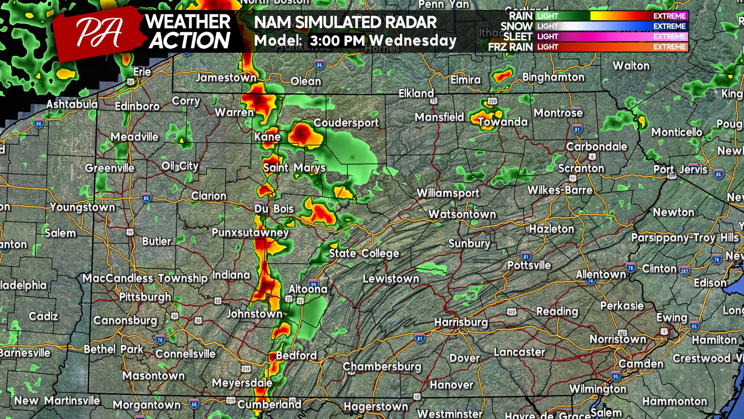
By mid-afternoon Wednesday is when we expect things to go severe, as storms near the Allegheny Mountains from the PA Wilds down into the Laurel Highlands. Storms farther north, say near and north of I-80, have the greatest chance to rotate and become tornado-warned. Below is future radar for 3:00 PM Wednesday.
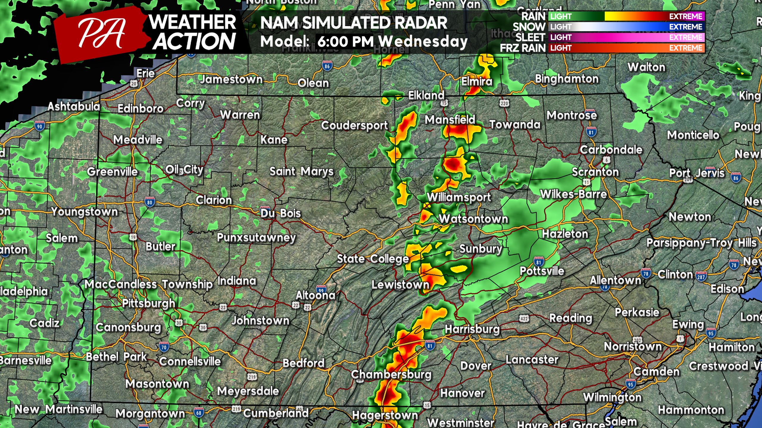
As we push towards dinnertime, a more consolidated line of storms is expected to develop and push west. This is when the main concern will become damaging winds, with spin-up tornadoes not out of the equation though. By 6:00 PM, storms will push into the heart of Central PA near Route 15 as shown below.
Heading towards sunset, storms will push east into the Susquehanna Valley. This model depicts widespread activity, whereas other models depict gaps in the line, meaning some areas may not see much.
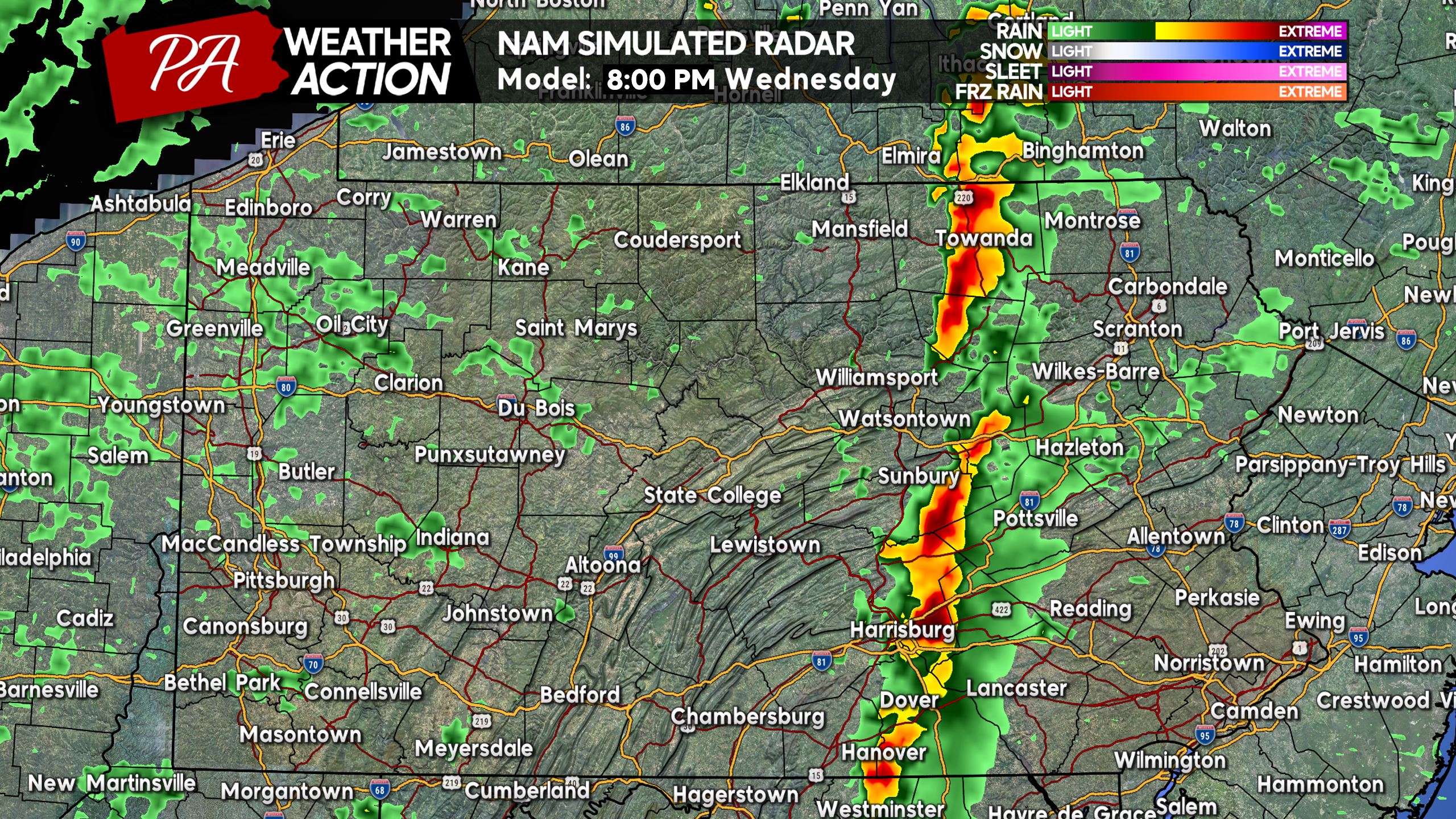
We believe there will be a few gaps, which is unfortunate because we really need the rain. A severe drought is expanding into South Central PA! Below is future radar for 8:00 PM Wednesday.
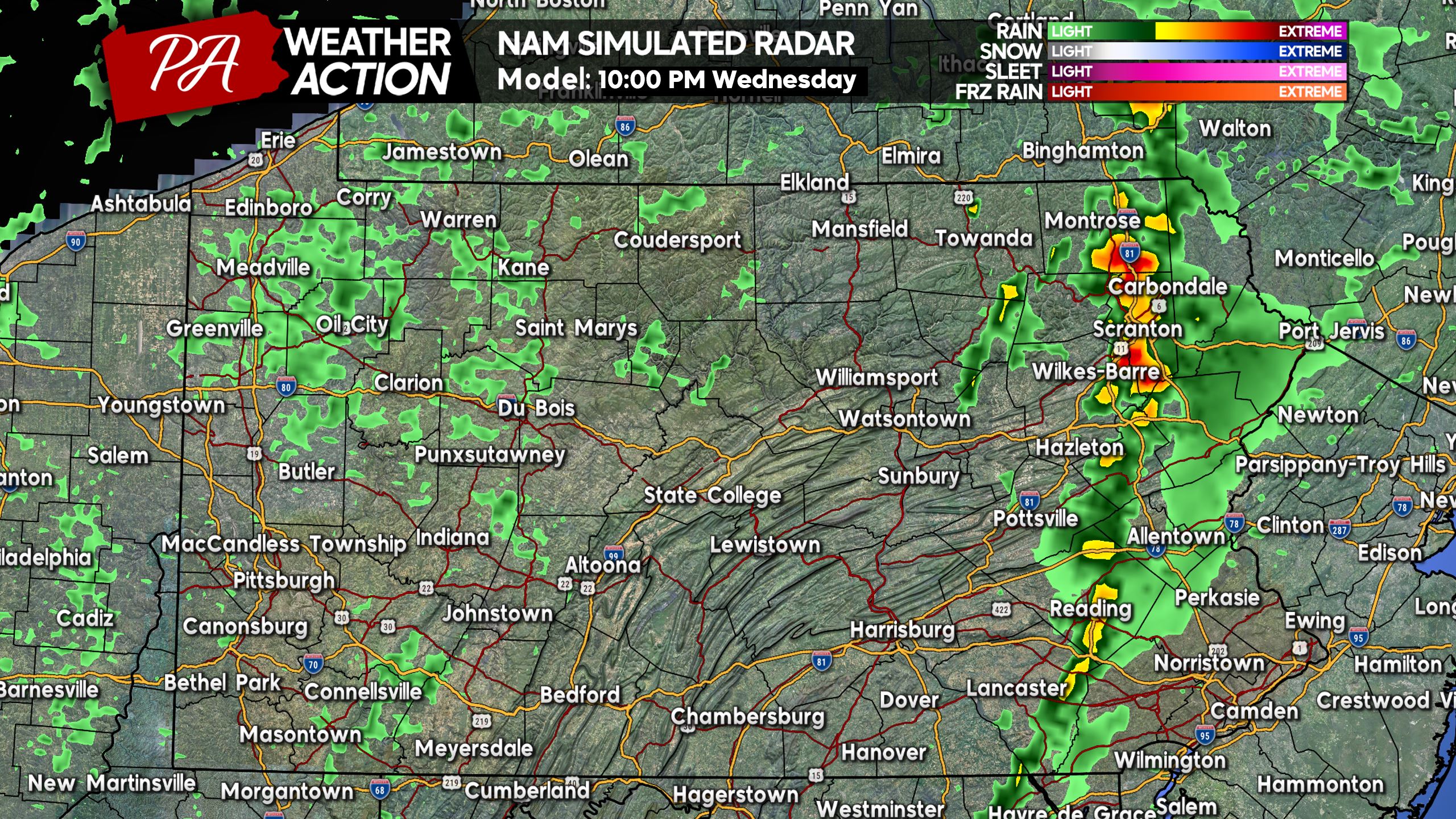
The line of storms is likely to dissipate after sunset as it pushes into Eastern PA. The Northern Poconos have the highest chance of seeing severe weather, whereas Southeast PA will probably just see the leftovers of this line in the form of some showers in the late evening. Here is future radar for 10:00 PM Wednesday.
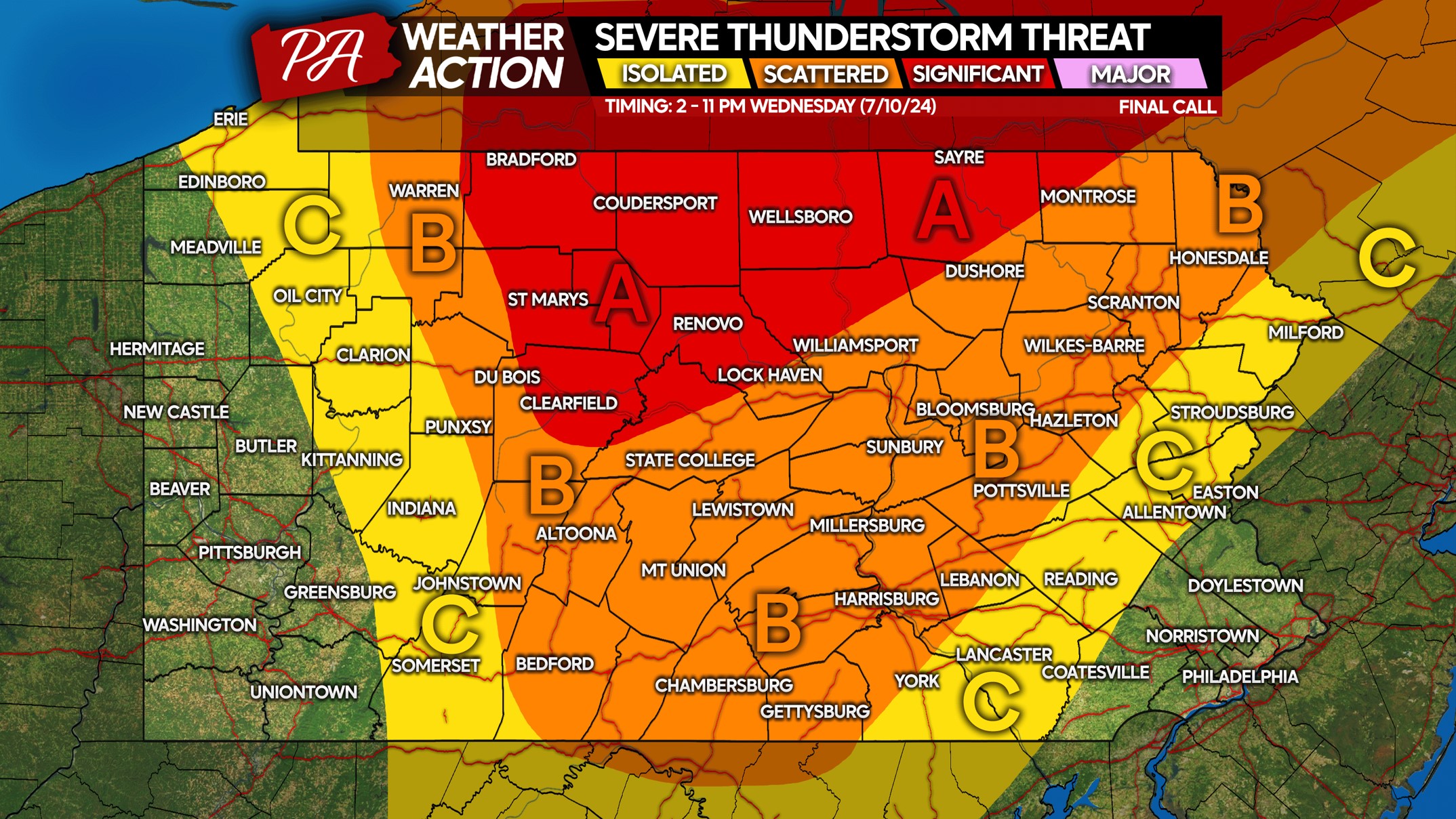
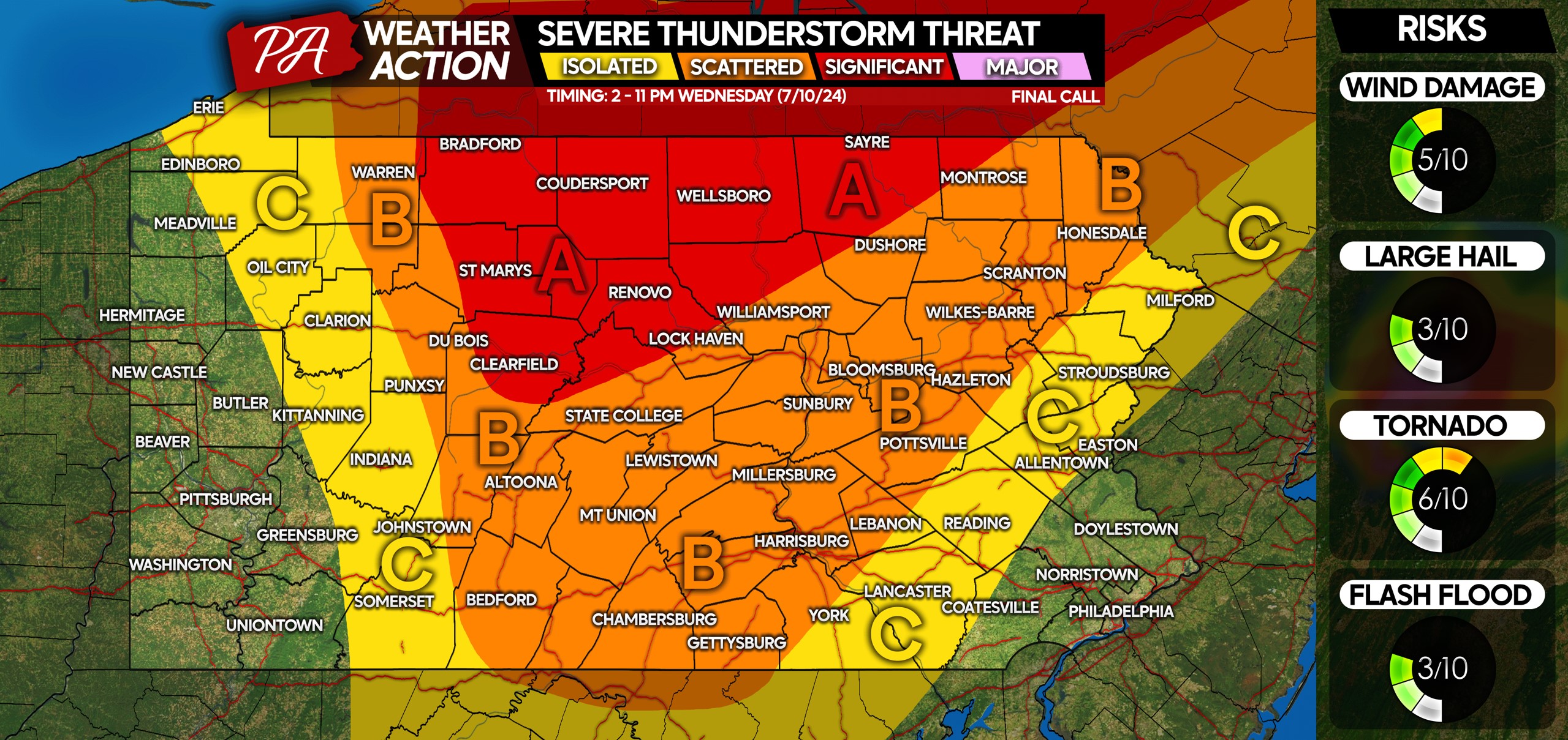
WEDNESDAY 7/10 SEVERE THUNDERSTORM RISK MAP
Area A: Scattered severe thunderstorms likely, with an elevated tornado concern. Damaging tornadoes and straight line wind gusts up to 70 MPH possible.
Area B: Scattered strong to severe thunderstorms possible. Watch for an isolated tornado, along with damaging wind gusts up to 65 MPH.
Area C: Isolated strong to severe thunderstorms possible. Damaging winds are the main risk, but we can’t completely rule out a tornado-warned storm especially in Western PA.
Be sure to share this forecast with family and friends in the risk area, or even where heat indexes will be dangerous! Never leave a person or pet in a closed car for any amount of time.
Get a message on Facebook messenger when we post updates like this, instead of relying on the algorithm! Tap below to join our channel!


You must be logged in to post a comment.