We could start to see tropical moisture build in the Gulf next week, and Florida could be in for a dumping of rain by the end of next week. We most likely won’t see as much rain here in the Carolinas.
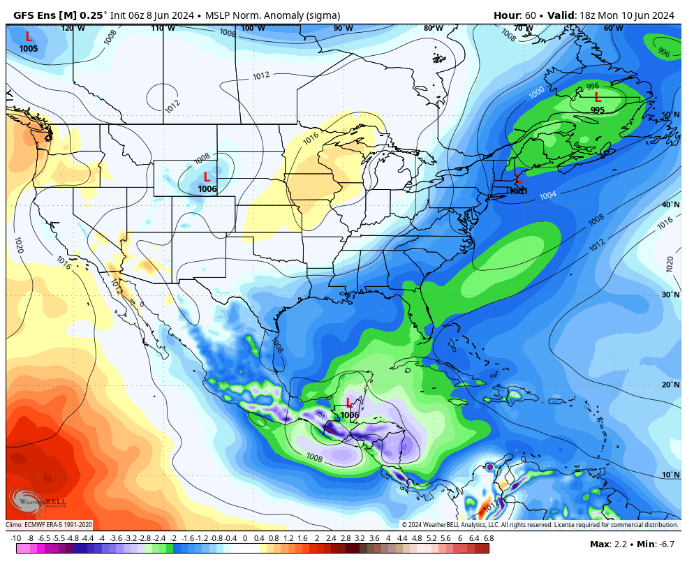
TYPICAL “GYRE” SETTING UP OVER CENTRAL AMERICA
The gyre is a typical area of low pressure that sets up over Central America this time of year. Most likely, nothing major comes from this such as a major hurricane. The most we’ve seen in recent times was Cristobal in 2020, and she was a tropical storm.
WILL CAROLINAS GET RAIN?
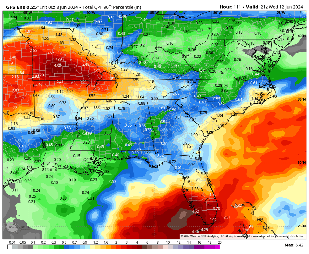
Most likely, South and Western Florida will receive torrential tropical rains, while us here in the Carolinas will get some tropical downpours in the form of thunderstorms, but the heaviest rain looks to be offshore or maybe along the SC coast. But the coasts could be looking at an inch or more of rain before midweek.
TYPICAL SUMMER DOWNPOURS NEXT WEEK
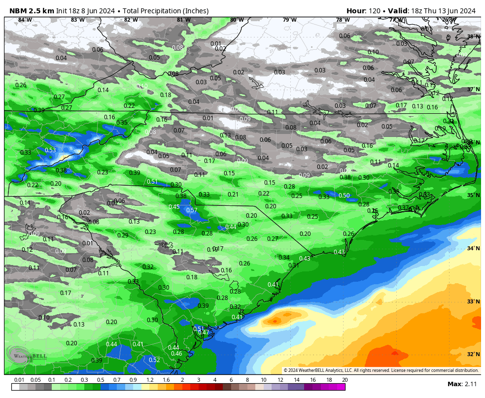
Into Thursday next week, the Carolinas can expect typical late-afternoon thunderstorm and downpours, especially as a potential weak tropical system moves offshore to our east. Below is the best estimate for rainfall as a whole through Thursday next week.
The heaviest plume of moisture stays offshore.
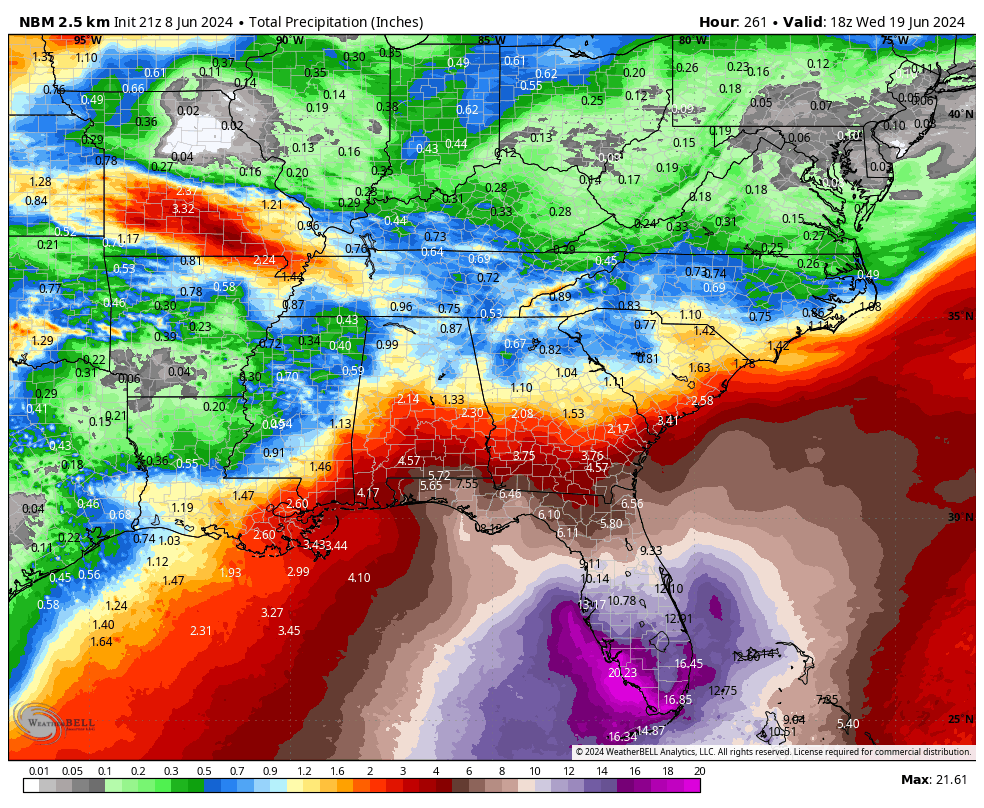
Tropical moisture could get out of control in South Florida into next Weekend! Some of the rain totals are starting to get out of control. Miami and SW FL could be in for major flooding.
SUNDAY COULD GET HOT
Highs Sunday will be toasty, and downright hot across the Lowcountry and SE NC. The heat index shouldn’t be too bad unless the humidity starts to creep back in. There could be some upper 90s in SC and SE NC.
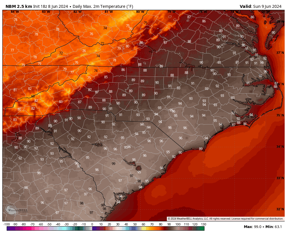
For the rest of next week it looks like typical June heat and humidity in the South. Temps will average around 90 with some locations seeing 95 and others seeing around 88.
There will be downpours especially along the coast if a weak tropical system passes just offshore. That could also mean downpours inland.
Stay tuned to the forecast this week especially if you work outdoors or have outdoor plans!


You must be logged in to post a comment.