
The tropics were asleep for a while, but now we have a couple of areas to watch. The first area will be one that could become a tropical depression in the coming days.
COULD WE HAVE ALBERTO?
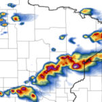
Below is the GFS ensemble mean plot for percent likelihood that a tropical depression forms this week that is currently Invest 90L. The first name on the list is Alberto if this system strengthens beyond a tropical depression, which is possible given how hot the ocean water temps are.
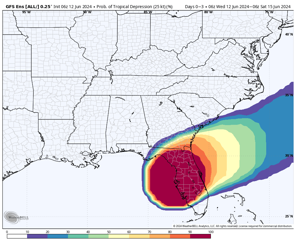
Most likely, the depression will form close to or over Florida. They are expected to get a metric ton of rain over the next few days, with 10″ + in spots. This will make for widespread flooding.
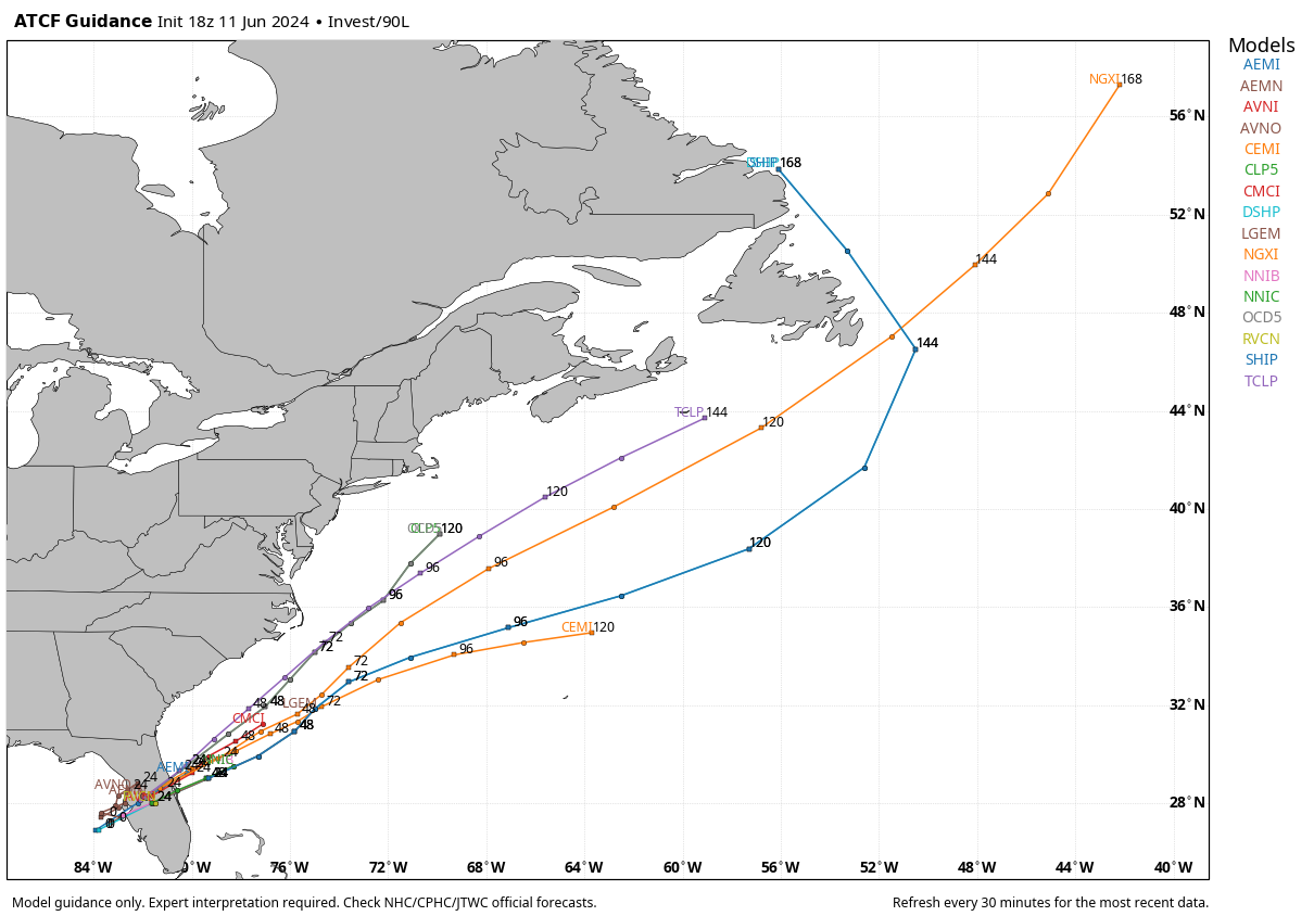
STORM TRACK FOR INVEST 90L
Current model plots take what could be our tropical depression out over the water. But depending on strength, the beaches could be affected with rip currents. Inland could get some tropical-style downpour in stronger thunderstorms.
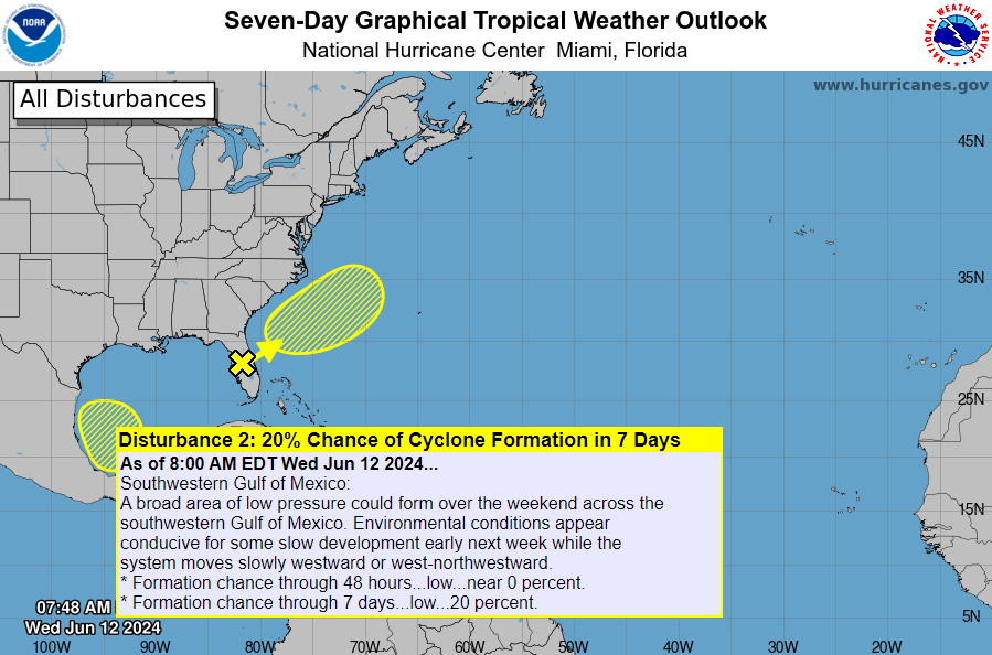
ANOTHER SYSTEM TO WATCH IN BAY OF CAMPECHE
The NHC has also outlined another area to watch in the southern Gulf, with a low chance of formation, however again it’s possible these systems are stronger than realized with the bath water in the Gulf. This system will not impact the Carolinas directly even if it does form.
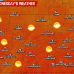
UPCOMING HEATWAVE
Other than our potential tropical depression off our coast, the other big story is the upcoming heatwave starting later this week. Many locations across the Carolinas could see highs in the mid 90s. It will get hot quickly.
Temperatures will start to heat up later this week, especially on Friday, and Saturday looks like a scorcher. There could be readings hitting the Century Mark in SC.
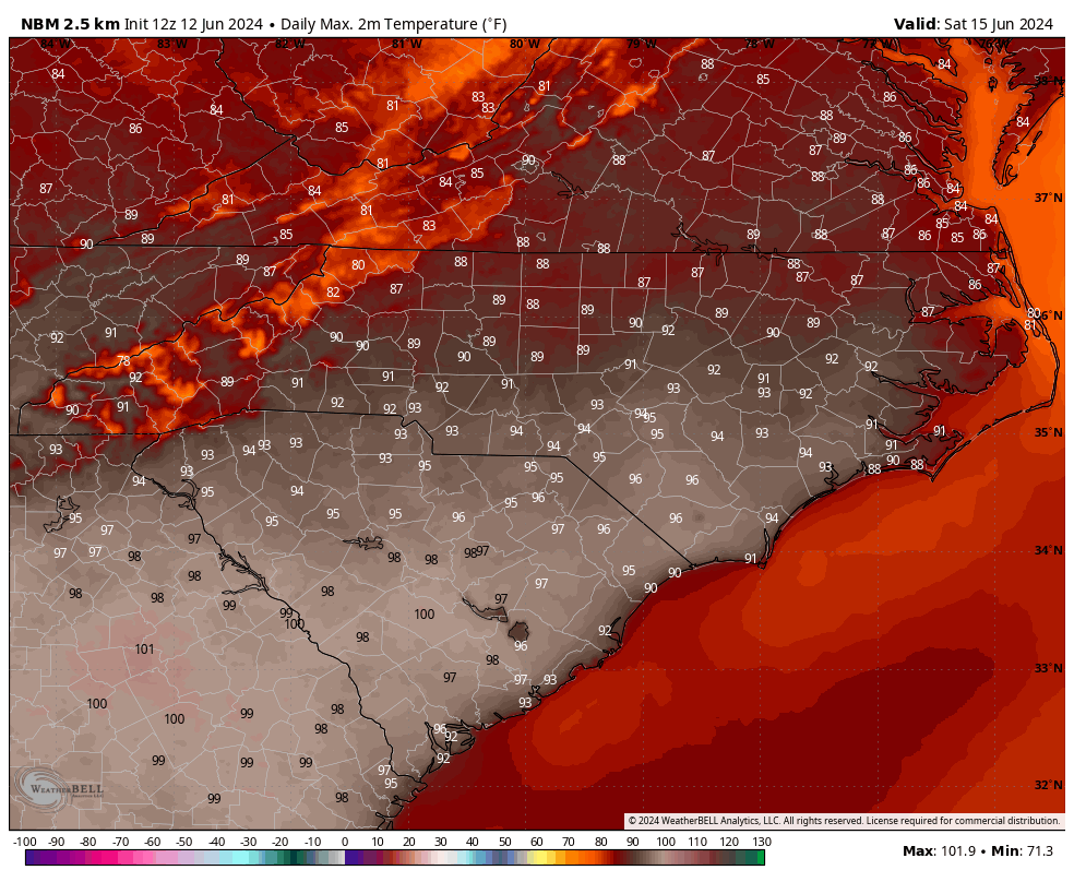
This will make for some great pool weather! However going outside during the heat of the day can be dangerous. Make sure to either stay inside in the a/c or take all heat related precautions when heading outside during a heatwave!
You must be logged in to post a comment.