

Azure blue skies and blazing sunshine drove temperatures well above normal today, with our southern valleys soaring into the upper 60s! The blue skies were courtesy of an upper-level high which will grace us with its presence through Tuesday.
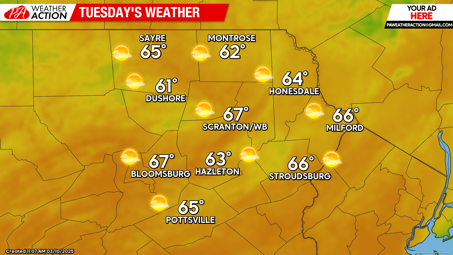
TUESDAY
The surface high will slide to our east over the course of the day, providing ample sunshine and much-above-normal temperatures. The circulation on the back side of that surface high will induce gusts close to 20 mph from the southwest during the afternoon. The lack of photosynthesis and the low albedo of the brown landscape could actually boost temperatures close to 70 in some locations! A cold front will push southward through our area late Tuesday night, possibly accompanied by light showers.
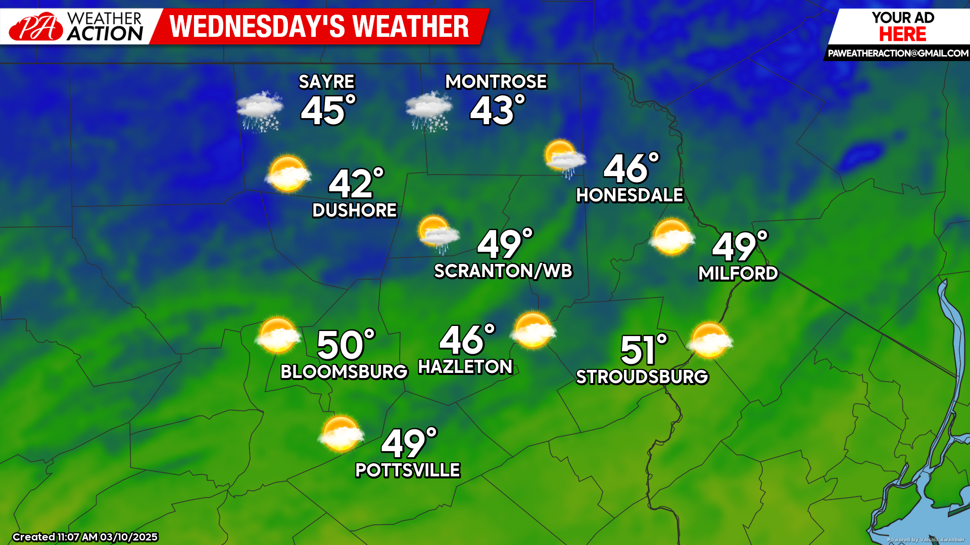
WEDNESDAY
A surface high will move over northern New England to induce a damp flow off the Atlantic during the daytime. This will hold temperatures in the 40s to near 50. Some light showers will be possible during the afternoon across our western counties as the surface high slides east of New England and allows the frontal zone to return northward as a warm front.
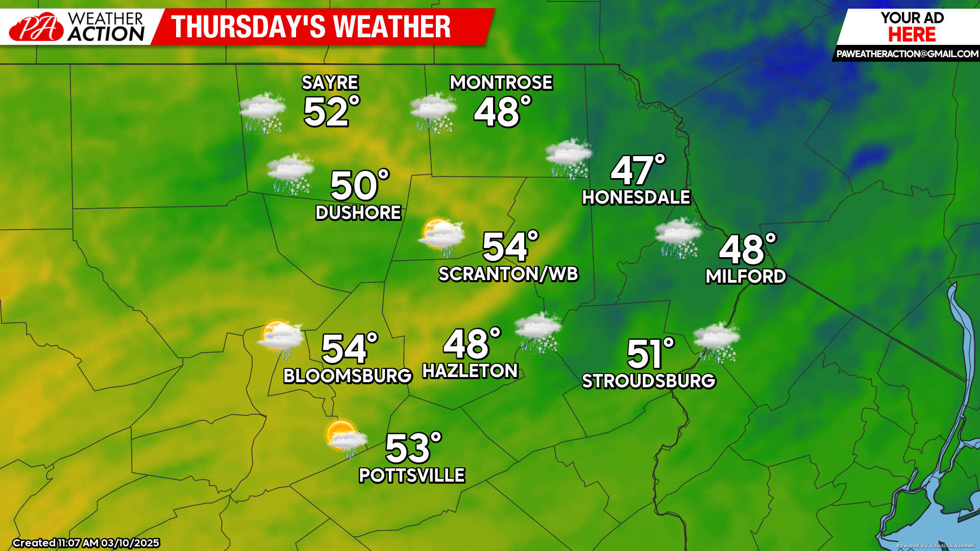
THURSDAY
There could be a few morning showers, especially across our northern counties. The flow off the ocean will maintain cool weather and damp conditions over much of our area. However, some of our western valleys could break out into milder air and some sunshine during the afternoon.


You must be logged in to post a comment.