
This week has an active weather pattern in store for us. This will be courtesy of a powerful storm system that well develop over the Plains early this week and track through the Great Lakes Wednesday and into eastern Canada Thursday.
An arctic high settled over our area Sunday into today. Max temperatures on Sunday failed to get out of the teens in our higher elevations on Sunday! That surface high will exit our area overnight. Clear skies this evening will make for good viewing of the current planetary alignment if you didn’t get outside to enjoy it yet. Saturn and Mercury will be visible near the western horizon for a short while after sunset. Venus, crescent Moon, Mars, and Jupiter will be higher in the sky all in a line.
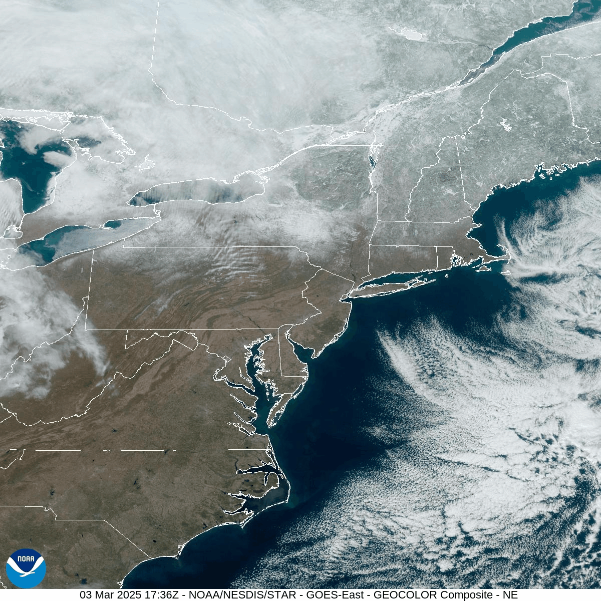
That clear sky also provided a great view on the current state of the snowpack. Please enjoy this visible satellite loop of the Northeastern US. Snowmelt and heavy rain could cause some issues later this week.
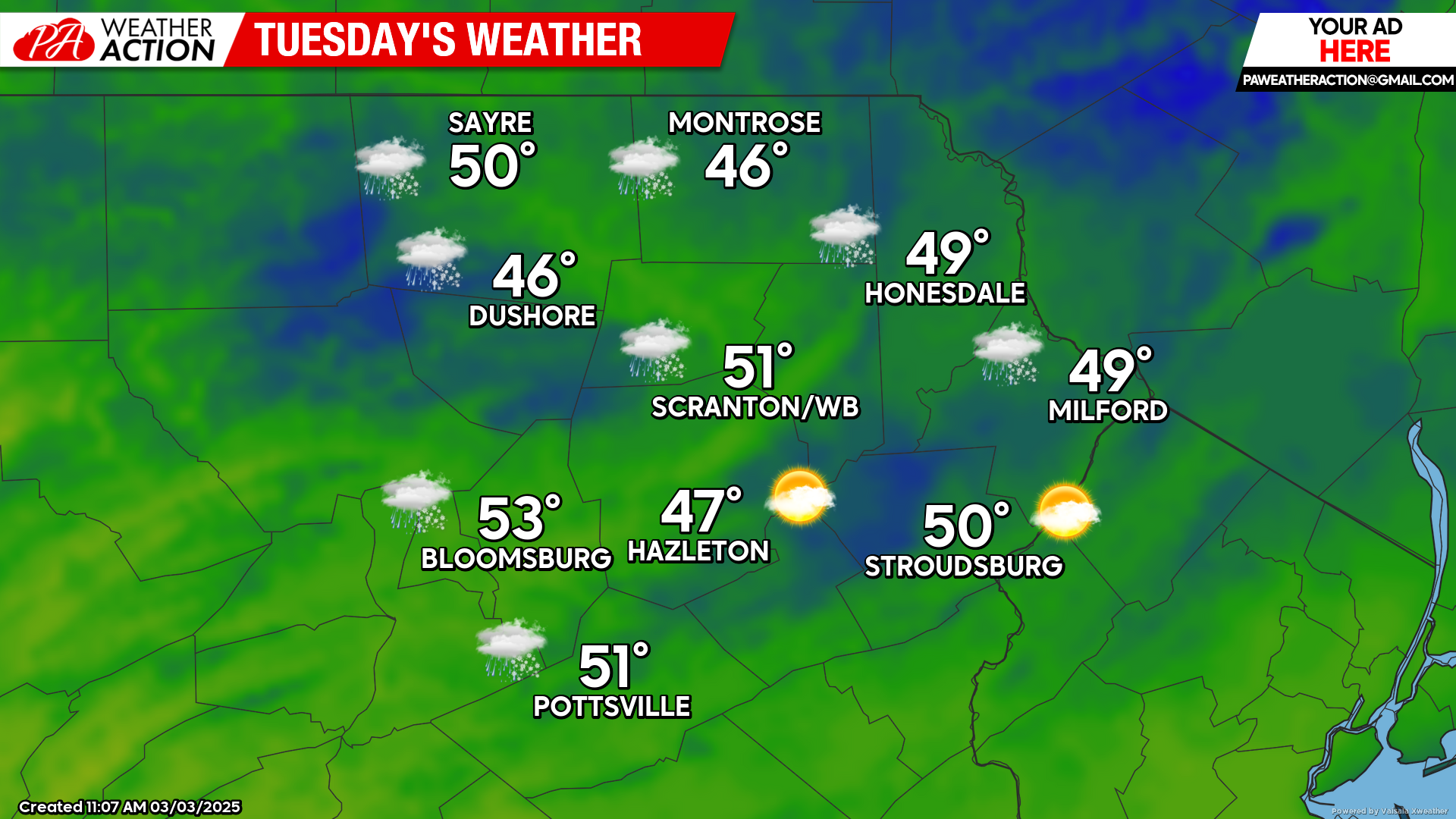
TUESDAY
A moisture-starved upper-level disturbance will bring clouds and perhaps a few very-light showers early Tuesday, but nothing measurable is expected. Temperatures will recover well into the 40s to near 50 degrees by afternoon!
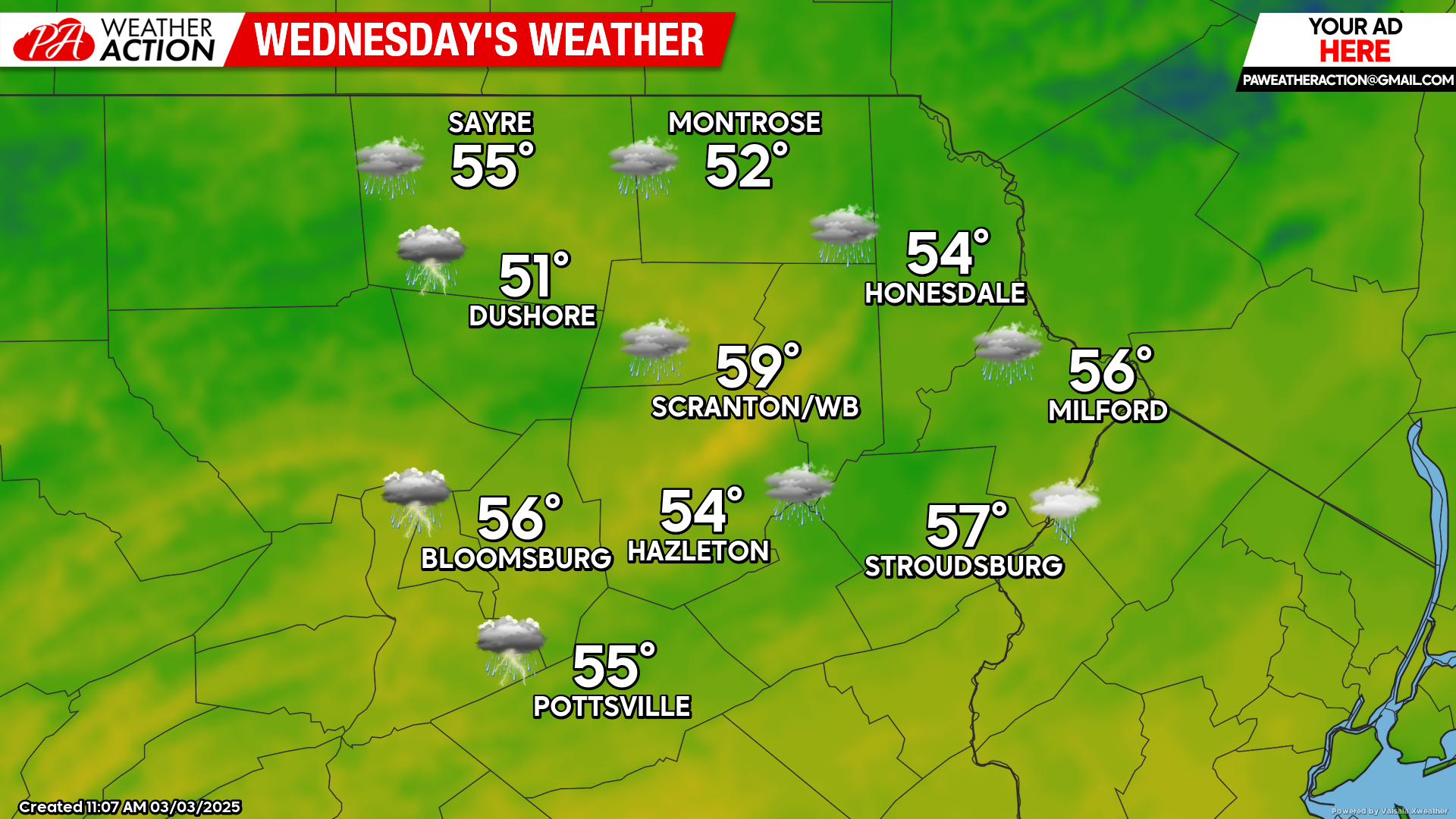
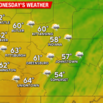
WEDNESDAY
A powerful storm system will move through the Great Lakes, drawing copious amounts of moisture all the way from the Gulf. Gusty south wind will bring mild temperatures and a soaking rain on Wednesday. There could even be some thunderstorms along the system’s cold front which will move across our area early Wednesday night. Rainfall amounts are anticipated to be between one and two inches. The widespread heavy rain along with snowmelt in the headwaters of the rivers could cause ice jam issues.
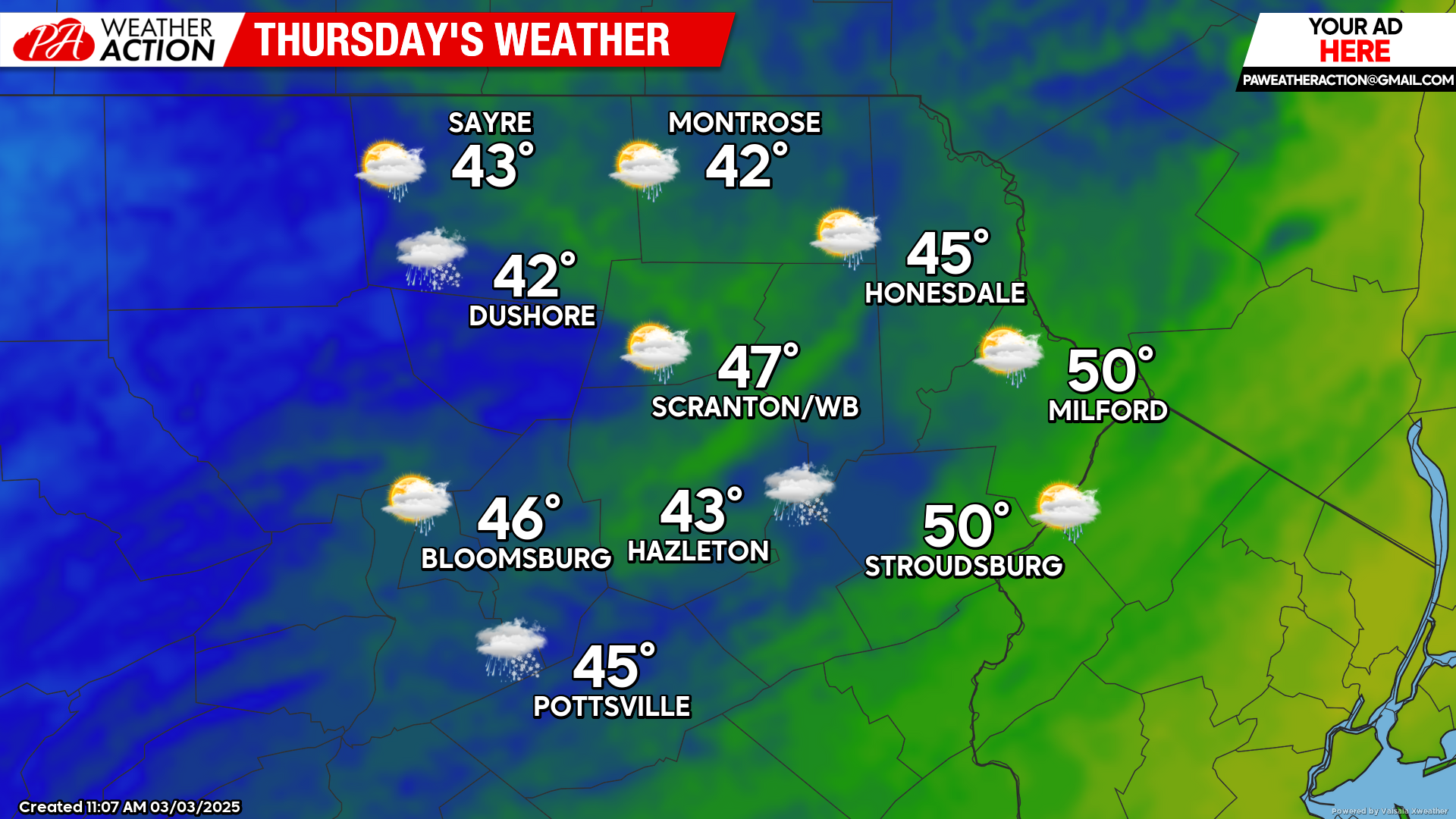
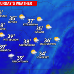
THURSDAY
The aforementioned storm system will be moving northeastward through eastern Canada, leaving windy conditions and spotty rain and snow showers in its wake. Those winds will circulate cooler air into our area, driving temperatures down into the lower 20s Thursday night.
You must be logged in to post a comment.