
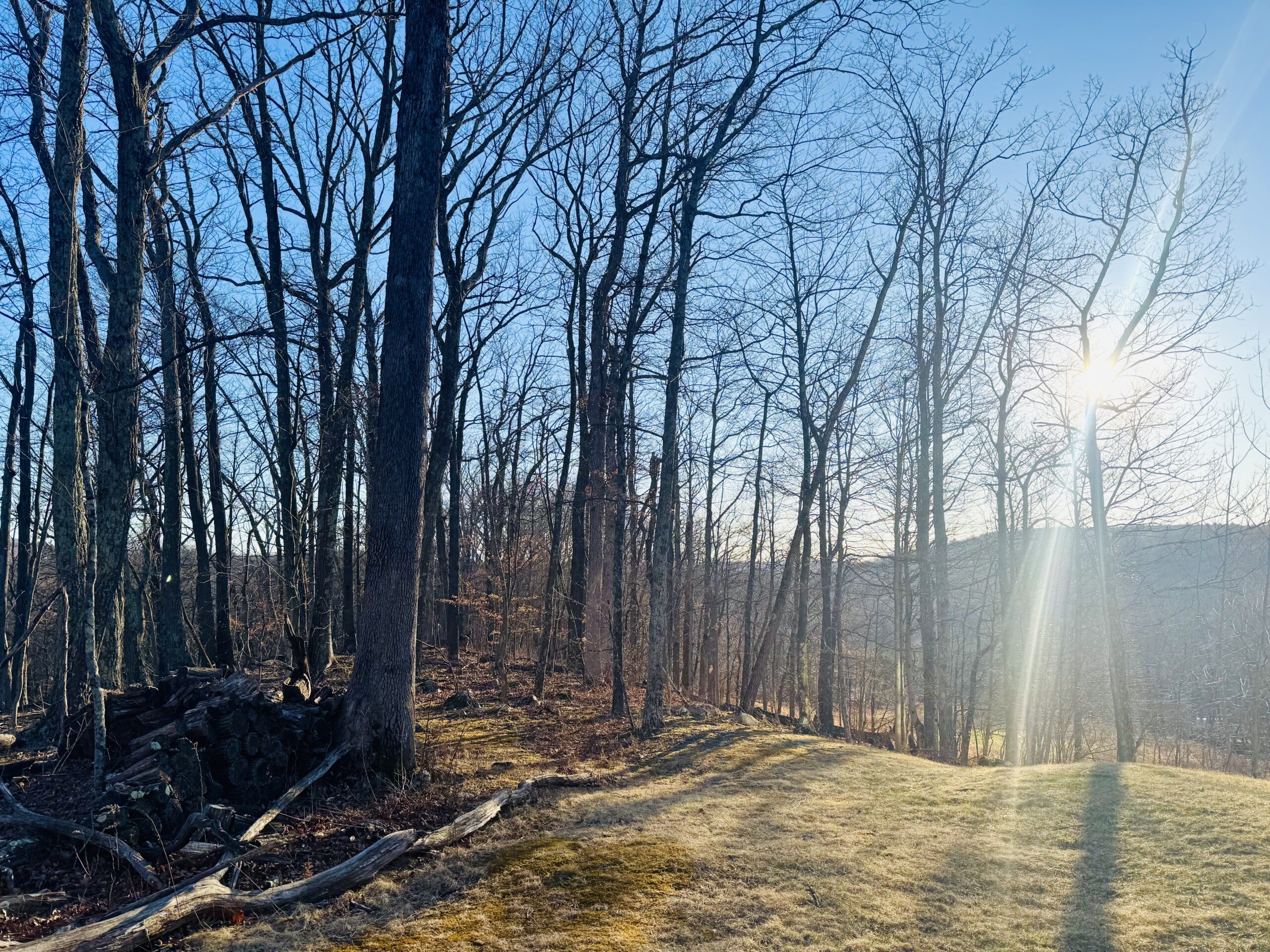
We got to enjoy a little remembrance of Winter yesterday as snow squalls blew across the region. After today’s seasonally gusty weather, a warm front will cross our area Friday night and deliver a tease of Summer this weekend. Please refrain from outdoor burning as the gusty wind and leftover dry tinder from last year makes for a high fire danger, despite the showers.
There will also be a partial solar eclipse Saturday morning. The small sliver blocked by the moon will be not only be obscured by clouds, but also obscured by the horizon as most of the eclipse will occur before sunrise.
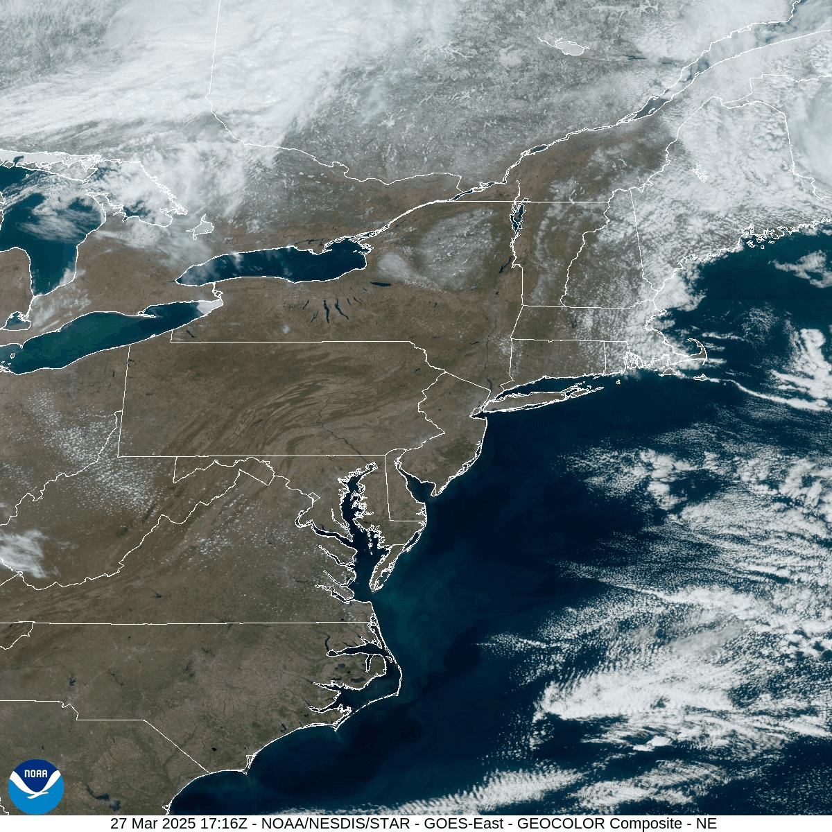
For those of you pondering where the snow remains, today’s visible satellite loop provides an excellent view of the snow left in the Northeast. Deep leftover snow remains over much of eastern Canada. Closer to home, snow remains on the Tug Hill Plateau of New York, the Adirondacks, and the mountains of New England. Despite this weekend’s heat wave, there will be one or two opportunities for Spring snow during the next couple of weeks!
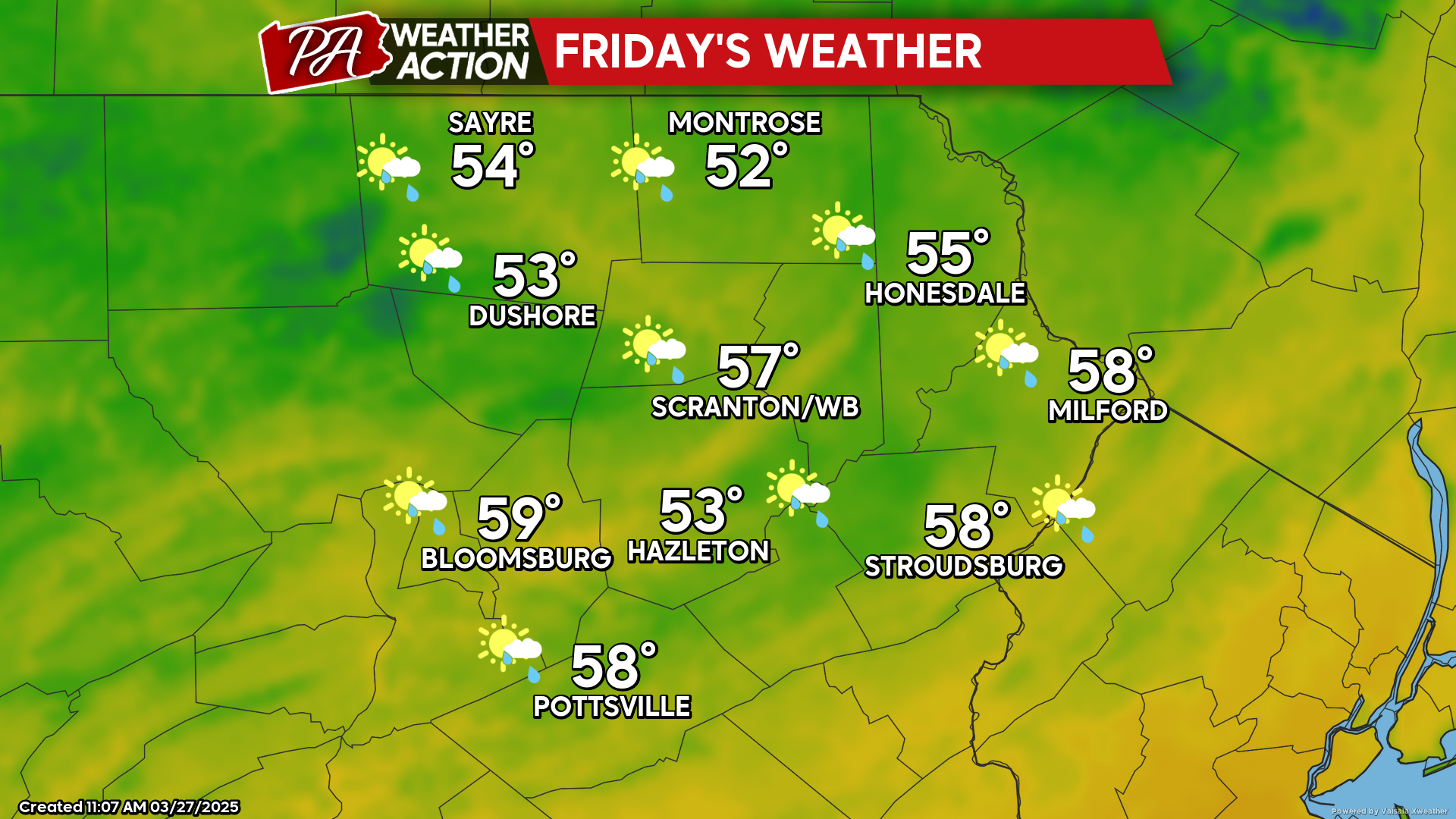
FRIDAY
Friday could have a few showers pre-dawn, then start the daytime sunny. As the warm front approaches, high clouds will quickly encroach and thicken, with showers arriving during the afternoon and lasting overnight.
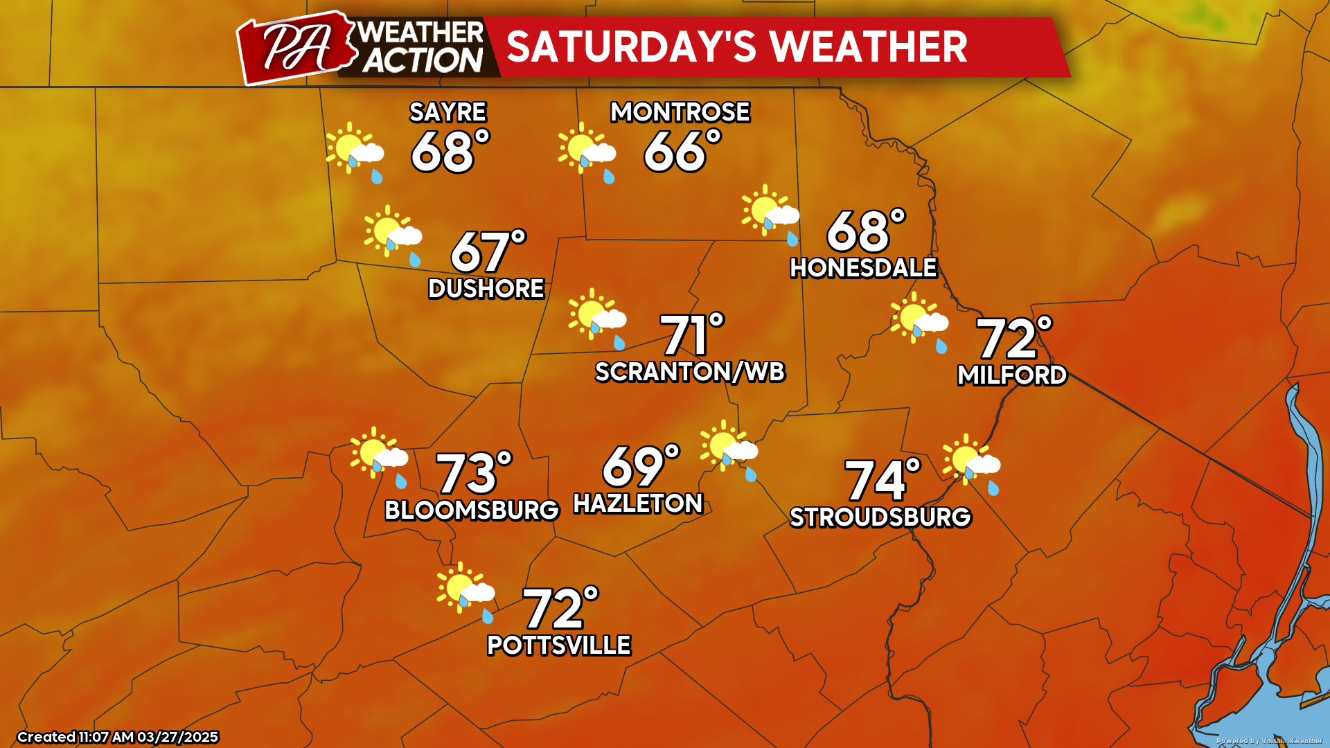
SATURDAY
The overnight showers will exit before dawn as the warm front lifts north of our area. Gusty wind from the southwest will deliver very warm weather for this time of year. The lack of leaves on the trees and the brown ground will contribute to the early-Spring heat wave as there will be no photosynthesis to use the sun’s energy and the brown ground will absorb the energy and heat the air next to it. Temperatures will rise into the 70s for everyone but those of you in the higher elevations. There could be some random showers that pop up during the afternoon although not everyone will see one. It wouldn’t be surprising if some of the deeper valleys in our southern counties get close to 80!
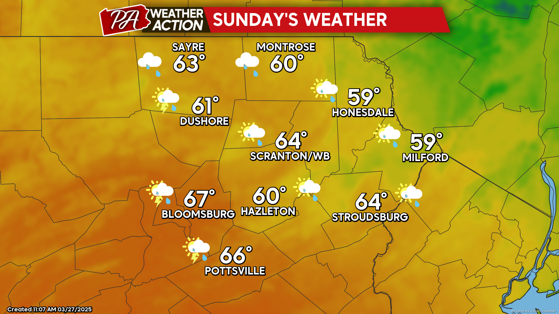
SUNDAY
The frontal zone will sag southward into the region again Saturday night, continuing the opportunity for showers. This will maintain overnight temperatures well into the 40s and 50s.
During Sunday the front will return northward, but there will be plenty of clouds and a continued opportunity for showers. It will still be a warmer-than-normal day with widespread 60s.

You must be logged in to post a comment.