What a Sunday it was for the Laurel Highlands to South Central and Eastern PA! Heavy snow rates of 1-2″ per hour were common across those areas, with the strongest bands pushing 3″ an hour. The storm is largely wrapped up now, and in its wake we are left with harsh cold.
Temperatures will begin to plummet on Monday, with gusty winds as the Arctic air furthers its grip. Coldest temperatures with a few mornings below 0° in most of the state come Tuesday and Wednesday. So if you have yet to clear snow off, we highly advise doing so.
It will take all the way until Saturday or Sunday for temperatures to hit 32°, meaning this snow is here to stay for a while. This will likely be the coldest week of winter, and the coldest week since the historically-cold February 2015.
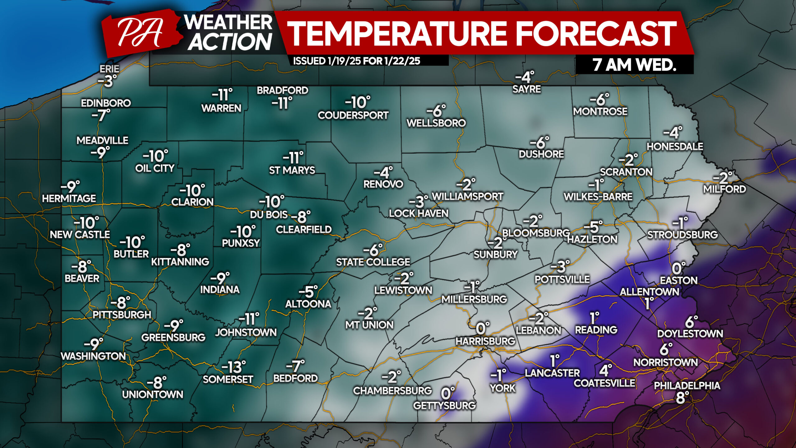
Tuesday morning will be frigid, but Wednesday morning will be the absolute coldest. The Allegheny Mountains will drop to -10°, with the rest of Western PA down to -5 to -9°. In Central and Northeast PA, temperatures will drop to a few degrees below 0° on average. Only SEPA will be above 0°.
While the winds won’t be too strong, maxing out around 10mph, it will feel even colder.
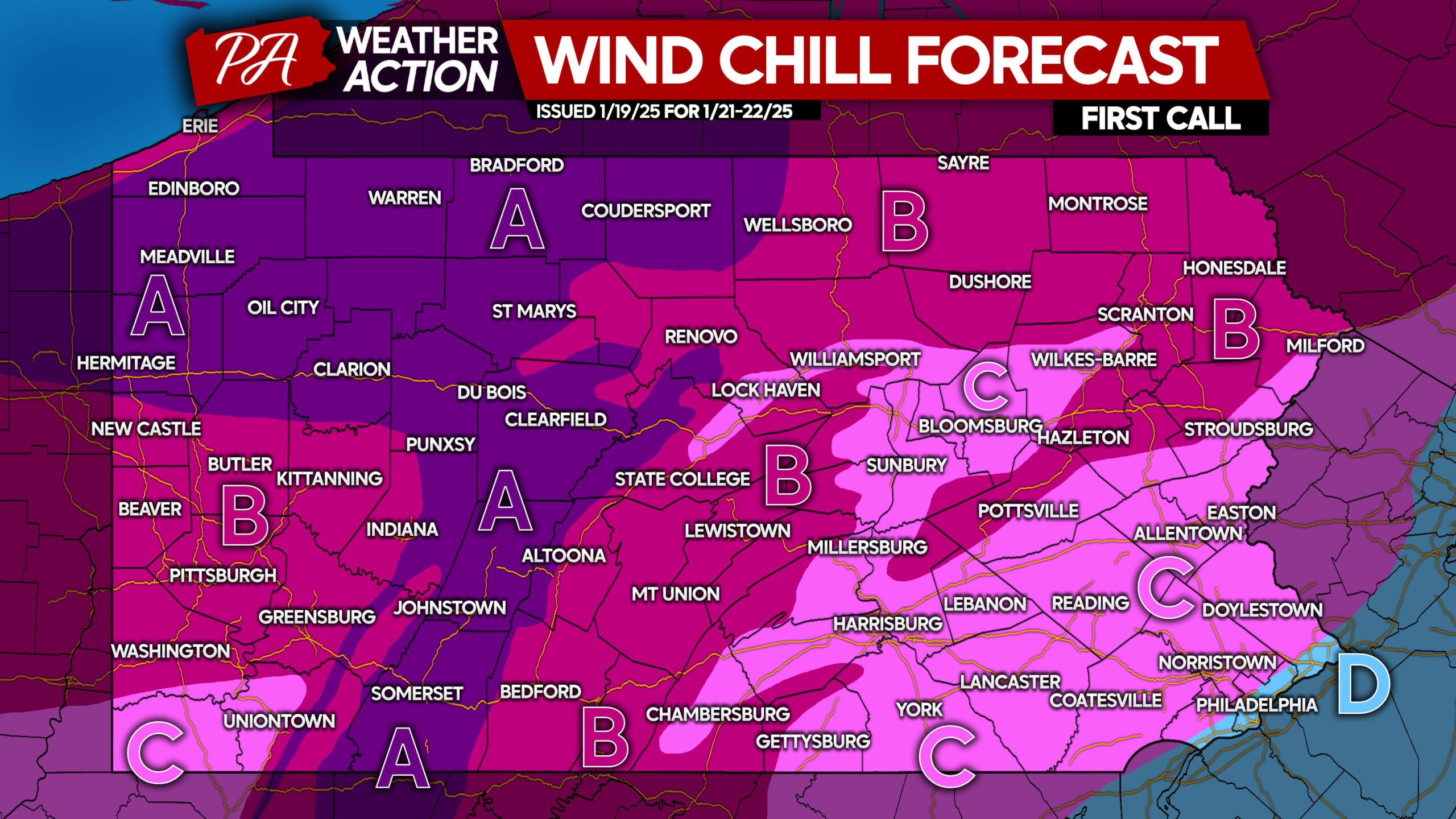
FIRST CALL WIND CHILL FORECAST FOR TUESDAY – WEDNESDAY
Area A: Wind chills of -20° to -25° are expected to cause school closings Tuesday & Wednesday. Frostbite can occur in 20 minutes of skin exposure.
Area B: Wind chills of -10° to -20° are anticipated to cause school closings Tuesday & Wednesday. Frostbite can occur in 30 minutes of skin exposure.
Area C: Wind chills of -5° to -10° may cause schools delays/closings Tuesday & Wednesday.
Area D: Wind chills of -5° to 0° expected.
We do not recommend being outside for long Tuesday or Wednesday.
Share this important information with friends and family below! Stay warm!


You must be logged in to post a comment.