
Good Evening Everyone! What was once looking like a mostly rain storm for the region has dramatically shifted into a winter storm for the region. Models had some of the worst performance I have ever seen leading into this storm, causing many last-minute changes in the forecast.
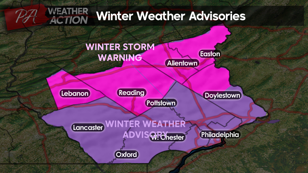
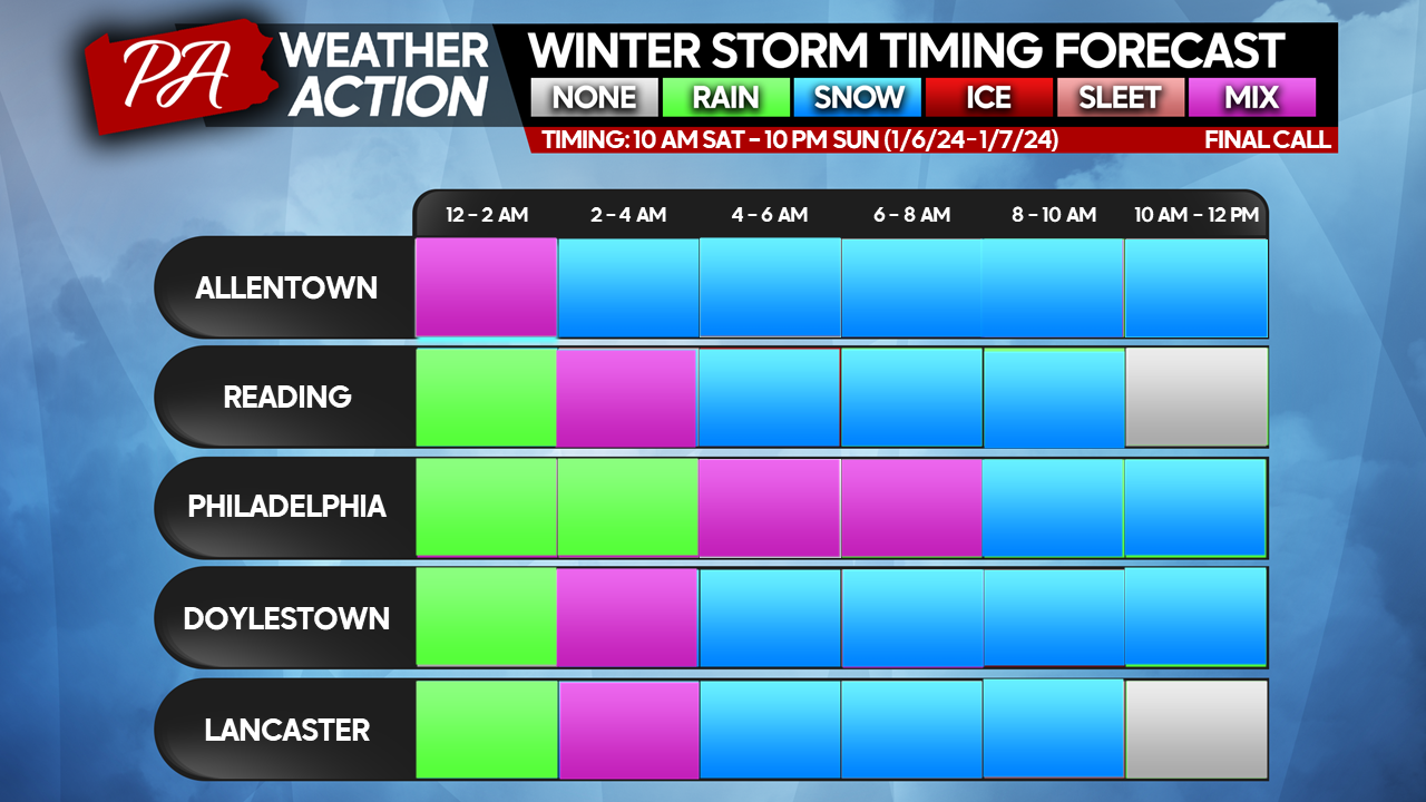
As of now, a quick-hitting heavy burst of snow is set to bring many travel headaches tomorrow morning. The National Weather Service has gone ahead and issued a Winter Storm Warning for Lebanon, Berks, Lehigh, Northhampton, and Northern Bucks counties. A Winter Weather Advisory is in effect for the remainder of the region.
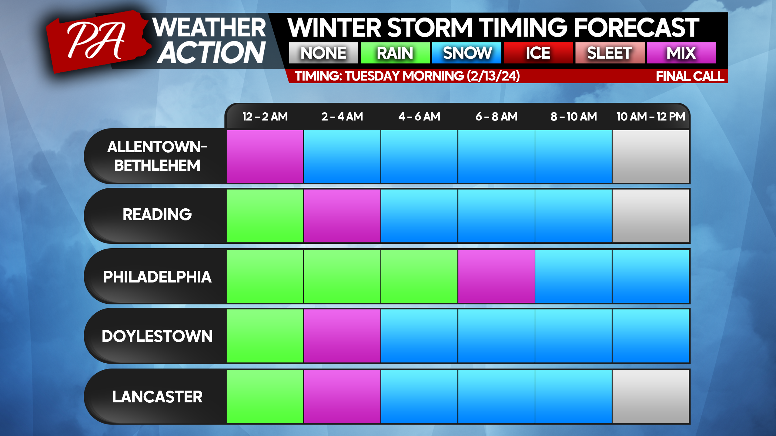
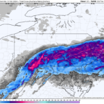
Precipitation will arrive in the form of rain around midnight across the region. Rain will begin to transition to heavy snow from North to South during the predawn hours on Tuesday. Portions of Northern Berks, Lebanon, Lehigh, and Northampton counties will see a changeover to snow around 2 am. By 8 am the entire region down through the Philadelphia region will have transitioned to heavy snow.
Latest model projections suggest that snowfall rates of 1-3″ per hour are likely with the heaviest axis of snowfall falling across our northern counties. I expect heavy snow to impact visibilities significantly, creating near-impossible travel conditions for drivers during the Tuesday morning commute.
Although temperatures will be near or just above freezing, snowfall rates will be heavy enough for a rapid pileup of snow tomorrow morning. Given the heavy snowfall rates, roads will likely be very slick and occasionally impassible.
Snowfall should quickly taper off and exit the region from West to East between 10 am and 1 pm tomorrow. Below is the protection for precip type and timing throughout tomorrow morning.
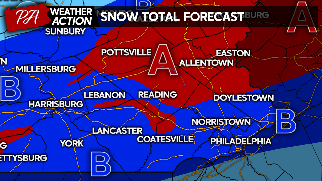
Area A: Heavy Snow 6 – 10″: Several hours of 1-3″ per hour snowfall rates unfortunately coinciding with the Tuesday morning commute. Plan on slick roadways, poor visibilities, and near-impossible travel conditions during the storm’s peak.
Area B: Heavy Snow 3 – 7″: Heavy snow of 1-2″ per hour is expected. Marginal temperatures will allow for some melting on contact, slightly limiting totals. Plan on slick roadways, poor visibilities, and very difficult travel conditions tomorrow morning.
You must be logged in to post a comment.