
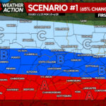
Multiple winter weather systems are expected to impact the region. Widespread snow showers are expected, with some heavy bands possible. PA Weather Action will provide statewide details with more specific information regarding snowfall totals.
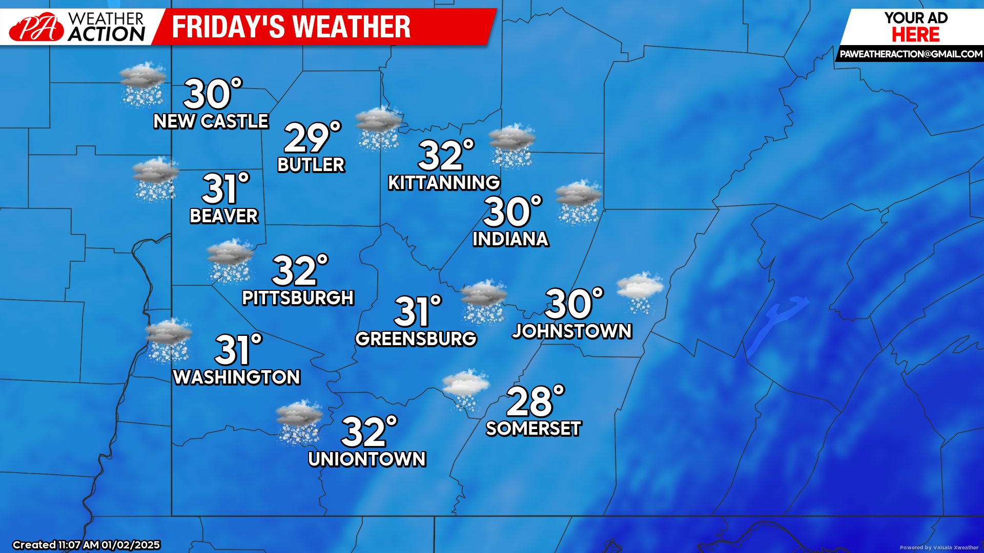
Friday
Snow showers are expected throughout the day. Highs will be in the low 30s to upper 20s, lows will be in the low 20s to lower teens. Winds will be out of the west at 6 to 15 mph, wind gust could approach 30+ mph, wind chill values could be in the single digits in some areas.
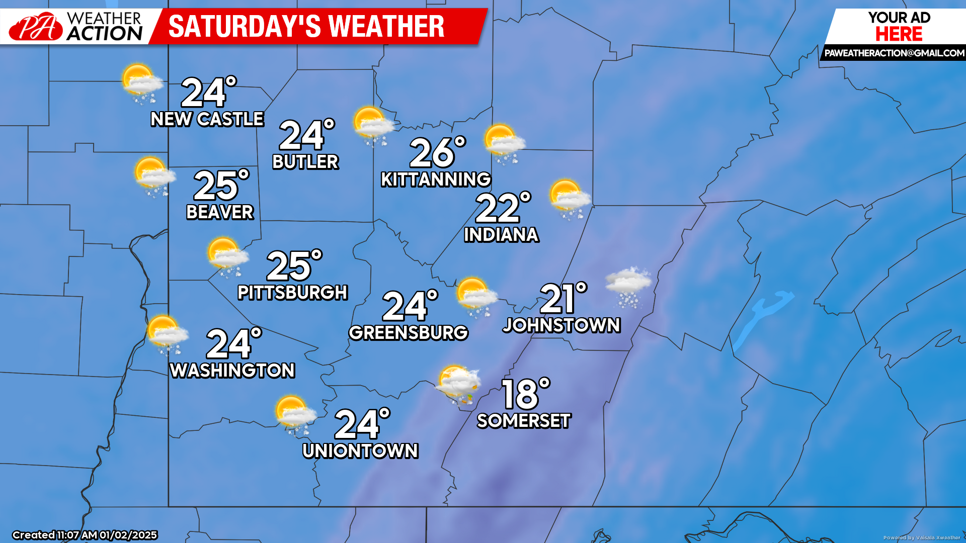
Saturday
Snow showers are possible in the daytime hours followed by mostly cloudy, cold and breezy conditions. Highs will range in the mid 20s to mid-teens, lows will be in the mid-teens to upper single digits. Winds will be out of the west at 15 to 20 mph, wind gusts will range between 20-35 mph, wind chill values will be in the single digits.
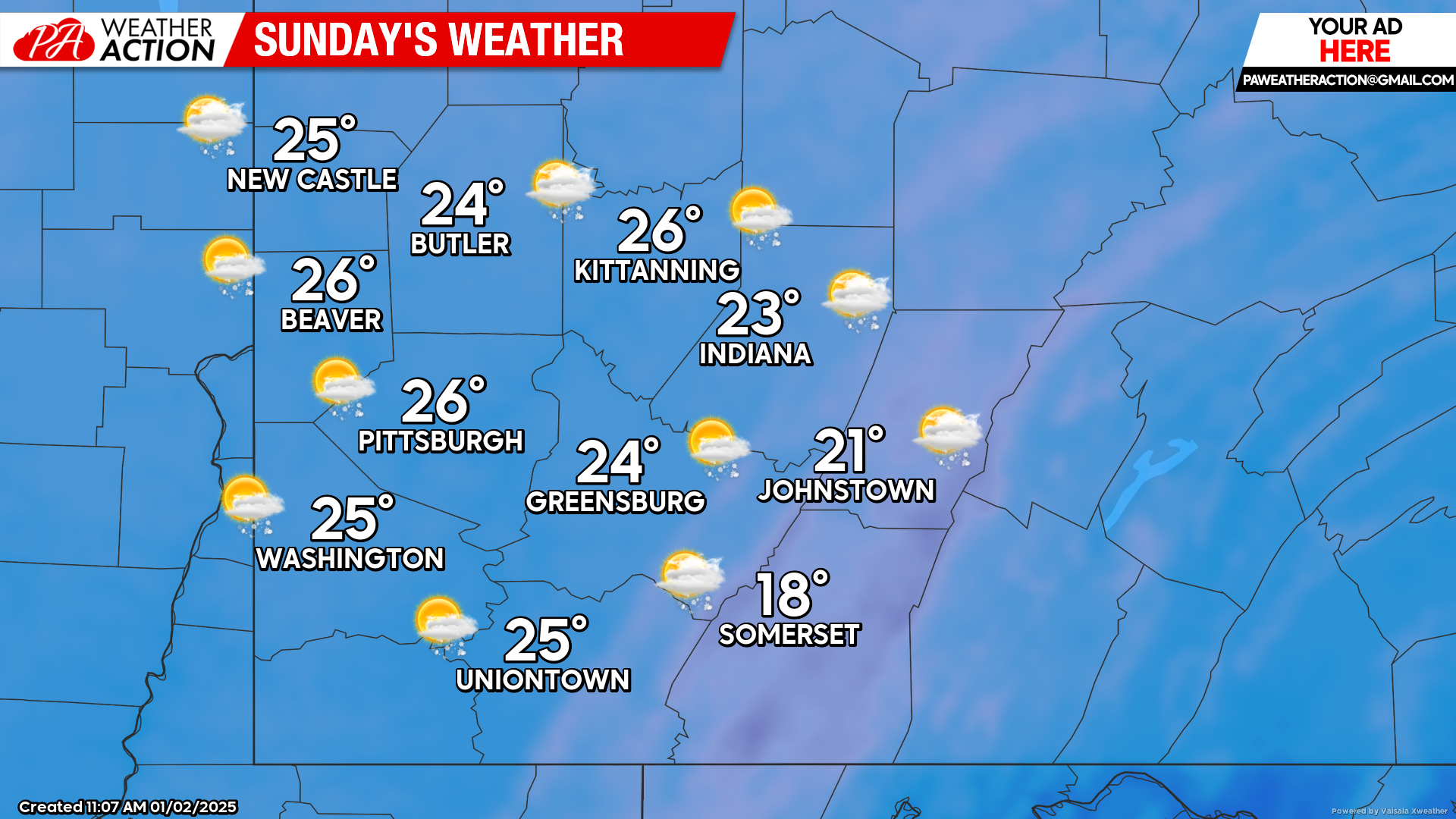
Sunday
Mostly to Partly sunny skies will begin to transition to another round of snow showers beginning the evening hours and continuing overnight. Highs will be in the mid 20s to mid-teens, lows will be in the low 20s to mid-teens. Winds will be out of the west at 5-10 mph, wind gusts between 10-20 mph.
Chances for snow showers will continue into next week. Be sure to follow PA Weather Action for more details on snow fall potential throughout the weekend.
You must be logged in to post a comment.