
After springlike warmth and the first 70s for many on Tuesday, a backdoor cold front delivered cooler weather for Wednesday and today. Skies managed to remain clear, and should be clear tonight except for some of our southern and western areas. This is important because tonight there will be a total lunar eclipse! The moon will start to redden after 1am, reach totality (“blood moon”) at 2:26am. Totality will last through 3:31am, and partial will end at 4:10am. Enjoy!
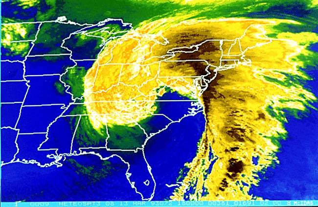
Meanwhile, today is the 32 anniversary of the “Superstorm of 93″ which blasted the entire east coast with damaging wind and crippling snow. Our area was blown shut with 20-30″ snow and wind gusts over 50 mph. Unfortunately some of our eastern areas were dry-slotted in a heartbreaking defeat of only 12-18” Great memories!
Satellite image during the morning of March 13, 1993″
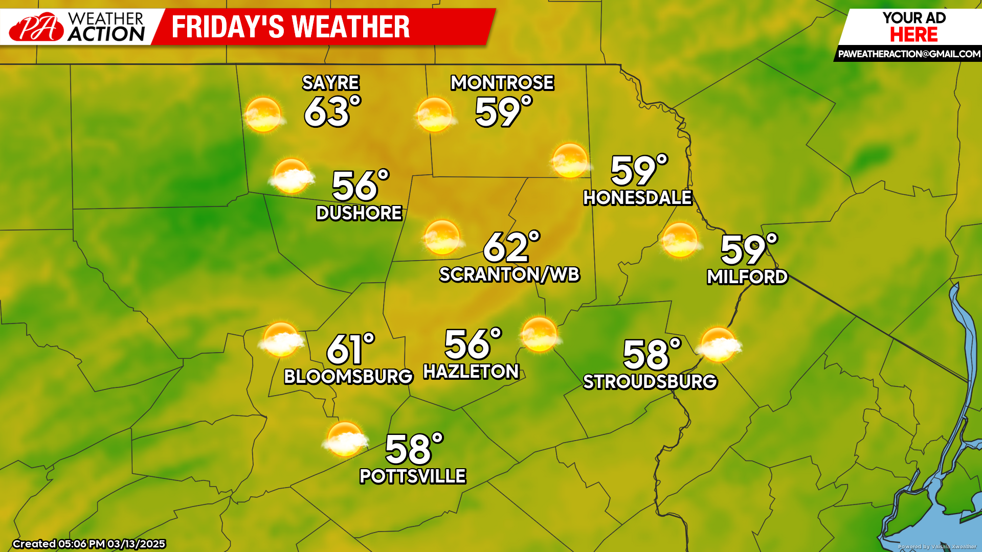
FRIDAY
Friday will feature mostly sunny skies and above-normal temperatures, along with a light wind from the east and eventually southeast. That southeast flow will bring patchy clouds into the area Friday and Friday night. There could be spotty areas of drizzle late Friday and Friday night, mainly in the higher elevations.
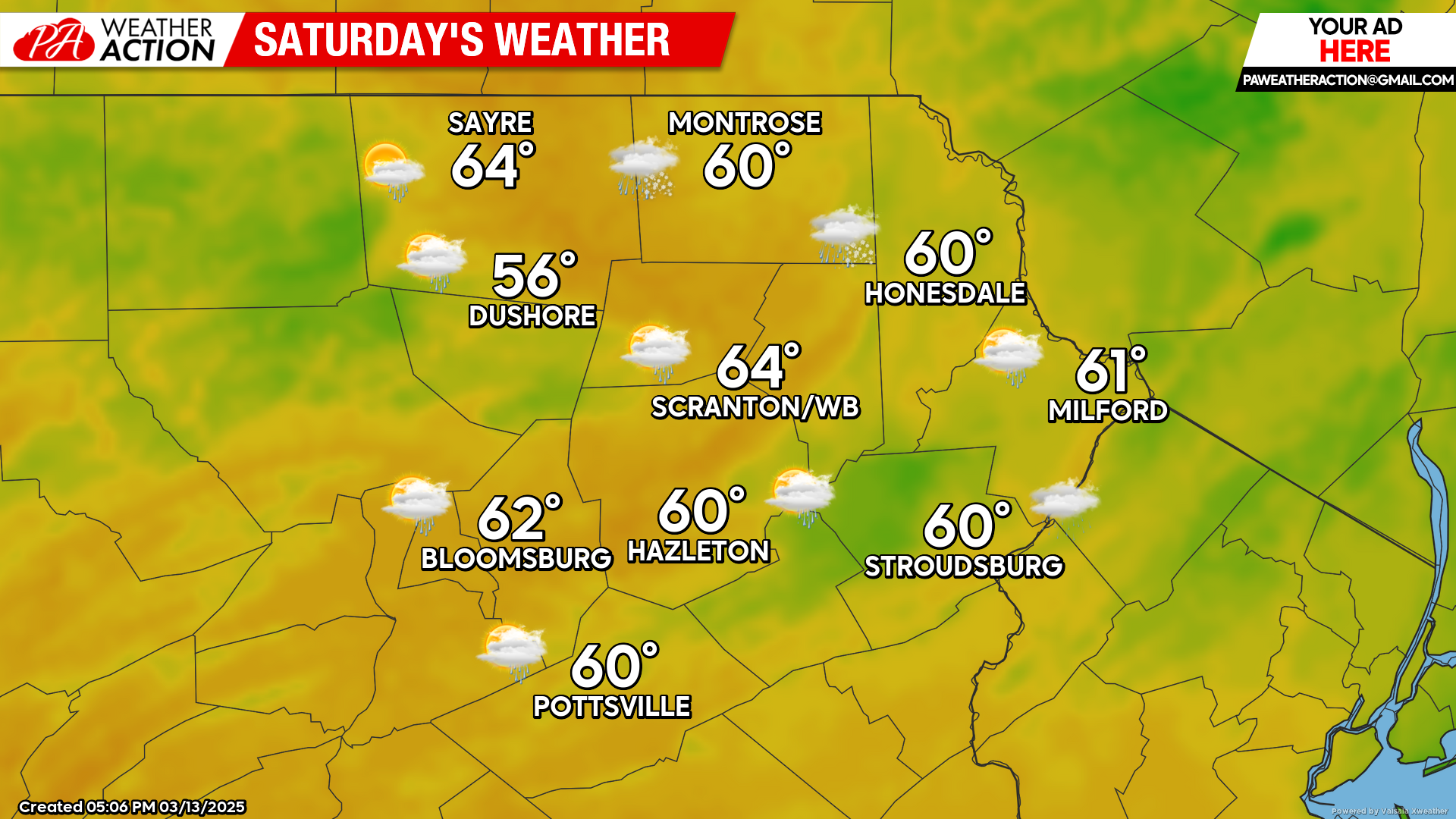
SATURDAY
The flow from the southeast will bring clouds and patchy light precipitation to our area, along with mild temperatures. Precipitation amounts will be light.
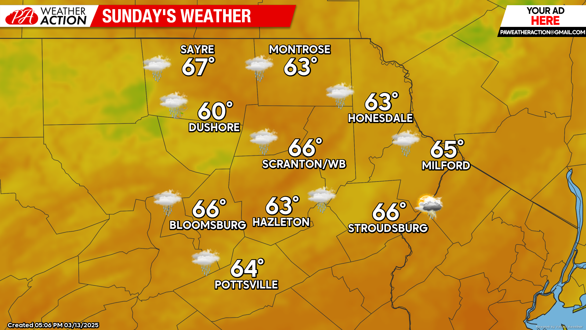
SUNDAY
Warm spring-humid air will flow through our region from the southwest ahead of an approaching cold front. A disturbance propagating northward along that front will amplify the frontal zone and induce a line of thunderstorms that could provide some early-Spring excitement. Showers will move northward through the region during the day, with a line of stronger storms possible with the frontal passage late afternoon and evening. Enjoy!

You must be logged in to post a comment.