
Rain will change to snow late this evening in the high elevations in western and northern Pennsylvania as a weak clipper moves through. Lake effect snow will then takeover in the pre-dawn hours of Sunday. Snow showers are possible in western and northern PA Sunday Morning, becoming more scattered by the afternoon and evening. Below is future radar for 3:00 AM Sunday:
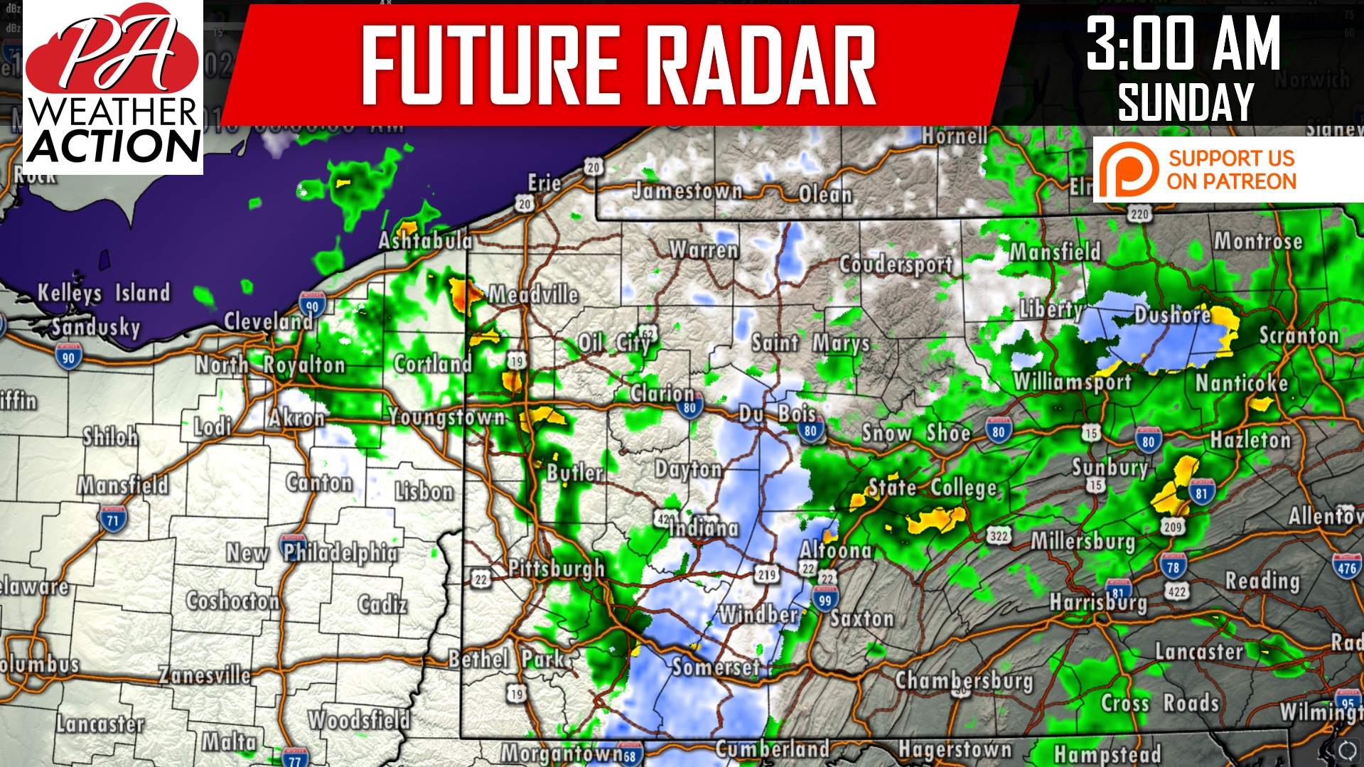
As you can see, by 3 AM snow will likely be falling throughout the Laurel Highlands and Northern PA Mountains, including Somerset, Johnstown, Du Bois, Bradford, Wellsboro, and surrounding locations.
Here is the future radar for 8:00 AM Sunday:
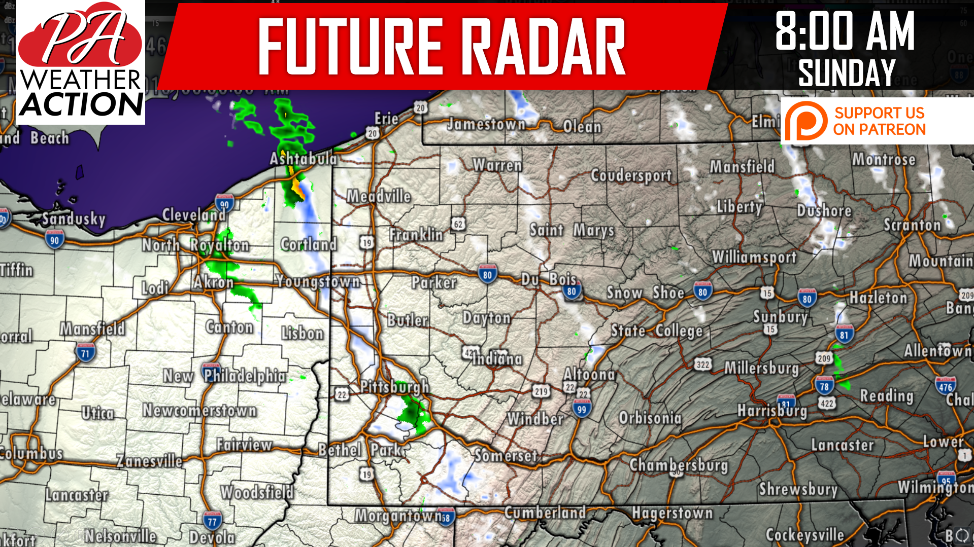
Snow showers will be scattered across much of western and northern PA Sunday Morning, lasting into Sunday Afternoon in the high elevations.
FINAL CALL SNOWFALL FORECAST
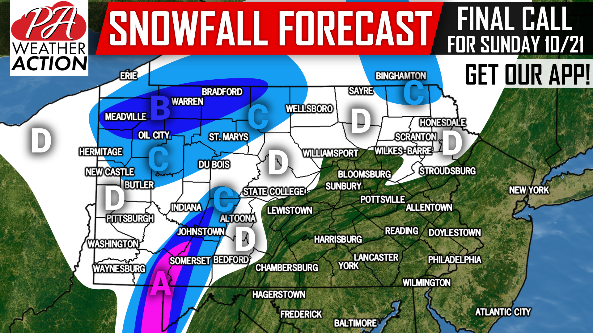
Area A: Heavy snow during the pre-dawn hours of Sunday is expected, leading to light to moderate snow showers during the day. Low visibility is expected, especially before sunrise. Watch for snow covered roadways especially above 2300′ elevation. Snowfall accumulation of 2-4″ is expected.
Area B: Rain will switch to heavy snow between 1-3 AM Sunday Morning, persisting until about 4-5 AM. Low visibility will be possible during this period, as well as in heavier lake effect snowfall bands. Then, off-and-on light to moderate snow showers are anticipated through the daytime hours of Sunday. Snowfall accumulation of 1-2″ is expected.
Area C: Rain will change to light to moderate snow in the early morning hours of Sunday. Off-and-on snow showers will then continue through the day Sunday. Low visibility possible in heavier lake effect snow bands. Snowfall accumulation of up to 1″ expected.
Area D: Scattered lake effect snow showers will be hit-or-miss in this area Sunday. No more than a dusting on ridge-tops is anticipated when it comes to accumulations.
Download our app for your latest hourly and daily forecast, radar, alerts, and PA-specific articles >>> Tap Here to Download PA Weather!
Feel free to share this snowfall forecast using the blue button below!
If you missed our Preliminary 2018-2019 Winter Outlook, just click this link!
You must be logged in to post a comment.