
Snow will move into the area from southwest to northeast Sunday Evening. Temperatures will be near freezing Sunday Evening, and as a result snow accumulations will be limited to mainly grassy surfaces. Northeast PA is the area most at risk to see accumulations on roads.
Highest snowfall amounts will be over Northern PA and the Laurel Highlands, with the least in Southeast PA. Areas near and south of route 30 from York, and east to Philadelphia will likely see a rain/snow mix.
Here is the NAM Hi-Res Model with time stamps every 3 hours in the top right. Our snowfall forecast map is below.
SNOWFALL FORECAST MAP
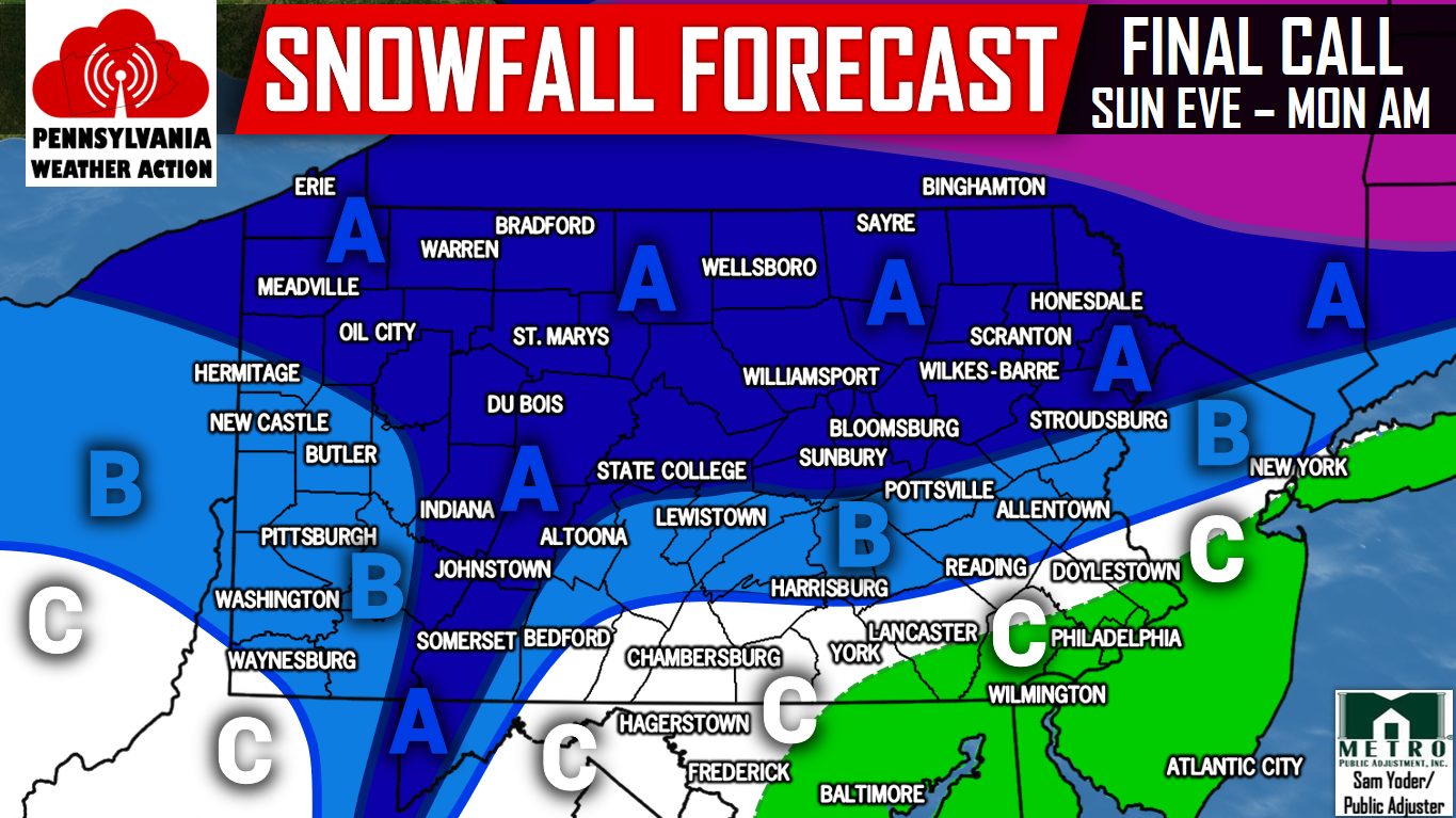
Area A – 2-4″ of snow is expected. Slick travel is possible late Christmas Eve into Christmas Morning.
Area B – 1-2″ of snow is expected.
Area C – A coating to an inch of snow is expected, with rain mixing in Southeast PA.
There could be a larger storm before New Years Eve. Make sure you have us liked on Facebook by clicking here>>>>PA Weather Action on Facebook!
Share the White Christmas Forecast with your friends and family using the button below!
You must be logged in to post a comment.