
A potent storm system will be making large impacts to our weather starting tomorrow and lasting through Friday. Heavy rain is expected tomorrow, especially for the eastern half of the state. As the storm system passes to our north, winds will change to a cold northwest flow, this will allow for any rain showers to change to snow showers for areas in western pa on Friday and even accumulating snow for some areas.
First, tomorrow is an all day rain event for just about all of us. There will likely be breaks in the rainfall, but it will be off and on from the morning through the nighttime. Below is the future similar radar image using the NAM model valid for 7 AM: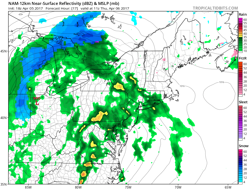
The rain will continue on and off during the day tomorrow, with periods of downpours possible. The rain will begin to taper off by Thursday night, below is valid 5 PM. The last of the heavy rain bands is passing through eastern pa. Notice the wraparound snow showers are not too far away already by tomorrow evening. 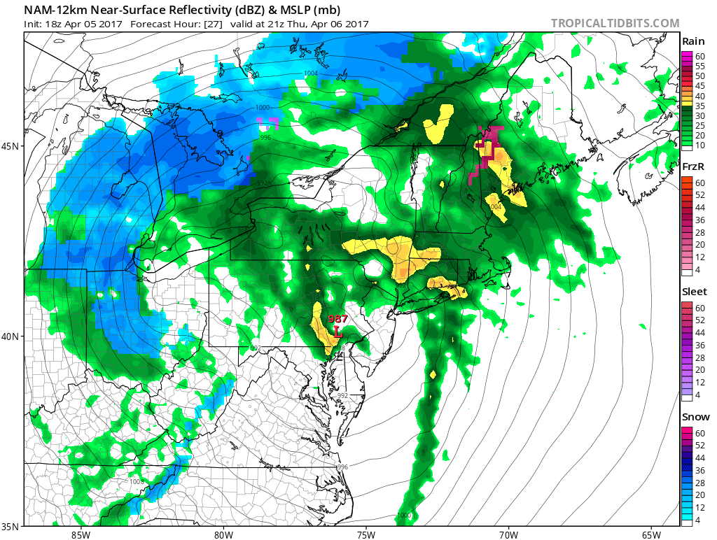
Snow showers and periods of heavy snow will begin to develop after midnight Friday and will continue throughout the day for western pa. Most areas in western pa will just see snow flakes fly, but not accumulate. However, there will be areas around Lake Erie, as well as high elevations over the Laurel Highlands that will receive accumulating snow. Below is the NAM valid 8 AM Friday: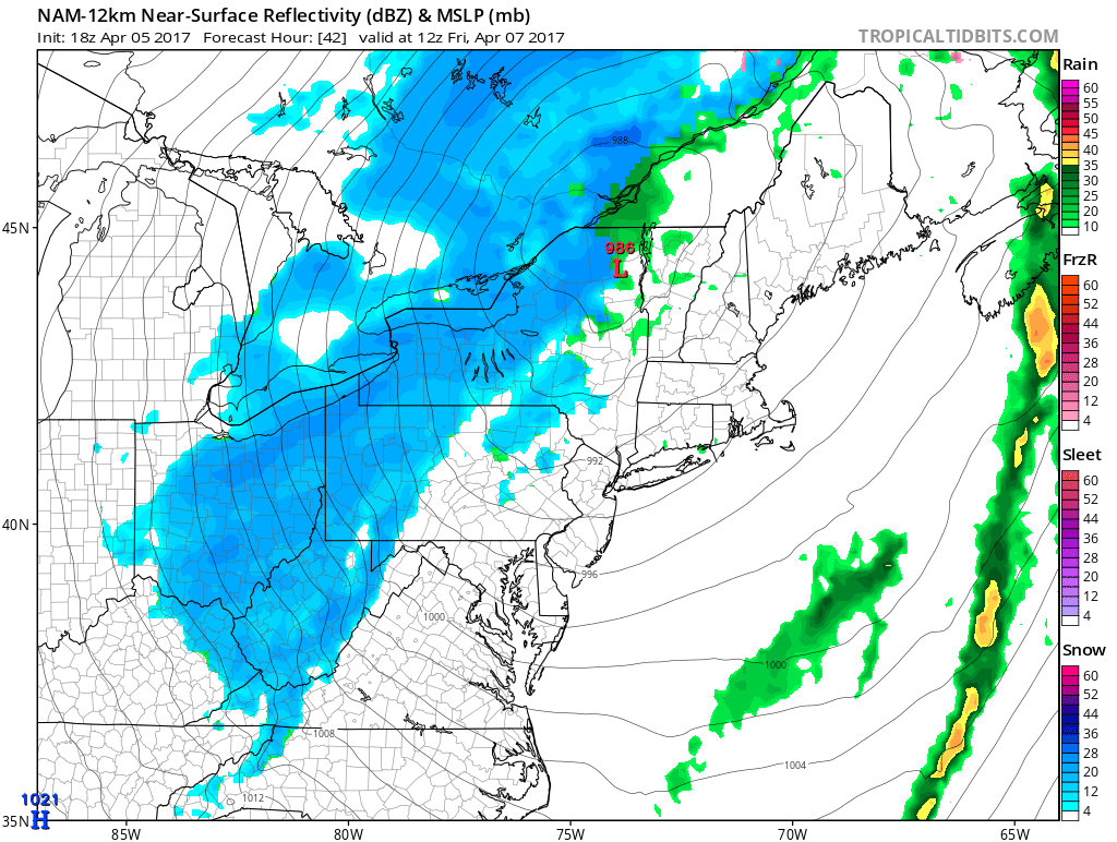
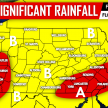
EXPECTED RAINFALL TOTALS THROUGH THURSDAY NIGHT BELOW:
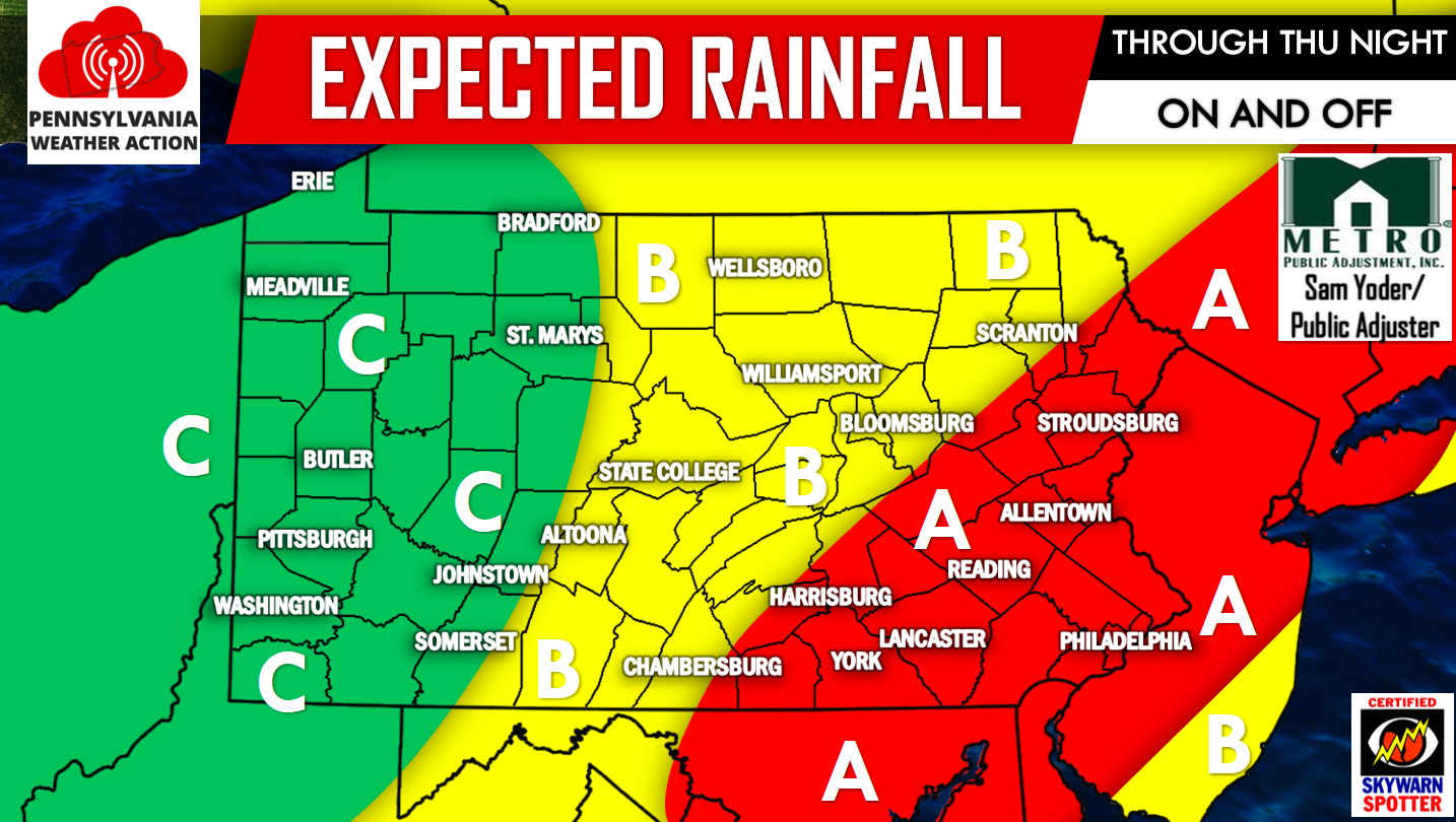
Area A: Periods of heavy rain off and on throughout the day. 1 to 2 inches of rainfall is expected. Localized flooding possible.
Area B: Periods of rain off and on throughout the day Thursday. 0.5 to 1 inch of rainfall is expected.
Area C: Off and on periods of rain showers throughout the day Thursday, heavier bands of rain will miss to the east leading to lesser amounts. Less than half an inch of rainfall is expected.
EXPECTED SNOWFALL FRIDAY AM THROUGH FRIDAY NIGHT BELOW:
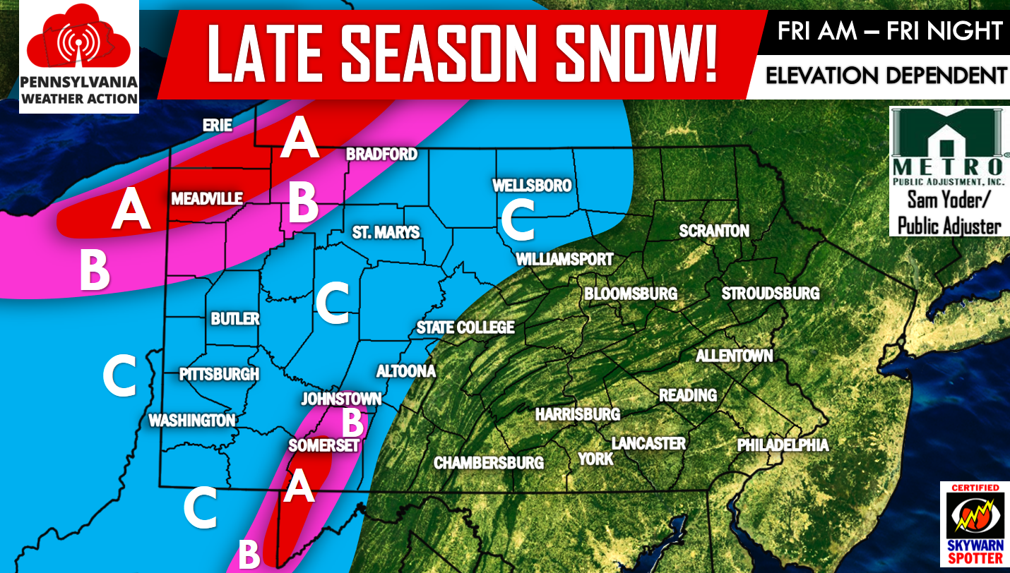
Area A: 3 to 6 inches of snowfall is expected over the Laurel Highlands and parts of northwest pa.
Area B: 1 to 3 inches of snowfall is possible. Please note the immediate shoreline of Lake Erie is not included in this zone.
Area C: Snow showers are possible with little to no accumulation.
For more updates regarding this storm and all of PA weather follow our Facebook page by clicking here>>>PA Weather Action on Facebook!
Don’t miss out on our BRAND NEW weather app, download our app using the links below!
Android –PA Weather Action App on Google Play
Apple – PA Weather Action App on the App store
Don’t forget to share this forecast with your family and friends below!
You must be logged in to post a comment.