

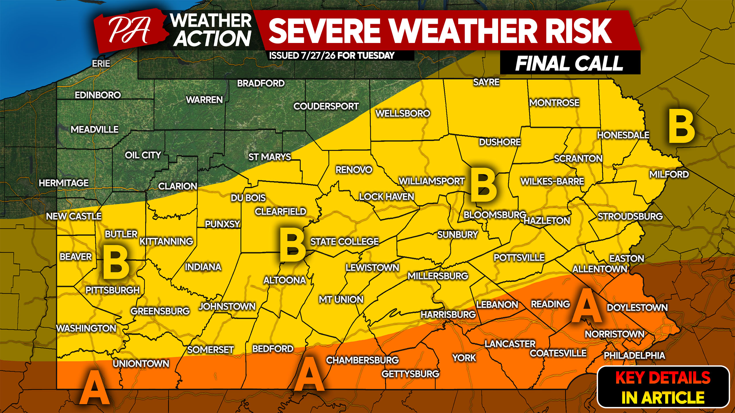
An ugly Tuesday is in store for parts of Pennsylvania as an upper level low spinning over the state will bring clusters of thunderstorms and torrential rain to the eastern half of the state. A lower-end severe weather threat exists along with an elevated risk of flash flooding.
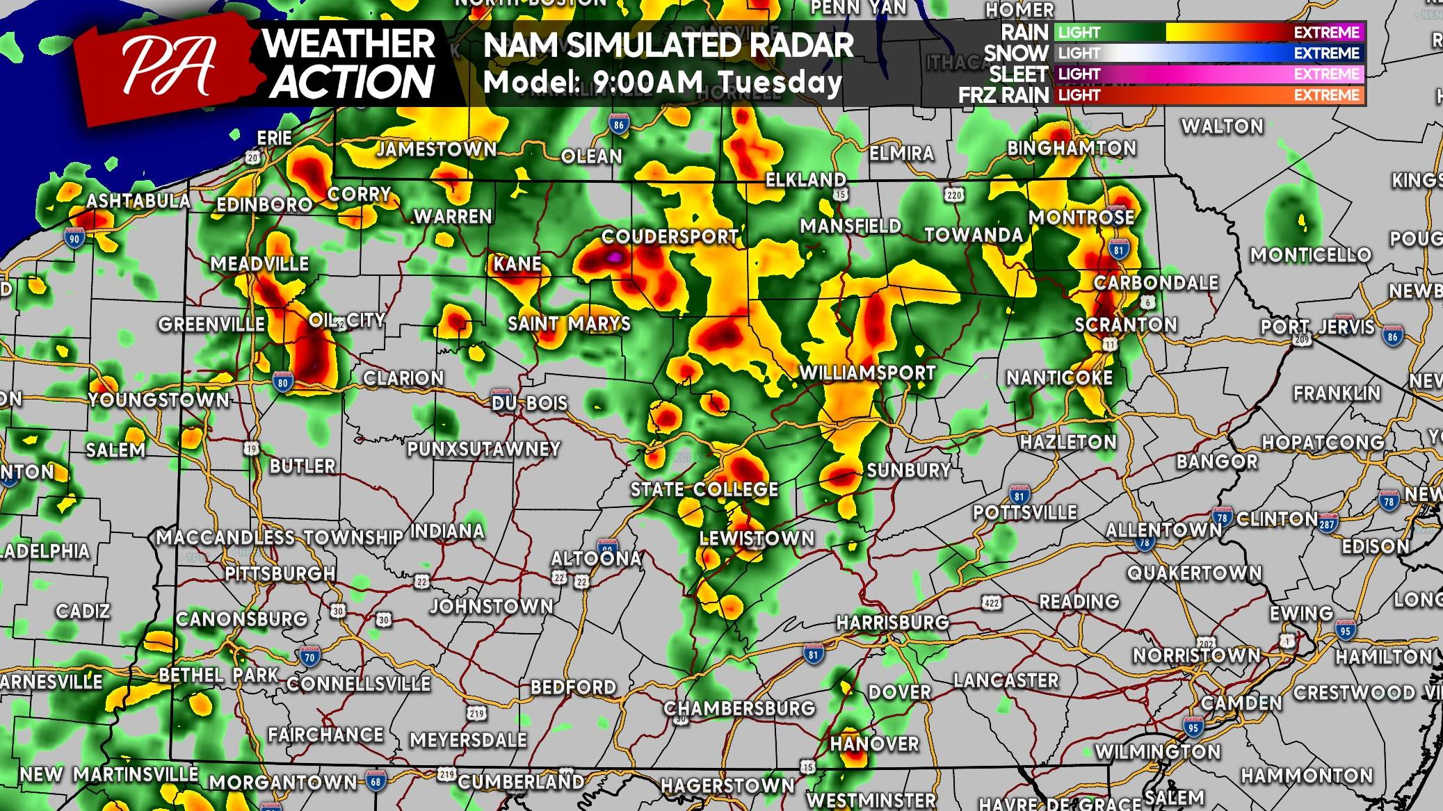
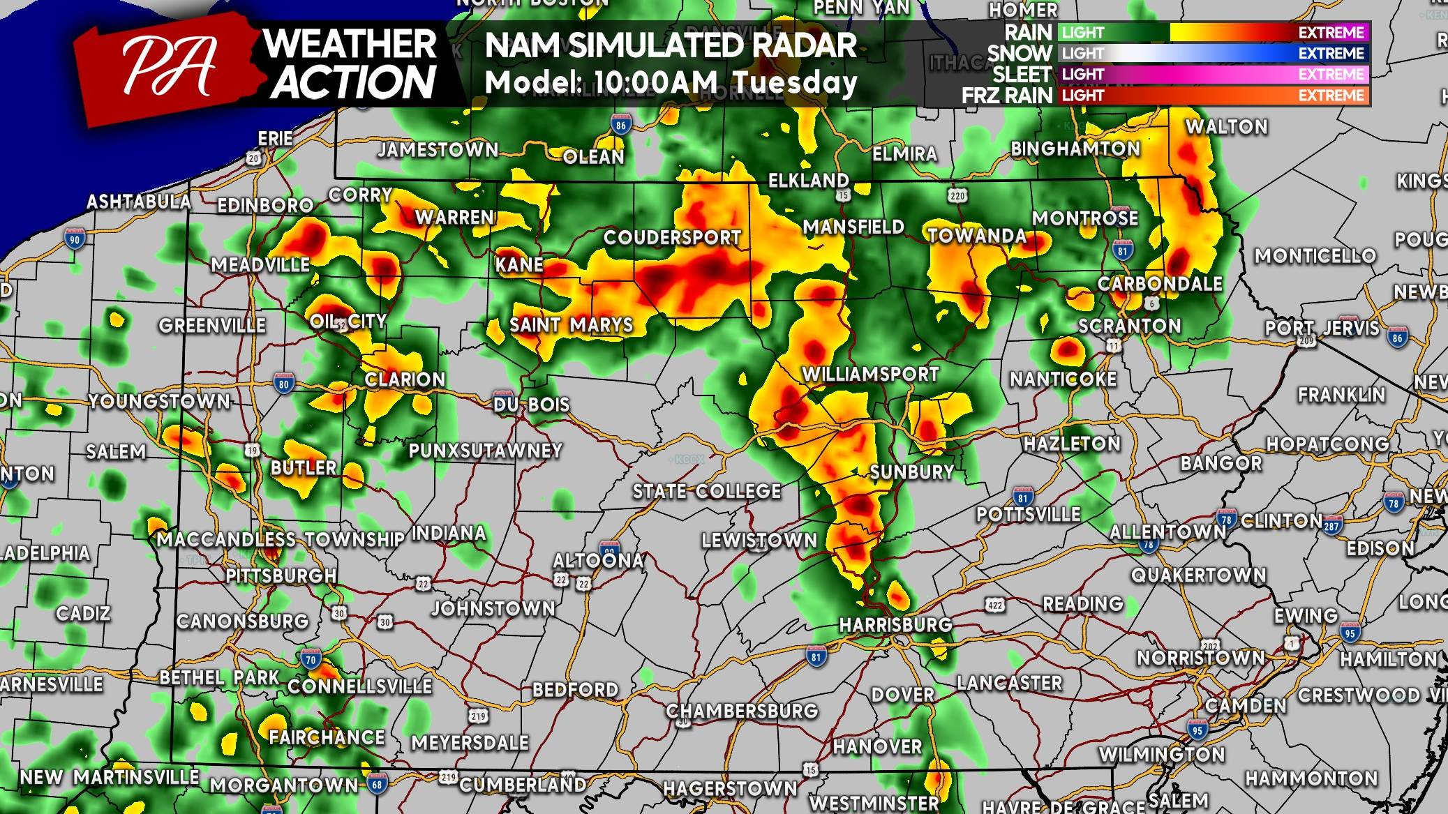
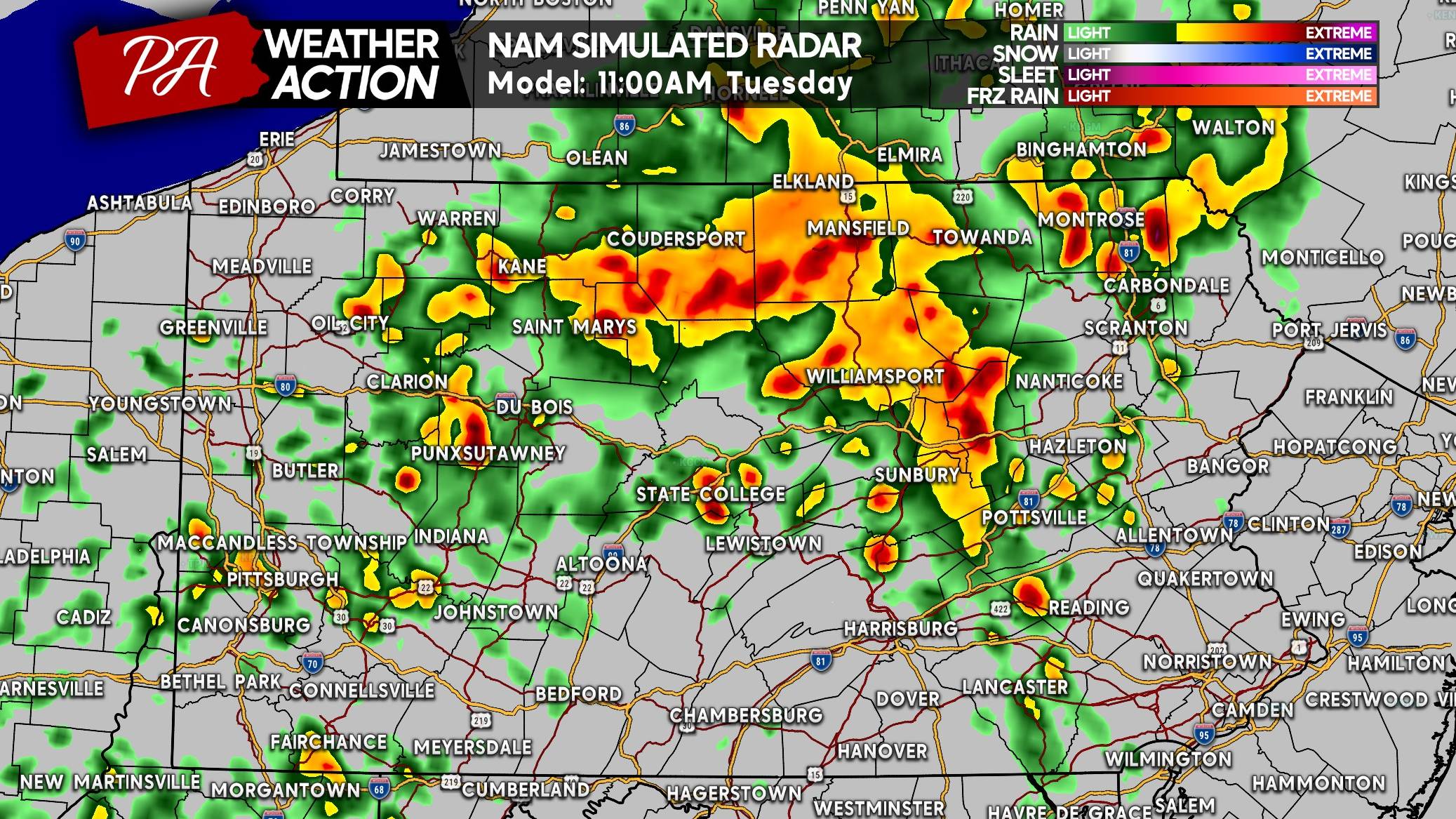
Heavy showers and thunderstorms are expected to develop near I-80 just after sunrise Tuesday morning and intensify as they move southeast. Clusters of thunderstorms will reach South Central and Southeast PA around lunchtime. Widespread thunderstorms will continue across far eastern PA into Tuesday evening, which is when flash flooding may occur. Rain looks to exit Eastern PA border counties by late Tuesday evening.
FUTURE RADAR TIMING
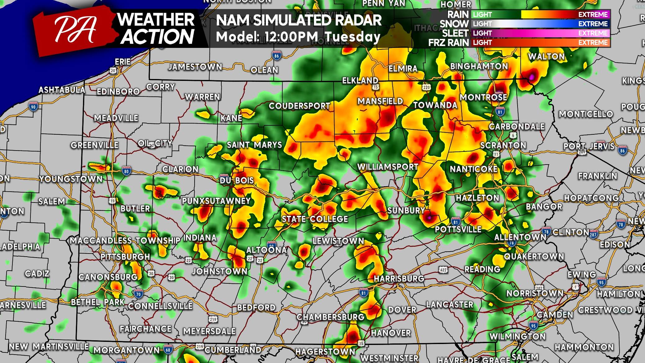
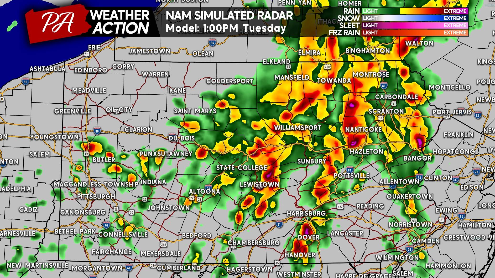
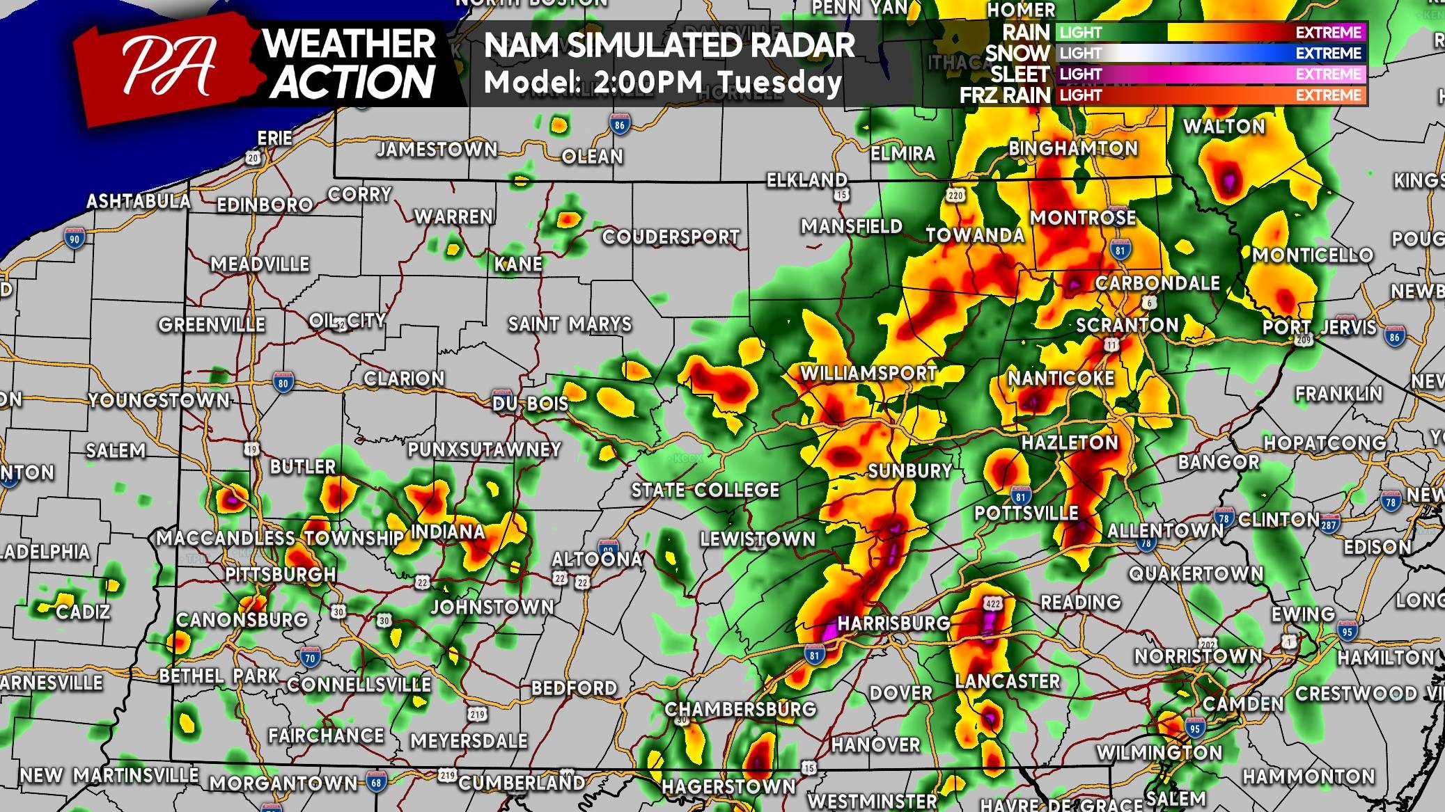
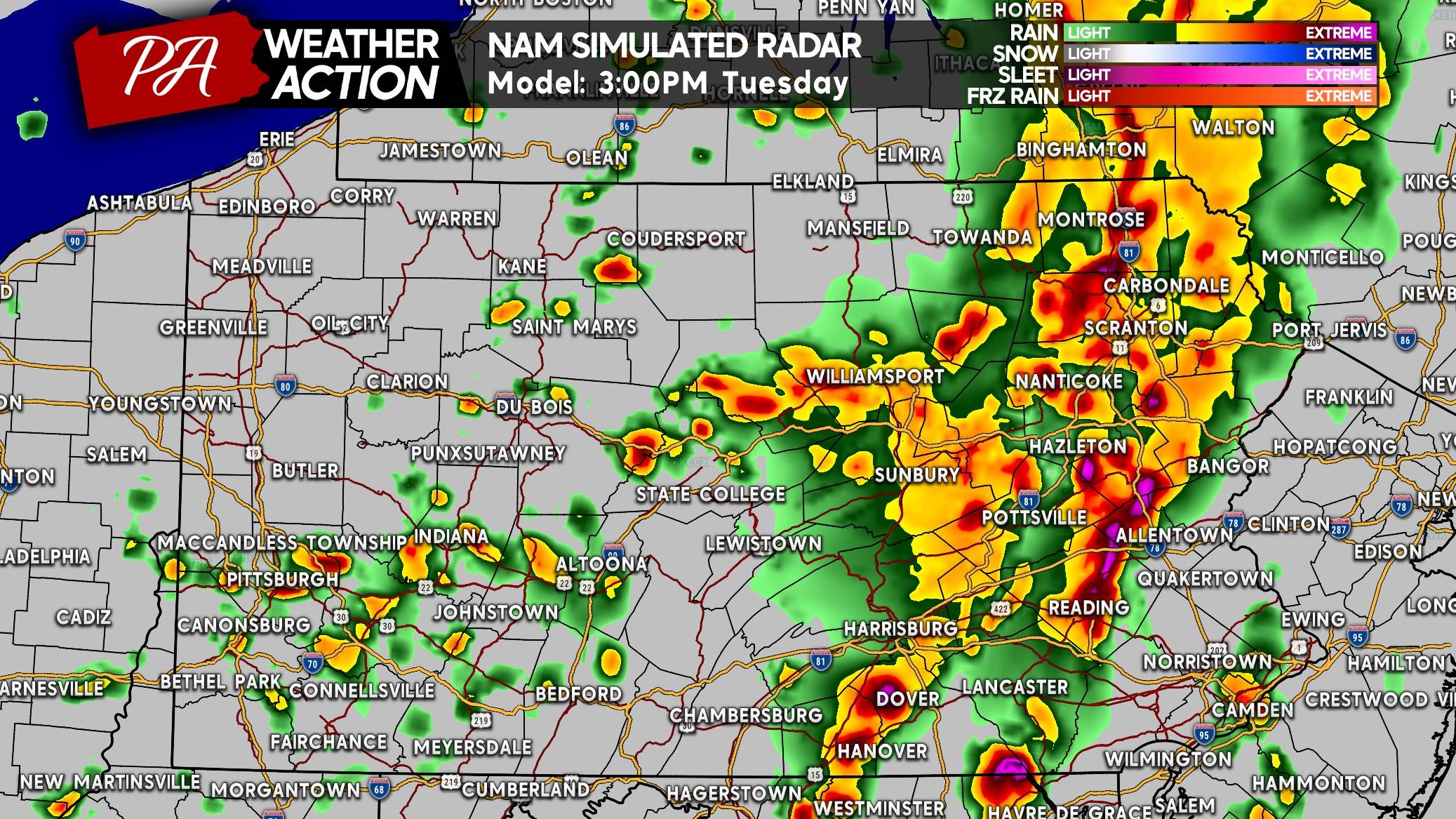
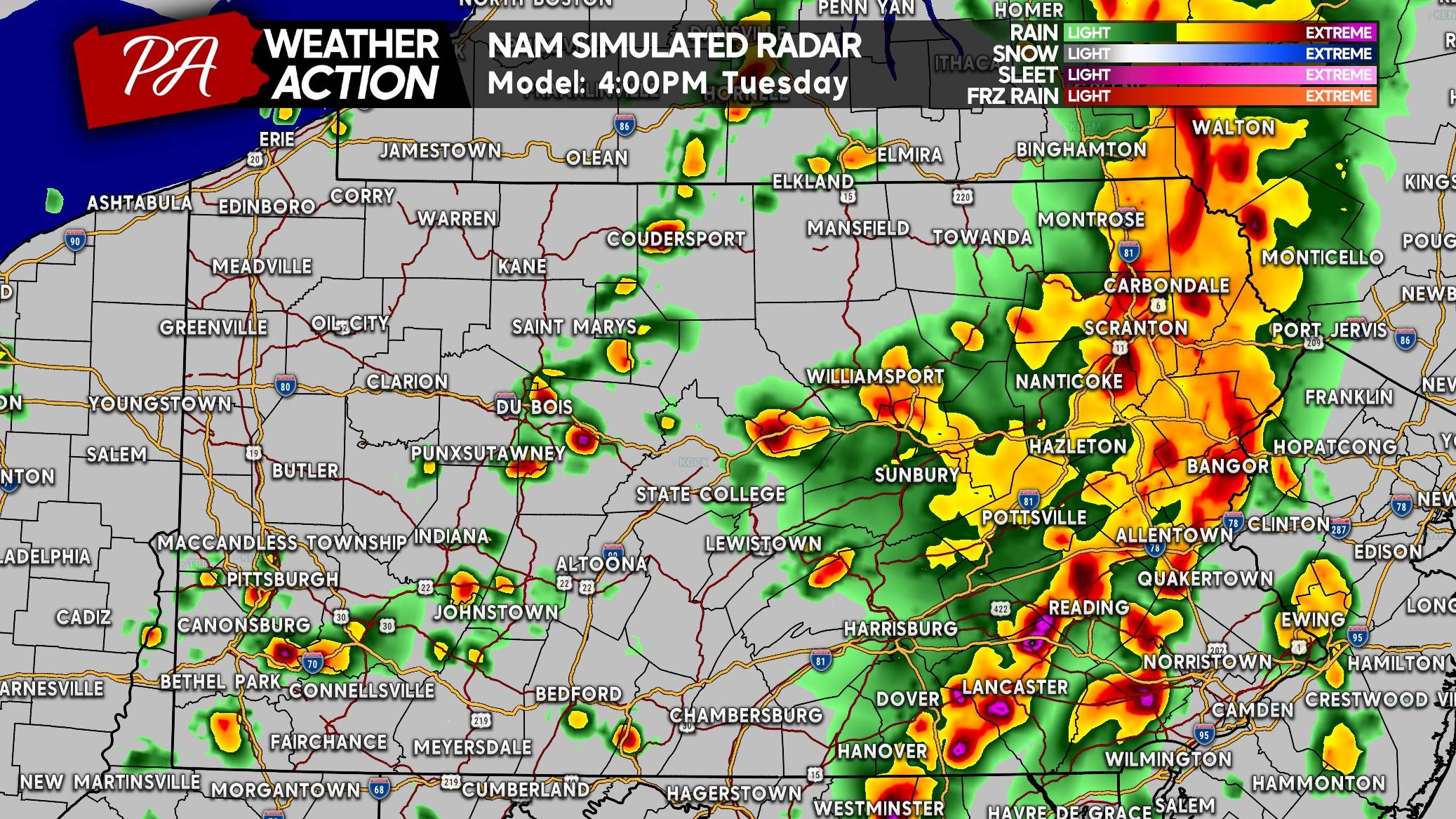
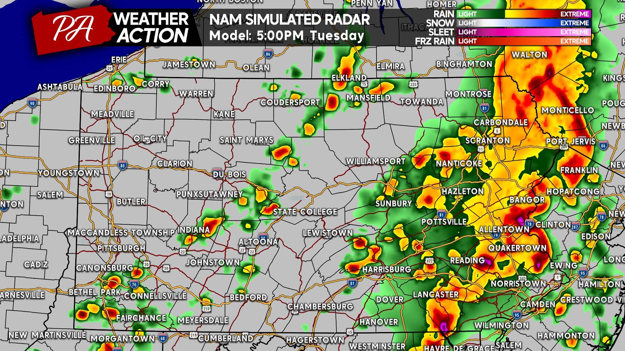
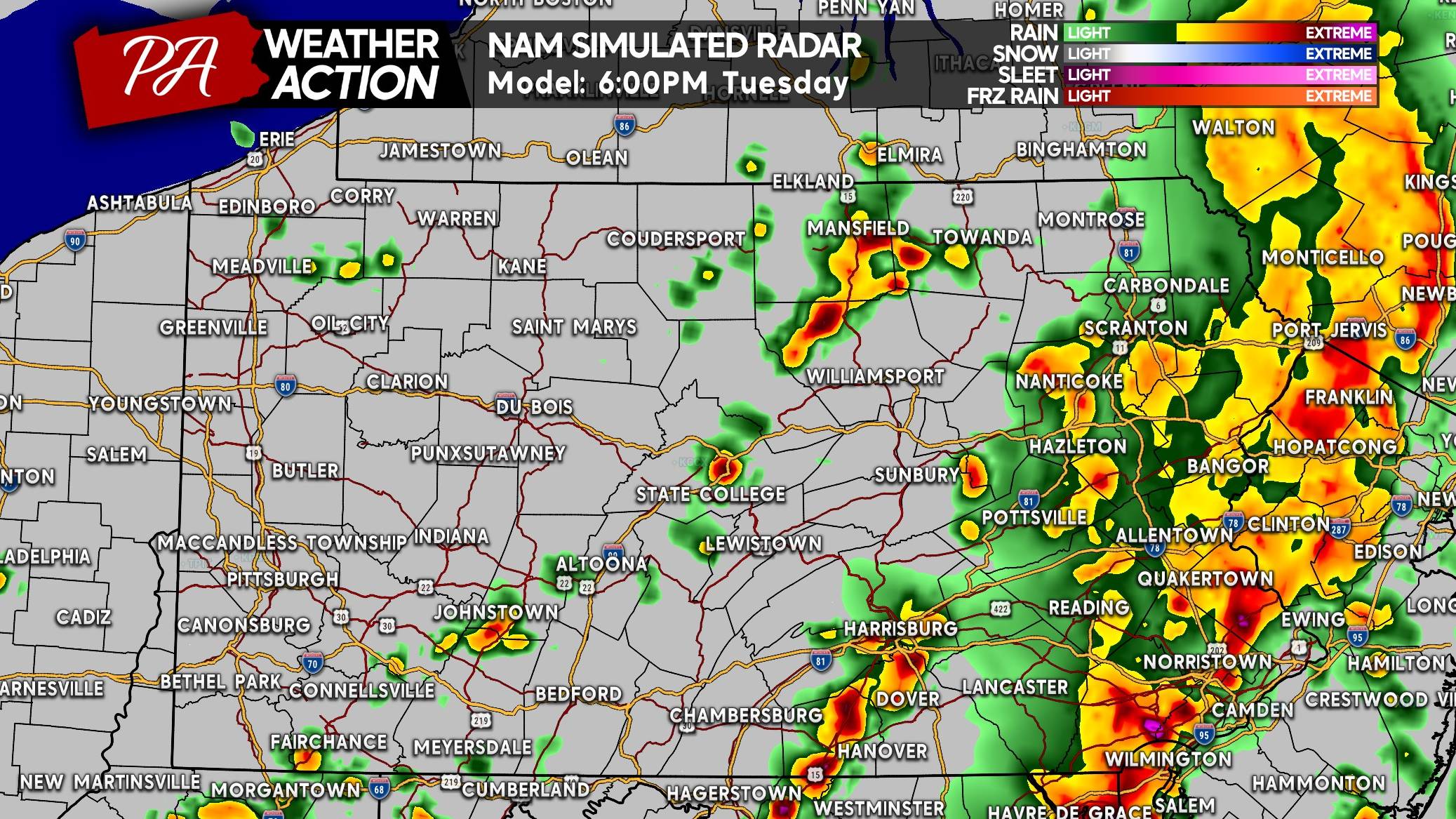
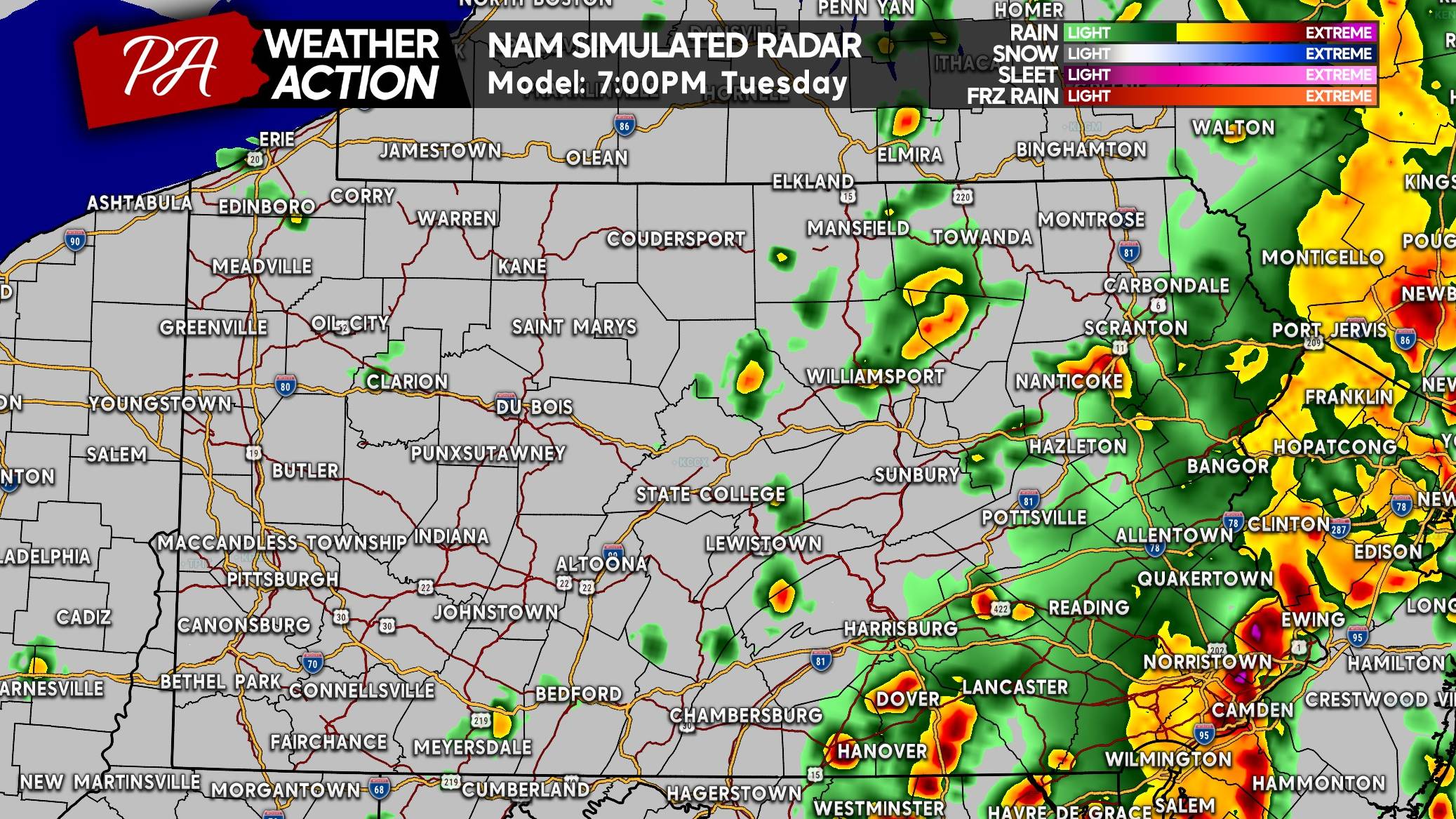
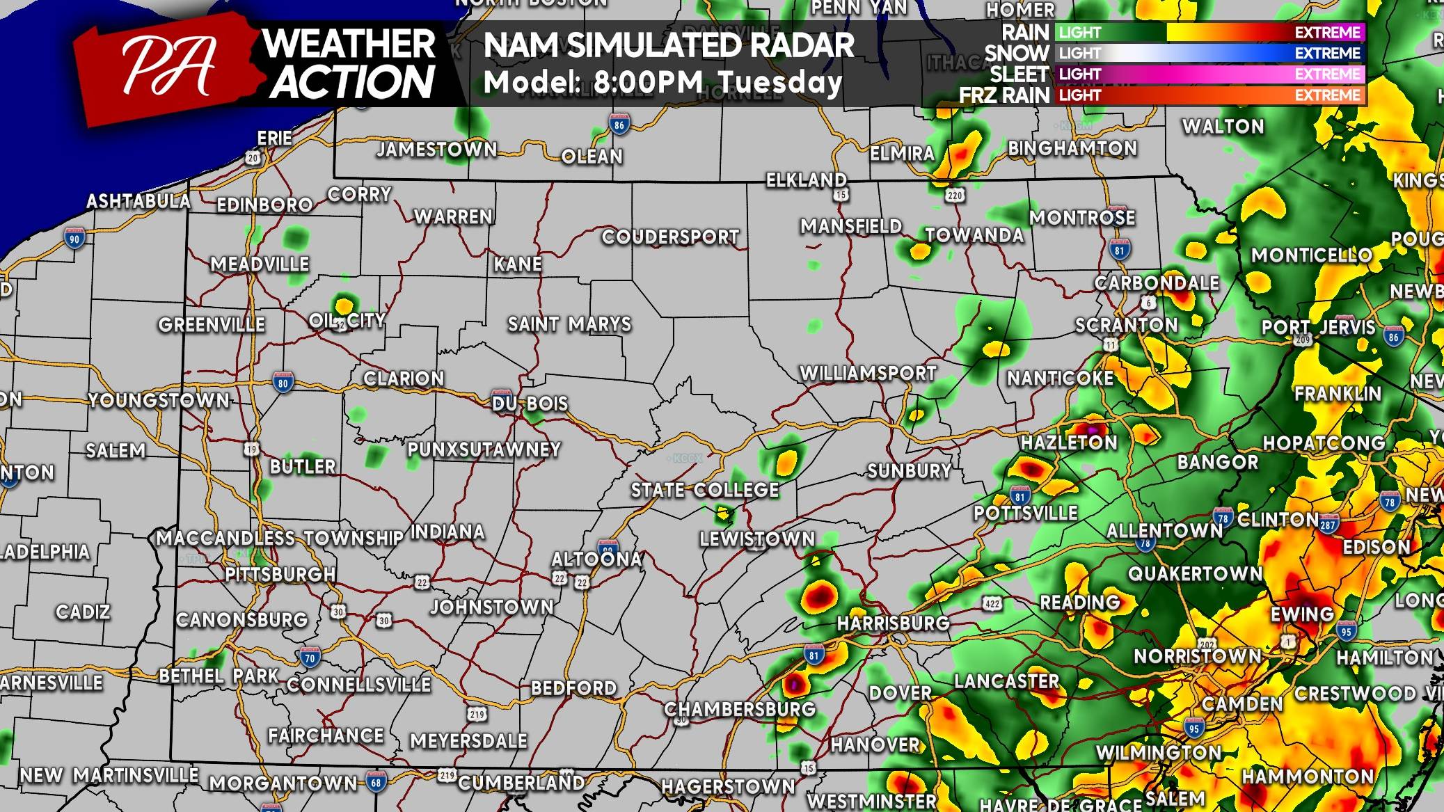
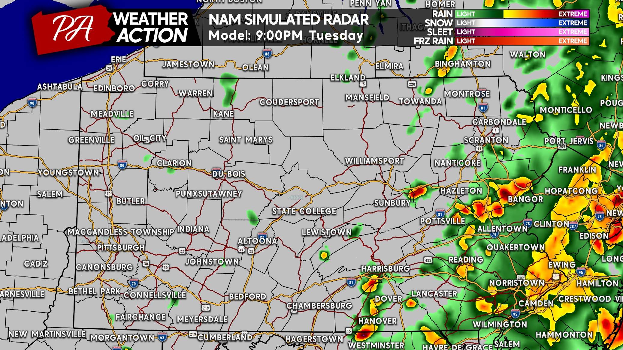
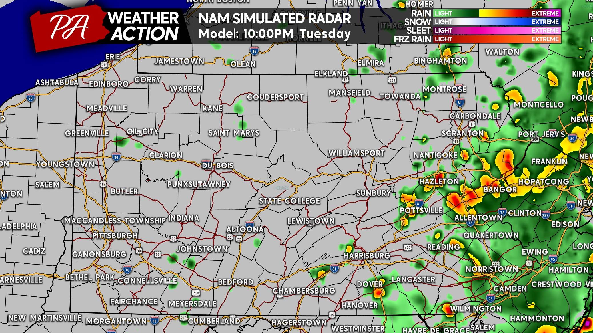
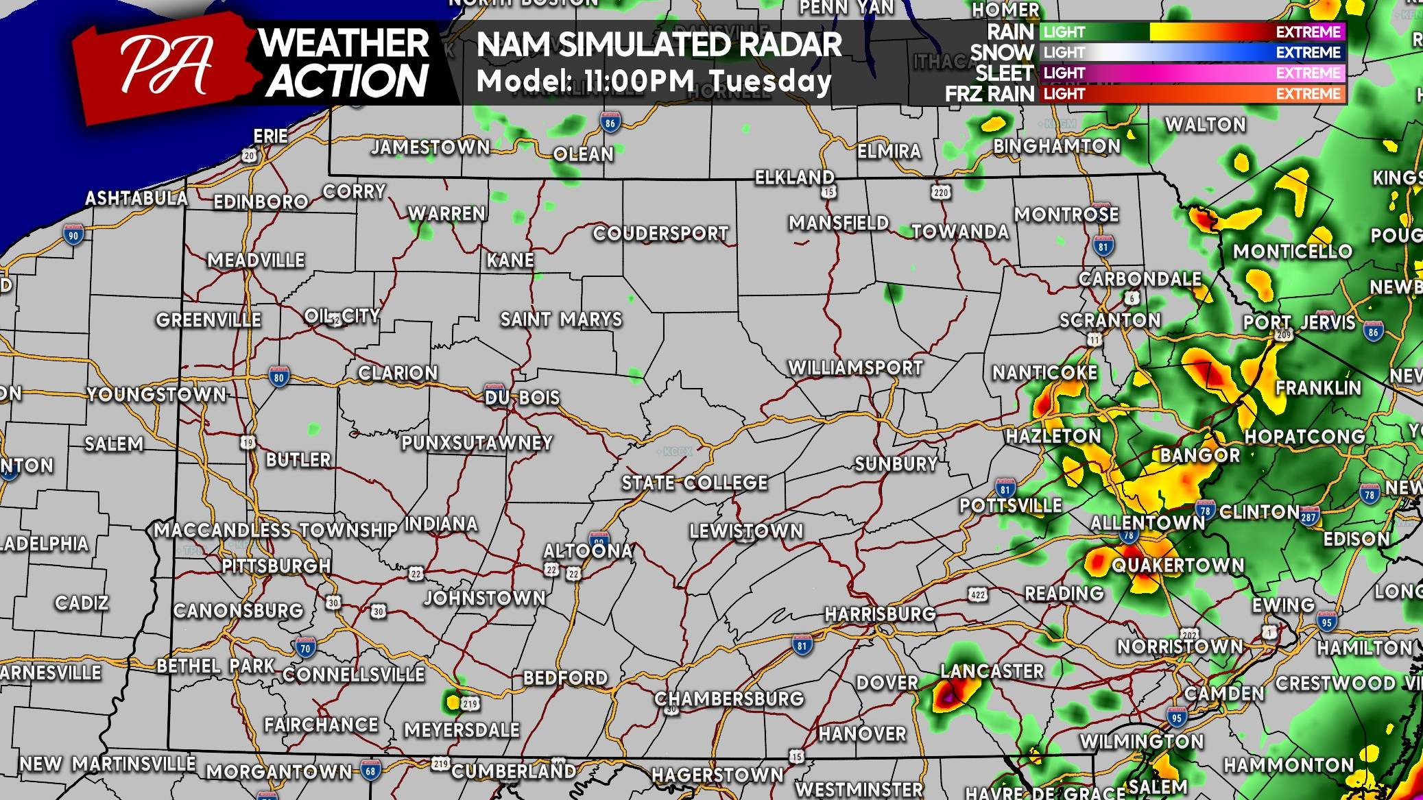
FLASH FLOOD THREAT FORECAST FOR TUESDAY 7/27
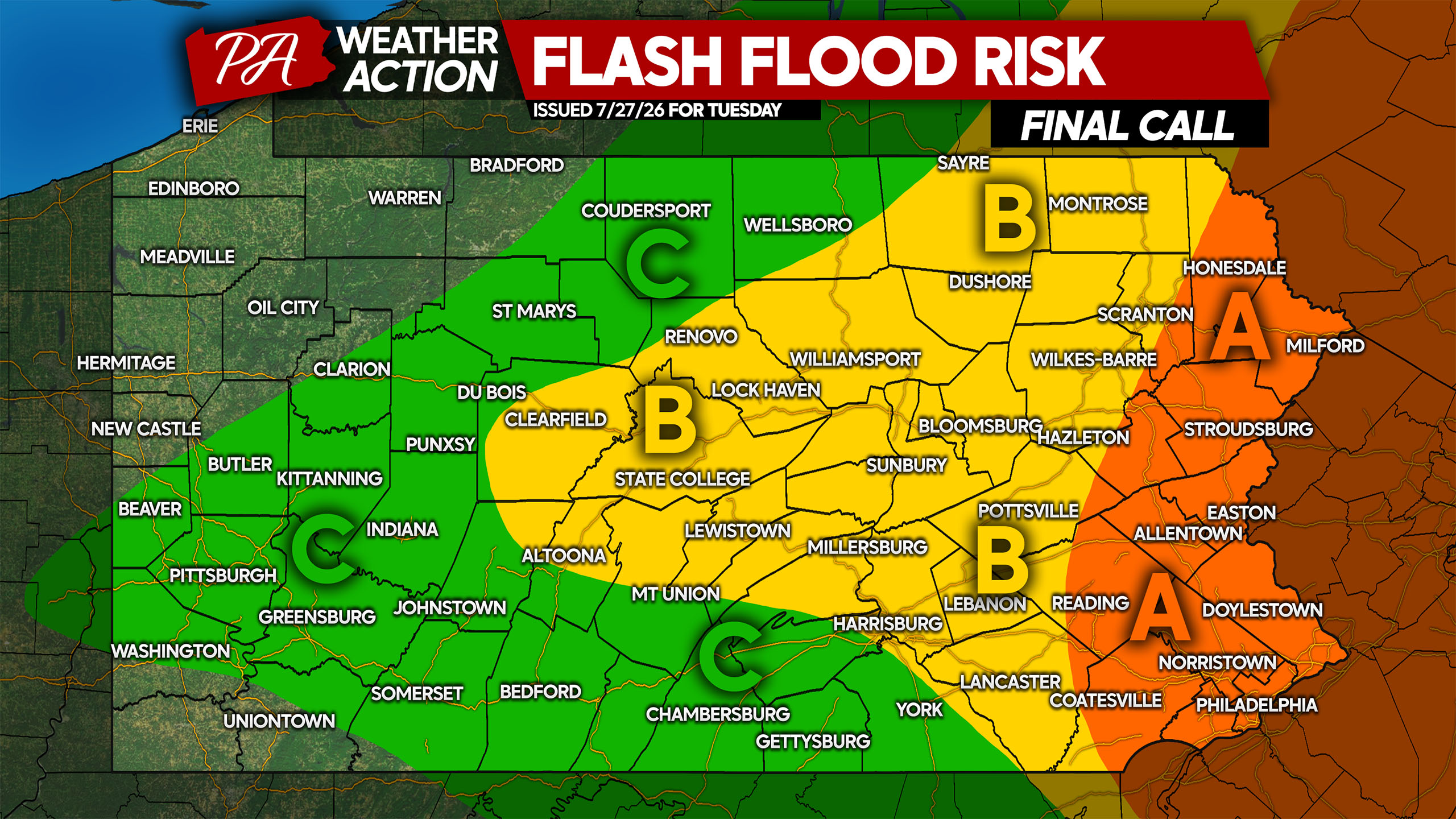
Area A: Elevated risk of flash flooding, particularly in areas with poor drainage or near small creeks that are known to flood. The highest flash flood risk will be Tuesday afternoon and evening. Potential for 3 – 5″ of rainfall in areas that see training storms.
Area B: Low risk of flash flooding, with the threat being localized in isolated areas that see heavy rain Tuesday morning into the afternoon. Potential for 2 – 3″ of rainfall in areas that see training storms.
Area C: Marginal risk of flash flooding with very isolated flash flooding possible in areas with poor drainage Tuesday. Potential for 1 – 2″ of rainfall in areas that see training storms.
SEVERE THUNDERSTORM THREAT FORECAST FOR TUESDAY 7/27
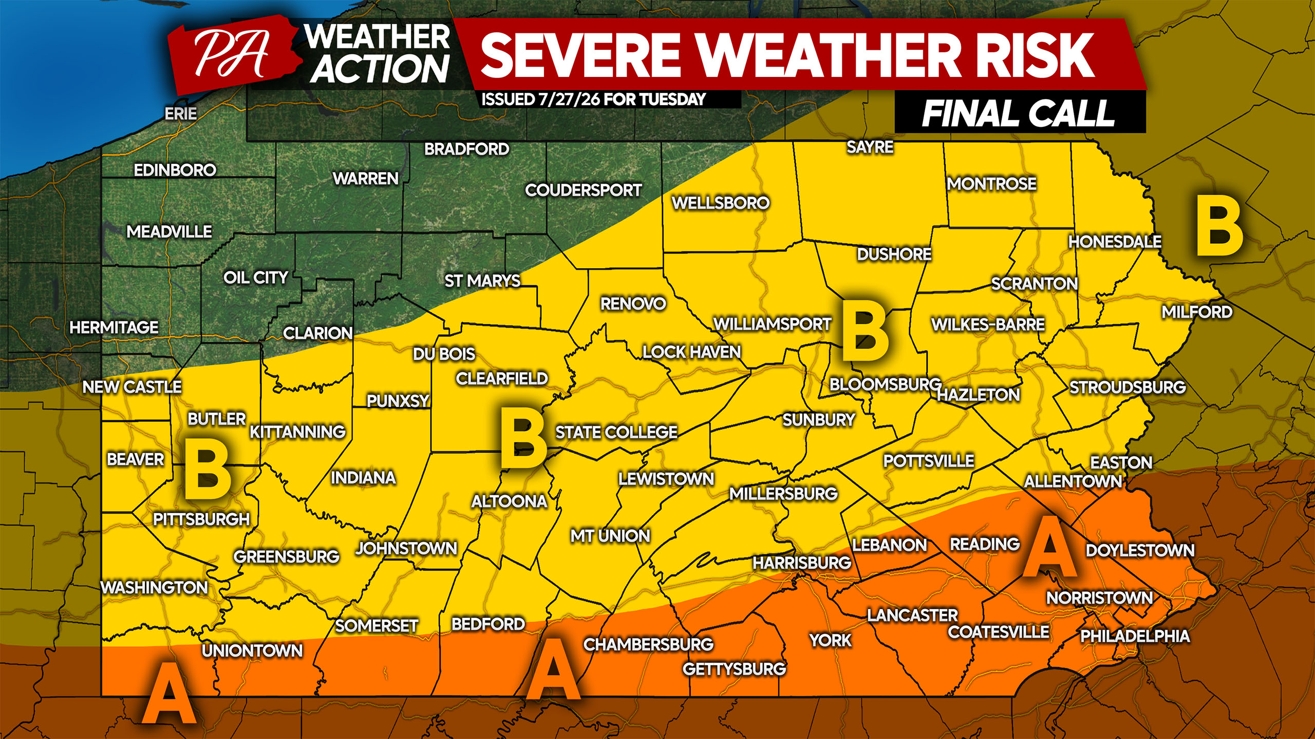
Area A: Scattered strong thunderstorms are expected, especially east of I-83 in this region. Some storms may reach severe criteria, with damaging winds the primary concern followed by a low risk of an isolated tornado.
Area B: Isolated strong thunderstorms are expected, with some storms bringing gusty winds with very isolated wind damage possible. Due to the low pressure being overhead, the primary severe threat will stay south of this area.
Share this forecast with family and friends in Eastern PA! If you approach floodwaters while driving Tuesday, turn around!



You must be logged in to post a comment.