
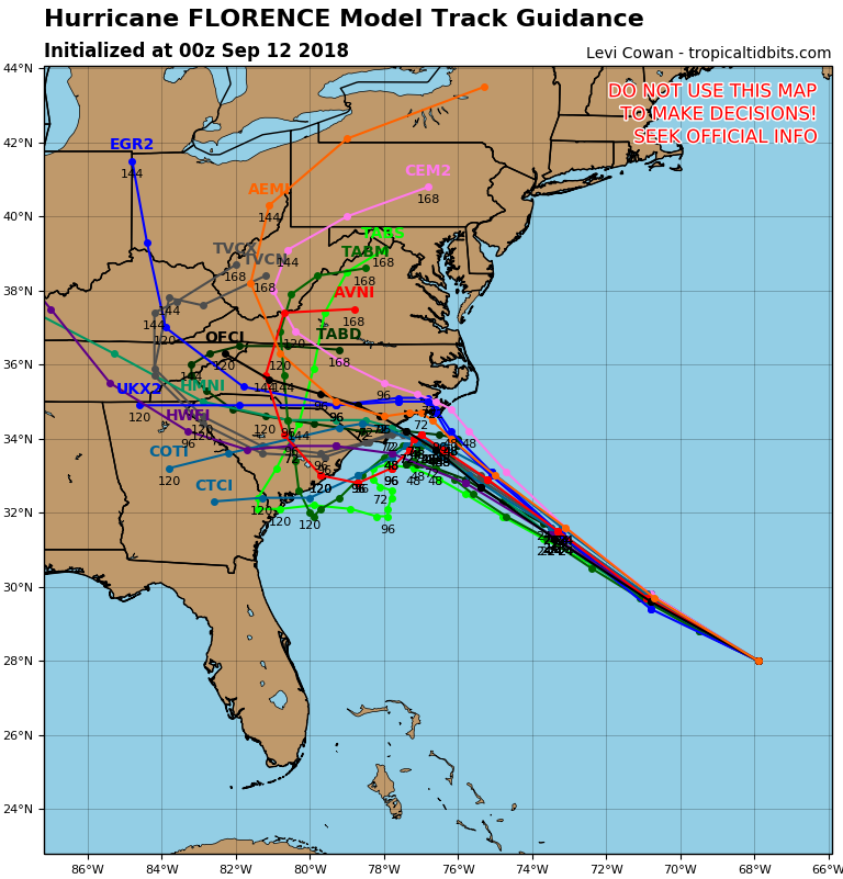
At this point we know Major Hurricane Florence will bring catastrophic impacts to the Outer Banks and Coastal NC. What still remains unclear is where the storm will track after making landfall or near-landfall. Latest runs of the GFS and Euro suggest the storm may not even fully come ashore in Southeast NC before moving back over water. Unfortunately, the models still have the storm within 5-10 miles of landfall so damage would not be any lesser for immediate coastal areas. However, places like Greenville, Fayetteville, and Raleigh would likely see less in the way of damage.
These new model runs then have the storm moving back down the South Carolina Coast as a result of high pressure to the north. The storm then makes landfall potentially for a second time near Charleston, SC as a category two or three storm. This is unexpected news for Coastal South Carolina, as it looked like they were going to avoid the worst of Florence. Here is the GFS model:
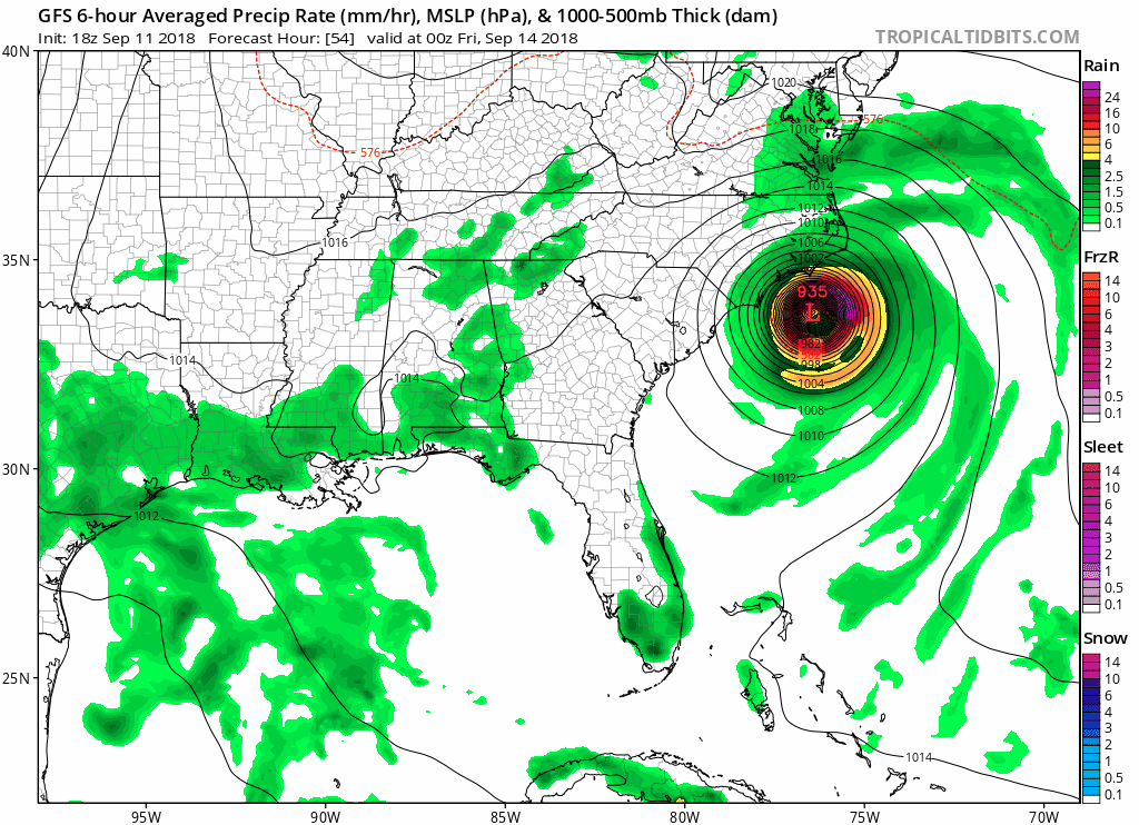 Unfortunately other model data is beginning to come on board with this scenario tonight. Below is brand new model data from this evening:
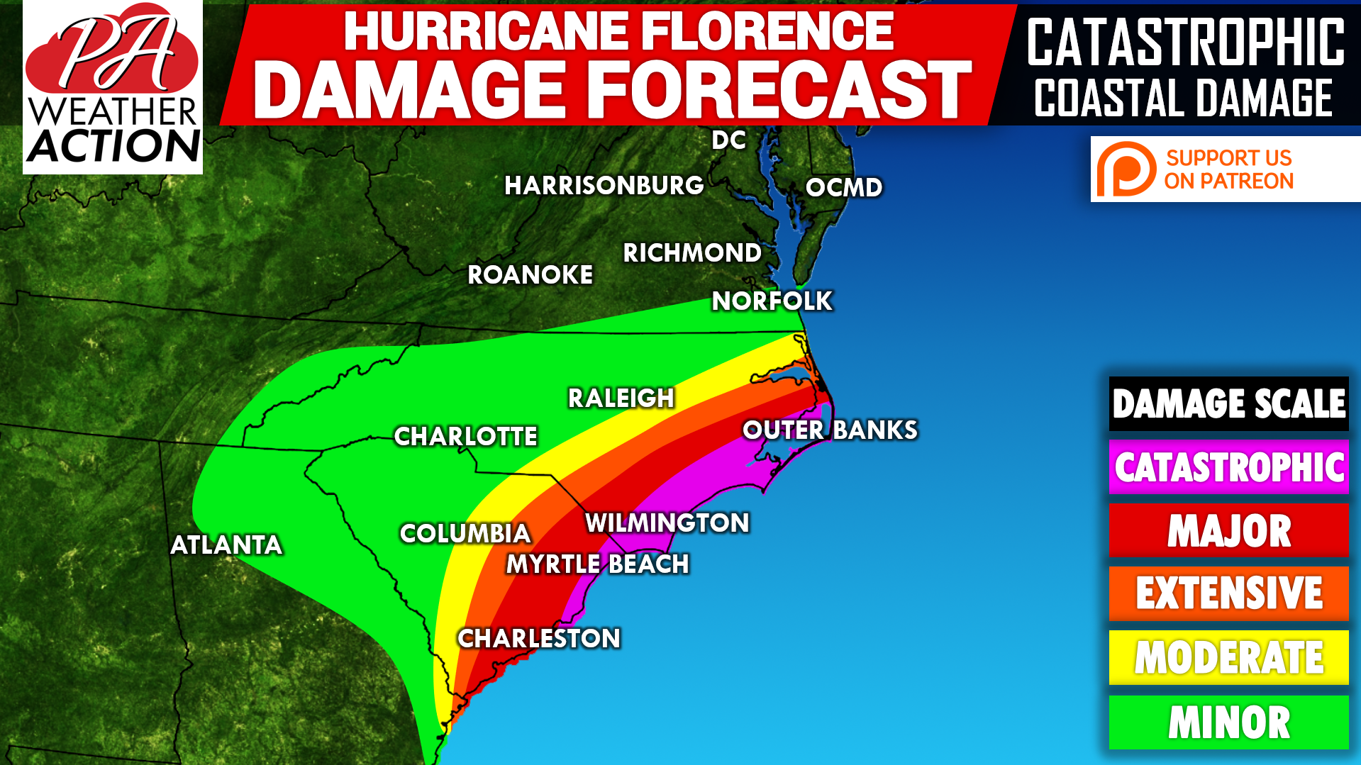
Finally, here is our updated Hurricane Florence Damage Map:
 A few positives we can take away from this shift is the threat of major flooding in Virginia has greatly subsided. In addition, we don’t expect any major flooding up here in Pennsylvania. The system may make its way up here next week, but we don’t anticipate much from it.
However, this shift suddenly puts everywhere from Myrtle Beach to Charleston in the bullseye for major to catastrophic damage. If Florence sits and spins for an entire day just off Wilmington as predicted, rainfall totals of 20″ will be common from Myrtle Beach to Ocracoke, NC. That, combined with winds constantly over 100 MPH will almost inevitably result in widespread structure collapse.
We will have another update Wednesday with the latest NHC Track, model guidance, and damage forecast. Download our app for the latest NHC track every six hours, impact and rainfall forecasts, and much more on Hurricane Florence, click here: Pennsylvania Weather Action’s App
Share this unexpected track shift of Hurricane Florence with your family and friends using our icon below!
You must be logged in to post a comment.