
After a reset to late winter this week, we are flipping back to spring this weekend with temperatures rocketing into the 70s by Sunday. Along with that will come a cold front crashing through later in the day from north to south. Severe thunderstorms with the potential to bring all hazards are likely in parts of Pennsylvania.
The primary threats will be damaging winds up to 70mph and large hail. A few supercells may produce an isolated tornado in Southwest PA Sunday afternoon. Most tornadoes in Southwest PA tend to travel southeast, and that will be the movement of these cells. Short range models are rather impressive with the tornado risk.
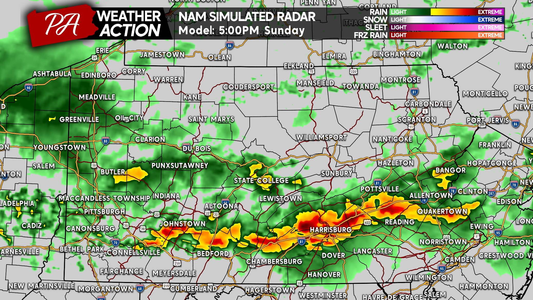
SEVERE STORM TIMING
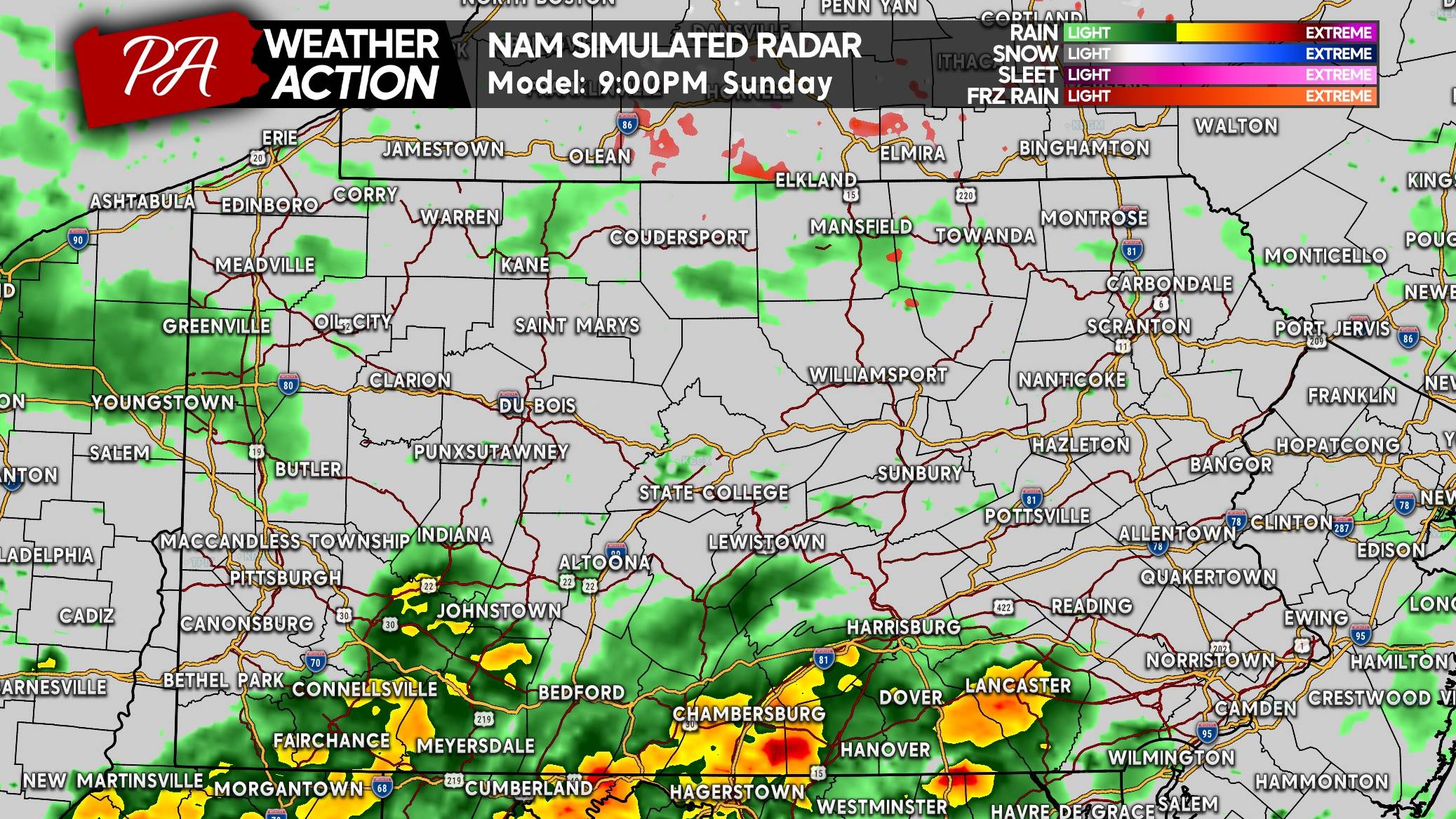
Widespread heavy rain and embedded thunderstorms will get going across Northern PA early Sunday afternoon. That activity should not have a severe component.
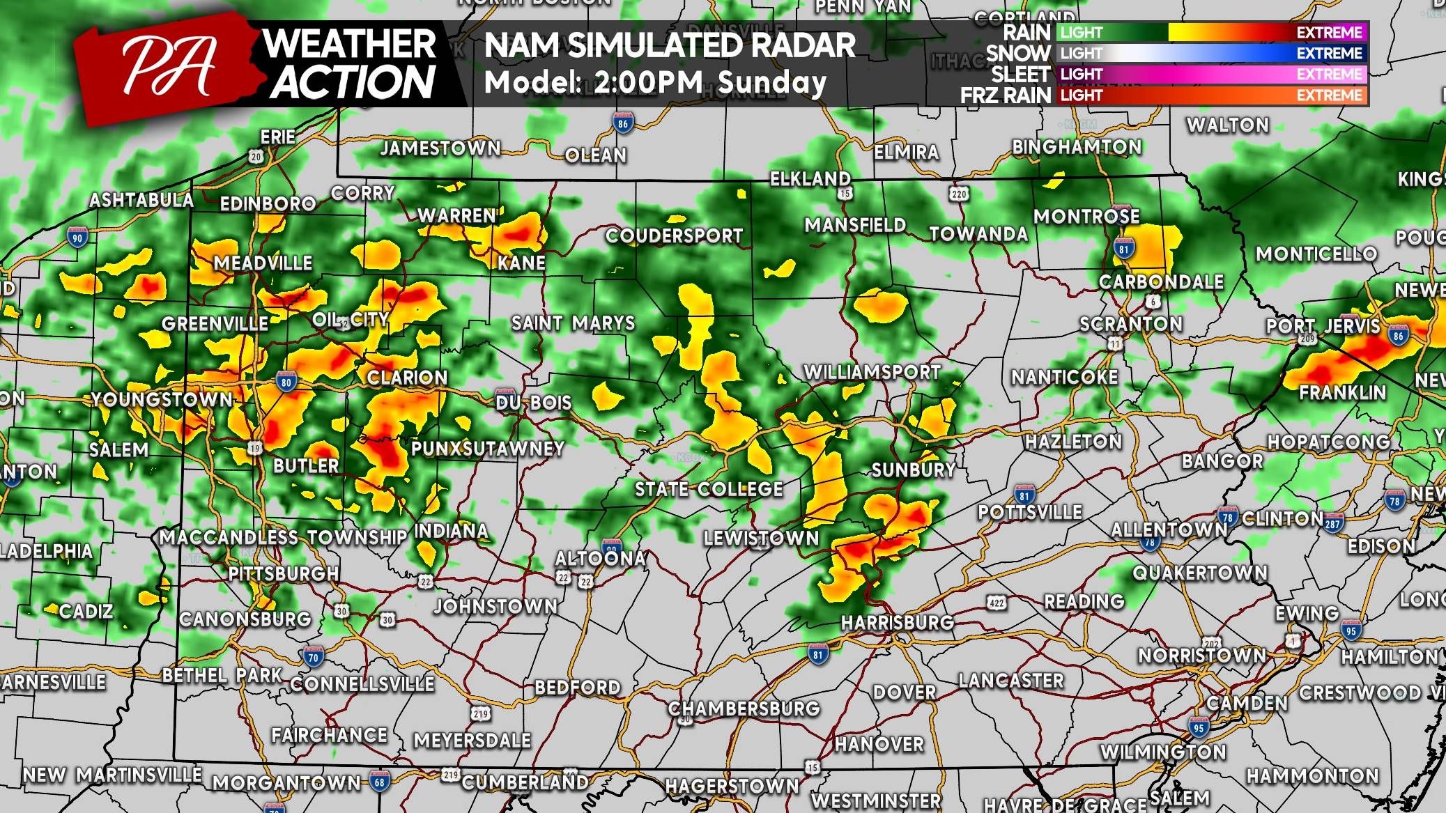
As it drops south into a much more unstable environment south of I-80, severe thunderstorms will immediately become scattered across Southwest PA.
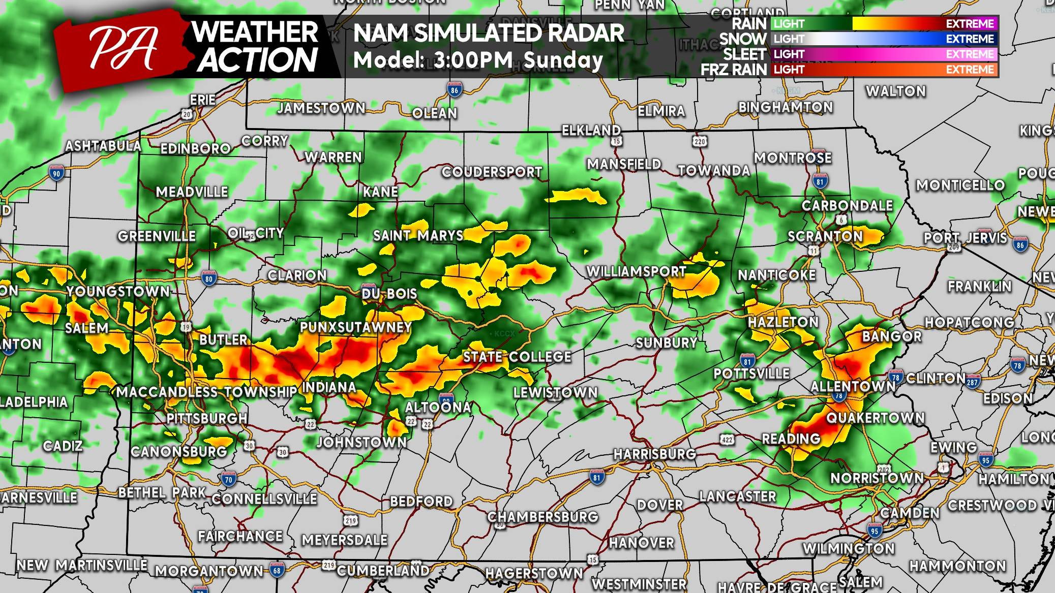
Strong to severe storms will track southeast in Southern PA late Sunday afternoon with the tornado threat highest in Southwest PA to South Central PA, especially west of Chambersburg.
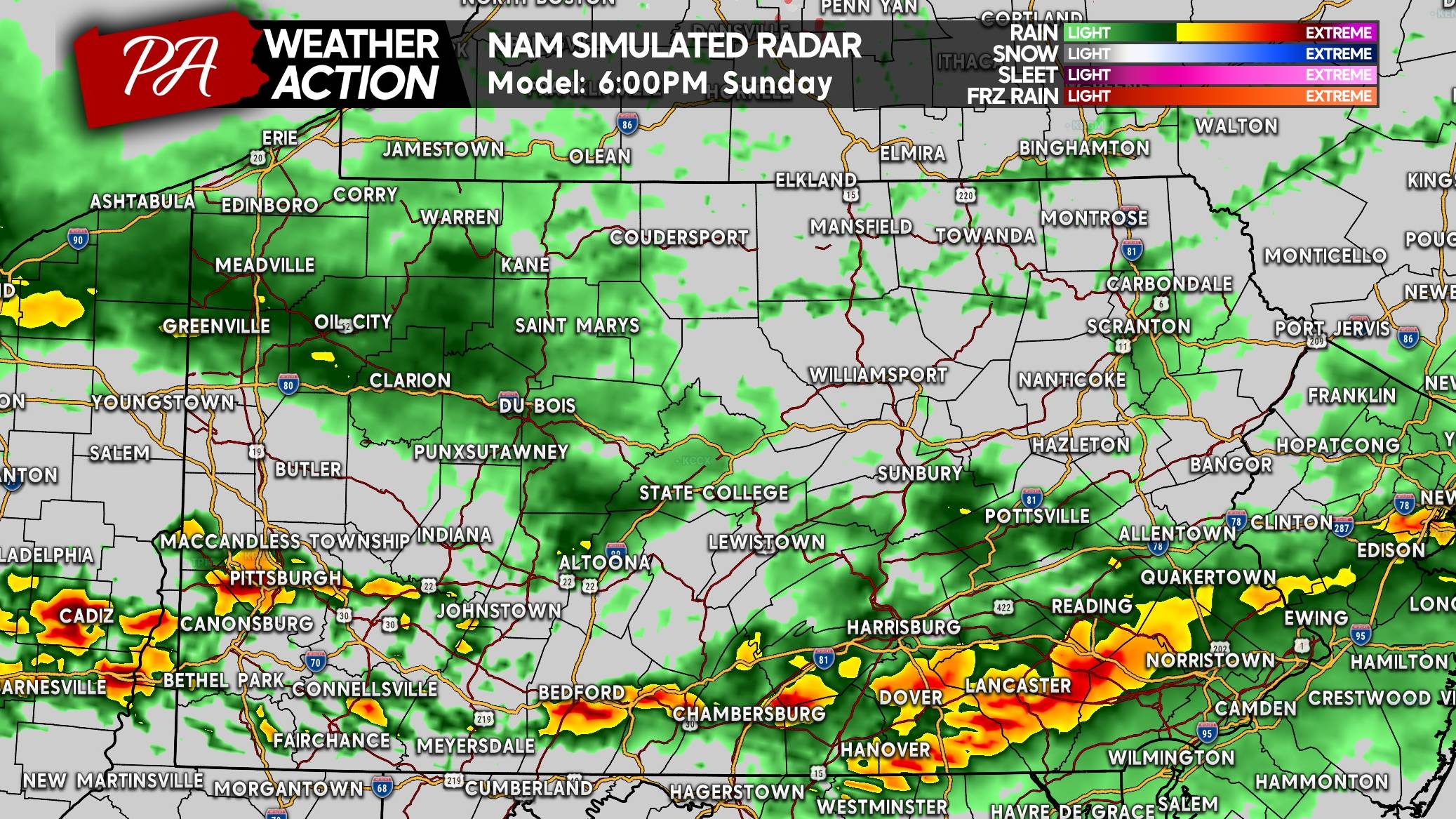
The Hi-Res NAM is a little faster than some other guidance with how early it drops this line towards the Mason-Dixon. As these storms form a more consolidated line along I-78 and the PA Turnpike in Central PA, the threat should shift to mainly damaging winds.
The tornado threat will persist in Southwest PA into dinnertime with less activity to rob the instability. Other models also have South Central PA seeing more discrete activity.
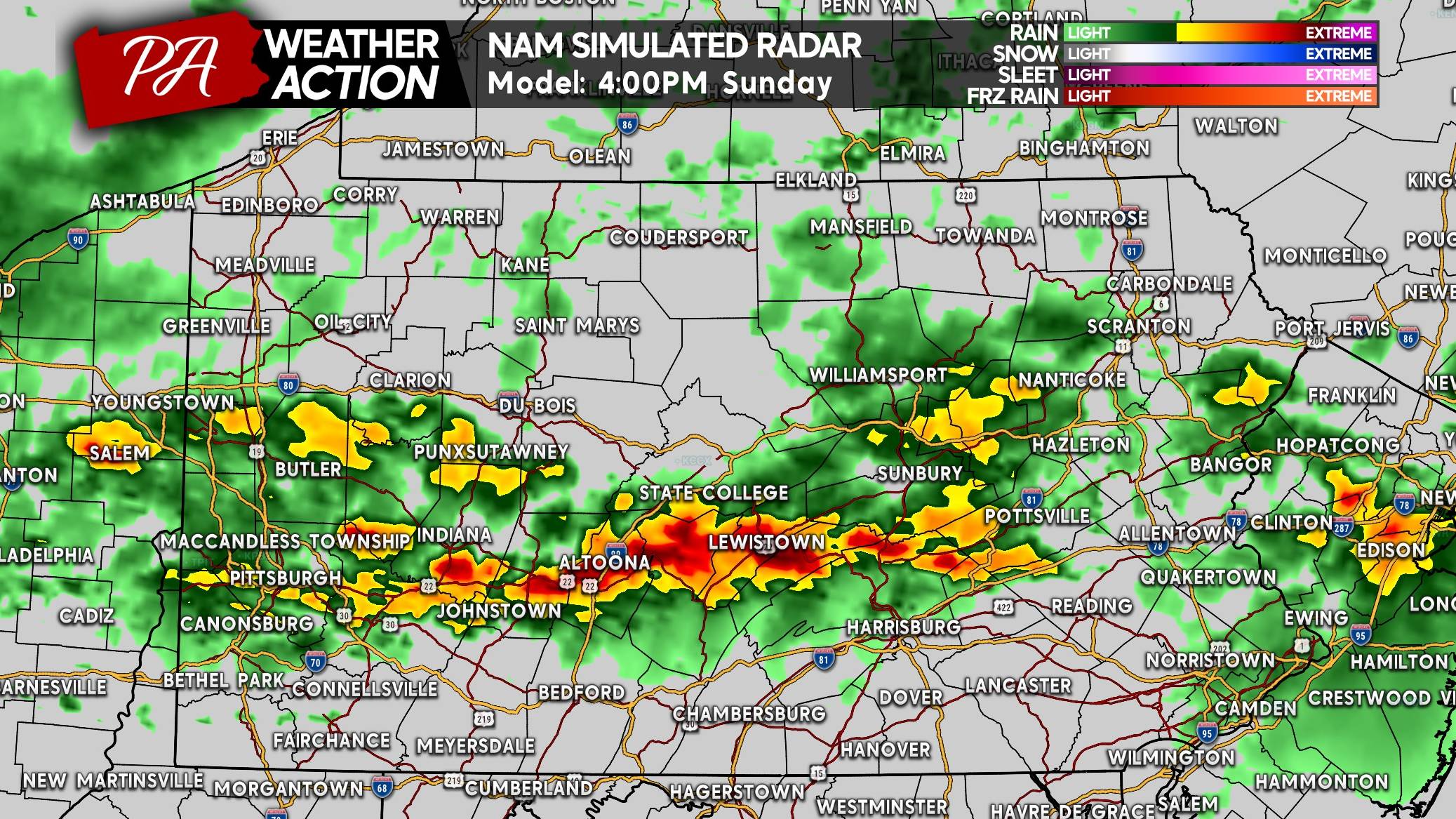
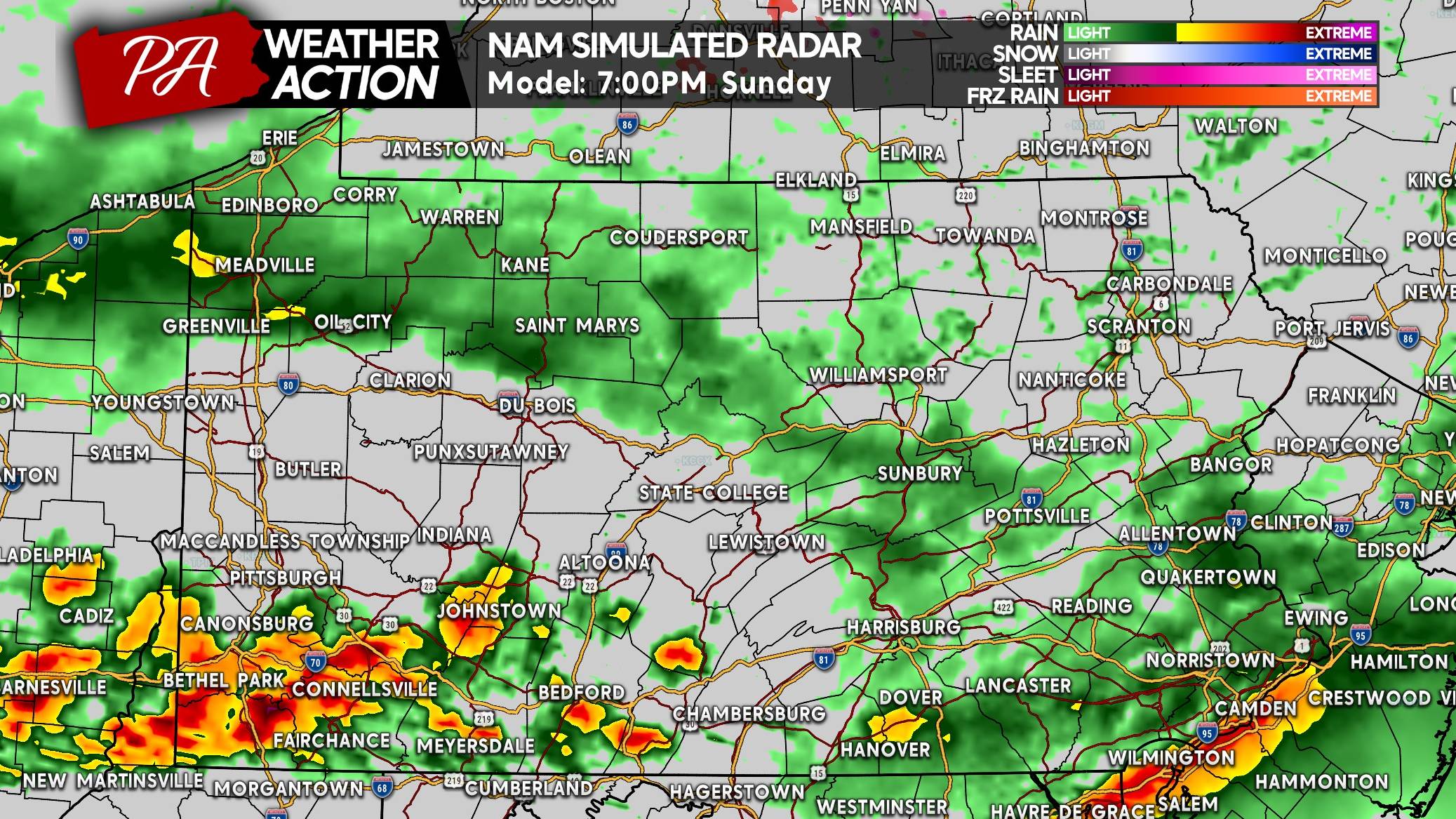
Southwest PA, south of Pittsburgh, will likely see peak severe activity around sunset.
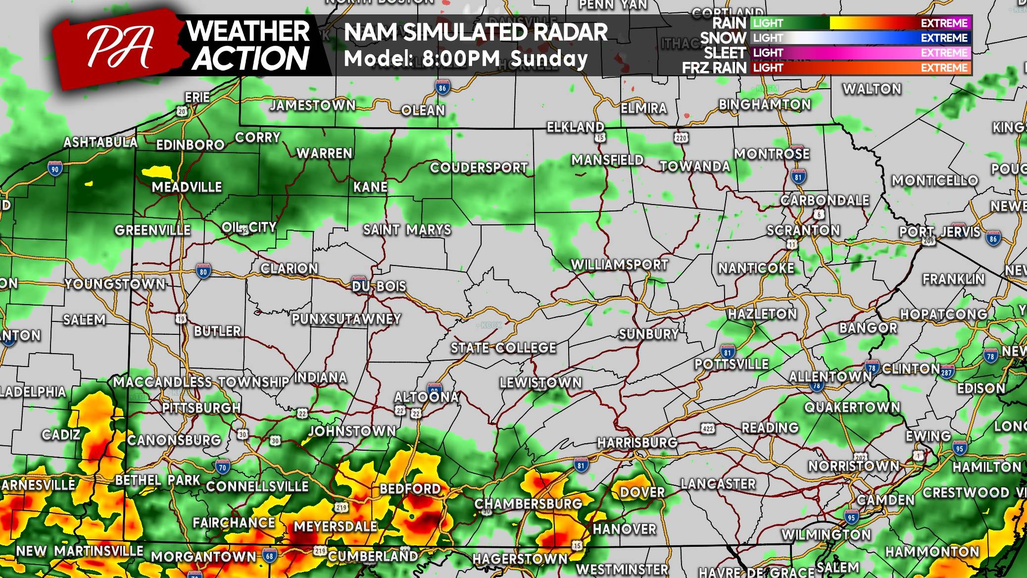
Finally by 8 PM Sunday, storms should be approaching the Mason-Dixon in the southwest quarter of Pennsylvania. The severe threat will still be active at this point, as that area won’t see much of any activity ahead of these storms.
And by 9 PM Sunday, the threat will be on its way out with some leftover heavy rain and rumbles of thunder in far Southern PA.
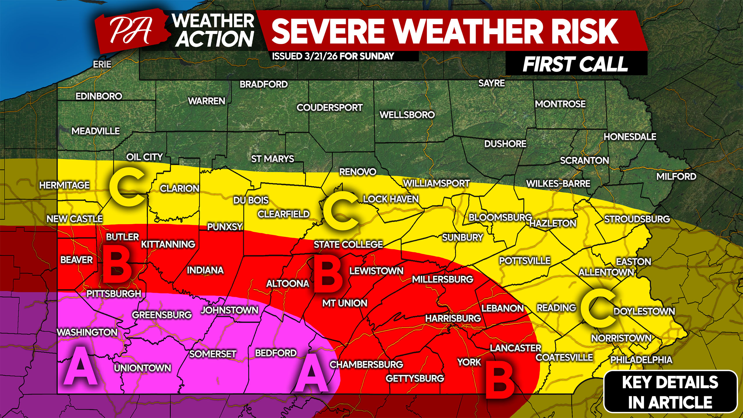
SUNDAY’S SEVERE WEATHER RISK FORECAST
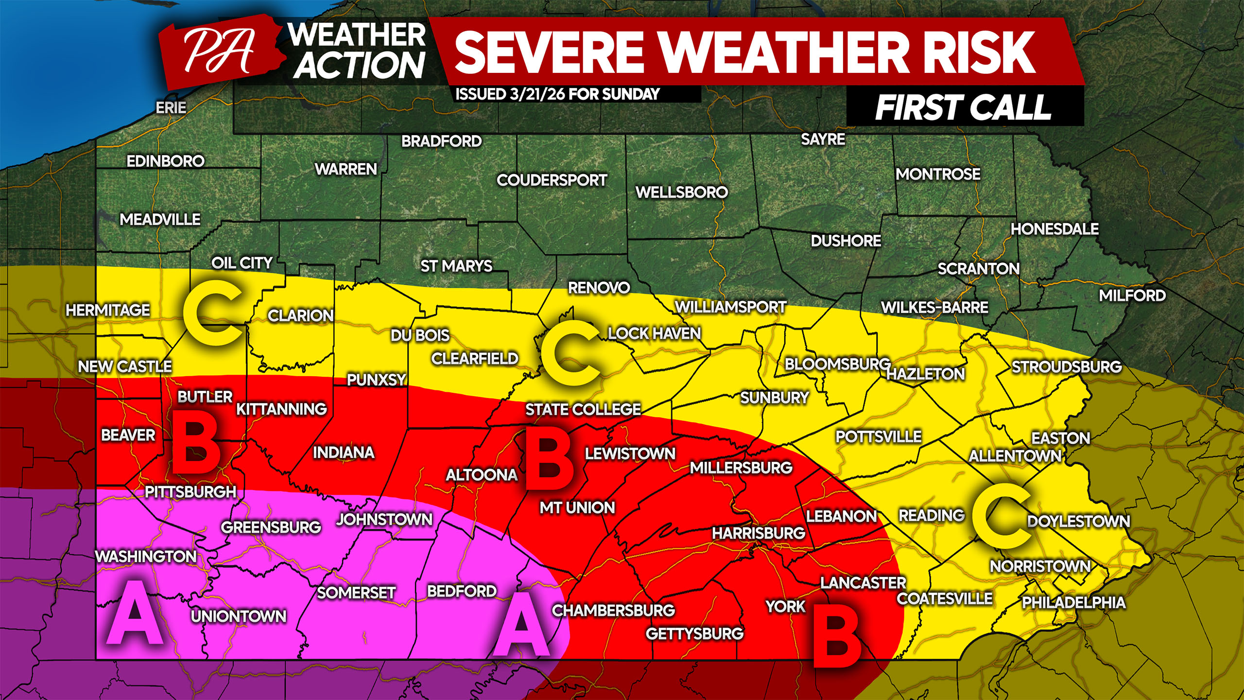
Area A: Scattered to widespread severe thunderstorms are expected. Damaging winds up to 70mph, hail up to 1″ in diameter, and an isolated tornado possible.
Area B: Scattered strong to severe thunderstorms are expected. Damaging winds up to 70mph are the main concern, with hail and a very isolated (unlikely) tornado possible closest to Area A.
Area C: Isolated strong to severe thunderstorms are anticipated but not a likelihood in any given location. Damaging winds up to 60mph are possible in the strongest of storms.
Many people have outdoor plans Sunday to enjoy the warm weather, so be sure to share this forecast with friends and family!
You must be logged in to post a comment.