
Today, a 127 year old record was broken across parts of the state. In addition, flash flood and severe thunderstorm warnings shaded the map in Western Pennsylvania north of Pittsburgh as a strong line of storms rolled through. This is what mid-January has come to here in PA. Will it last? Of course not! Just 36 hours from now snow will be falling in some of the same regions that reached the mid 60s today.
The same system that will be giving us snow and ice Saturday will be crippling some areas of the Central Plains with up to an inch of ice capable of knocking out power for weeks. We will be impacted much less fortunately.
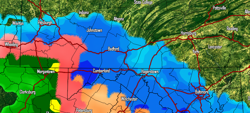
Primarily snow will move into Southern Pennsylvania Saturday Morning, although the southwest corner will likely start with sleet or freezing rain. Here is the NAM model for 10 AM Saturday Morning.
Fast forwarding three hours, here is the same model at 1 PM.
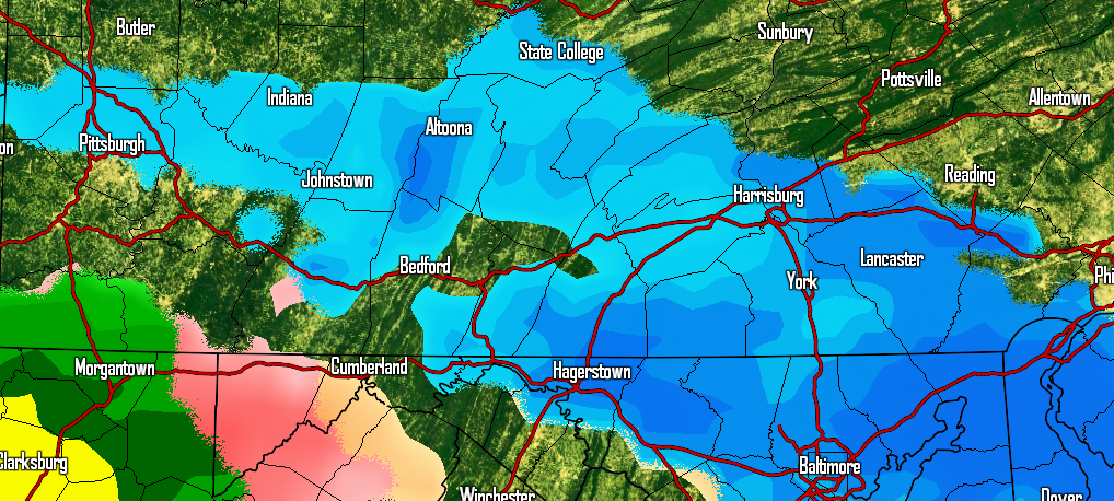
Snow should switch to freezing rain across the Laurel Highlands and possibly into Southcentral PA especially near the MD Line by late afternoon.
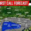
SECOND CALL SNOW & ICE MAPS
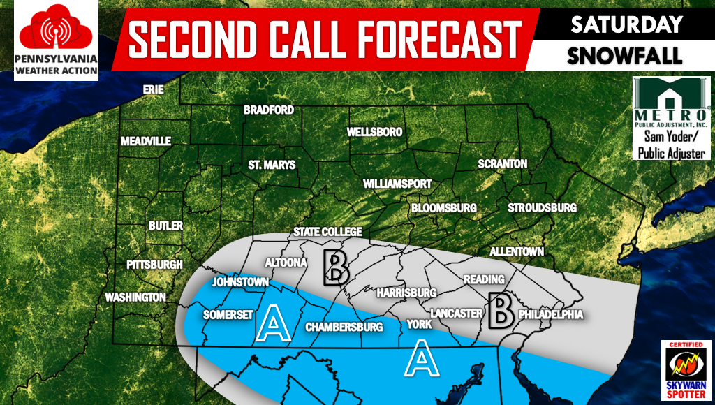
Area A – Snowfall accumulation of 1-2″ likely.
Area B – Snowfall accumulation of a coating to 1″ is likely.
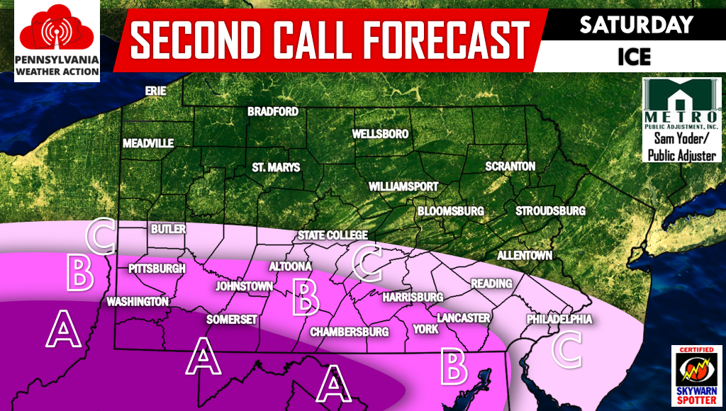
Area A – Ice accretion of .10-.20″ is likely.
Area B – Ice accretion of .05-.10″ is likely.
Area C – Ice accretion of .01-.05″ is likely.
For more updates regarding Pennsylvania Weather, be sure to have us liked on Facebook, click here>>>PA Weather Action on Facebook! Don’t forget to share the forecast below!
You must be logged in to post a comment.