
A messy winter storm is expected beginning Friday Afternoon, continuing into Saturday Afternoon. After a warm day Thursday, a low pressure will move through Southeast PA Friday. There will be a tight gradient in precipitation type starting in Western PA Friday Night, and Central and Eastern PA Saturday Morning.
Rain will change to freezing rain as temperatures fall below freezing, followed by a changeover to sleet and then snow. Here is the GFS Model for 11 PM Friday Evening: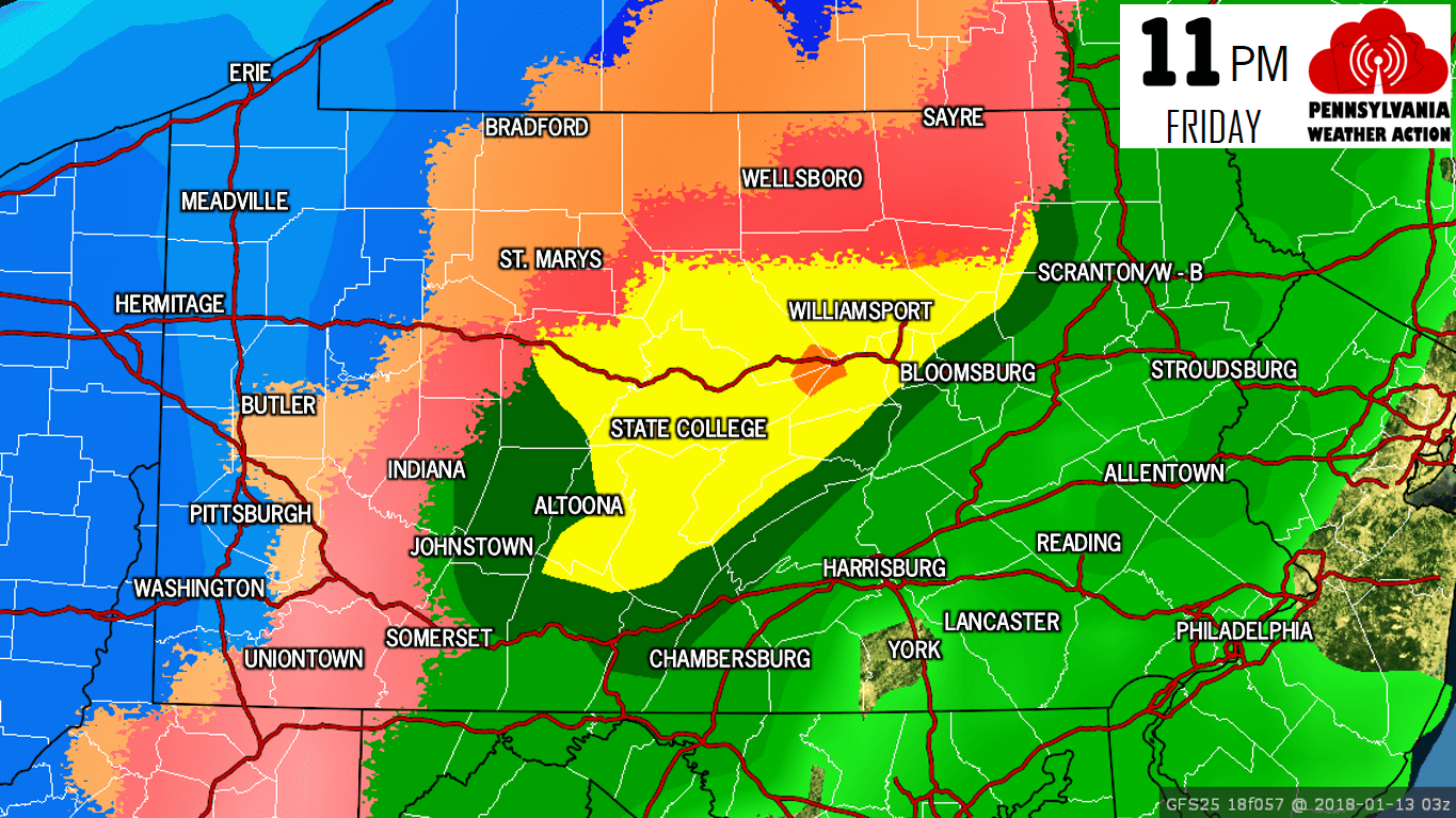
By this time, snow will likely be falling across all areas within 50 miles of the Ohio Border. Freezing rain (pink color) will be a threat in the suburbs east of Pittsburgh all the way up into Northcentral PA. Here is the GFS Model for 5 AM Saturday Morning:
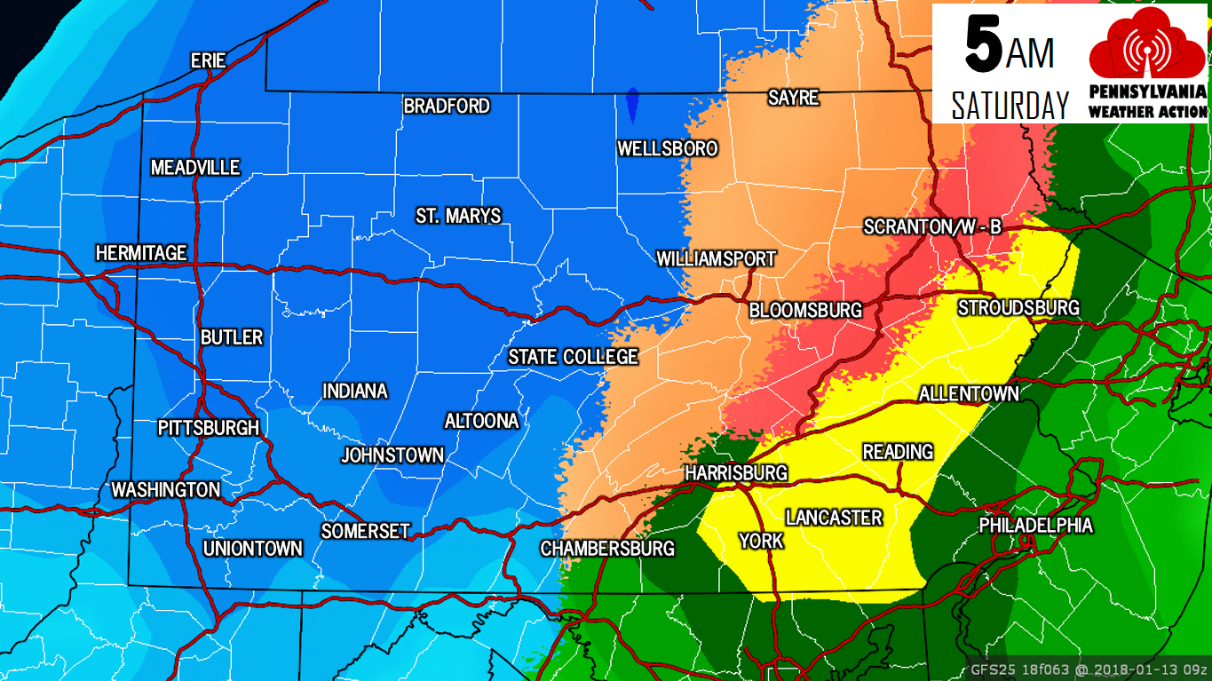
As you can see, temperatures will rapidly drop as the cold front swings in just after the center of low pressure passes. There may be as much as a 30 degree temperature difference in two locations only 40 or 50 miles apart. By 5 AM, snow is expected to be coming down throughout all of the western half of the state. Freezing rain will now be a risk along the i-81 corridor from Scranton down to Harrisburg.
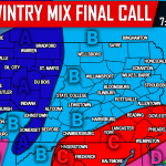
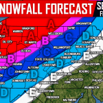
Even though areas of Central and Eastern PA are not expecting much besides rain, temperatures will drop quickly Saturday Morning, likely freezing up all wet surfaces. The risk of black ice will definitely exist Saturday. Below is our Snowfall Forecast Map and key, followed by our Freezing Rain Forecast Map and key.
FIRST CALL SNOWFALL FORECAST
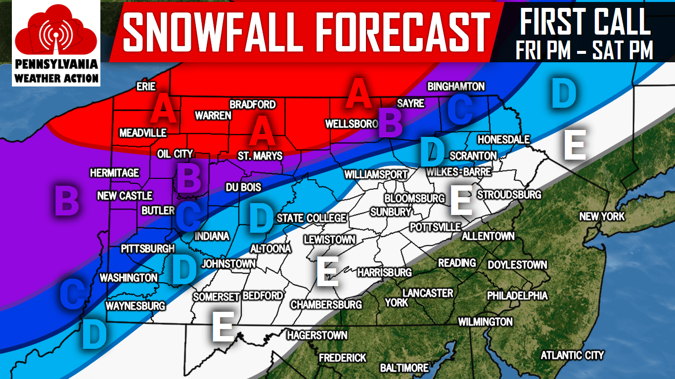
Area A: 6 to 10 inches of snow is expected after the changeover from rain to snow Friday Night from west to east. Travel will be very hazardous due to a layer of ice under the snow.
Area B: 4 to 6 inches of snow is expected after the changeover from rain to snow Friday Night from west to east. Travel will be hazardous due to a layer of ice under the snow.
Area C: 2 to 4 inches of snow is expected after the changeover from rain to snow Friday Night into Saturday Morning from west to east. Travel will be difficult due to a layer of ice under the snow.
Area D: 1 to 2 inches of snow is expected after the changeover from rain to snow Friday Night into Saturday Morning from west to east. Travel will be difficult due to a layer of ice under the snow.
Area E: A coating to 1 inch of snow is expected after the changeover from rain to snow Friday Night into Saturday Morning from west to east.
FIRST CALL FREEZING RAIN/ICE FORECAST
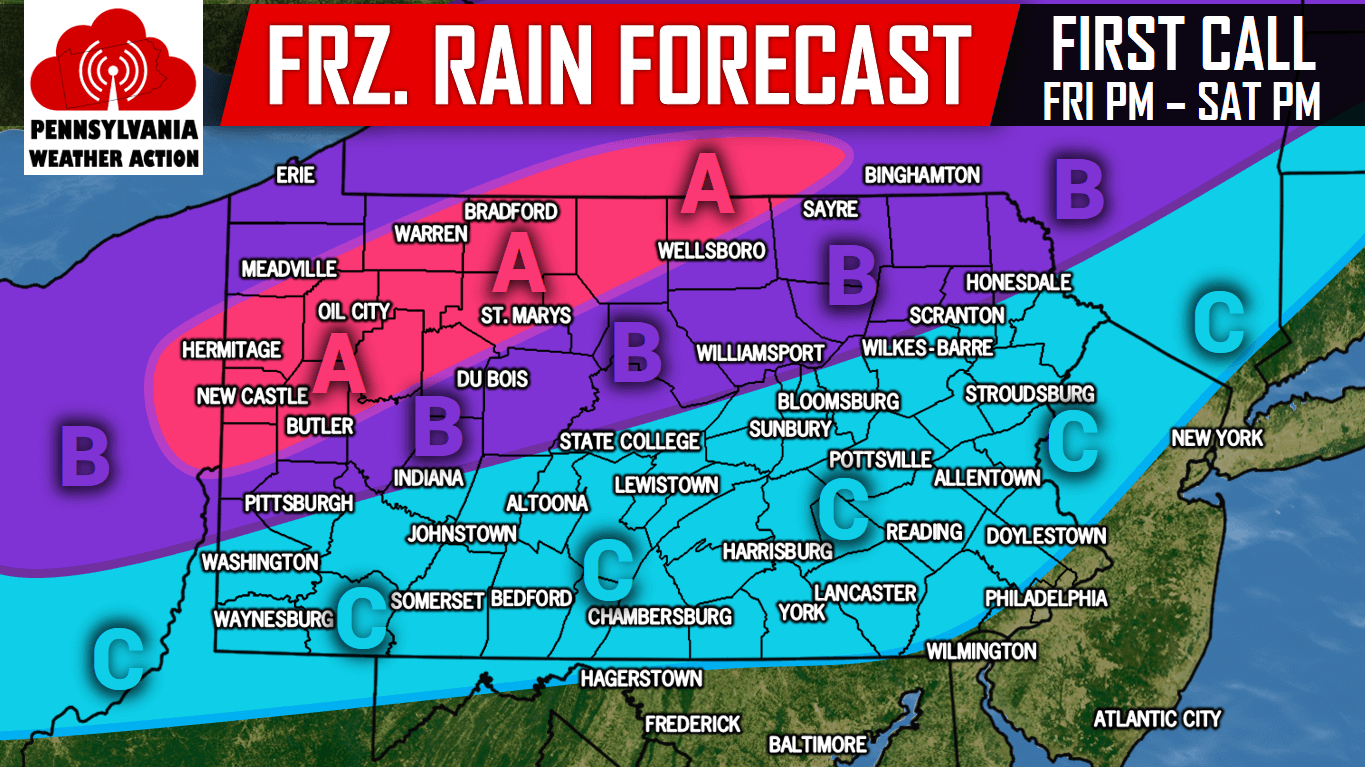
Area A: .20″ or more of freezing rain/ice accumulation expected after the changeover from rain to freezing rain Friday Evening from west to east. Travel will be very hazardous.
Area B: .10″ to .20″ of freezing rain/ice accumulation expected after the changeover from rain to freezing rain Friday Night from west to east. Travel will be very hazardous.
Area C: .01 to .10″ of freezing rain/ice accumulation expected after the changeover from rain to freezing rain Friday Night from west to east. Travel will be very hazardous.
For more updates regarding this significant winter storm, like our page on Facebook by clicking here>>>Pennsylvania Weather Action’s Facebook Page
Download our app to stay ahead of the storm>>>Click here to download our app!
Share the important forecast with your family and friends using the button below!
You must be logged in to post a comment.