

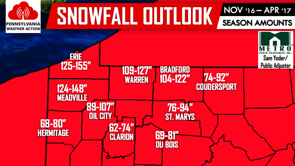
Well above average snowfall is expected with below average temperatures. A combination of a warm Lake Erie and cold air in play is a result for hefty amount of Lake Effect snows on top of synoptic Winter Storms. All areas shaded in red will likely receive at least 50% more than their typical snowfall for a season.
Stay ahead of the Winter Weather by subscribing to our Ahead of the Action Winter Text Alert Service. Sign up now to enter yourself in a $50 visa gift card drawing. First month is free! Click here>>>Ahead of the Action Winter Text Alert Service sign up!
Don’t forget to like Pennsylvania Weather Action on facebook and share this article below if you have family and/or friends in Northwest PA. Stay safe!
You must be logged in to post a comment.