
Good evening everyone! I hope you all had a great weekend despite the wet weather and Eagle’s loss on Sunday. Our coastal low that delivered steady rain throughout Saturday has since moved out to see. Behind it, a surface trough has settled in, keeping scattered clouds, showers, and cooler weather in place over SE PA. This week, we can expect a gradual increase in temperatures and clearing skies as a weak ridge of high pressure builds into the region.
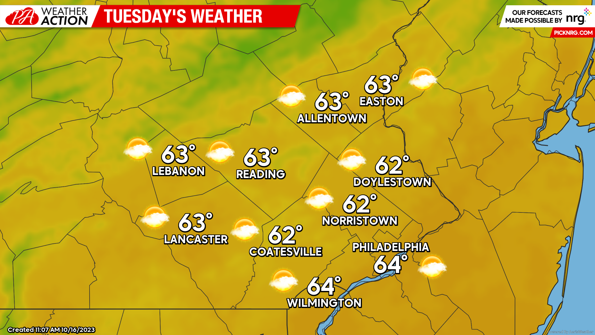
Tuesday
Tomorrow morning will feature partly cloudy skies with lows in the low-mid 40s. Scattered cloud cover is expected to remain in place throughout the day. An isolated rain shower is possible, especially across northwestern portions of our region, however, most will remain dry. Highs Tuesday afternoon will peak in the low-mid 60s. Winds will be out of the NW at 5-10mph.
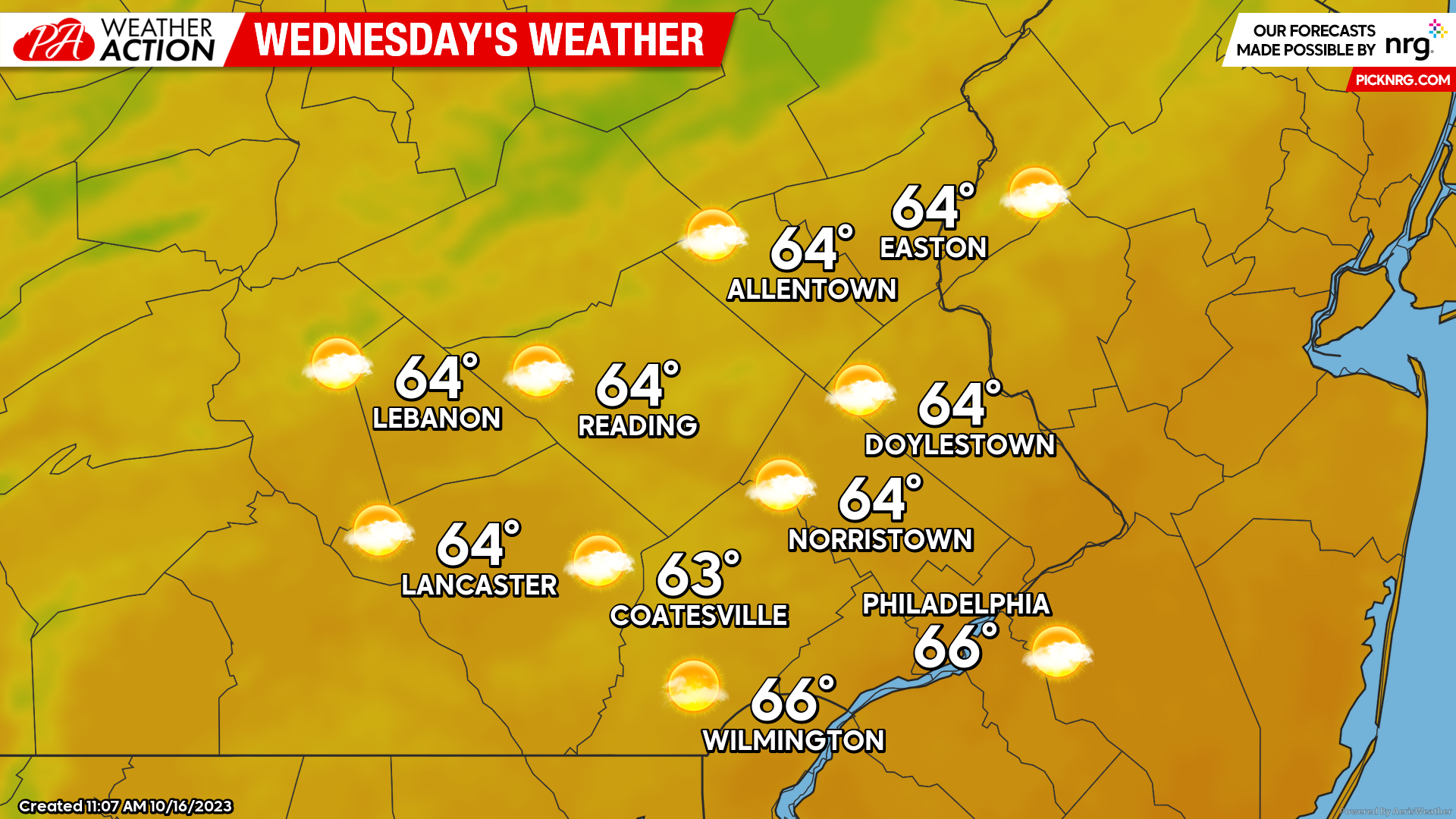
Wednesday
Wednesday’s weather will be very comparable to Tuesday. Partly cloudy skies will remain in place during the morning with lows starting in the mid-upper 40s. Wednesday afternoon may see more peaks of sunshine than Tuesday, however, a mix of sun and clouds will remain in place. Highs will top out in the mid-60s with winds out of the W at 5-10mph.
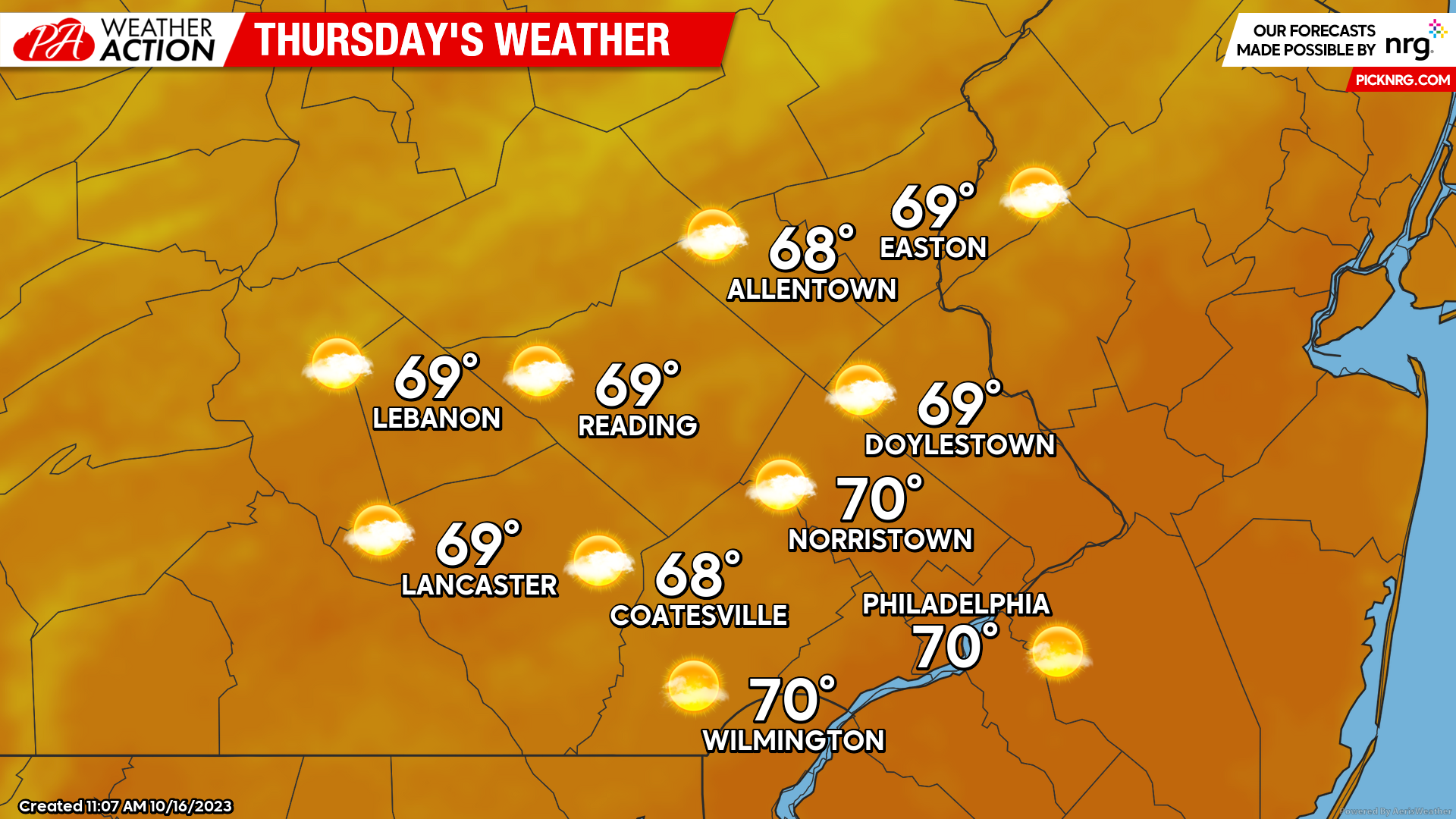
Thursday
For Thursday, the axis of our ridge will finally build in ahead of a weekend cold front. This will bring warmer and sunnier weather for most of the day. Low’s Thursday morning will once again start in the mid-upper 40s on mostly clear skies. The clouds should hold off until the evening, allowing temperatures to warm nicely into the upper 60s – near 70 by Thursday afternoon. Clouds will begin to increase by the evening as a cold front approaches from the west.
Looking ahead to the weekend, unfortunately, we are tracking the potential for more rain. A cold front will move into the region from the west Friday evening. This cold front may initiate the development of a coastal low during the day on Saturday that could bring substantial rain and wind to the region once again. Uncertainty still lies in the progression of this weekend’s pattern and whether a coastal low will or will not develop. The development of this low will determine whether this weekend’s rain is more scattered in nature than another washout. Expect more updates on this in the next blog post! I hope you all enjoy the pleasant week ahead. If you have any questions or comments regarding the forecast, feel free to let me know!
-Michael Woytowiez


You must be logged in to post a comment.