

Milder air will gradually flow into our area this week, driving temperatures to slightly warmer-than-normal levels for most days. A storm system will develop over the Southeast and track northeastward well offshore. A pattern-changing cold front will approach our area later this week and cross Saturday, generating showers and delivering colder-than-normal temperatures late this weekend that will persist through next week… along with a pattern that might provide the first widespread accumulations of snow later in the week!
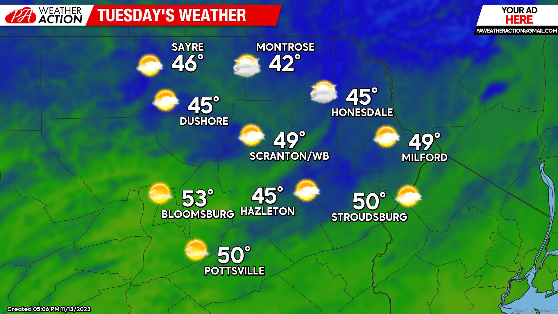
TUESDAY
Tonight will be milder than last night along with slightly breezy conditions and temperatures remaining mostly above freezing with no frost. Tomorrow will be breezy with near-normal temperatures and no precipitation. Enjoy!
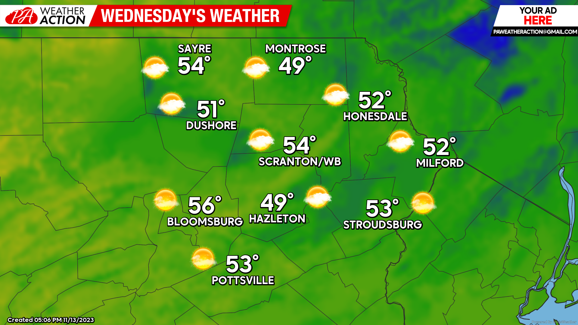
WEDNESDAY
Wednesday will be even milder with more sunshine and dry weather. Enjoy!!
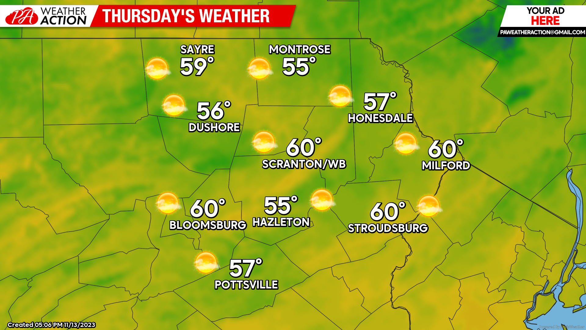
THURSDAY
The mild and dry weather will continue with temperatures well into the 50s, and even approaching 60 in the southern valleys!
Looking into the weekend and beyond, there will likely be a strong storm system moving northeastward along the coast to near Cape Cod by Saturday. Meanwhile, a cold front will approach from the west – and this should maintain above-normal temperatures into Saturday as it also spreads showers across the area late Friday into Saturday. Colder air will flood across much of the East Sunday, and persist throughout next week, along with the potential for an accumulating snow event midweek. Something to look forward to! Just don’t get your hopes up.. but it is that time of year…


You must be logged in to post a comment.