
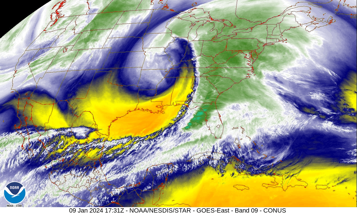
Please enjoy the featured image which is a water vapor loop of Tuesday’s powerful storm which pummeled our area with 40-60 mph gusts and 1-3″ flooding rain.
As power is still being restored from Tuesday’s storm, we will have a repeat of Tuesday night’s event, except this time with very little snow, less rain, and possibly stronger gusts. Arctic air will follow the storm to maintain below-normal temperatures most of next week.
FRIDAY
Clouds will increase across the area from SW to NE. Temperatures will slowly climb into the upper 30s during the afternoon, and into the 40s overnight Friday night into Saturday morning.
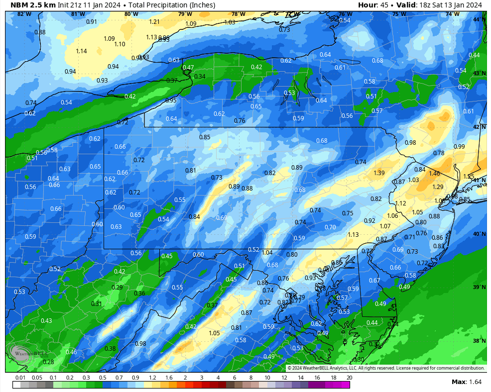
Precipitation will spread northwestward across our area Friday night, possibly starting as a brief coating of snow for the northern counties. Wind will increase overnight as well, with gusts over 40 for most locations, and possibly over 55 mph across the higher elevations, along with Wyoming Valley (which will be downsloping off the Pocono Plateau). Locations in the deep valleys along with the southern Poconos will be somewhat shielded by an inversion, but this inversion doesn’t look quite as robust as Tuesday’s and thus they could experience higher gusts than Tuesday night. There could also be a line of thunderstorms that develops, which could mix down stronger gusts to even those locations. I suspect the National Weather Service will issue a wind advisory.
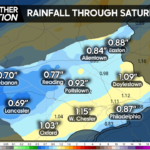
Precipitation totals will be 1-2″ over the Poconos, and an inch or less for the rest of the area. Because of the already-saturated ground, elevated stream levels, and leftover snow to melt, this could be enough for more minor flooding issues for the Poconos.
Expected precipitation:

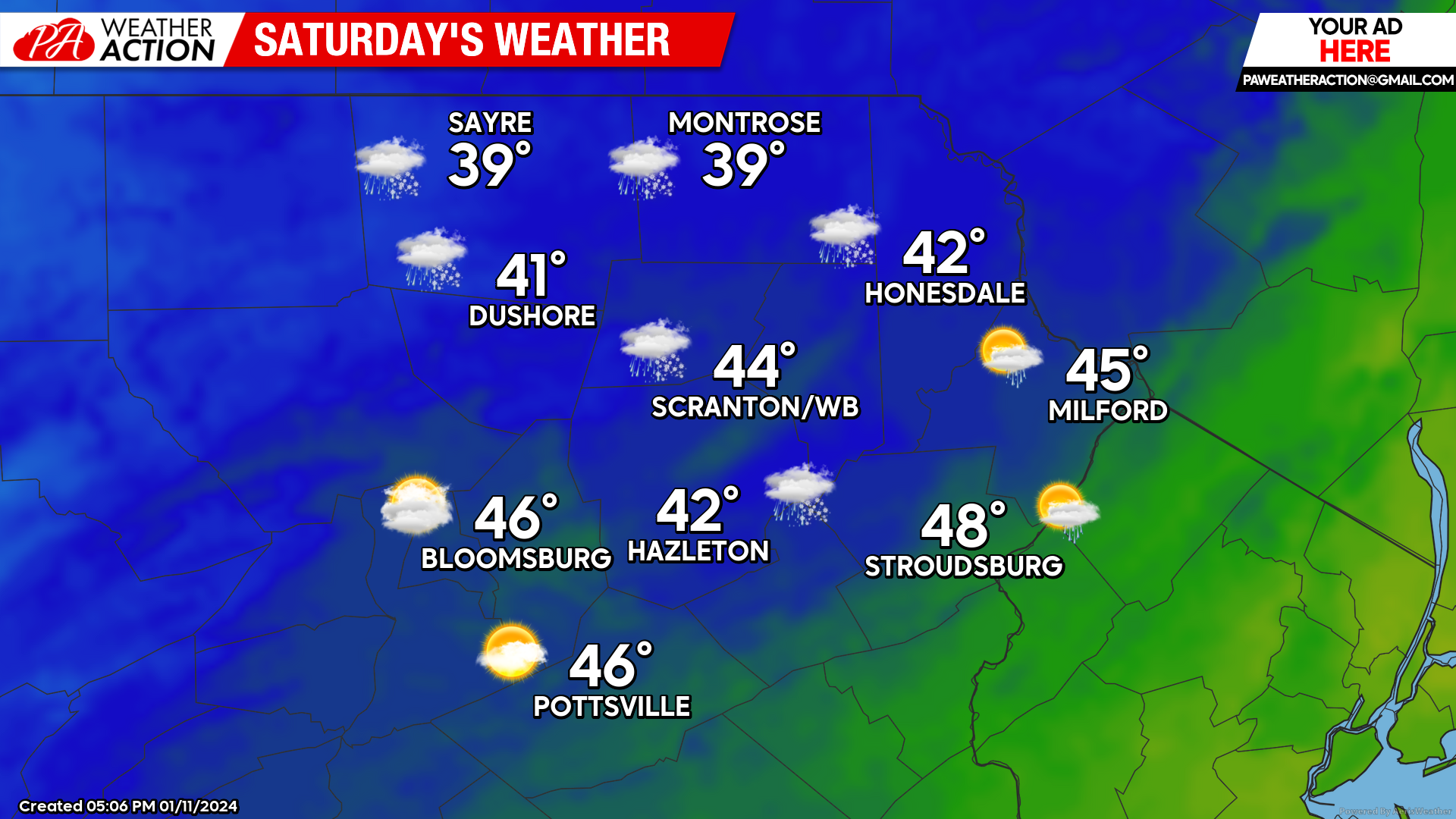
SATURDAY
Akin to Wednesday, 40 mph gusts from the west will usher in colder air. After morning temperatures in the 40s, temperatures will fall through the 30s during the afternoon, and even down into the 20s for the higher elevations. There could be snow showers as well.
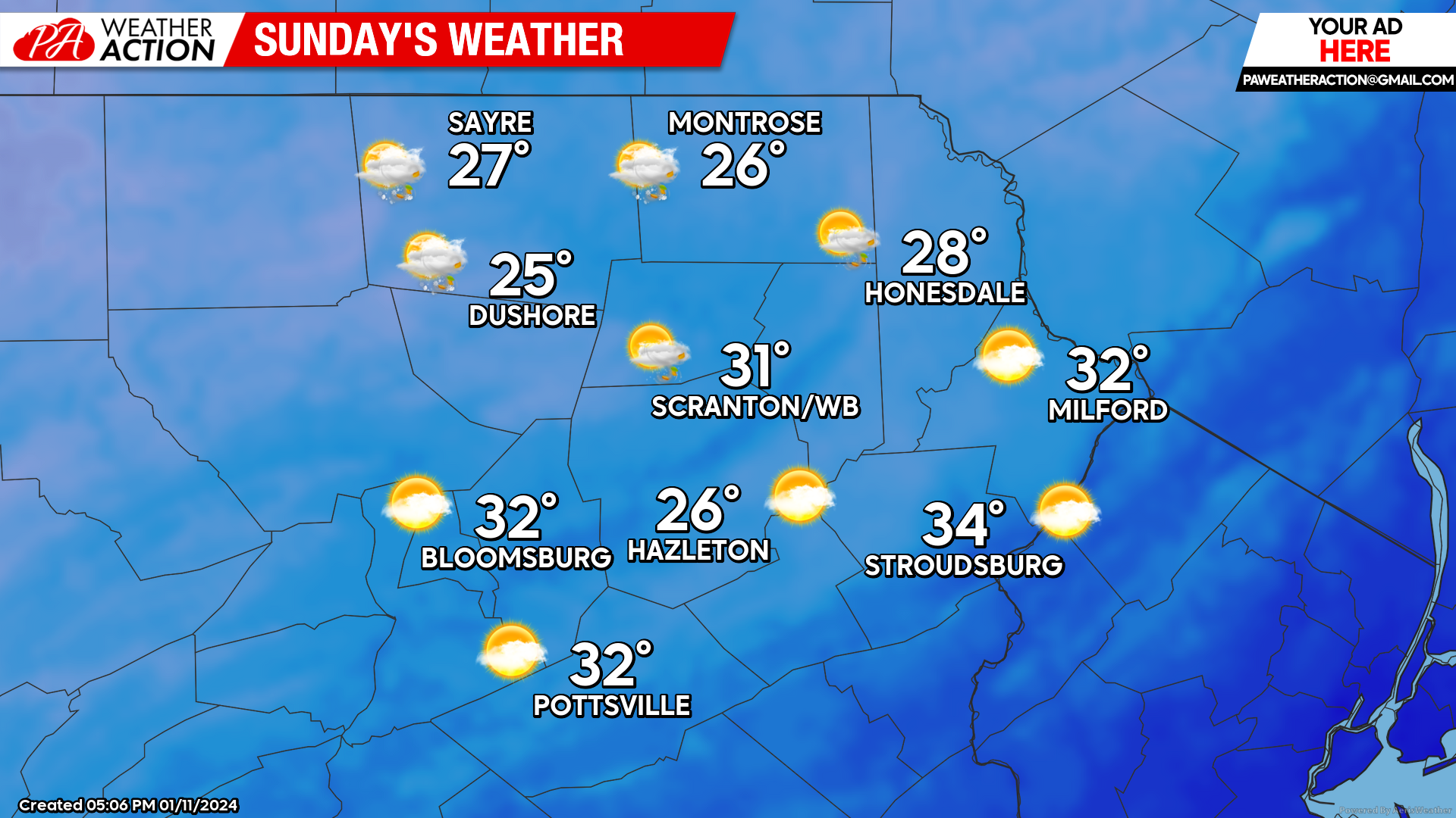
SUNDAY
Temperatures will climb into the upper 20s and low 30s by midday, with arctic air pushing temperatures down through the 20s for the entire area during the afternoon and into the teens Sunday night.
BEYOND SUNDAY
Most, if not all, of next week will be under the influence of arctic air and average 5-10 degrees colder than normal. There are indications of a potential plowable snow event on Tuesday, but unfortunately there remains a bit too much uncertainty to get your hopes up. Otherwise the week will be dry. Normal highs this time of year are in the upper 20s in the higher elevations, and low 30s in the valleys. Normal low temperatures are in the teens for most places.
You must be logged in to post a comment.