I hope everyone survived this weekend’s arctic assault as wind gusts over 50 mph blasted the area with power outages and ultimately drove temperatures down into the low-mid teens last night.
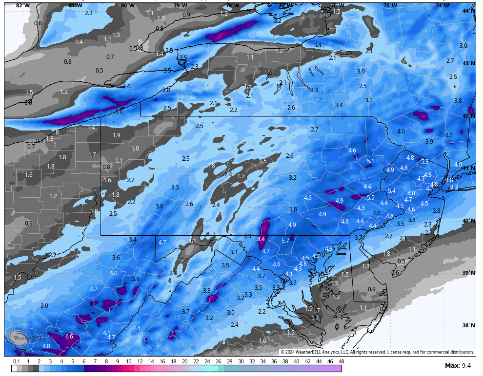
A weak system will spread snow into our area from south to north late tonight, with the snow continuing into tomorrow for widespread 3-6 accumulations. Reinforcing arctic air will return to our area behind the system.
Expected snowfall through Tuesday evening:
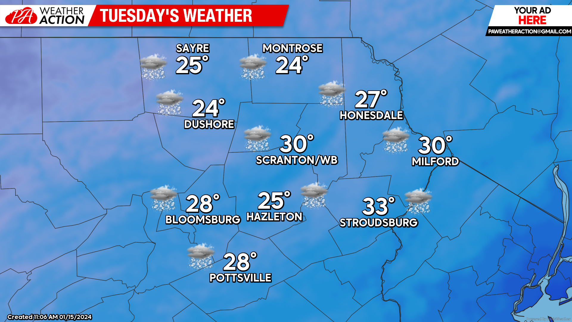
TUESDAY
Snow will arrive late tonight and last into the afternoon Tuesday. Unlike last week’s Atlantic glop, this will be a low-density snow, with widespread 3-6″. Arctic air will be drawn into our area behind the system, with temperatures dropping into the single digits Tuesday night on gusty wind that could create wind chill temps below zero.
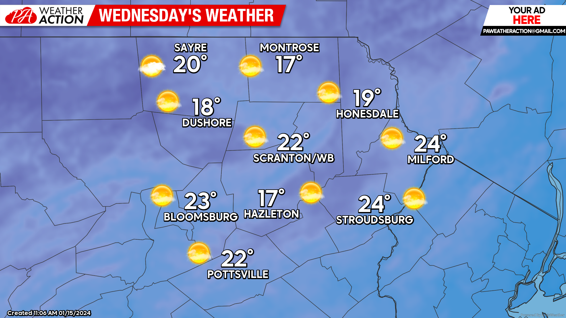
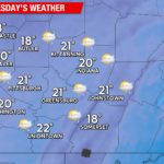
WEDNESDAY
Wednesday will dawn with arctic air entrenched over us, with morning temperatures in the single digits to near 10 degrees. Despite ample sunshine, daytime temperatures will barely climb above 20 in the lower elevations and fail to get out of the teens in the higher elevations.
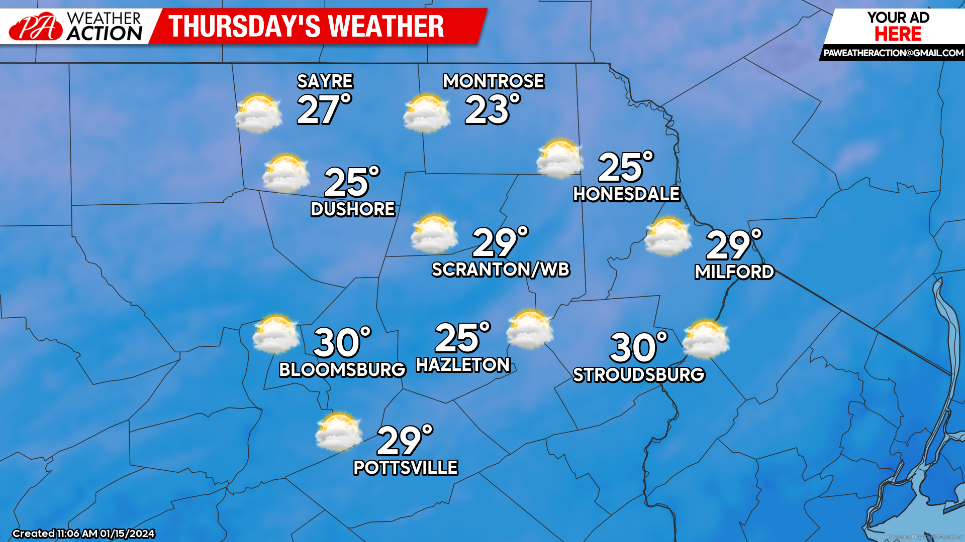
THURSDAY
Clouds will return to most of the area, with slightly ‘milder’ temperatures. Along with the clouds will be the possibility for snow showers, especially late afternoon or Thursday night.
BEYOND THURSDAY
An upper-level trough will dominate the eastern US Friday through Sunday A parade of moisture-starved disturbances will ripple through the area late Thursday through Saturday, bringing clouds and snow showers. However, there are indications that one of the disturbances will generate a coastal low that could spread accumulating snow northwestward into parts of our area Friday. Confidence is low at this time, but it is worth watching as we progress through the week. Reinforcing arctic air will overtake the region for Saturday with temperatures once again struggling to 20 F. More-normal temperatures will return early next week, and indications are that next week’s trend will be for warmer-than-normal temperatures.


You must be logged in to post a comment.