
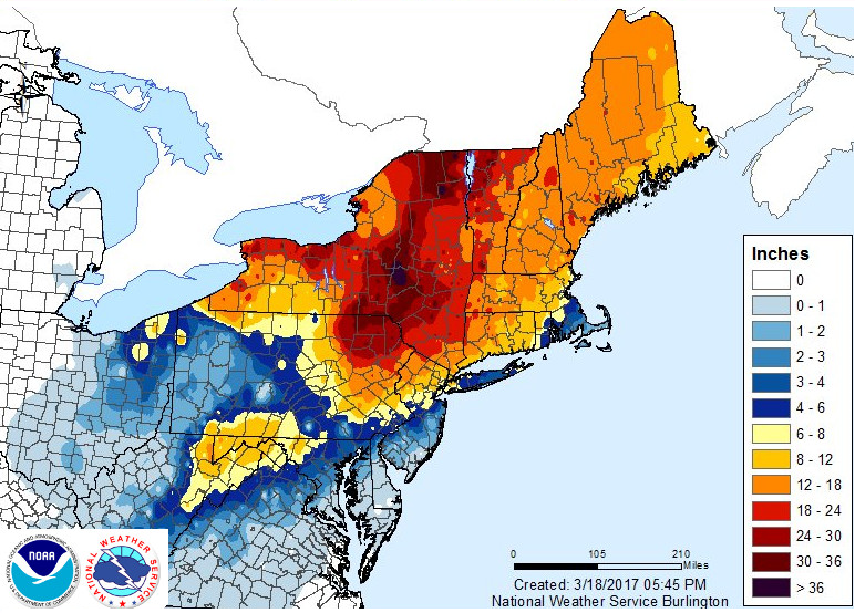
After a wild windy Monday, temperatures soared to well above normal with temperatures reaching into the 70s in the Valleys this week. This was much different than the weather 7 years ago today when 1-3 feet of snow buried the region. Please enjoy a map of that event:
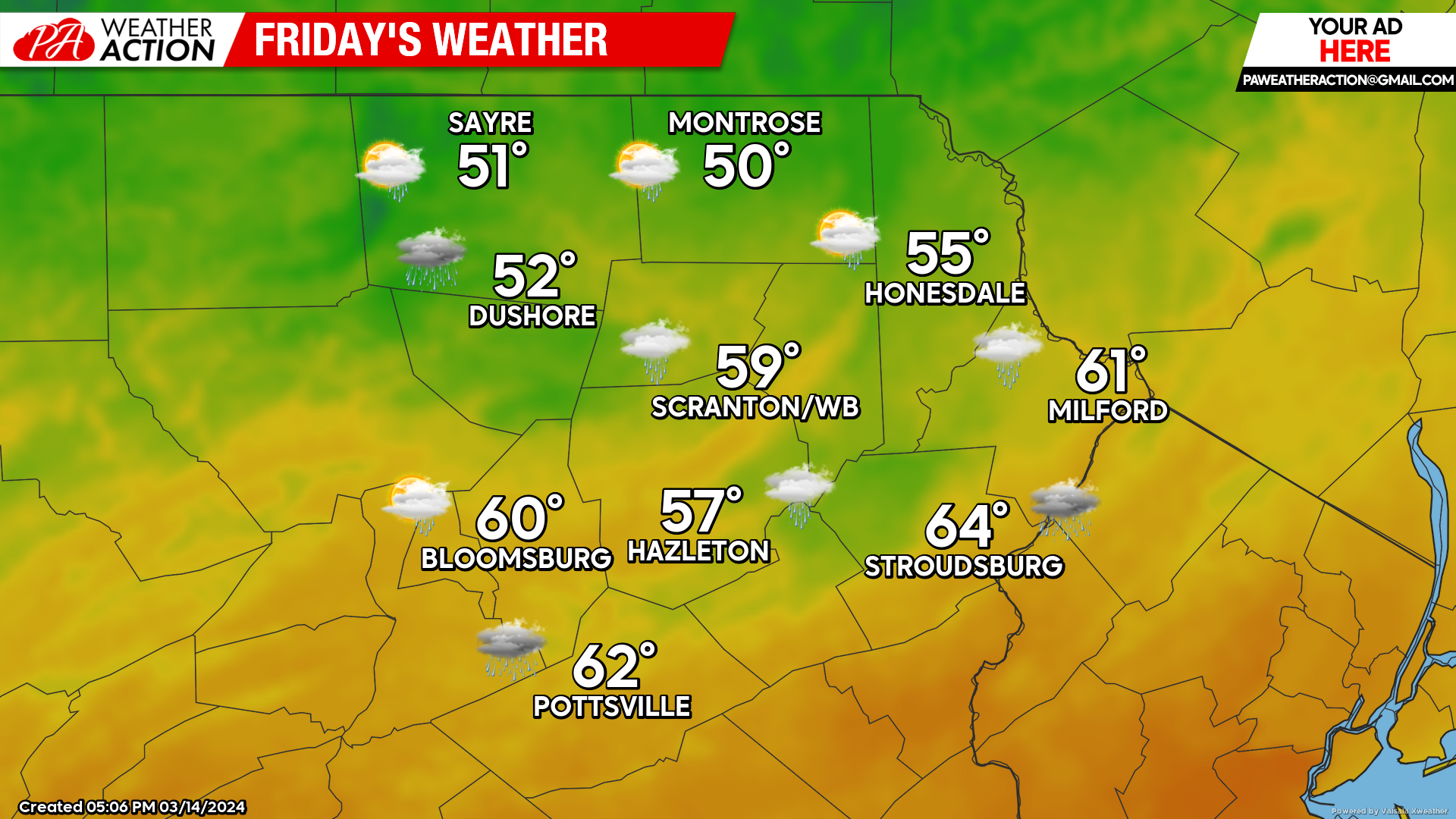
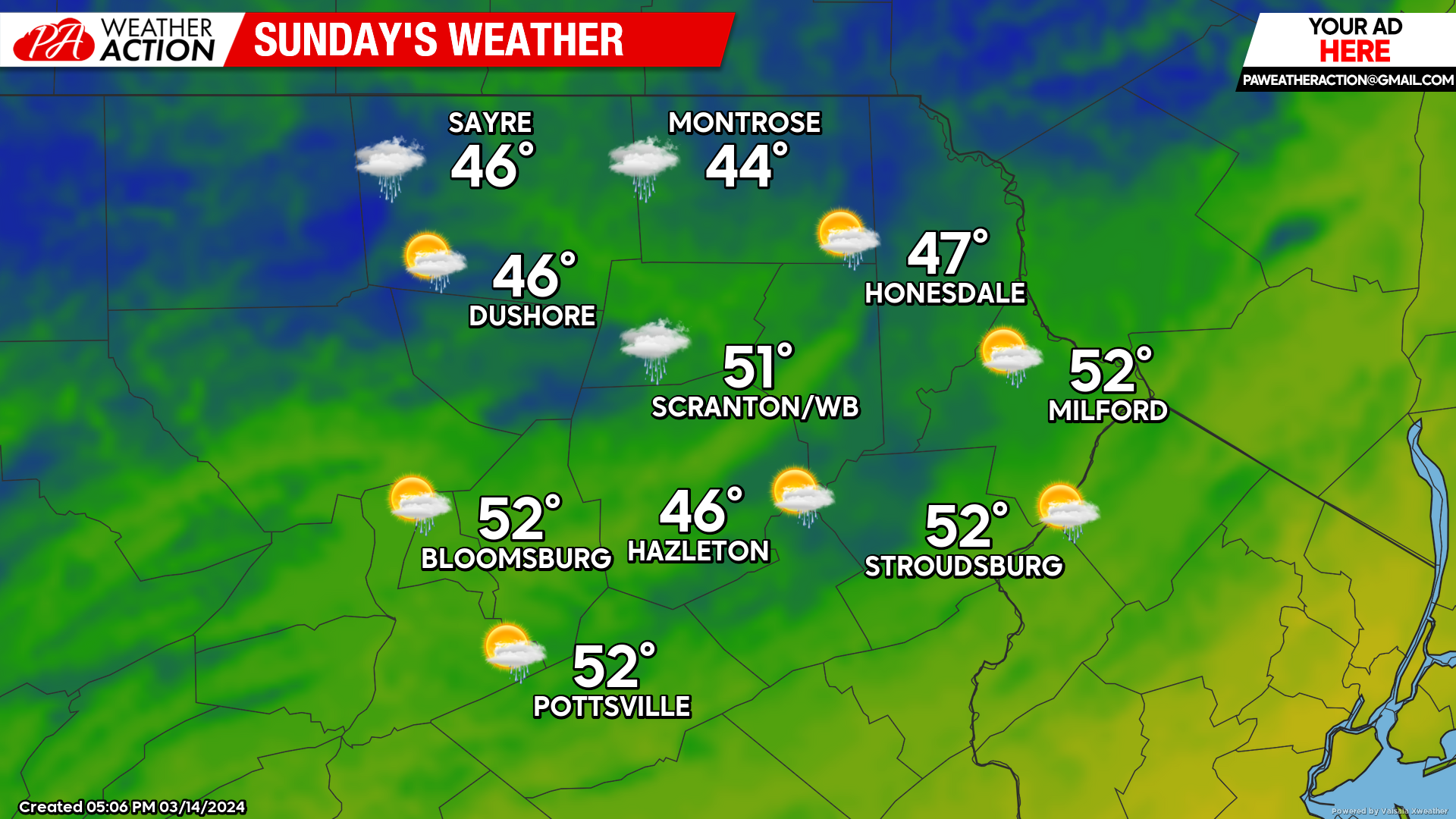
A weak system passing to our north will drag some showers across our area later tonight into Friday morning. While that system will attempt to circulate cooler air into the region, it will not be able to tap any arctic air so temperatures will remain above normal. Total precipitation amounts will be around a tenth of an inch. Another system will attempt to deliver showers early Sunday, with normal to slightly above-normal temperature for next week.
FRIDAY:
After morning showers, skies will become partly cloudy and while cooler than this week’s heat, it will still be much above normal.
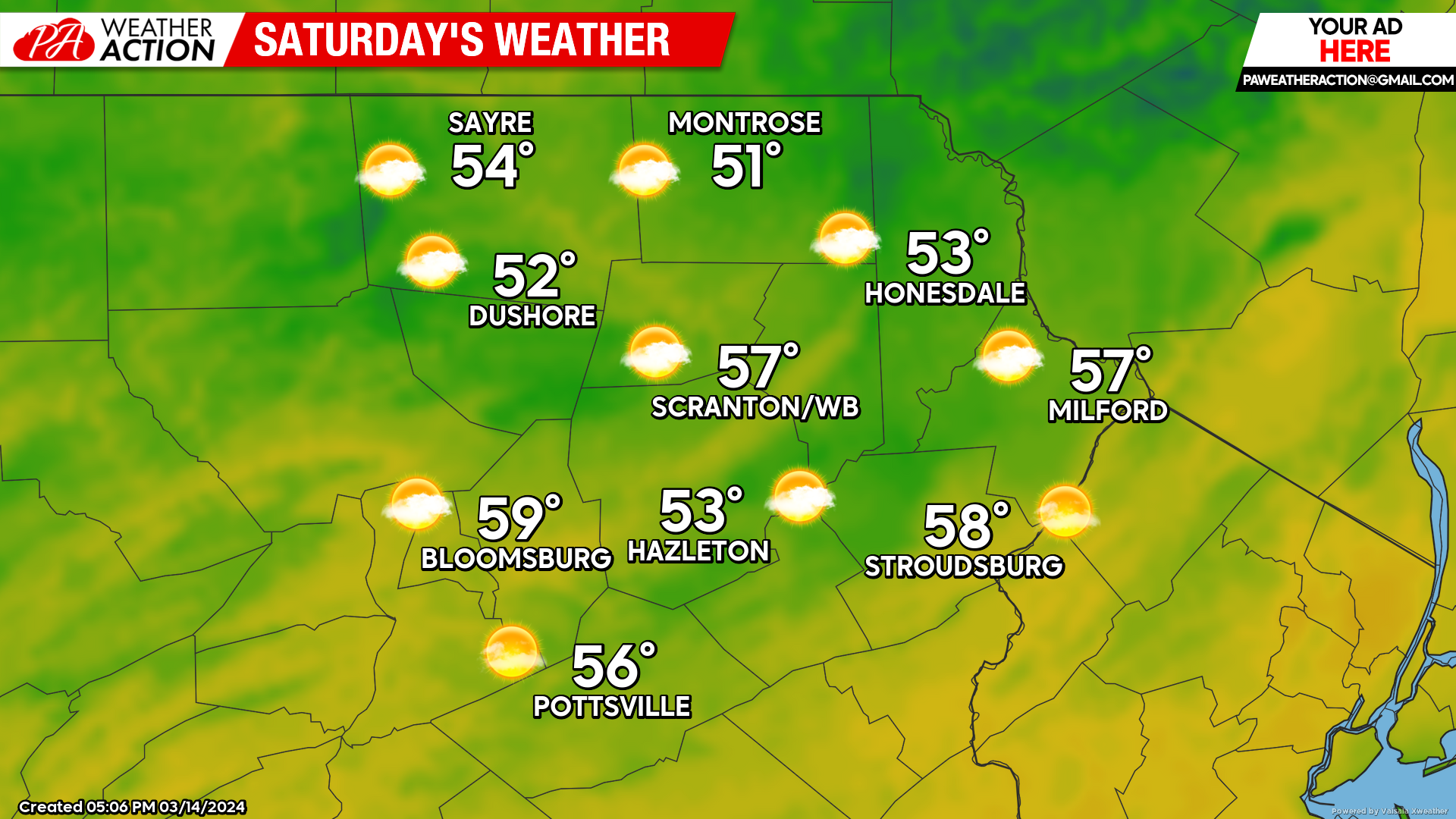
SATURDAY:
Saturday will be dry with partly cloudy skies and above-normal temperatures.
SUNDAY:
After some potential pre-dawn showers, more-normal temperatures will move into the region with partly cloudy skies and a few rogues rain/snow showers.
You must be logged in to post a comment.